| Trigger | Natural | Remote Trigger | Unknown |
| Avalanche Type | Soft Slab | Aspect | Unknown |
| Elevation | unknown | Slope Angle | unknown |
| Crown Depth | 24in | Width | unknown |
| Vertical Run | unknown |
Avalanche: Portage / Placer
Location: Squirrel flats
Placer river Valley to standard (north) uptrack.
Avalanche Details
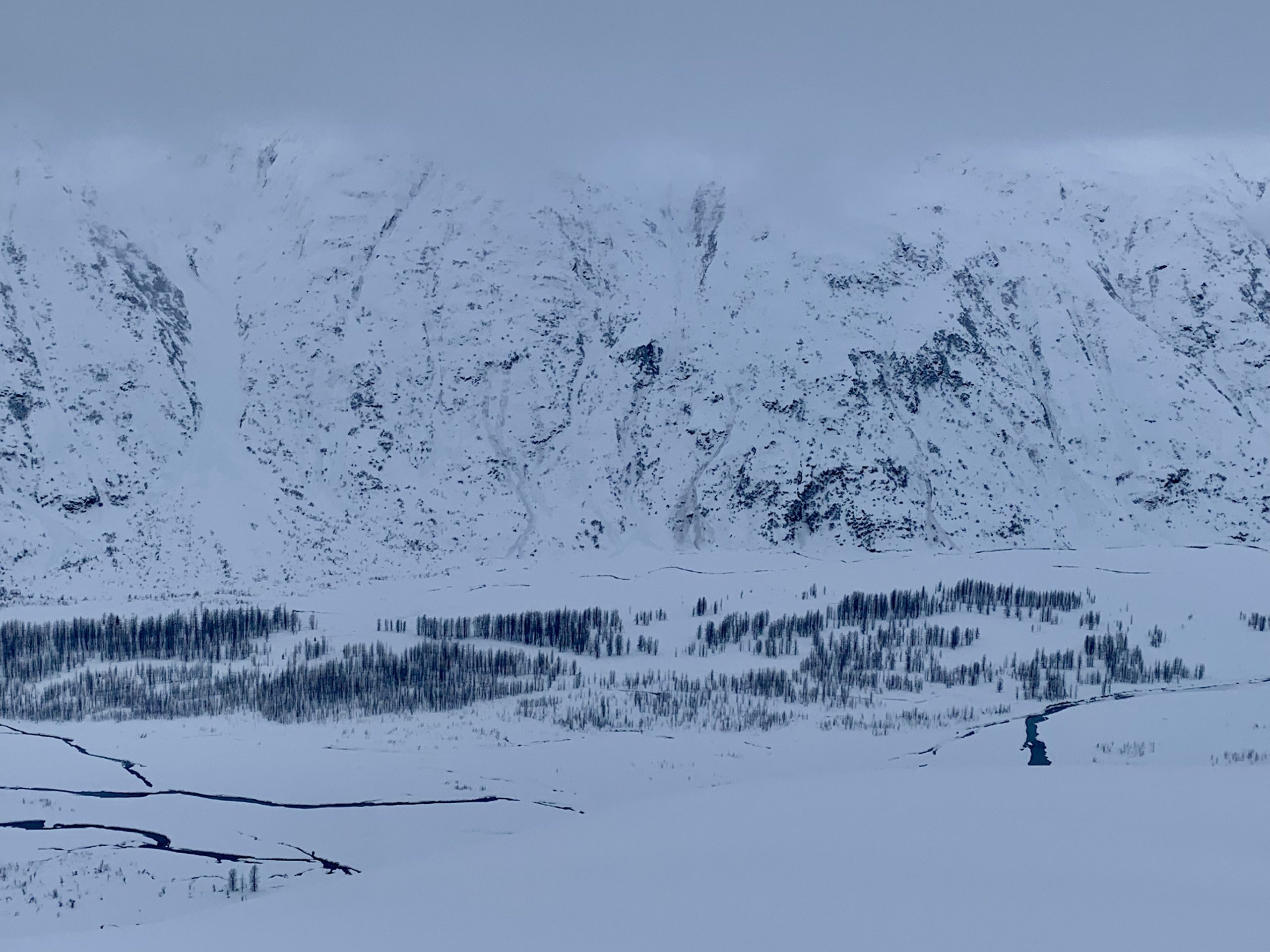
Widespread natural avalanche cycle from 1/26-28 storm. Storm slabs observed as low as 700' and up to ~2,000. We did see some larger debris piles on Comet Glacier (start zones closer to 3K) but crowns were obscured.
Obvious signs of instability
| Recent Avalanches? | Yes |
| Collapsing (Whumphing)? | No |
| Cracking (Shooting cracks)? | No |
Observer Comments
Several storm slabs all appeared to be ~2' deep, relegated to 1/26-28 storm snow. Very little to no wind effect in this area.
Also observed several debris piles running to Placer Valley bottom in channeled terrain on west side of the Valley.
Weather
Like riding inside of a ping pong ball! Clouds were in and out but mostly in. Temps in the mid-20's in Vally bottom, mid-teens at 2K. Winds were nonexistent and no new precip falling today.....just spent the day inside a cloud!
Snow surface
4" breakable crust below 500' made for tricky riding. Crust goes away quickly and snow surface transitions to deep powder around 700-1000'. Boot pen = crotch deep.
Snowpack
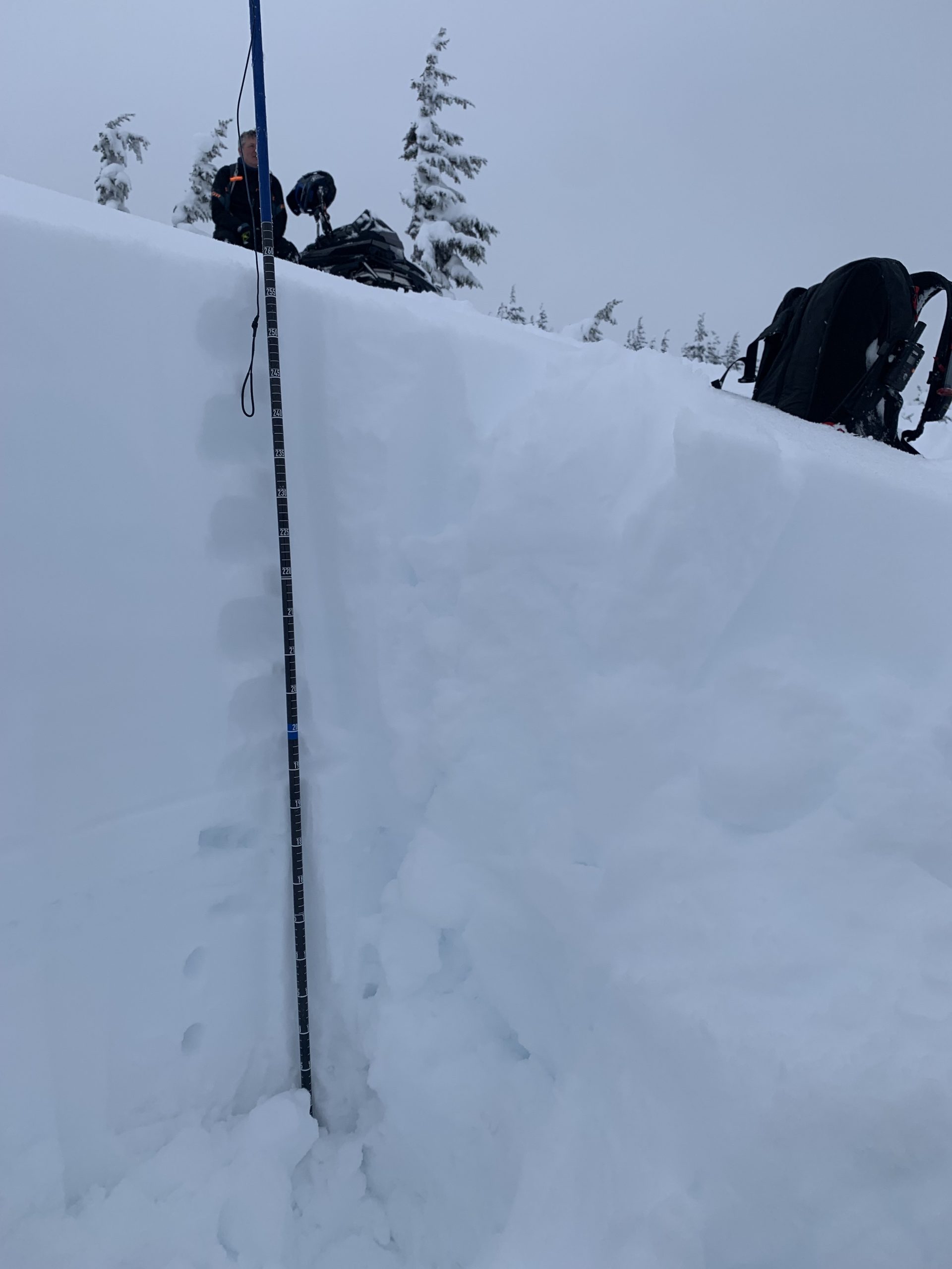
Snowpit #1: 2230', South aspect, 26 degree slope.
ECTN21 down ~60cm on very thin drizzle crust noted in Wendy's obs from last Tuesday. Also marks the storm snow depth.
Snowpit #2: 1550', North aspect, 21 degree slope.
ECTN26 down ~65cm on same layer as above.
Takeaway, storm slab seems to be healing well. All avalanche activity observed today appeared to be mid-storm or on the tail end of the storm (yesterday morning) and relegated to storm snow. Some crowns were quite wide (~200') in the mid-elevations, thin drizzle crust is likely culprit. Stressed a few smaller test slopes with the sled, no result.
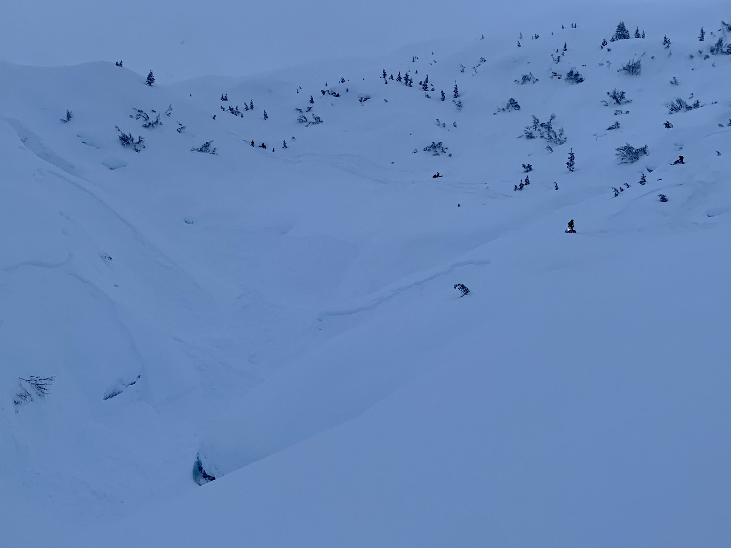
Several recent storm slabs around 700' elevation. Squirrel uptrack.

Recent natural storm slabs above the Placer river Valley, ~2,000'.
Debris seen in channelled terrain running to Valley bottom, west side of Placer Valley.

Snowpit #1: 2230', South, 26 degree slope. ECTN21 down 60cm on thin drizzle crust/ storm snow interface.
Snowpit #2: 1550', North, 21 degree slope, ECTN26 down 65cm on thin drizzle crust/ storm snow interface.