| Trigger | Natural | Remote Trigger | 0 |
| Avalanche Type | Soft Slab | Aspect | Northwest |
| Elevation | 4000ft | Slope Angle | 35deg |
| Crown Depth | 24in | Width | 3000ft |
| Vertical Run | 2000ft |
Avalanche: Chugach State Park
Location: South Fork of Eagle River, Hiland Road, Cottongrass Path
Large natural and human triggered avalanches continue throughout the South Fork Valley. Travel on terrain near slopes steeper than 30 degrees is discouraged. This instability will be very slow to stabilize.
Avalanche Details
Cottongrass Path ran naturally on 3/16/18 and nearly reached Cottongrass Road and adjacent houses. This slide path has killed skiers in the past. Over 30 major natural and human-triggered avalanches have occurred in the South Fork Valley over the past two weeks and likely will continue for the foreseeable future. Backcountry travel on or adjacent to any slopes in excess of 30 degrees is strongly discouraged.
Obvious signs of instability
| Recent Avalanches? | Yes |
| Collapsing (Whumphing)? | Yes |
| Cracking (Shooting cracks)? | Yes |
Observer Comments
30 major natural and human-triggered slides are now visible along Hiland Road. This is one of the most extensive and sustained avalanche cycles on Hiland Road in the past 20 years. Slides have been occurring on E, N and W facing slopes above 2,000' elevation and on slopes as low as 30 degrees. Human-induced collapsing is triggering avalanches at distances of 1/2 mile or more from slopes that are steep enough to slide.
Snowpack
Roughly 50% of the snowpack thickness in the South Fork is comprised of faceted crystals that are resulting in widespread collapsing and propagating failures. This snowpack configuration is extremely resistant to strengthening through compression and will remain unstable until it melts. It is likely that this snowpack configuration extends to other Chugach Front Range Areas.
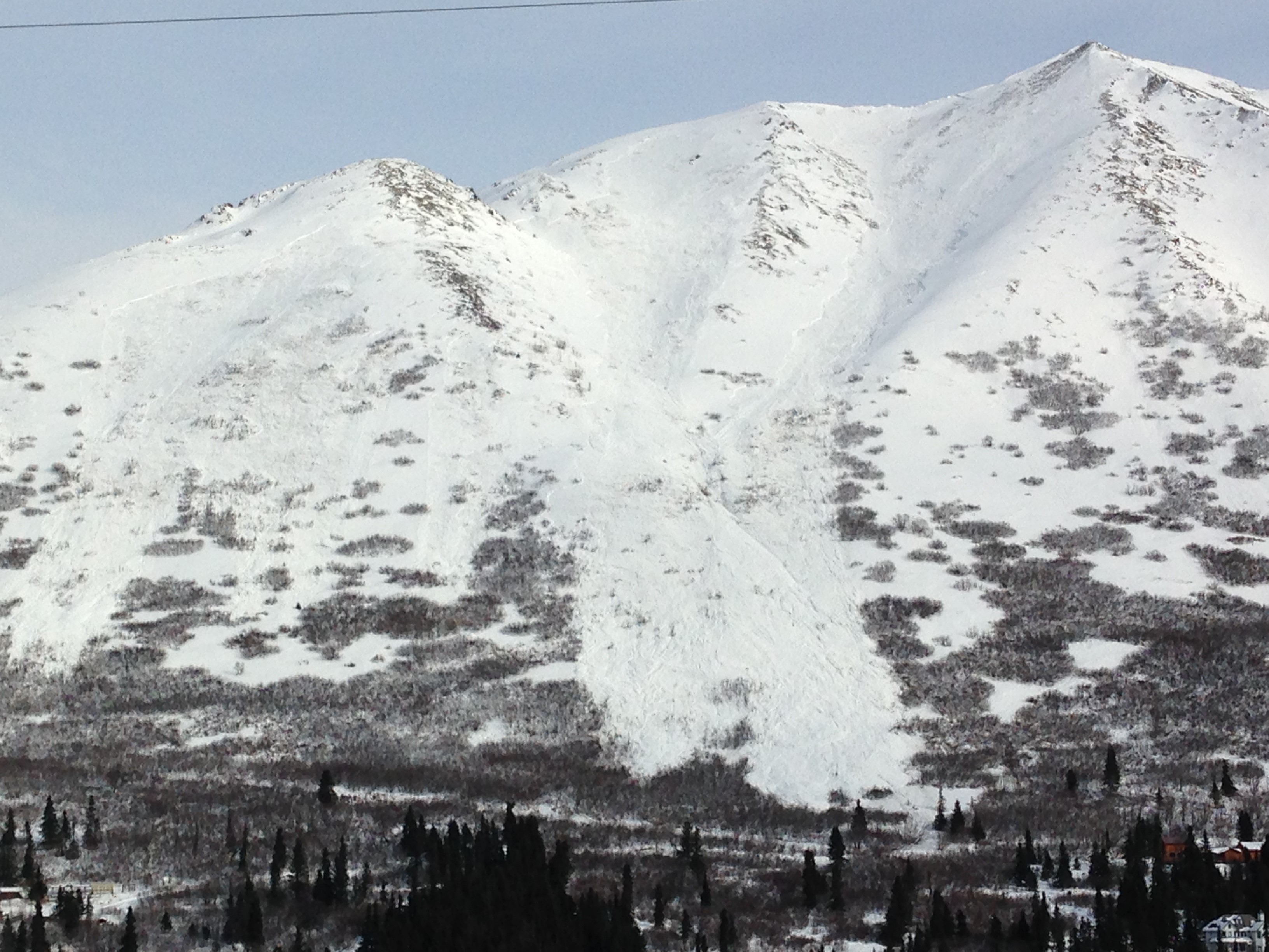
Cottongrass Path, South Fork of Eagle River