Below are road observations from Girdwood, Portage Valley and Turnagain Pass during a storm day rated at
HIGH avalanche danger.
Weather:
WARM WINDY and STORMY
Rain/snow line 1,500′-2,000′
Moderate to heavy rainfall (1.2″ of water at Turnagain Pass by Monday evening – storm total).
Strong East winds along Arm (Sunburst anemometer destroyed by wind at a 129mph gust!)
Obscured skies
Temperatures mid 30’s F sea level to 1,000′.
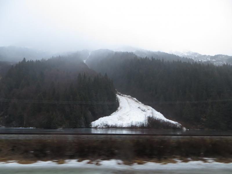
Widespread natural avalanche activity over the entire region. Most of the activity was beginning in the
upper elevation (>3,000′) start zones in dry snow as slab avalanches and running into wet snow on the
descent. Wet debris filled the bottom of most gullies with some debris making it to just above sea level –
most slides terminated in the 500-1,000′ band. Below are some photos of these piles along the highway.
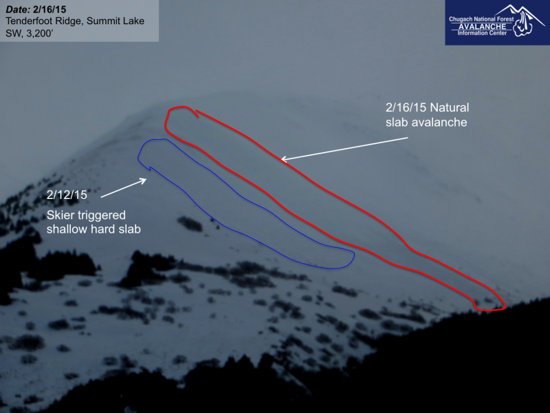
Very little visibility at Turnagain Pass limited information from this area unfortunately. There were a few
new debris piles seen on the East face of Seattle ridge, none of which were very big due to a thin snowpack
and little existing snow available to avalanche.