Route:
Seattle ridge common up-track to Warmup Bowl. High point 3,000′.
Weather:
Overcast skies
Light snowfall – trace accumulation through the day
Ridgetop winds – light to moderate from the West
Temperatures – teens F
Obvious Signs of Instability:
Recent avalanches – NO
Collapsing – NO
Cracking – NO
We did see one cornice break that looked to have possibly been in the past 48 hours (3,000′ West aspect, photo below).
Snow surface conditions:
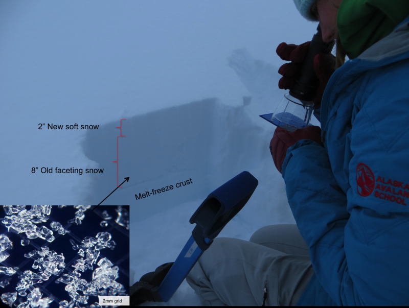
From valley bottoms to ridgetops there is 2″ of new snow – 1″ overnight plus 1″ from yesterday (Friday).
The new snow covers vegetation below 1,500′. Above 1,500′ the new snow plus 2-4″ of old loose snow covers a stout melt-freeze crust up to ~3,000′ or so. Above 3,000′ is where the best skiing/riding is as the melt-freeze crust under the 4-8″ of loose snow (including the new snow) disappears.
In exposed areas off ridgelines old shallow wind slabs 4-8″ were found and not reactive. Old and tired.
Snowpack observations:
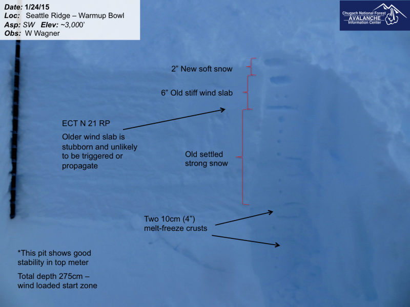
We dug in two locations at 3,000′ today looking for any type of buried weak layer or concerning interface. What we found was a strong snowpack in Warmup Bowl. There was one hardness change 50cm down in one pit (3,000′, SW aspect) that propagated with boot hard hits (well past the 30 taps in standardized tests). No persistent grain type was seen in this hardness change (1cm of 1 finger+ snow sandwiched between pencil hard snow). Interesting it propagated nonetheless and something to take note of.