Route
Seattle Ridge up to Bermuda Bowl uptrack (3,100’)
Weather
Overcast, calm to light winds-South in the morning veering to West in the
afternoon, temps in the low to mid 20s F, no precip
Obvious Signs Of Instability
Shooting Cracks-NO
Collapsing-YES, small (10 ft radius) on Seattle ridge in scoured and generally
thin areas
Recent Avalanches-yes, several small debris piles observed (D1) – lower Hippy
Bowl (Tincan), lower Todd’s run Bowl (Tincan). These appeared to be natural
releases that most likely occurred during the wind event on 12-25. One
additional debris pile observed on the East face of Pyramid (D2?) around 2,800’
below a cross loaded gully. Low light prevented more detailed observation.
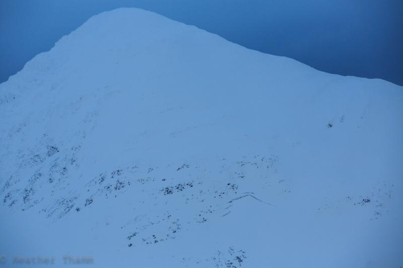
Observed one new glide avalanche on the West side of Seattle Cr near Big Chief
around 3,000’ East aspect (see photo) Glide crack on East face of Pyramid has
reopened and was first noticed on 12/9.
Surface Obs
Above 2,500 – a mix of thin (2-8”) pockets of windslab, exposed crust, and
anywhere from 2-6” of soft settled snow
Below 2,500 – 4-5” of soft snow sitting on a supportable base
Strong winds out of the South on 12-25 loaded many north facing slopes and cross
loaded slopes in channeled terrain.
Snow below the surface
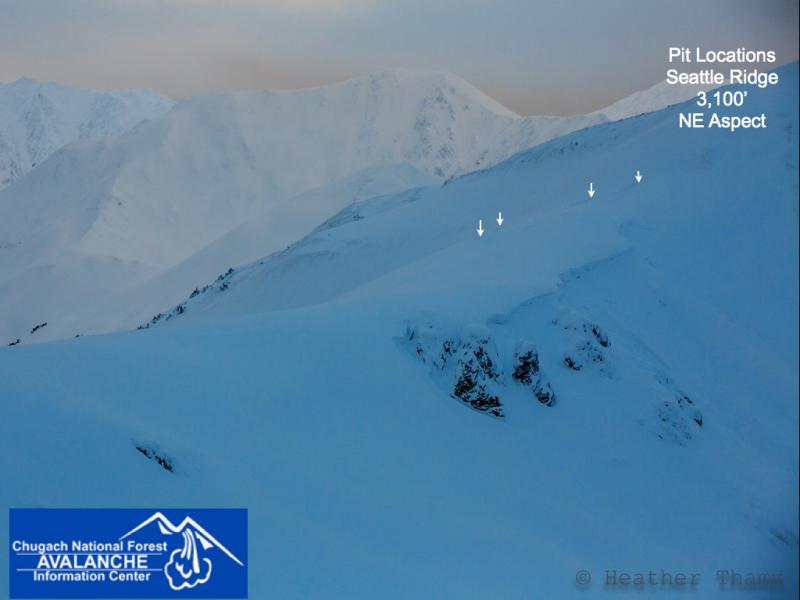
We are continuing to track the buried surface hoar layer, especially in the
alpine elevations. Today we dug 4 pits (see photo) around 3,100’ on Seattle
ridge with varying snowpack depths and slope angles. Results were a mixed bag,
ranging from no results to tests showing only moderate strength and high
propagation potential. The buried surface hoar was standing up in some pits and
laying down in others and variable within each pit. It was both reactive and
non-reactive.
What does this mean? It means we still have a layer buried 2’ deep in the
snowpack that has very slowly gained strength. Understanding what spots and
slopes have “healed” and which ones are still capable of producing wide
propagating avalanches is a very difficult task. This layer was fairly uniform
around the forecast zone when it was first buried (intact). It is still present
and cannot be trusted in terms of actual decision making. In other words, it
would be hard to justify getting onto a steep slope or teasing this layer, given
all of the evidence we have gathered over the past 10 days.
Read the rest at your own risk! The name of the game today was spatial variability.
Pit 1
3,100’, NE aspect, 15 deg slope
HS=150cm
ECTX (x2)
ECTP24 Sudden Collapse on 5mm Surface hoar 55cm down
PST 50/100 (End)
*Surface hoar was standing up with first test (ECTP) and laying down when moving
upslope to perform additional tests. Surface hoar was sitting on a 1 cm
breakable crust
Pit 2
same as location info as Pit 1, 30 feet away
HS=85cm
ECTN19, 14 on 5mm Surface hoar 30cm down
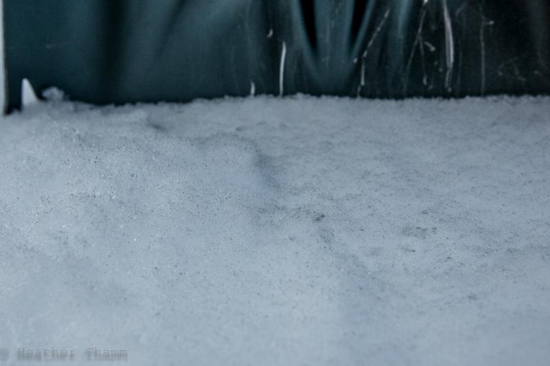
30cm from the surface was standing up on 1cm crust
Below this crust was a mix of crusts and facets (see photo)
Pit 3
3,150’, NE aspect, 28 degree slope
HS=120cm
ECTX, ECTN 24, 26, 28, ECTP 12, 20, 21 SC
*All results were on a thin layer of fist hard mixed forms (not surface hoar)
below 1cm crust. Surface hoar was attached to the bottom of the slab/top of the
1cm crust and laying flat. The crust remained attached to the slab in some
tests (see photo)
Pit 4
3,150’, NE aspect
HS=110cm
ECTN 18, ECTP 29 RP on 5mm Surface hoar 45cm down