| Trigger | Natural | Remote Trigger | Unknown |
| Avalanche Type | Unknown | Aspect | Unknown |
| Elevation | unknown | Slope Angle | unknown |
| Crown Depth | unknown | Width | unknown |
| Vertical Run | unknown |
Avalanche: Turnagain
Location: Seattle Ridge
Rode up the common up-track to the weather station and back. Looked around for any recent avalanche activity.
Several natural slab avalanches from the storm, mostly in terrain across Seattle Creek. No human triggered avalanches that we know of. Hardly any steep slopes were tested, folks mainly having a good time in the mellow terrain.
Avalanche Details
Several Natural avalanches from Thursday's storm or shortly after.
Zero Bowl (just on the opposite side of the up-track): what looked like a cornice fall that triggered a storm slab.
Several small wind slabs in the 6-12" range that did not go very far or wide.
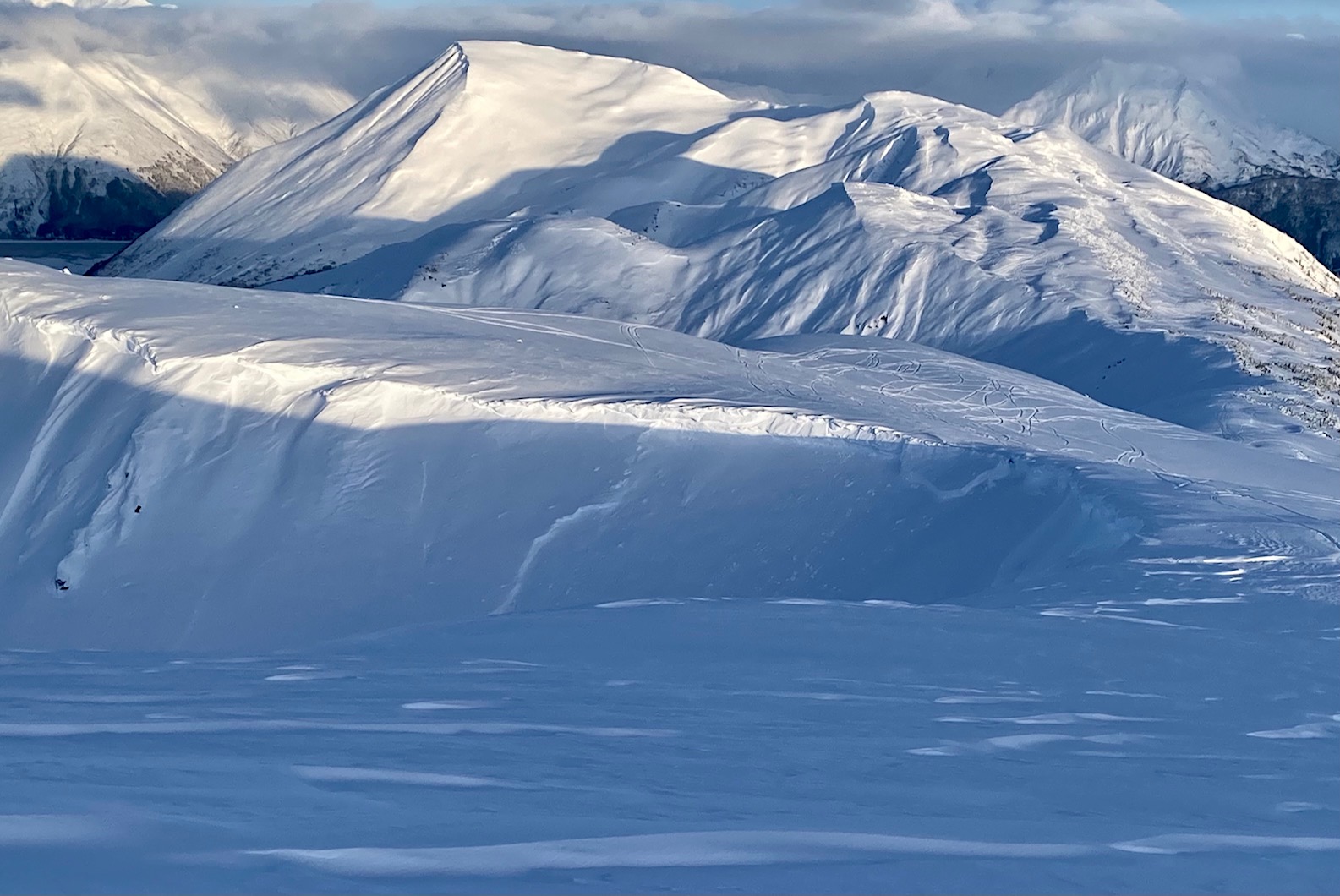
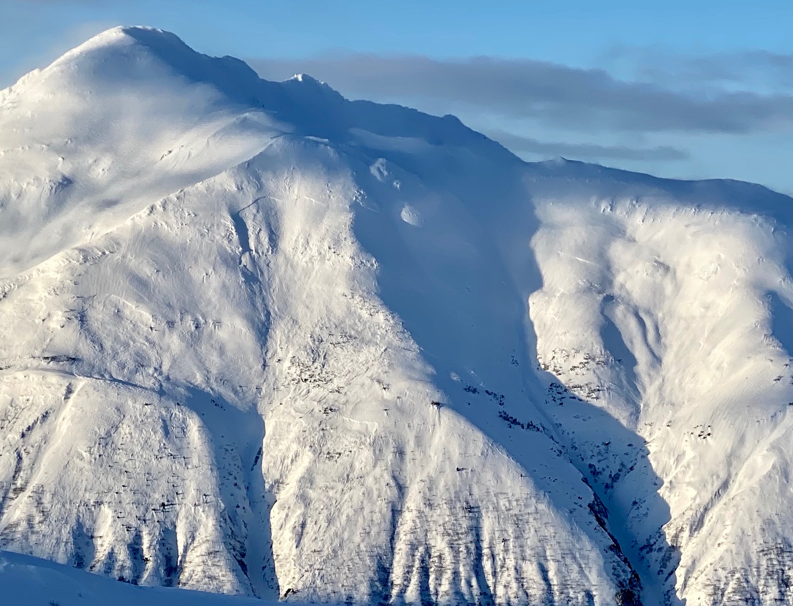
Across Seattle Ck drainage were much more ominous looking natural avalanches from the tail end of Thursday's storm. These were in the 1500' to 3000' elevation range.
See photos.
Tincan - there was what looked to be a storm slab avalanche in the lower Tincan Trees on the north end. No photo.
Obvious signs of instability
| Recent Avalanches? | Yes |
| Collapsing (Whumphing)? | No |
| Cracking (Shooting cracks)? | No |
Observer Comments
Recent avalanches were the red flags we got. No cracking/collapsing seen or felt.
Some very shallow and small new wind slabs were seen (~6" deep).
Weather
Partly sunny skies.
Winds were gusty from the NW along the ridge (~5mph, gusts to ~15).
Chilly... around 10F or so.
Snow surface
Two feet of settling storm snow from Thursday night's storm.
Wind effect along the ridge... soft sastrugi...
Snowpack
We dug one pit to look at the new storm snow.
SE aspect at 2,200' - total snow depth was 10-11 feet.
Snow depth above the facets was 5-6' and the Halloween crust was 6' deep.
We only tested the top 4' of the snowpack and had no results (EXTX). The top 2 feet of new storm snow is soft (fist hard) and sits over a stiffer layer of storm snow from 4-5 days ago. The new storm snow looks to have bonded with the other settling snow from earlier in the week. Save for any wind slabs... we only saw very small ones, but I'm sure there are larger ones out there.

Large natural slab(s) that released sometime during the stormy weather on either Dec 6th ish or Dec 9th ish.
Natural cornice fall that looks to have triggered a storm / wind slab below in Zero Bowl.
Natural slabs seen across Seattle Ck from the weather station

Close up of the slabs pictured above
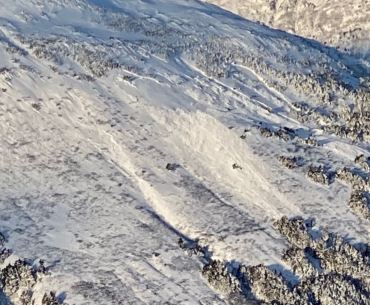
More natural slabs at a lower elevation (~1500' maybe?)

Older natural slab on the road side (SE face) of Seattle Ridge - across from the motorized parking lot.

Snow pit at 2,200' on a SE aspect.

Jr's Bowl - some wind effect...

Warmup Bowl - the glide crack that is mid-slope looks to be covered up or filled in.