| Trigger | Skier | Remote Trigger | No |
| Avalanche Type | Hard Slab | Aspect | Southeast |
| Elevation | 2800ft | Slope Angle | unknown |
| Crown Depth | 6in | Width | 20ft |
| Vertical Run | 300ft |
Avalanche: Turnagain
Location: Seattle Ridge
Approached TT43 from Cornbiscuit lot. Crossed the bridge and headed up a scoured ridge to 3500′. Descended a leeward ridge just north of our uptrack.
Avalanche Details
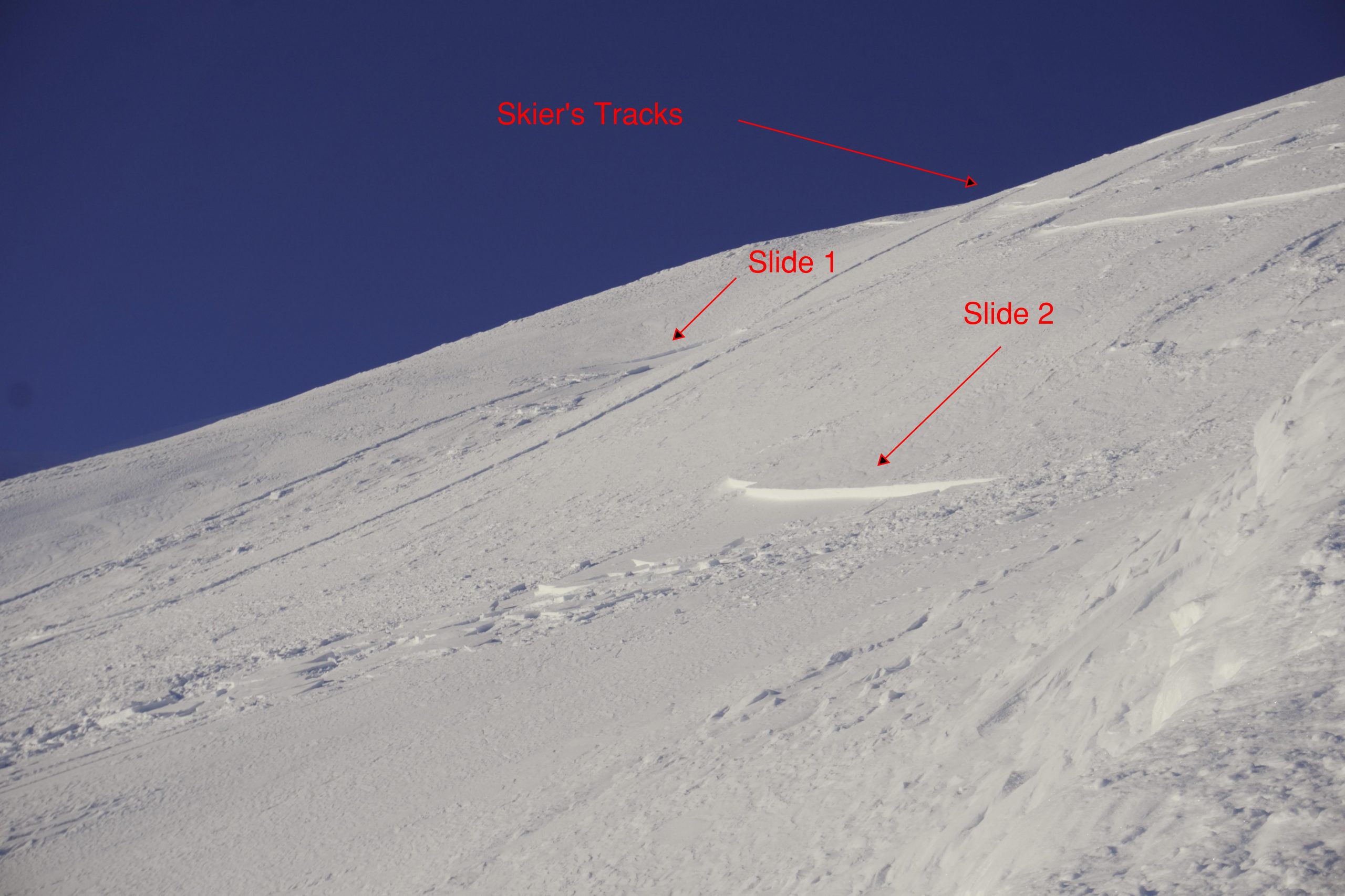
While descending a leeward ridge, my ski partner made several hard turns while traversing a windloaded slope. He was able to trigger two windslabs, both initiated from his sluff and stepped down, further down the slope. The debris combined and ran into a steep gully/slide path.
Obvious signs of instability
| Recent Avalanches? | No |
| Collapsing (Whumphing)? | Yes |
| Cracking (Shooting cracks)? | Yes |
Observer Comments
Near the top of the ascend ridge I walked onto a steep wind slab. The slab fractured and failed, but only shifted ~1" due to the terrain feature. The cracks propagated south out of sight roughly 150' into a steeper slope. We did not see any signs on a slide, from the ridge or the road. The pin on the map indicates the location of this event.
Weather
Very cold in the valley. Slightly less cold at elevation in the sun. Snow transport visible on Pastoral and the peaks above Lynx Creek. Miserable west wind on the bench at 3500' between TT43 and New World.
Snow surface
Impressive surface hoar in the valley. Very light sugary snow on crust up to ~2100'. Most snow was wind affected above alder line.
Snowpack
We investigated the snowpack at the site of the large shooting crack.
Pit location: 3500' SE
HS 80cm
Slab depth ranged from 30-45cm of Pencil to 1F wind deposited snow
The weak layer was 10cm of 4F facets sitting on Pencil hard snow
No formal stability test.

The slab failed and cracked all around me, but only shifted an inch.

A hard windslab sitting on a layer of loose facets was the culprit.
Two windslabs failed and slid in a leeward gully.

Debris