No signs of obvious instability.
Observation: Turnagain
Location: Seattle Creek Drainage
Rode into the Seattle Creek drainage to investigate the weak layer responsible for the widespread natural avalanche activity last week as well as the several snowmachine triggered slides in the area from over the weekend. Bad news, the March 27 buried surface hoar was the culprit weak layer (as suspected) and this means the potential for human triggered large avalanches remains and will not go away soon in areas that have not slid.
Observer Comments
Weather
Mostly cloudy skies, temperatures in the 40's at 1,000' and 30's at 2,500'. Winds were light from the Northeast. A few flurries in the afternoon but no measurable accumulation.
Snow surface
Lower elevation (1,500' and below) had a supportable 6-8" melt-freeze crust that softened and became unsupportable by 3-4pm in the afternoon. Above 1,500', a 4-10" layer of moist settled powder existed over a 4-6" melt-freeze crust (some skiers in the area classified this as fun creamy skiing, while snowmachines were not penetrating more than 4").
Snowpack
Dug two pits today. The first was a flank profile for a suspected snowmachine triggered slab avalanche in Main Bowl. The second was near the weather station in a thin spot in the slab to assess potential trigger points for the future.
Pit 1: 2,100' NW aspect. Flank of avalanche.
Slab was 3' thick on flanks and between 2-6' thick at the crown. Average hardness was 1 finger.
Weak layer: BSH 6-8mm
1,500' wide, estimated, running 1,500'.
No stability tests, weak layer had collapsed and had strengthened.
Pit 2: 2,300', N aspect. Thin spot in the slab to assess weak layer that has not collapsed and a potential trigger point.
ECTP 16, 18, 21 down 35-40cm (16") on the Mar 27 buried surface hoar
Slab was 1 Finger hardness and capped by a 2-5cm melt freeze crust with a rimed surface (wind scoured zone, hence why it was a thin spot).
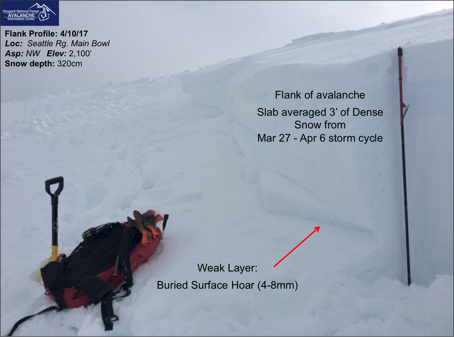
A look at the flank of one of the slab avalanches triggered in Main Bowl in Seattle Ck presumably on April 8th.
Wider view of avalanche where flank profile was performed, in Main Bowl - Northwest facing. Crown 3-5' deep.

Bed surface with buried surface hoar in clear view on the top - proving its guilt
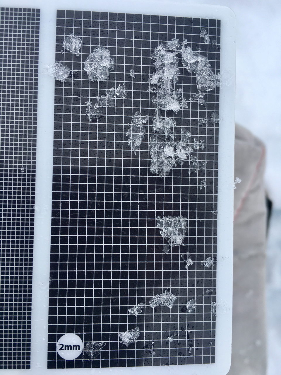
6-8mm in size at this flank, however larger grains were seen in other areas - up to 1cm

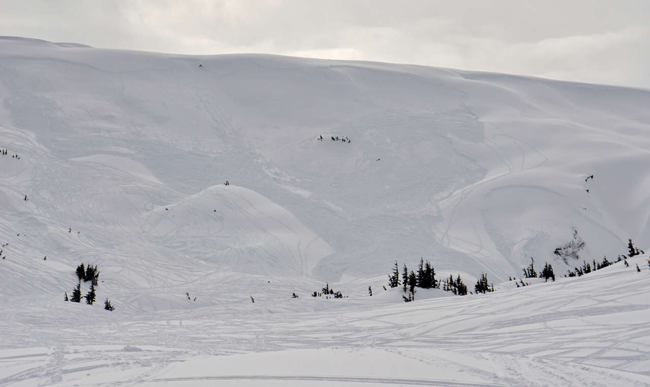
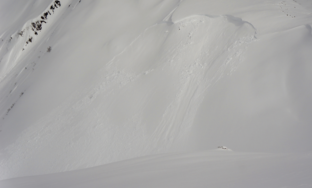
A picture of the two other avalanches reported in Main Bowl on April 8th. Possible snowmachine triggered as well, with pockets pulling out sympathetically.
Closer look at these slides - looker's left of the main 'Widowmaker' slide path

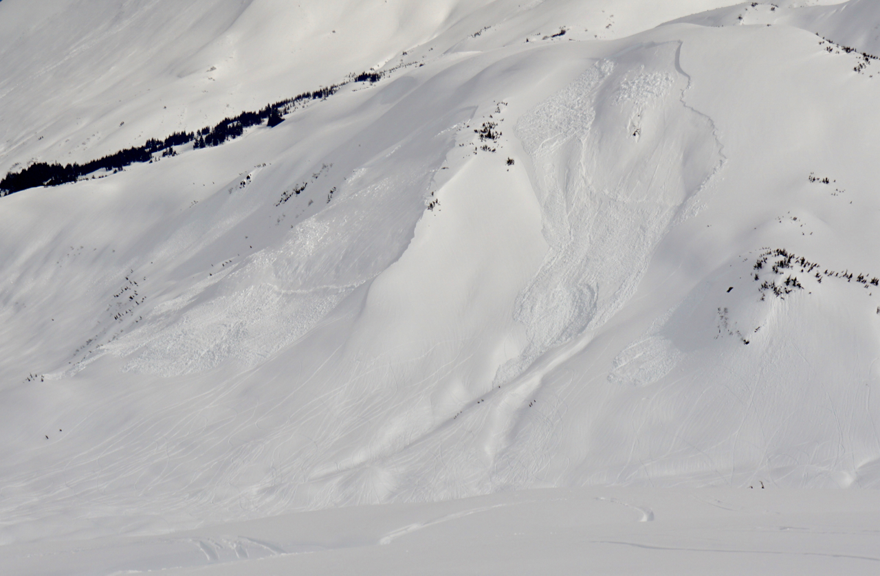
Jr's Bowl and a reported snowmachine triggered slide in here from April 8th. Crown appeared to be 6-10' deep with wind loading near the ridgeline.
A closer look at the avalanche in Jr's bowl.
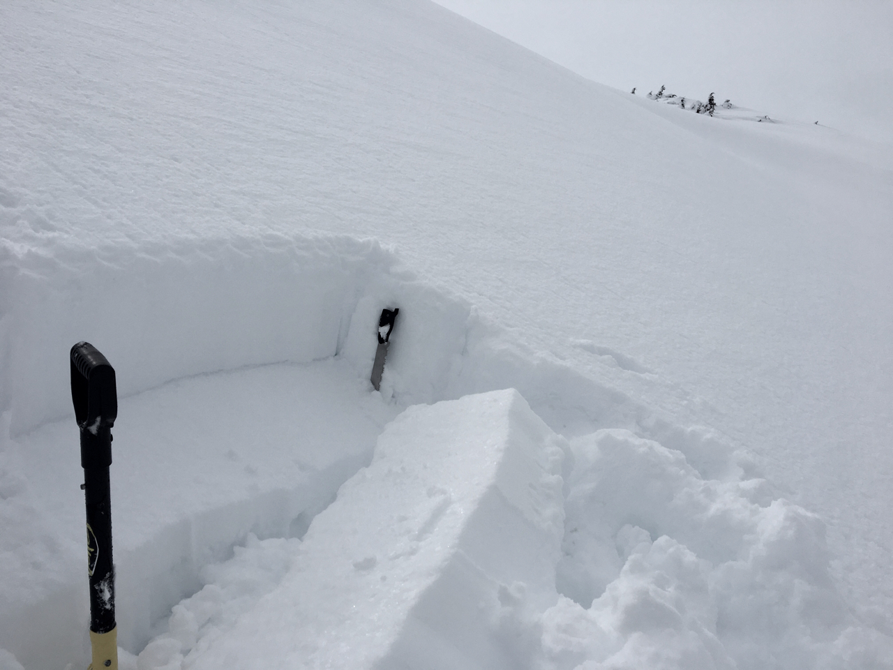
Pit 2, dug in a shallow zone which is a likely trigger spot as the weak layer becomes harder to trigger as time passes. ECTP 16, 18 and 21, down 16" on BSH