Strong snow over weak snow at ground
low density snow immediately above 12/4 crust
Observation: Summit
Location: SE Summit Pass
800′ – HS 45, supportable rain crust under 4-6cm, marked rain runnels, LOUD skiing
1000′-1350′ HS 70-80cm, crust becomes unsupportable
2100′- HS 100cm, 10-15cm soft snow over MF crust (12/4)
2650′- notable wind effect increasing to Ridgeline
inversion and wind shear increase in valley throughout the day
Observer Comments
Weather
new snow after obvious prior rain
clear, cool, light breeze in the alpine
Obvious storm front to the South
a zephyr of warm air @ 1215h
Snow surface
increasing new snow with elev. and disappearance of 12/8 rain crust
1-1.5cm SSE wind skin above 2650'
Snowpack
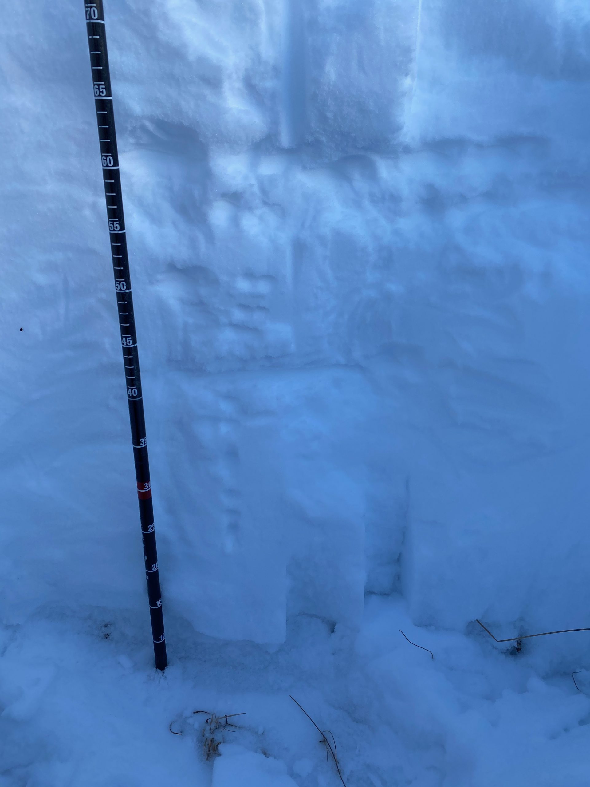
3 pits w/in 30' radius high variability, all showed strong 1F slab over F basal facets (4-4.5mm)
100cm pit - ECTN, STE @ ground
80cm pit - ECTP24, CT16, STE @ ground
50cm pit - ECTP14, CT1, STE @ ground
Watch out for the thin part(s) of the slab!
still lurking