| Trigger | Natural | Remote Trigger | 0 |
| Avalanche Type | Unknown | Aspect | Unknown |
| Elevation | unknown | Slope Angle | unknown |
| Crown Depth | unknown | Width | unknown |
| Vertical Run | unknown |
Avalanche: Girdwood
Location: Road obs between Whittier and Ingram Creek.
Afternoon road trip to view the avalanche carnage in the wake of this potent spring storm. Girdwood – Ingram corner – Portage – Whittier.
Avalanche Details
Widespread natural avalanche cycle since 3/27. Likely most active 4/4 - 4/6. All aspects and elevation bands. Portage and Placer zones seemed to have the most activity.
Obvious signs of instability
| Recent Avalanches? | Yes |
| Collapsing (Whumphing)? | No |
| Cracking (Shooting cracks)? | No |
Observer Comments
Roller balls observed this afternoon in Portage on due south slopes.
Weather
46 degrees in Girdwood at 4:30pm. 43 degrees in Portage. 38 degrees in Whittier. Winds were light from the east. Skies partly to mostly sunny. Definitely the most sun we've seen in a week and a half.
Snow surface
Many areas around Girdwood and Portage sported a 'sheen' indicative of a sun crust. Rain runnels very evident on terrain in Whittier leading up to the Whittier Glacier.
Snowpack
Most avalanches I observed appeared to be breaking mid-pack (storm snow only?). Many were very connected and showing serious propagation potential, indicative of failing on buried surface hoar or facets.

Squirrel flats up track. Looked like at least 3 separate avalanches deposited debris in the gut.
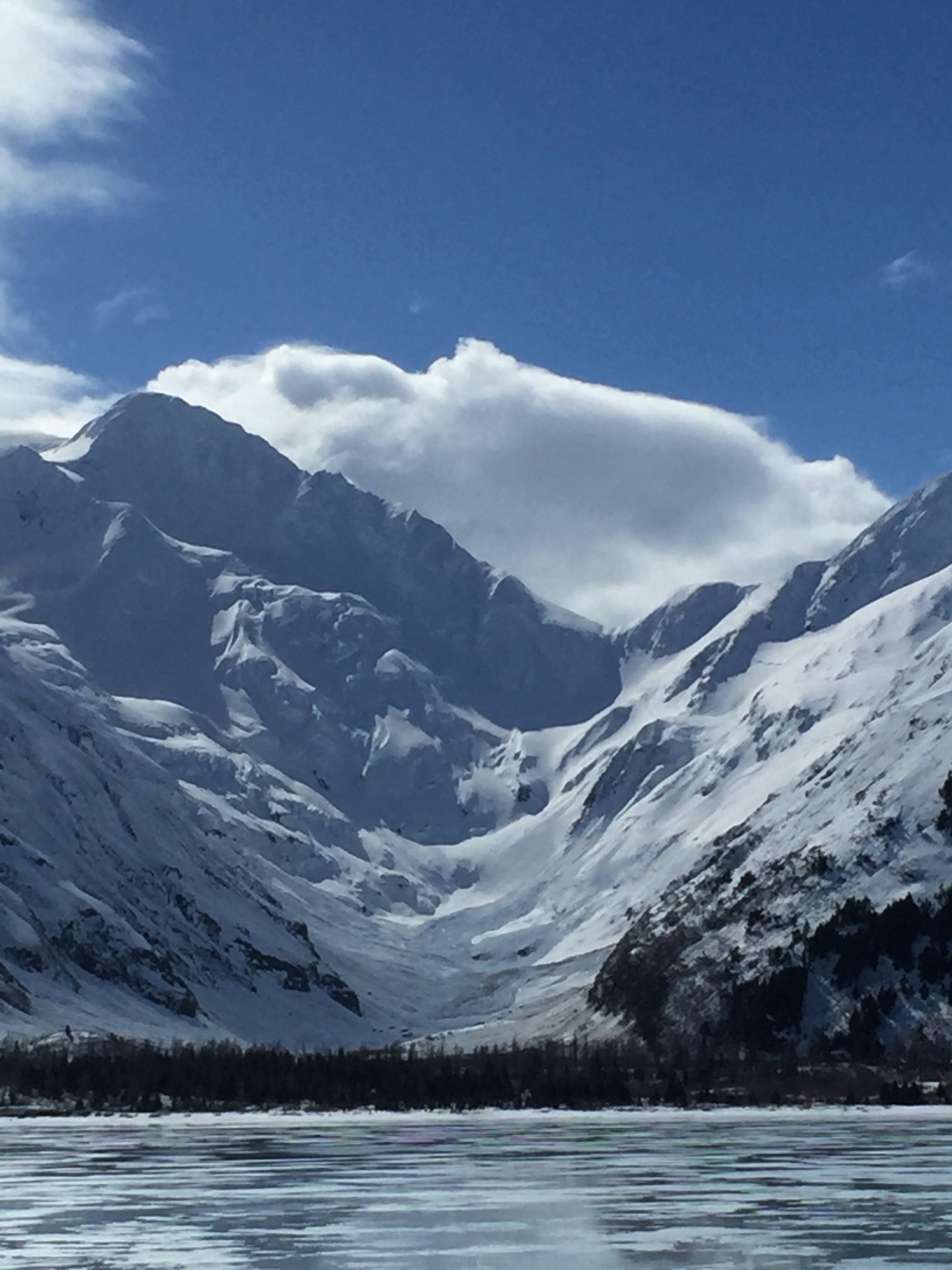
Byron Peak. The Byron Glacier Trail runs up the center of this Valley and is covered in debris from both sides of the valley.

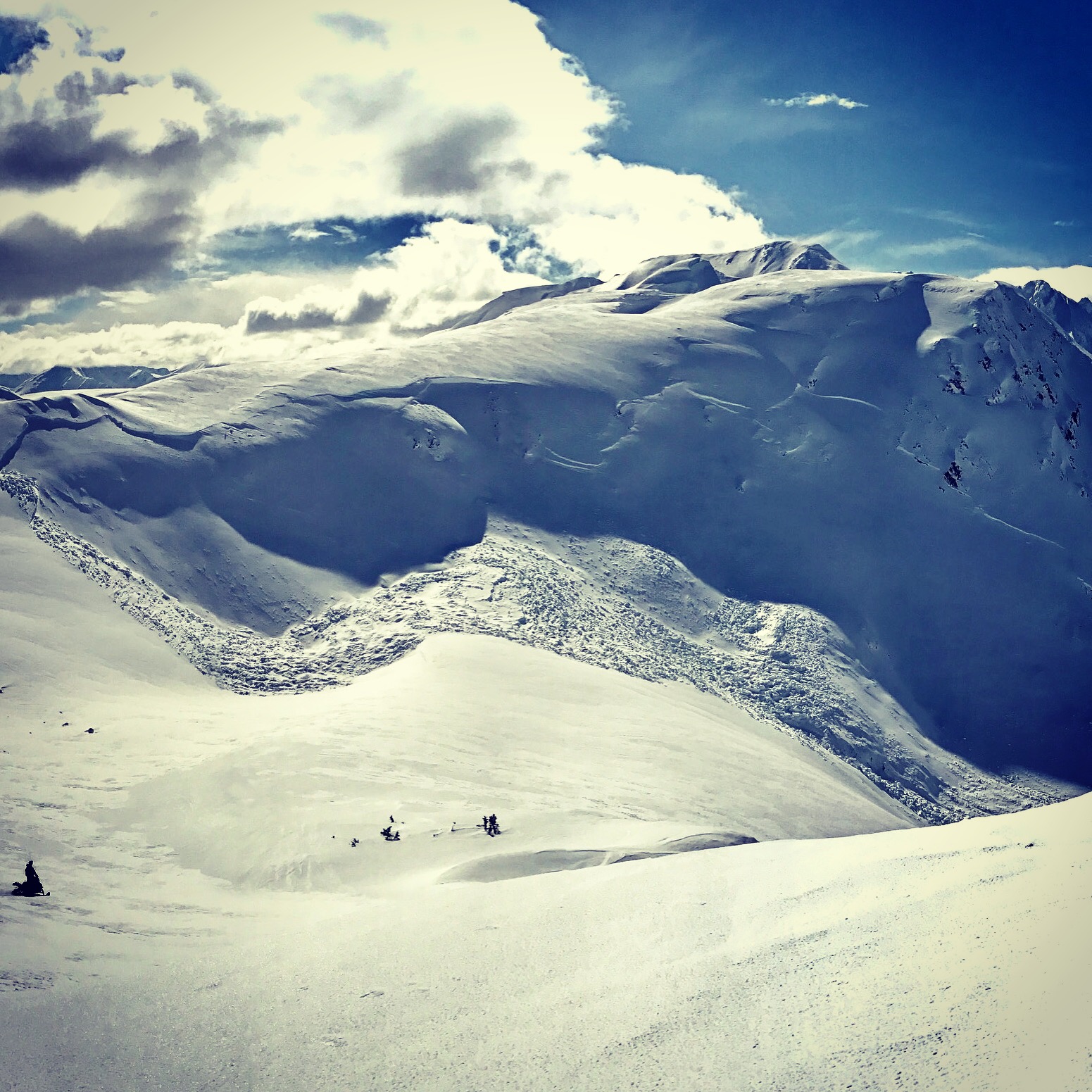
Crown of a large avalanche lookers right of the Anton Anderson tunnel to Whittier.

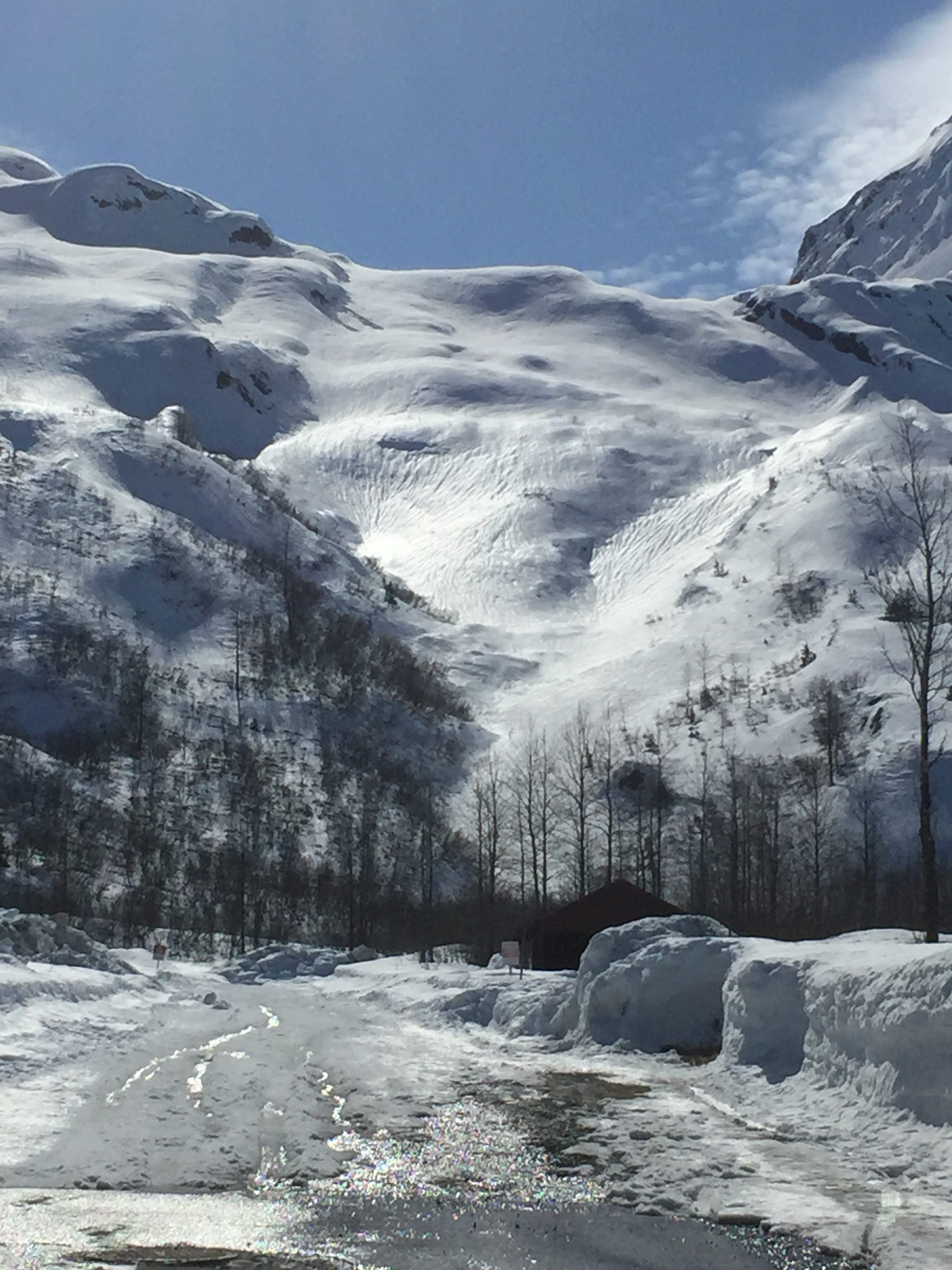
Close up of debris, lookers right of the tunnel (Portage side).
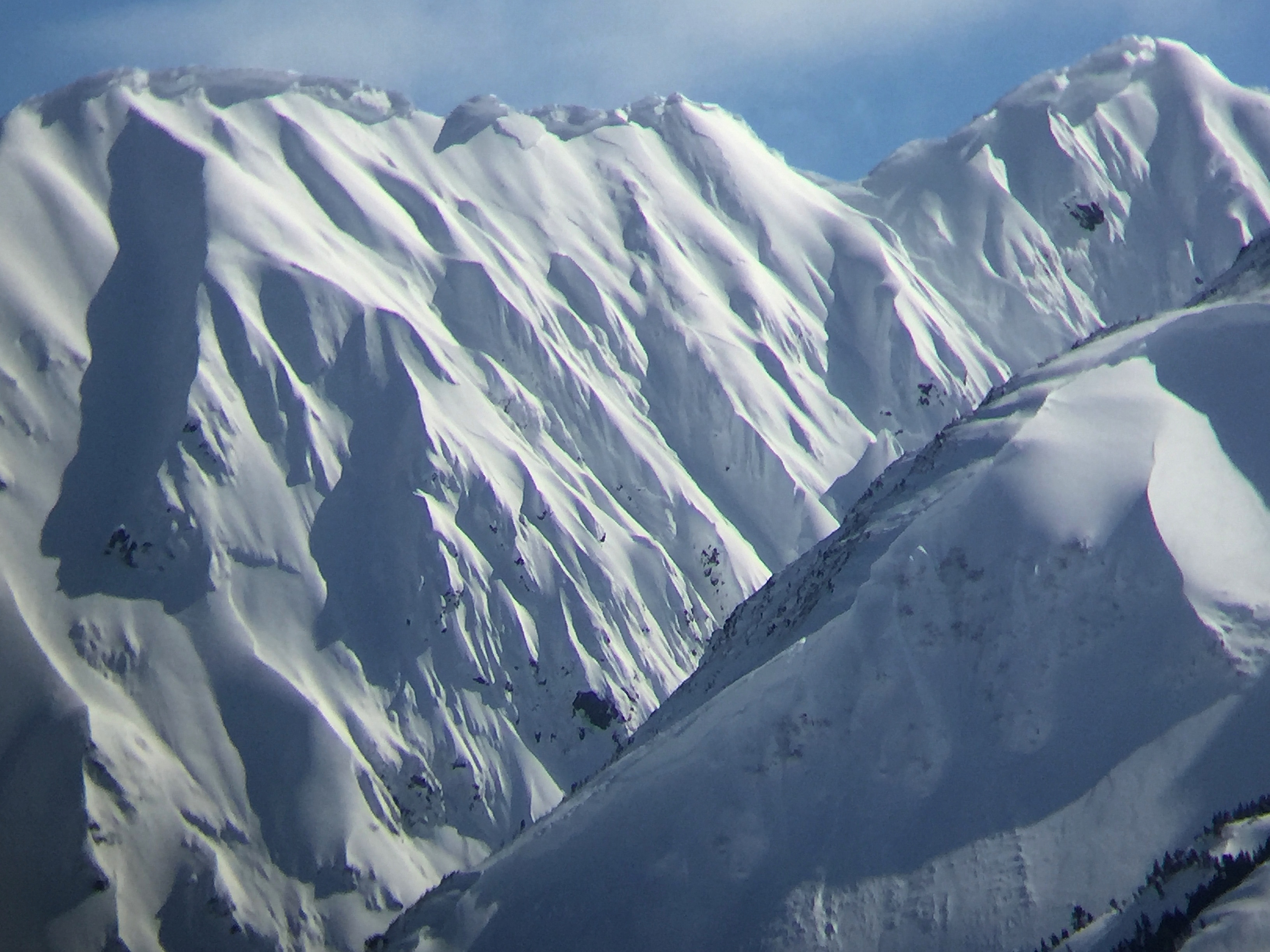
Mid-slope crowns and large cornces loom over complex terrain in Portage Valley
Natural avalanche mid-storm in Warm up bowl, Seattle Creek. photo: Travis Smith
Rain runnels leading up to the Whittier Glacier.