No cracking, collapsing or observed avalanches.
Observed strong SE wind plumes on Peak 3 ridge (3,000 ft) and S. Suicide Peak (5,000ft+) at approx. 10:45 which calmed down around 11:15.
Observation: Chugach State Park
Location: Rabbit Creek Canyon
11:15-4:30pm
Approach contoured the Rabbit Creek canyon before ascending southwest into gradual meadows below McHugh Proper.
Our intentions were on familiarization of snowpack within this area and assess early season setup.
Blue skies, no crowds, and no Avalanche related incidents made for a solid Sunday tour!
Observer Comments
Weather
Clear sky
-7°C to -5°C in shade
Calm to light SE winds during tour
Observed slight sun affect on ridges and gullies of Peak 2,3,4, and Ptarmigan.
Snow surface
Surface Hoar feathers from 6-8mm were present 1,500ft and up to our high point of 2,600 ft.
Trees in area still maintained snowfall accumulation leading to a lack off wind within area.
Ski/Boot Pen: 10-20cm/ 30-60cm.
Snowpack
In general, an early season setup of basal facets associated with a MF crust, supports a varied middle layer, with widespread surface hoar existing on most north facing aspects.
Due to a cooling event following a possible early November snowfall, buried surface hoar (6-8mm feathers) exists generally 15-25cm below the surface, found easily above 1,200ft , that produced results in our instability tests at 2,400 ft.
Due to the shallow snowpack and open terrain, we believe the snowpack base and mid-layers varied greatly from water runnels on the ground surface, ultimately creating a mixed base of melt-freeze, pencil hard crust, while being meters away from a loose, sugary facet base. This dry on wet layer could continue to produce facets above and below the crust, so a natural loading event could be the next trigger for slopes with the existing basal facet setup to release.
Height of Snow varied from 60cm to 100cm in terrain traps and exposed ridges. *See SnowPilot for Details*

SnowPilot Profile

Buried Surface Hoar- Photo by Kakiko
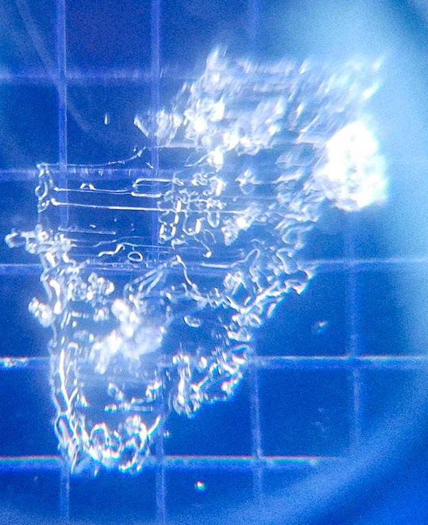
Buried Surface Hoar (6-8mm) found 20cm below surface.
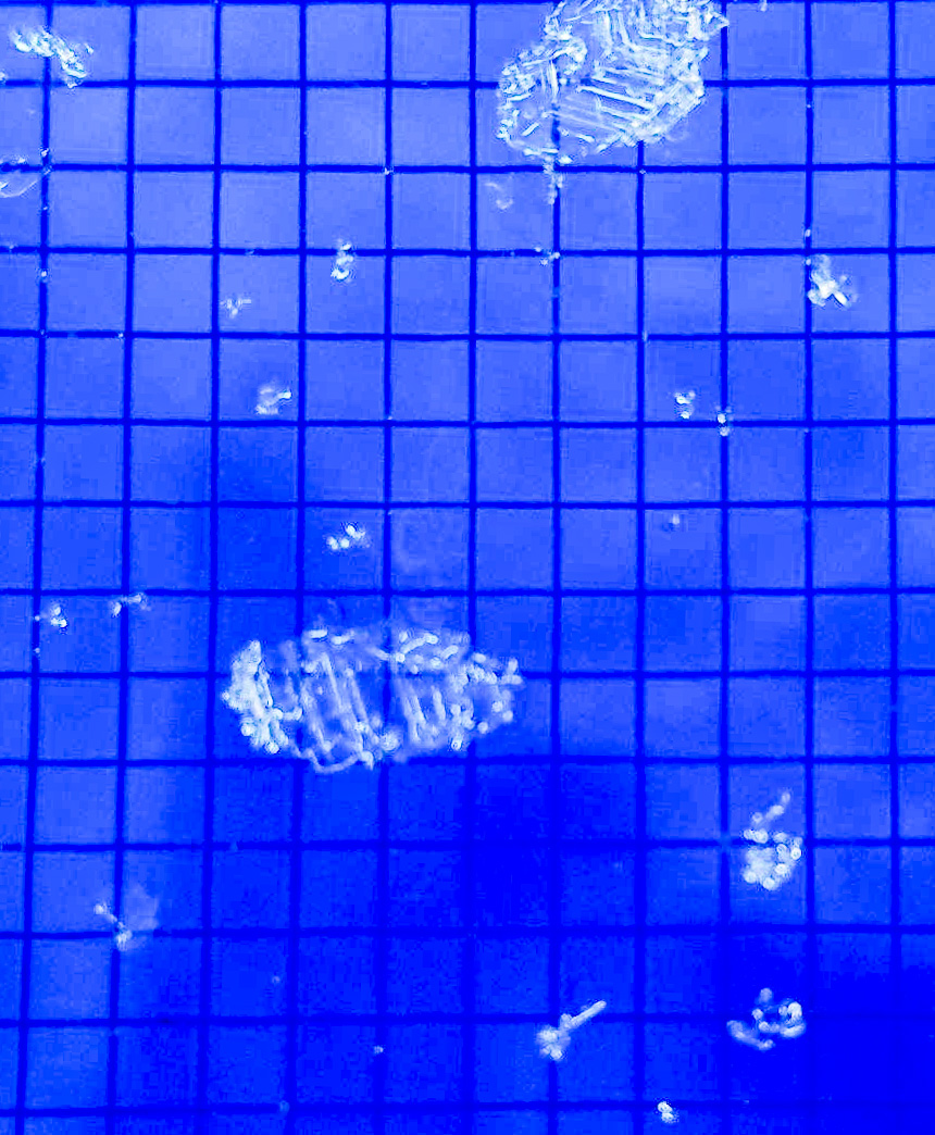
BSH on crystal card