| Trigger | Skier | Remote Trigger | Unknown |
| Avalanche Type | Soft Slab | Aspect | West |
| Elevation | 2100ft | Slope Angle | 35deg |
| Crown Depth | 6in | Width | 100ft |
| Vertical Run | 50ft |
Avalanche: Turnagain
Location: Pete's North
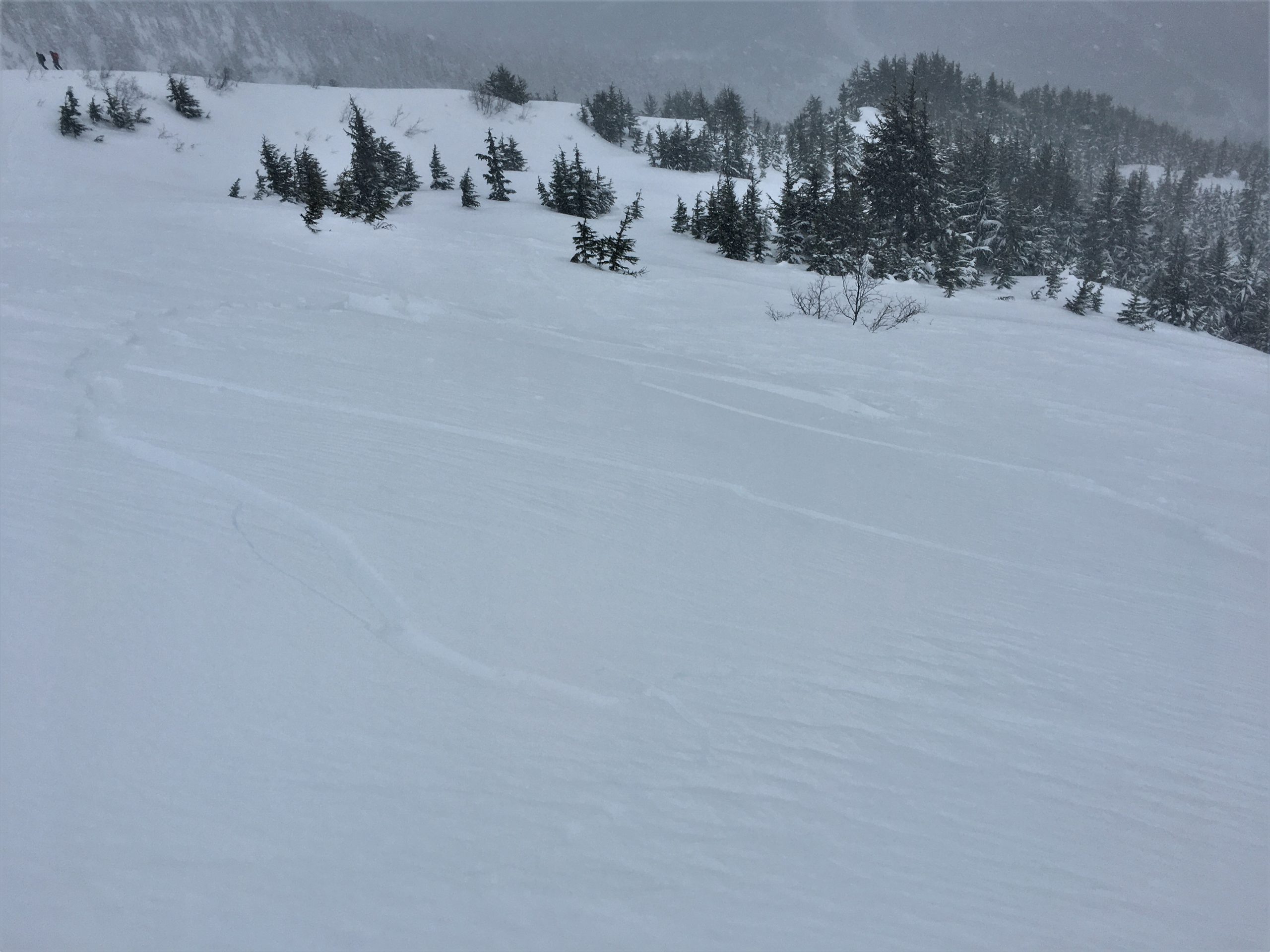
We toured up to about 2200′ at Pete’s North and skied a few laps in the trees.
Avalanche Details
We were able to trigger multiple small wind slabs that formed as winds picked up for a few hours mid-day.
Obvious signs of instability
| Recent Avalanches? | Yes |
| Collapsing (Whumphing)? | Yes |
| Cracking (Shooting cracks)? | Yes |
Observer Comments
We saw a lot of shooting cracks on wind-loaded slopes that weren't steep enough to slide.
We met another group that got a large collapse as they worked their way up an existing skin track for their second lap of the day:
"At 1600' on a NW aspect, ~32 degree slope on Pete's North we heard a large collapse that propagated throughout the entire clearing in the trees... probably 75+ yards wrapping around us from the SW aspect to the North. This was on our second lap having put in the track earlier with no result, and after 8 people had also traveled on the uptrack. It occurred when a member of our party was just exiting a slightly tree sheltered area - total snow depth at the location was 140cm, with the new snow above the Dec 1 crust totalling just 50-60cm. We dug at this spot, and the 60cm slab started fist hard and transitioned to four finger+ (see photo below), sitting on a broken up super thin crust, with several centimeters of fist hard facets below that. This all sat on the stout crust that was ~5cm thick and pencil + hard. For test results, got a CTV, CT6 SC down 60cm, and an ECTP 17!" (From Andy Moderow)
Weather
Light snow for most of the morning until around 2:00 p.m., with winds picking up to 15-20 mph for about two hours before the snow finished. Winds calmed down and skies cleared at the end of the day.
Snow surface
About 4" new snow, sitting on top of another 6" or so of soft snow from earlier in the week. The newest snow buried a crust that only went up to about 800'. Winds were making fresh slabs about 6" deep throughout the day.
Snowpack
Our main concern was fresh wind slabs that were easily triggered with ski cuts. There was still plenty of snow available to make these slabs deeper if (when) winds pick up.
The more surprising find was the large collapse in the 12/1 facet/crust combo. This seems like an isolated incident at this point, but it is definitely worth paying attention to. Tests on this layer showed mixed results- ECTX (x3), ECTP17, ECTP26.
More snowpack info in snowpit profile.

Shooting cracks on a freshly wind-loaded slope. Photo: Andy Moderow. 12.26.2020
Wind slab that fractured with a ski-cut. The slope was just not quite steep enough for the slab to run. 12.26.2020

Small wind pillow that fractured with a ski cut. 12.26.2020
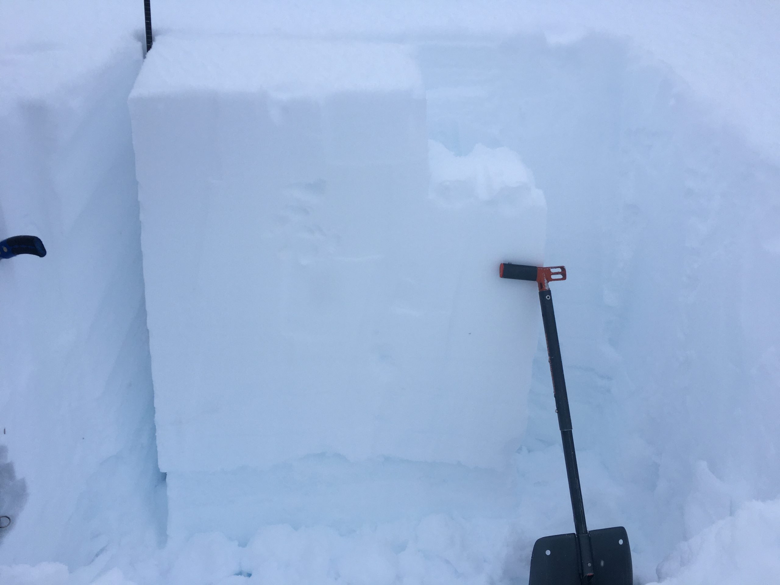
Unstable test result (ECTP26) on the 12/1 facet-crust combo. 12.26.2020

Snowpit profile from NW aspect near 1500'. 12.26.2020