Nothing too recent - all activity occurred during last storm cycle (Jan.26th)
Some small surface cracking in top 3" of snow where wind was activily filling in old skin track
Observation: Turnagain
Location: Pete's North
Standard route from Power lines up West aspect of Pete’s North. Good coverage in trees, but not many options through alders in mid meadow. Could see several older small slab avalanches from the Jan.26 storm on the North side of Pete’s South and a good view of the larger natural activity in the gullies on the S. end of Seattle Ridge above Bertha Creek. Active wind loading was observed above treeline on South and West aspects.
Observer Comments
Weather
Cloudy becoming overcast by afternoon
East winds 15-20mph (Shifted between NE and SE at times)
Temperatures were on the rise throughout the day (24F at 10:30 and 30F at 3:30pm - at 1000')
Light flurries, no accumulation was observed
Snow surface
2-4" of loose settled snow on a firm melt/freeze crust below 1500'.
6" of loose settled snow on the surface above 1500'
Snowpack
Below 1400' - two firm melt/freeze crusts are within the top 12" of the snowpack. By 1500' they become very light and disappear
Probed along West ridge between 2200' to 2500'. Height of snow varied from 100cm (on flat more scoured areas) to 180cm (deepest areas of W and SW slopes.)
Pit at 2350', W aspect, 32* slope, HS=170cm, We found a deep snowpack with a large slab (just under 4' thick) sitting on a 4F hard layer of facets 120cm below the surface. It was difficult to trigger in a Compression Test, required 30 taps (CT30 RP.) PST 60/100 End. Did not do an ECT due to how difficult it was to trigger in Compression Test.
*Note for the PST we should have isolated a longer column 120cm (same length as the weak layer is deep) - results are not fully up to SWAG standards.
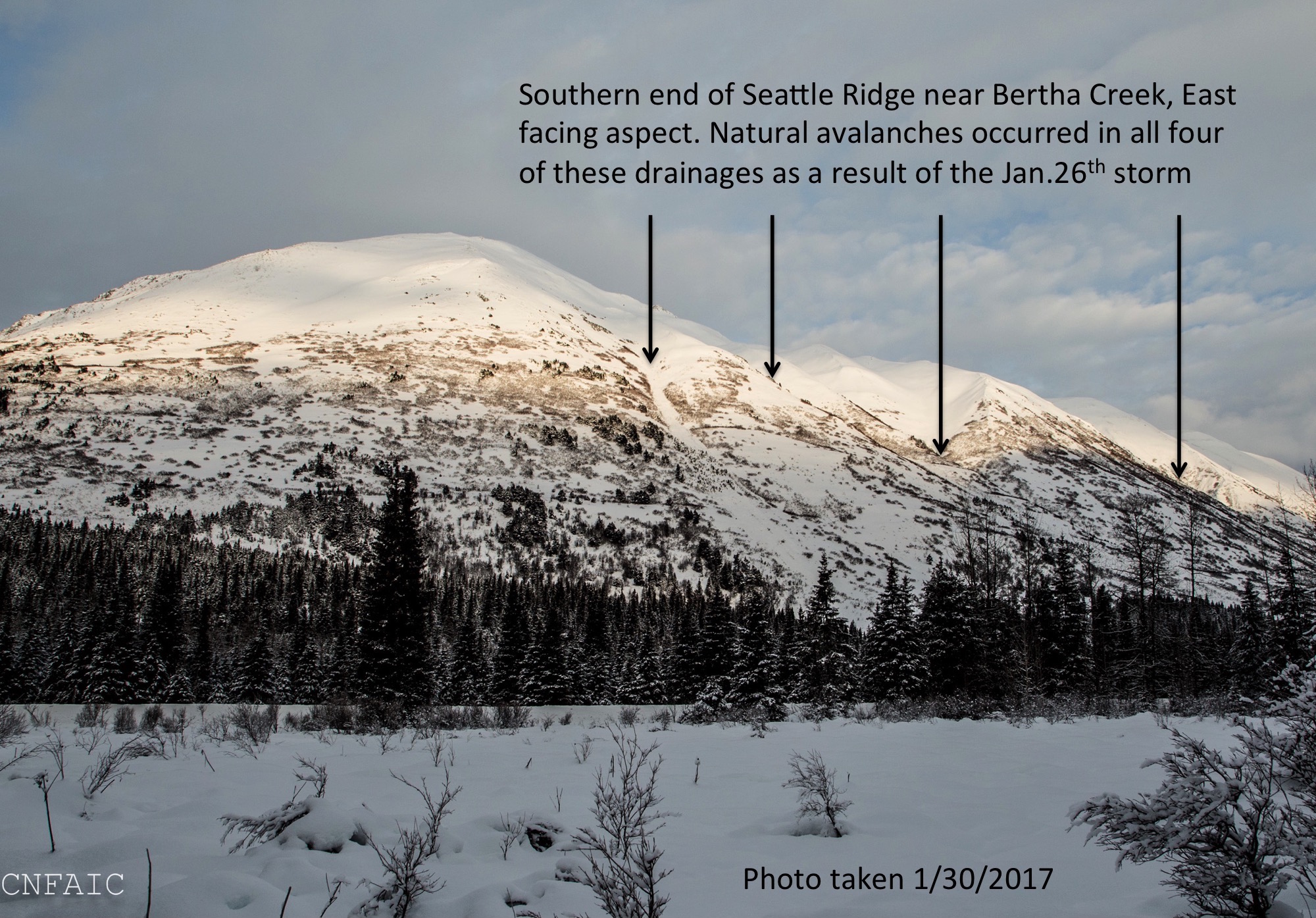
Recent avalanche activity on the East facing aspect of Seattle Ridge on the South side of Turngain Pass - all occurred near the Jan.26 storm
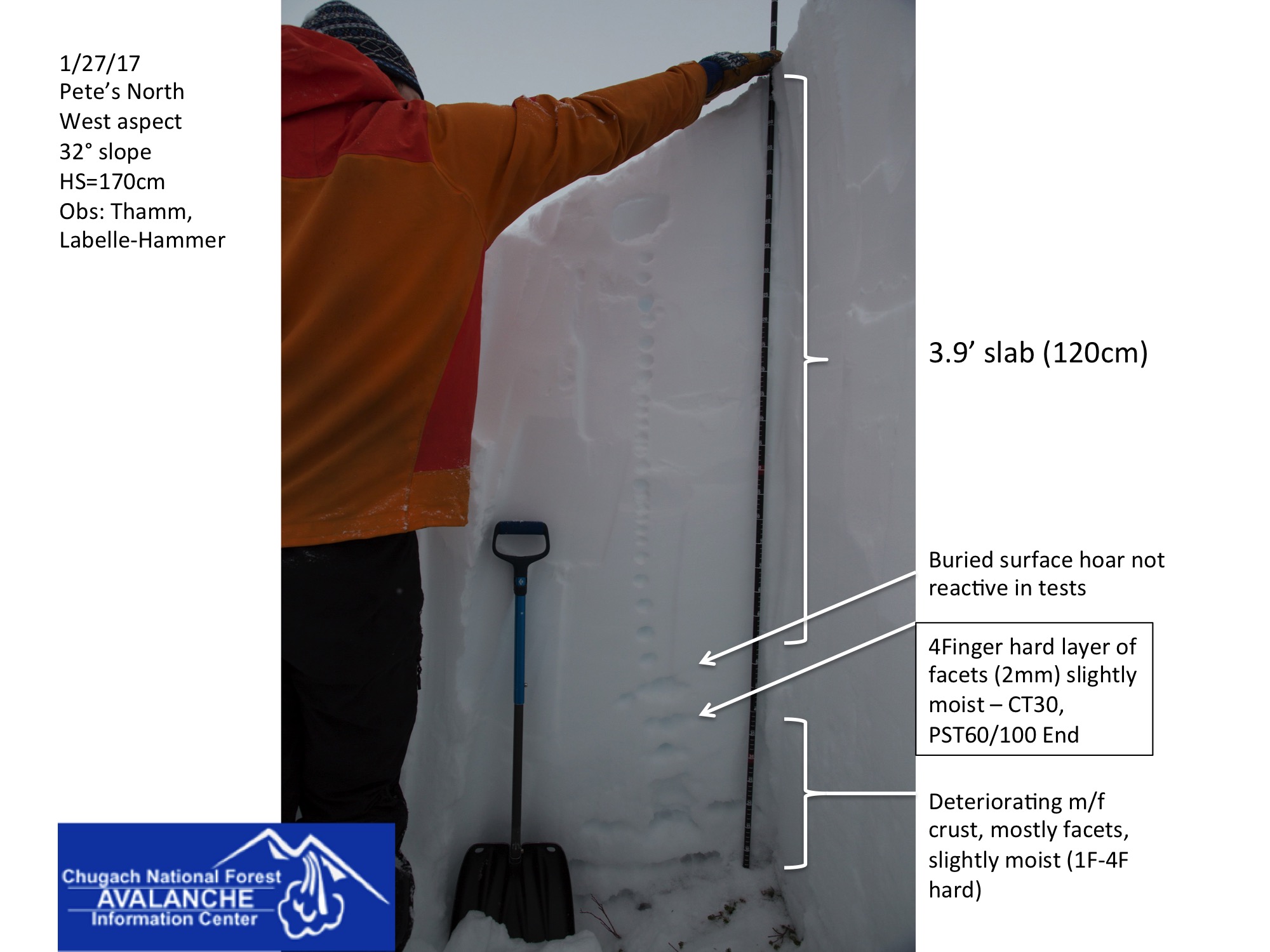
Pit at 2350' on W aspect of Pete's North

Two crusts that formed below 1400' due to rain and wet snow during the Jan.24 storm
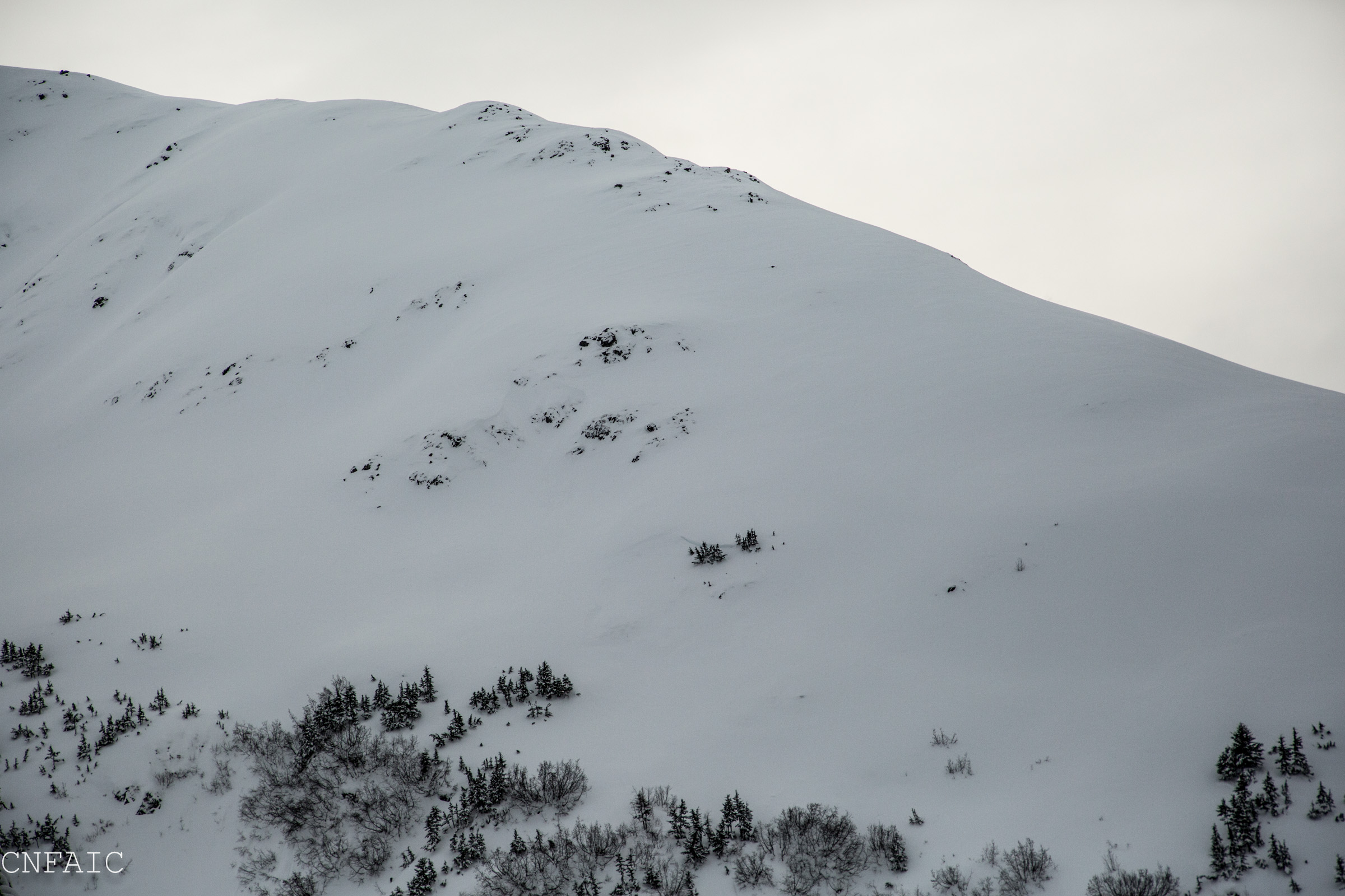
North aspect of Pete's South. This is an area with a thiner snowpack. One small natural mid slope, but otherwise this hasn't avalanched.

Clouds were moving above Seattle Ridge, but didn't see any flagging from ridge tops. Gullies show signs of cross loading

Small wet slab at 1000' that released during the Jan.26 storm. This is now a re-frozen melt-freeze crust with a few inches of loose settled snow on top.

Skin track was filling in with wind blown snow above treeline, but not enough to fully cover skin track.

Large chunks of snow in the foreground likely fell during the warm wet conditions on Jan.26th. A good view of how much snow is at 2000'.