| Recent Avalanches? | Yes |
| Collapsing (Whumphing)? | No |
| Cracking (Shooting cracks)? | No |
Observation: Portage / Placer
Location: Middle Glacier near Williwaw Camp Ground
We hiked over to the large avalanche debris pile near the bottom of Middle Glacier behind the Williwaw Camp Ground. This avalanche occurred in mid-March from a series of storms between March 7th-24th – an storm cycle that triggered widespread avalanches around our region. Bear Valley (Portage) DOT RWIS weather station recorded 27″ of rain – this amount of rain is equivalent to ~30+ feet of snow in the upper elevations. We estimated the debris to be 30+’ deep, a few hundred feet wide and extends a few hundred feet out of the canyon onto the flats. This specific avalanche was not even close to the size of some of the historical avalanches that occurred in the early 1980’s. For comparison:
“A large avalanche released from a high peak just south of Williwaw campground in Portage Valley in January (Figure 2.3). Debris from the avalanche crossed to the north side of the Portage Glacier Highway, and the wind blast area crossed the southern channel of Portage Creek, damaging Williwaw Campground and knocking over several hundred trees (March and Robertson, 1982.) Although this slide was likely on the order of a 100-year event (DOWL Engineers and Arthur I. Mears, P.E., Inc., 1983), similar events occurred here in 1982 and 1983.” – From the USDA 2004 Upper Turnagain Landscape Assessment.
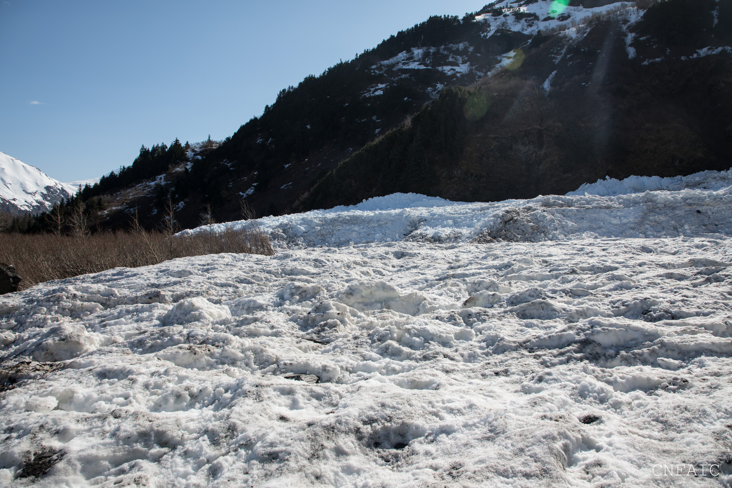
Jill Fredston describes in her book, “Snowstruck,” how an avalanche in this same path in 1983 had an impressive pile of debris and a powderblast that hit the Williwaw campground. “Where there should have been a two seater with brown walls and a green roof, white toilets sat exposed on a concrete pad. Nothing much bigger than a matchstick was left of the outhouse walls. In the surrounding forest, trees the diameter of basketballs had been yanked from the frozen earth like weeds, and pulverized limbs littered the ground. Some standing trees had pebbles embedded like shrapnel in their trunks, forty feet above the ground. Picnic tables weighing 350 pounds had been tossed like Frisbees half the length of a football field.” The 1983 avalanche had a crown 36 feet deep, the debris was more than 2000′ wide and 500′ long, equivalent to 22.5 football fields. The avalanche debris we saw yesterday was closer in size to one football field.
Obvious signs of instability
Observer Comments
None observed
This is not a recent avalanche from the last week.
Weather
Sunny
Temps - low 40Fs
LIght winds
No precip
Snow surface
No snow until we got to the debris pile

View of the debris at the bottom of Middle Glacier lower canyon from a viewing platform on the Trail of Blue Ice.
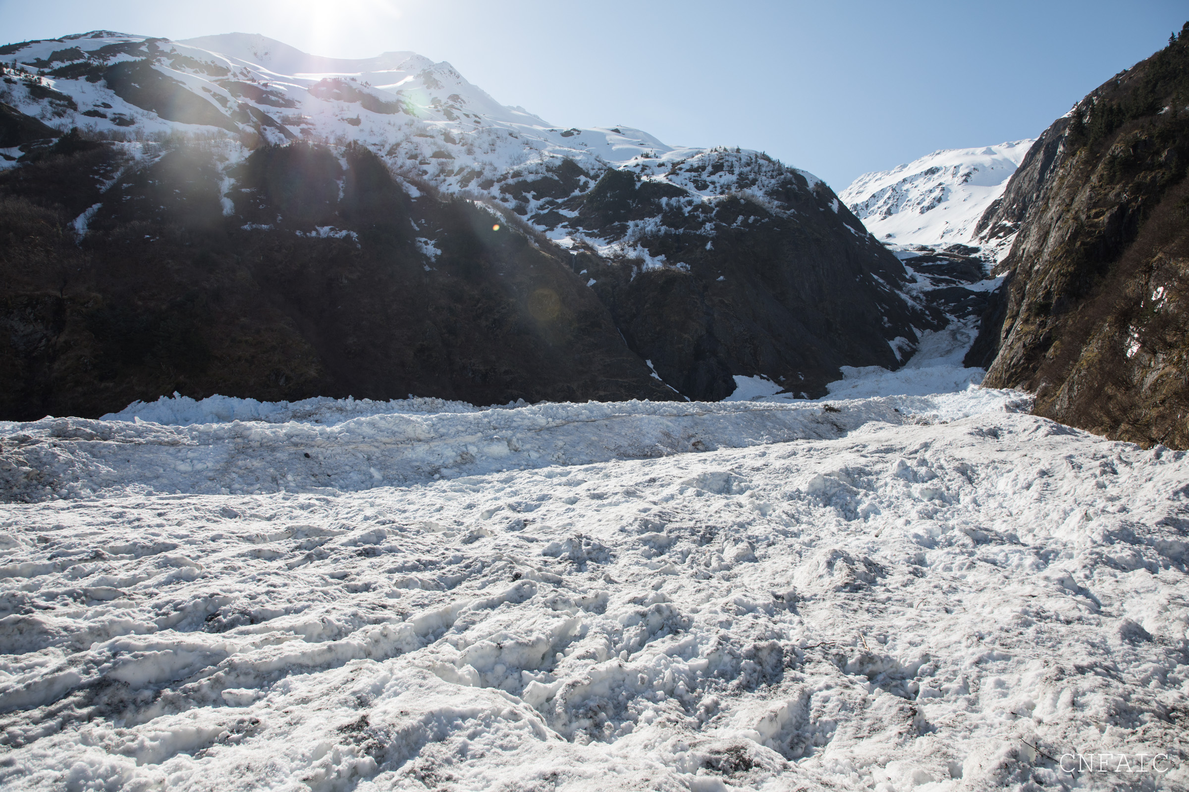
Standing on the edge of the debris looking up the canyon towards Middle Glacier

Looking at the toe of the debris. Notice the line of taller Cottonwoods, a good reference of where the debris ran in the early 80's.
Looking across the toe of the avalanche debris
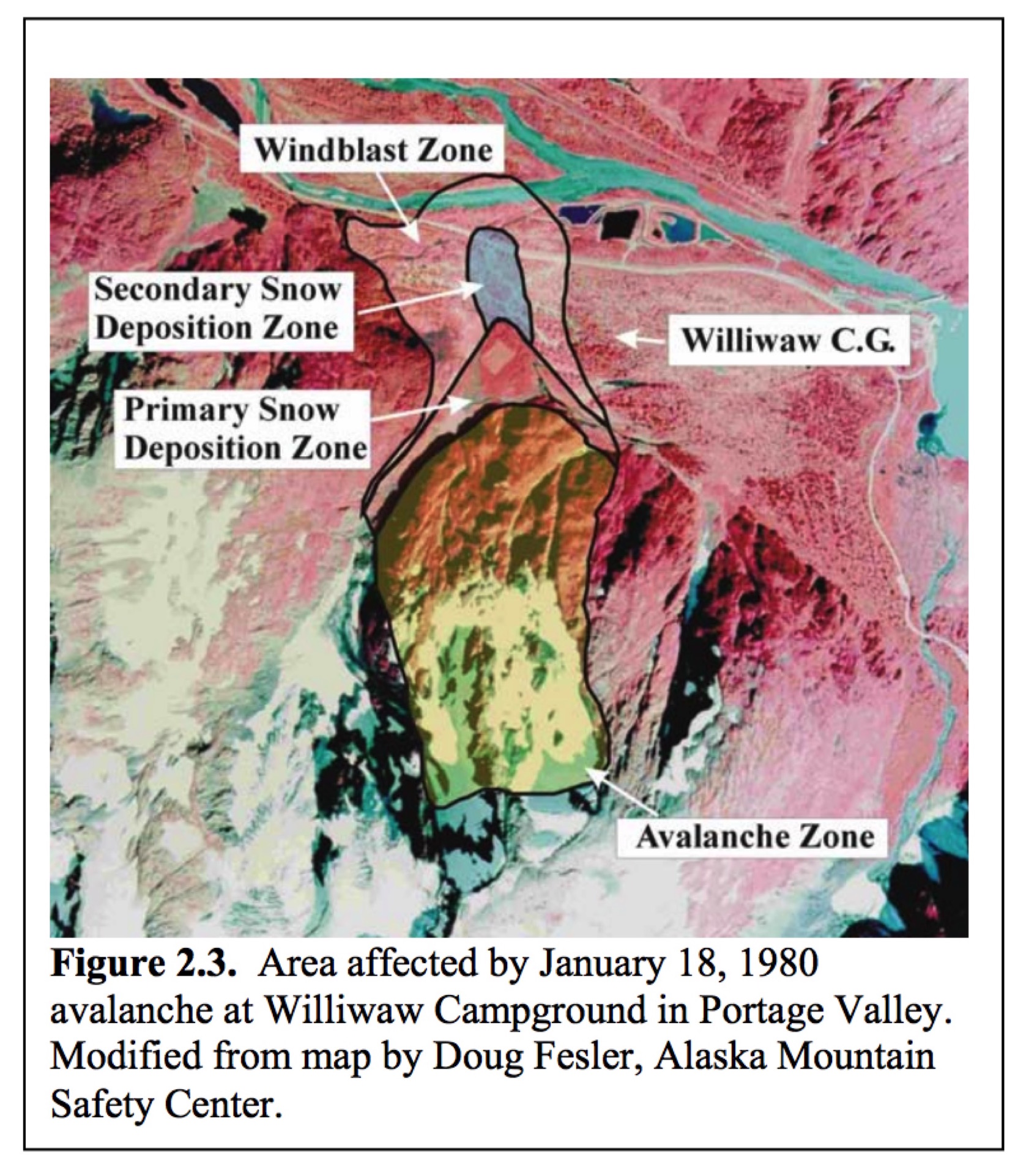
This diagram is from the USDA 2004 Upper Turnagain Landscape Assessment, and maps out the historical avalanche path.