| Recent Avalanches? | Yes |
| Collapsing (Whumphing)? | No |
| Cracking (Shooting cracks)? | No |
Observation: Hatcher Pass
Location: Marmot Mountain, SW Face
SW Face of Marmot Mtn. evidences significant wind effects after new snow of approximately six inches on Monday, 2/22, and wind events on Wednesday, 2/24, with gusts to 50 mph, and early this morning, Thursday, 2/25, with gusts to 60 mph.
Obvious signs of instability
Observer Comments
Storm point releases from rock surfaces.
Weather
Wind, 11G17, ESE from Wx Station. Broken skies. Temperatures, 32-34 F at 3000' eleva.
Snow surface
Wind crust and satstrugi.
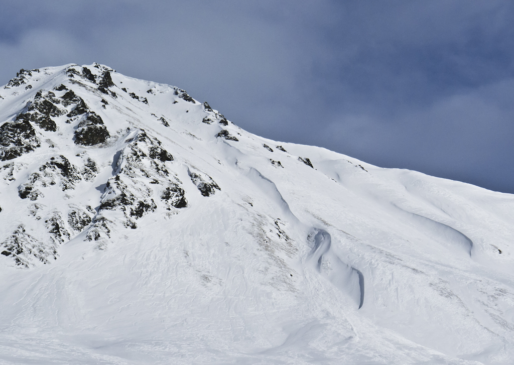
SW Face, Marmot Mtn., Wind Effects and Storm Releases