None observed.
Observation: Summit
Location: Manitoba Mtn
Standard approach post 12/13-14 wet storm and after new snow 12/15. No obvious sign of instability noticed on this aspect or surrounding slopes. Stout (frozen) rain crust to 2,200 with 2-3 inches of new snow on top and wet to moist snowpack underneath the rain crust. 6-8″ of new snow since 12/14 above 2,200 ft. Near surface rain crust becomes breakable 2,200–2,800 ft and disappears by 2,800 ft. Prominent older rain crust 60cm down at this elevation (3,200 ft), but seems well-bonded to layers above and below.
Observer Comments
Weather
2" of new snow overnight on top of 4-6" new that appears to have fallen after 12/13-14 warm, wet storm.
Calm, temperature = 25F.
Snow surface
wind-affected new snow (soft slab) approx 20cm thick.
Snowpack
See attached image (note: elevation = 3,200 ft not 2,800 as noted in pit image).
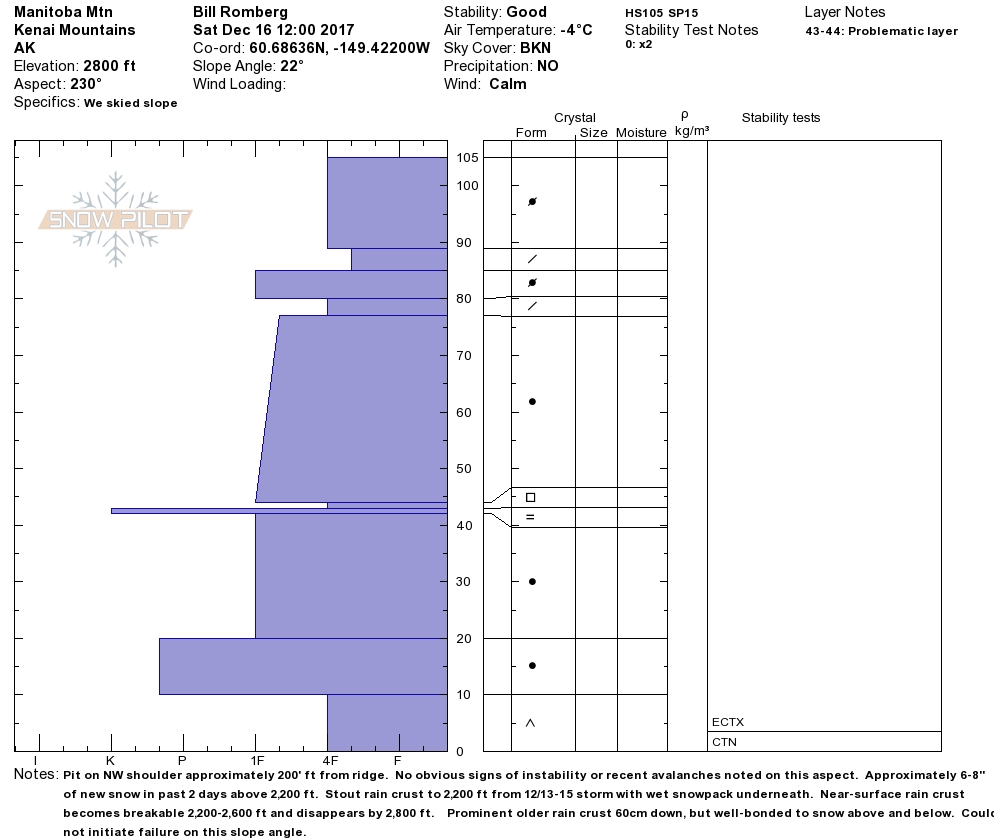
Pit profile 12_16_17

20171216_122653

Unreactive buried surface hoar found around 10cm from the ground on Manitoba

Photo: Avalanche debris in slide paths of Moose Mtn (MP 52) from avalanche cycle second week of December.