| Recent Avalanches? | No |
| Collapsing (Whumphing)? | Yes |
| Cracking (Shooting cracks)? | No |
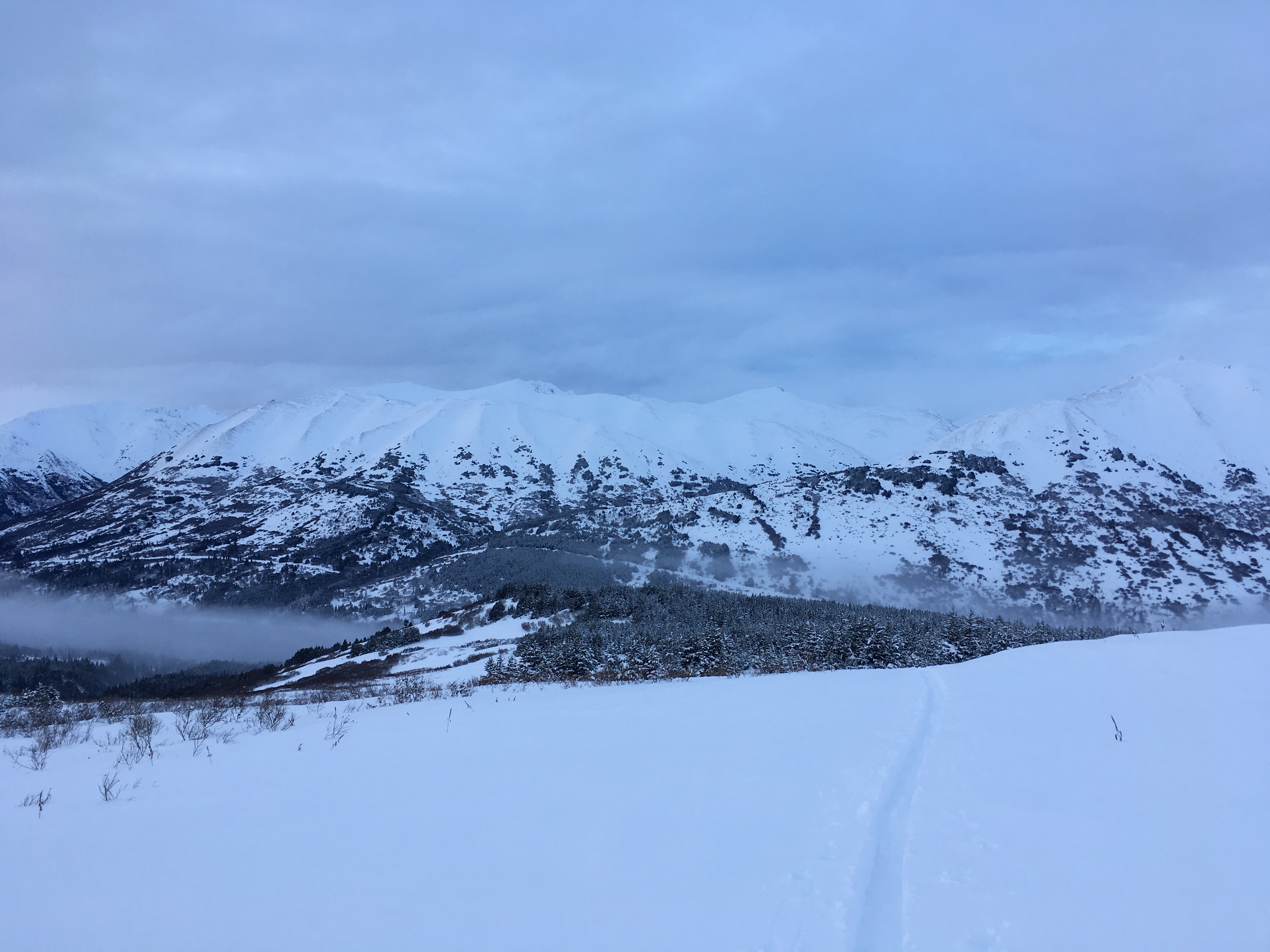
Observation: Summit
Location: Manitoba
Standard route to summit of Manitoba. Stopped a few hundered feet short of summit on west ridge to dig pit on south aspect. 8-12 inches of new dense heavy powder all the way up. A few localized collapses observed below tree line putting in fresh skin track.
Obvious signs of instability
Observer Comments
No avalanches observed. A lot of severe wind affect on exposed ridges of most aspects. Minor localized collapses.
Weather
8-12 inches fresh dense heavy powder. High cloud cover, some blue sky and patchy fog. Slight downslope breeze. 29.7 F in Parking lot (10am), 24.7F at pit location ( 1:30pm).
Snow surface
Dense heavy powder. Breakthrough crust at times underneath new storm snow, mostly below tree line. Wind crust developing at Manitoba Summit.
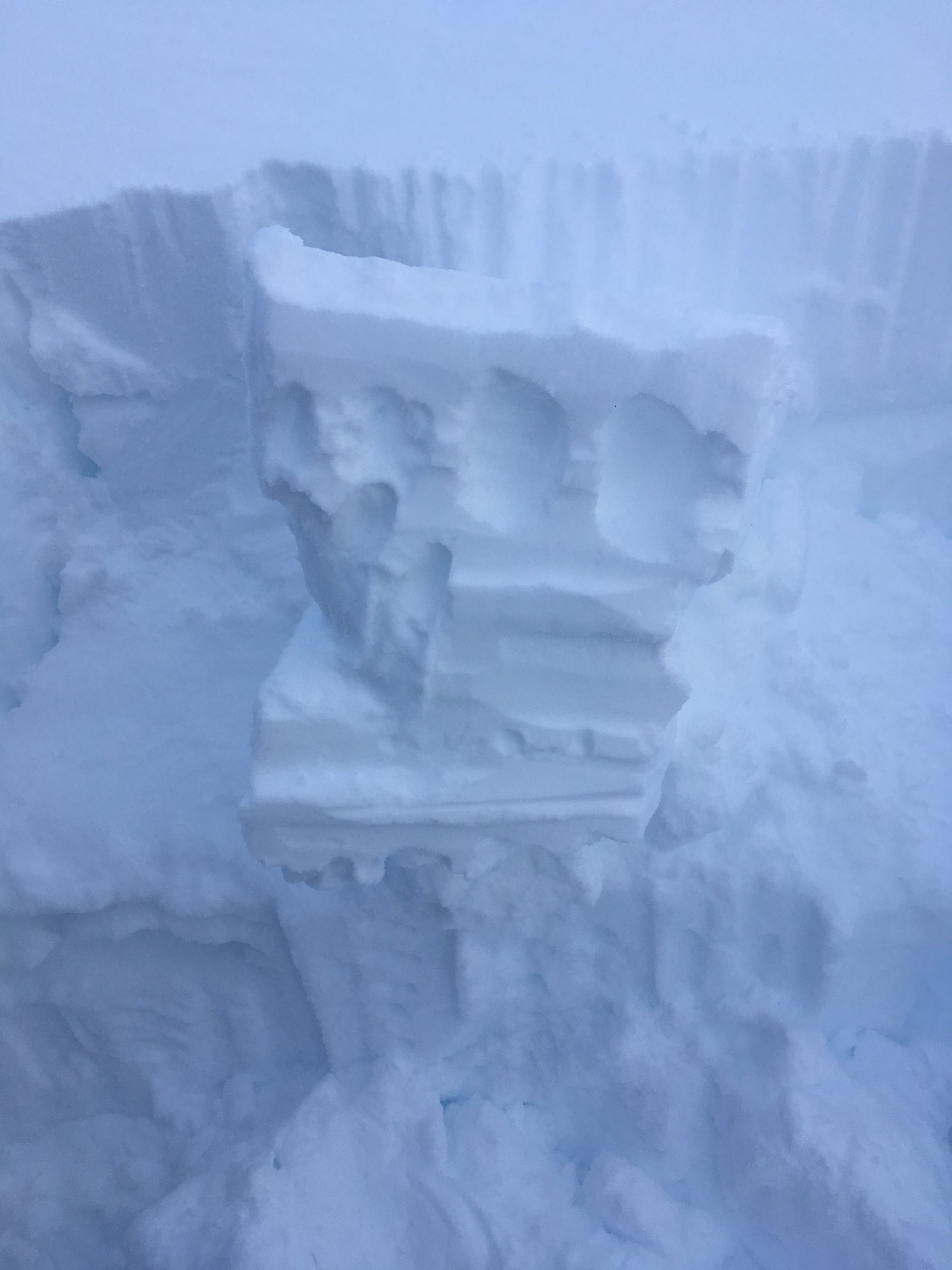
Snowpack
Dug pit at 110cm snow depth. Obvious weak layers at 65cm and 70cm. ECT 7-8 Result affecting 1/3 of column. ECT 26 Q2. Temp gradient min/max .6F/.8F per 10cm. 26.9F at 50cm, 23.3F at 100cm, 24.7F air temp.
Wind affect on ridges of all aspects
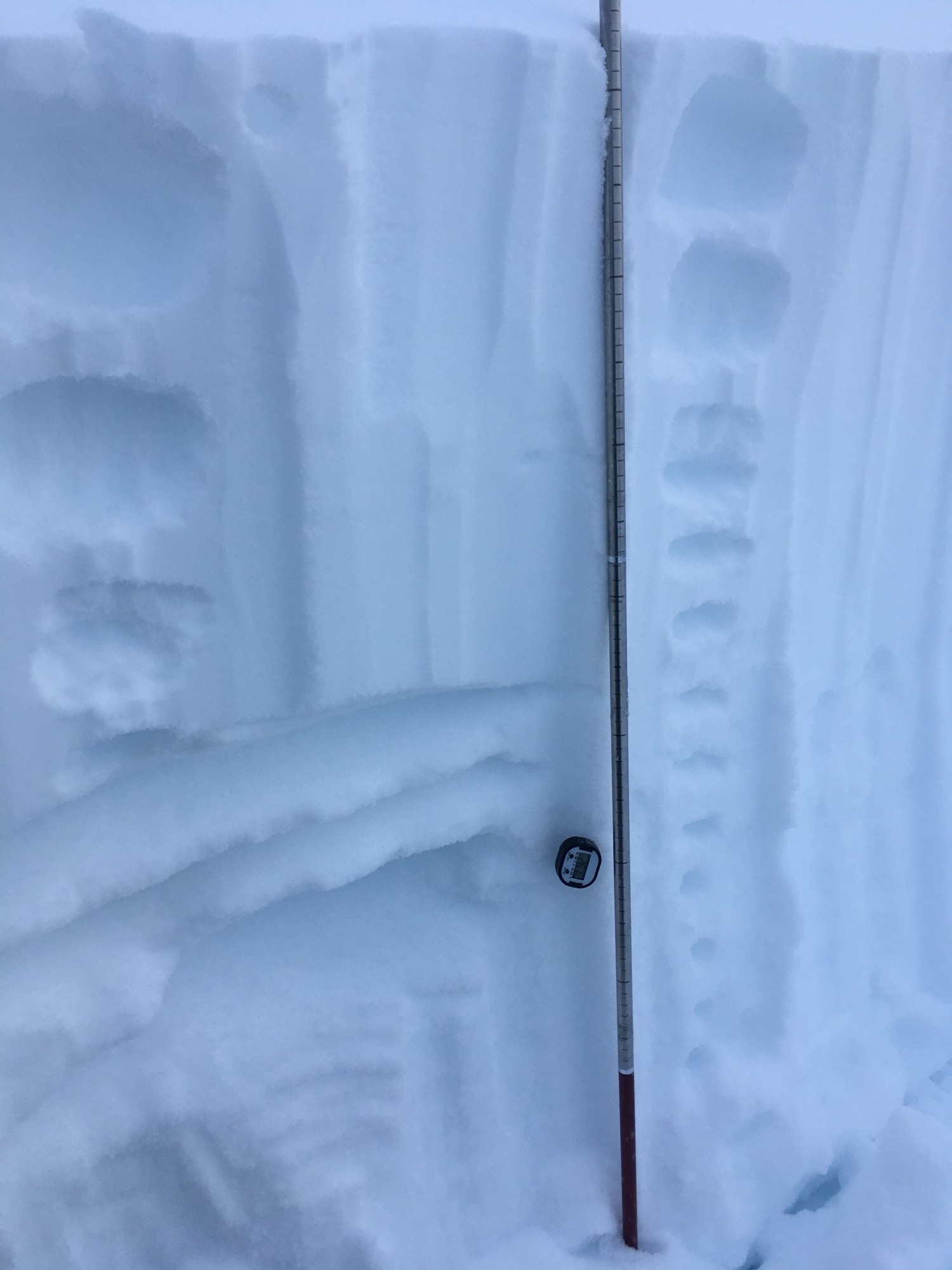
Weak layers evident at 65cm and 70cm
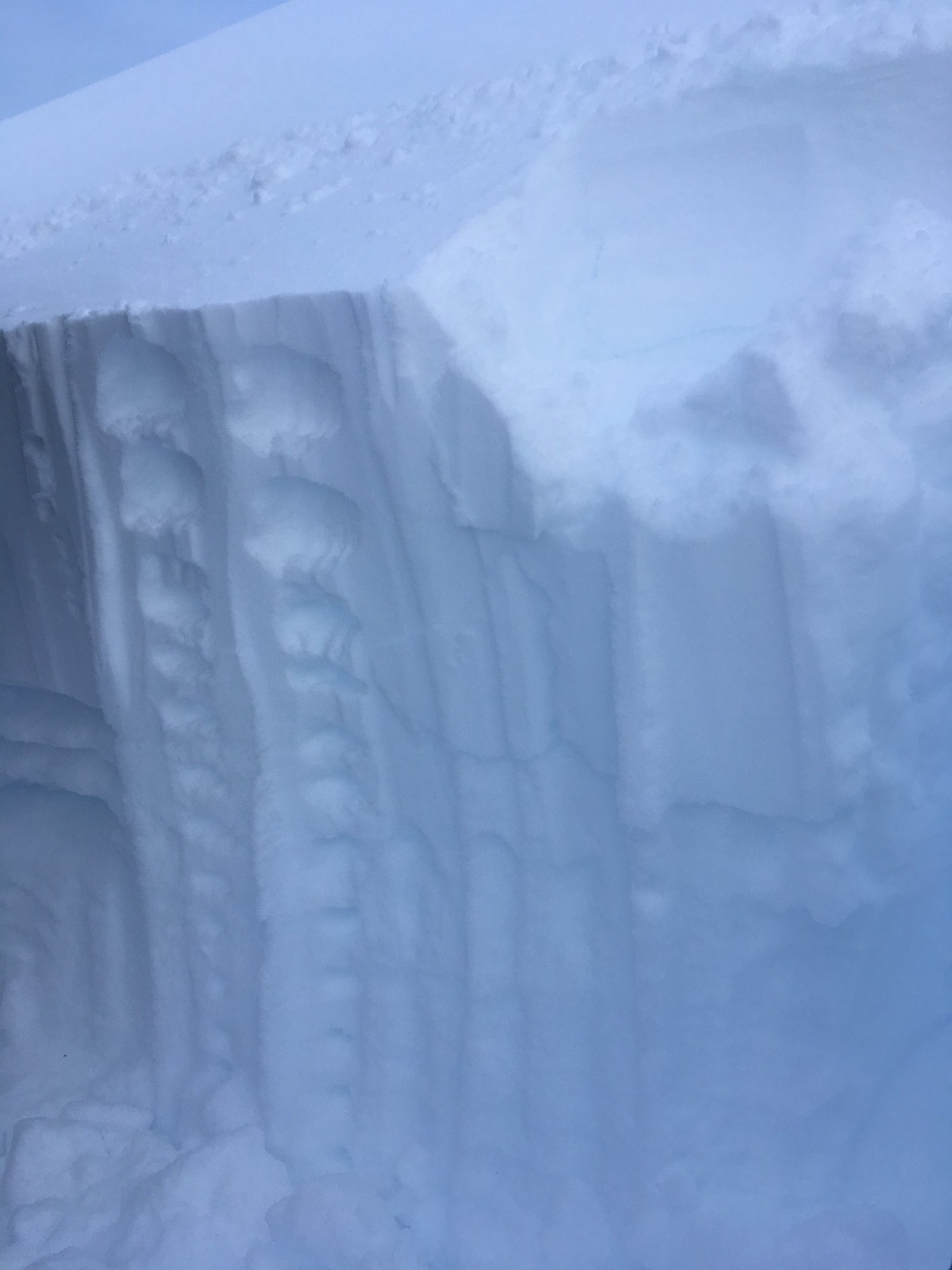
ECT 7-8 @ 65cm and 70cm Q3

ECT 26 @ 70cm Q2
IMG_0482