Sunny!
Cold... single digits.
Light southerly breeze along the ridge, calm below.
Observation: Turnagain
Location: Magnum
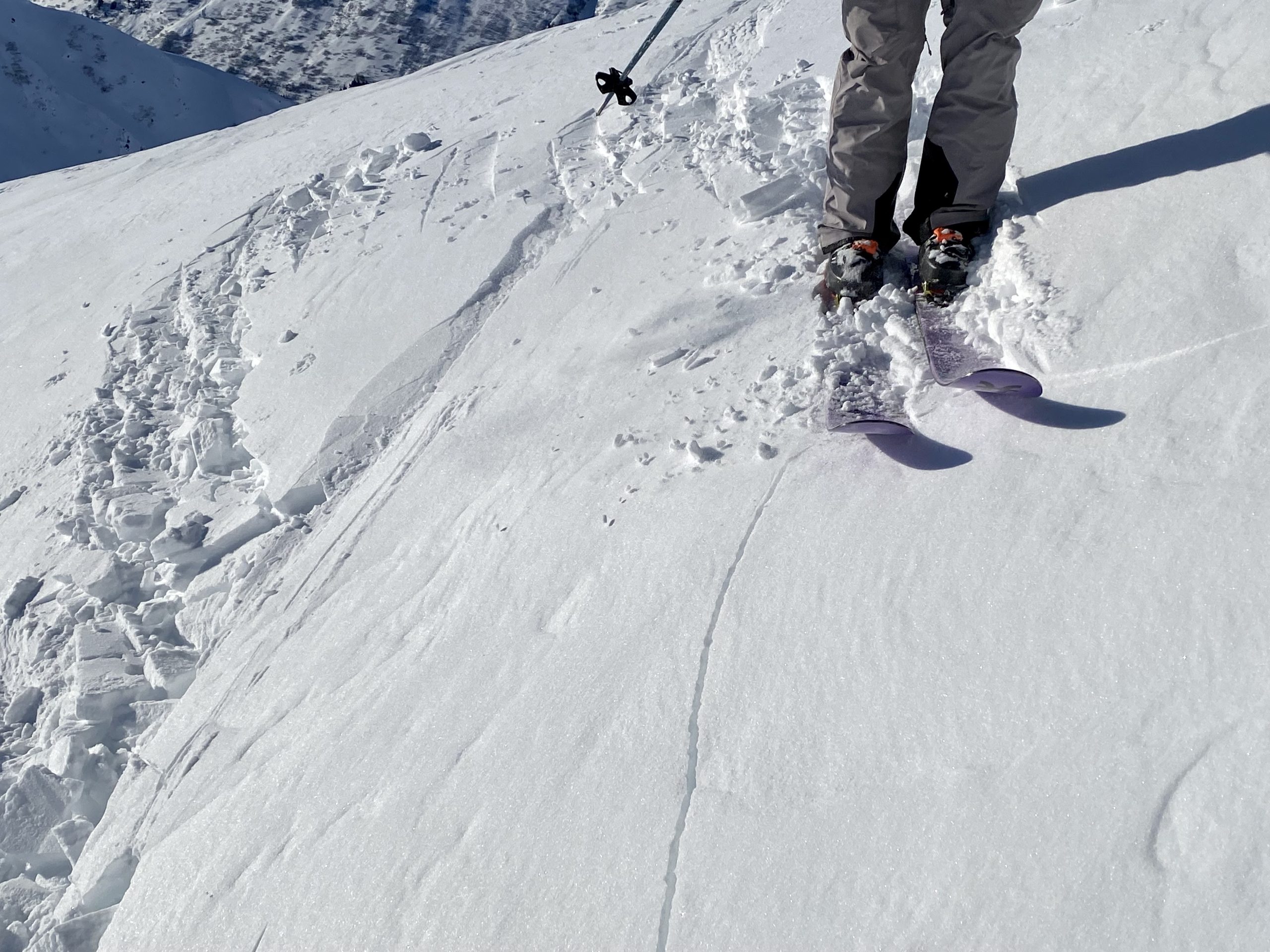
Toured up to the high point on Magnum Ridge (3,500′). We wanted to get a last look at the surface conditions before the next storm arrives tomorrow (Tues and into Wed). We found no signs on instability and a mixed bag of surfaces that the new snow will fall onto. These were thin crusts, loose faceted snow, and old stiff wind slabs and crusts. One surprise was how much the top 2-4″ of the snowpack has weakened with the cold temps over the past couple days – even rotted out some wind crusts – making for good skiing today, but possibly tomorrow’s weak layer…
Weather
Snow surface
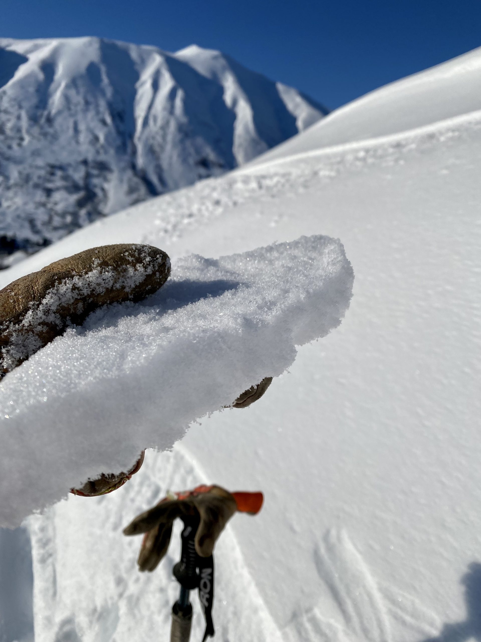
Much of the snow surface was small near surface faceted grains that have formed from the last few days of cold temperatures. What many call 'recycled powder'.
There was a sun crust on very steep south aspects that have a skiff of snow on top.
Some areas have a very thin rime crust on top of the soft surface snow that is composed of small faceting grains.
All these mixed surfaces are suspect for poor bonding with the new snow expected in the next couple days. Something we will be watching.
Thanks to Kakiko Ramos-Leon for most of the photos below.
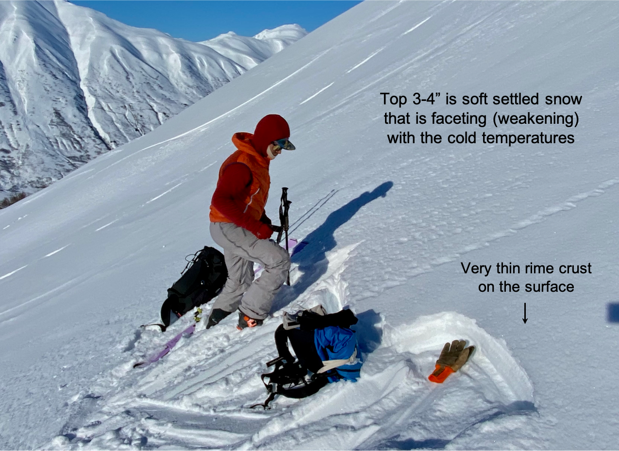
Taking stock of the current snow surface prior to the upcoming storm. We found a lot of weak faceted snow in the steeper slopes along with various sun crusts and older wind crusts.
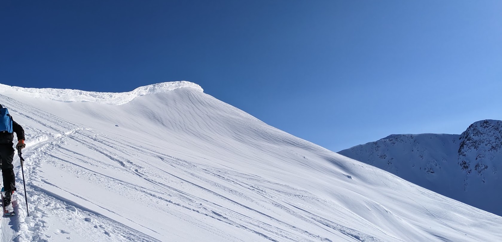
Magnum cornice above PMS Bowl
Sun crust on steep due south slopes
Wind crusts and slabs scattered about
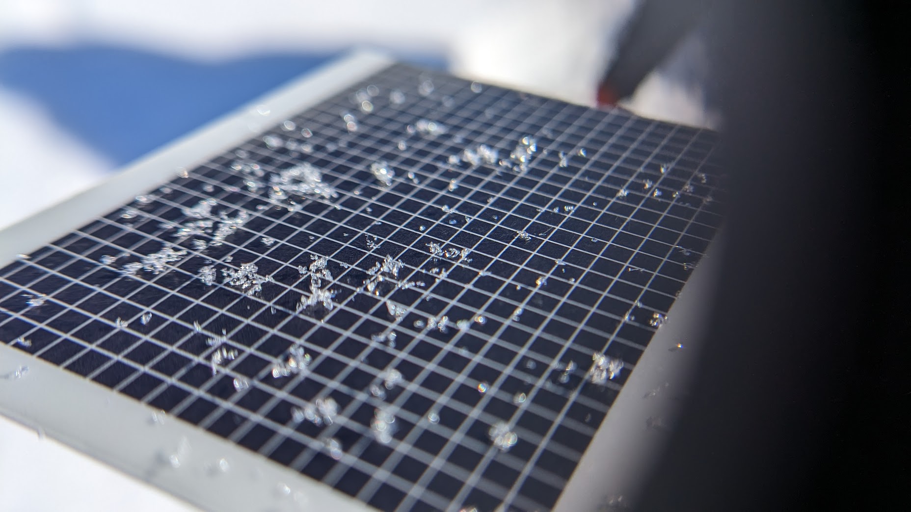
A sample of the near surface faceted grains we saw.

Sunburst

The Sun :)