Minor, localized cracking (3 feet long x 2" thick) on previous wind loaded and stiffened (1F-P) snow over old NSF's.
No whumphing .
No slab avalanches. Old, 2/10-11 mostly small storm slabs observed.
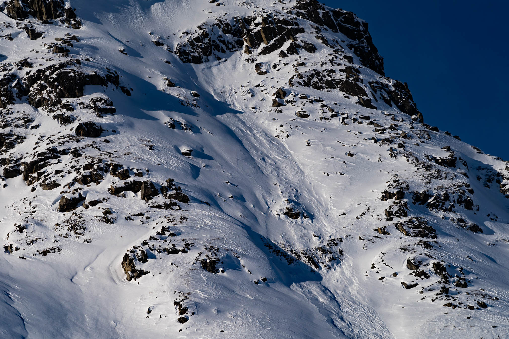
Many recent, small, natural loose avalanches at mid to upper elevations on southerly to westerly aspects, 2-6" deep x 5-20 feet wide, generally running short distances, around rock outcroppings with high angle if incidence, failing on old NSF's. Some loose avalanches dredged into old NSF's increasing volume. These same aspects were heating up with direct solar (calm winds) and by afternoon the top 2" of snow was moist. This will be frozen crust this evening and tomorrow morning.
Observation: Hatcher Pass
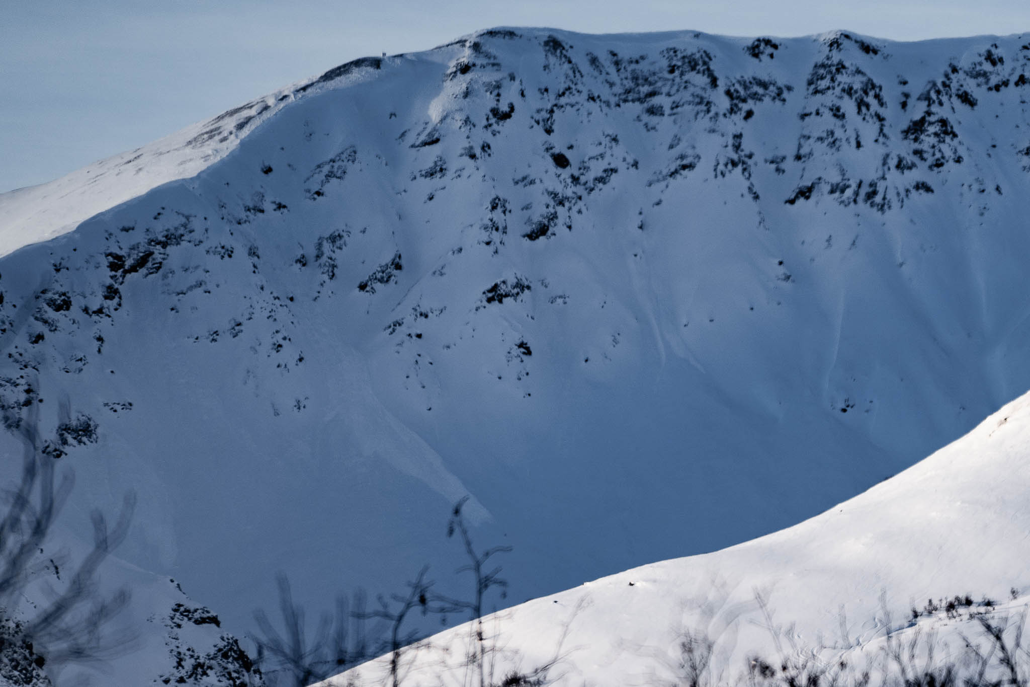
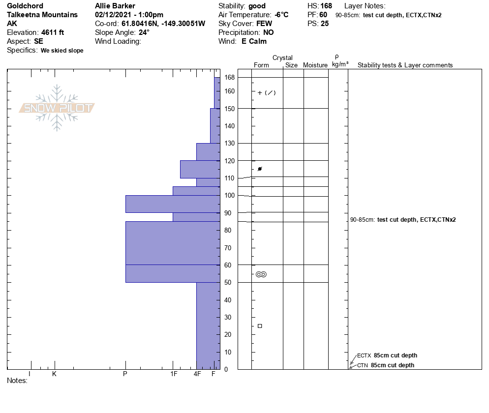
Location: Gold Chord
IM Lot to Gold Chord. Investigated the ridge traverse along the summit of Gold Chord. Coverage was too thin for the standard knife edge walk. Descended the cable climb and the South Face. Also skied Cross Hill.
Observer Comments
Weather
Clear, skies all day, Calm wind, 22F at 4500' mid day.
Snow surface
4-5" of F new snow from Tuesday over several inches of F+ settled powder from 2/2-3 sitting on old, weak, 4F NSF's.
Solar gain on steep south to west aspects with top 2" of snow moist by afternoon with possible natural releases today in some locations, most likely from yesterday's first sunny day affecting new snow from Tuesday. Dry snow beneath.
Snowpack
Generally a pile of weak sand. The biggest hazard today was penetration of the snowpack and hitting rocks, which many people reported today. Boot penetration 60/160cm at upper elevation southerly aspect. Secondary to that hazard was loose dry sluffs in steep terrain (40 degrees+) at mid to upper elevations.
A generalization of the snowpack looks like a foot or two of weak new snow, sitting on 4F NSF's, sitting over 4.0mm DH.
As long as the snow above the NSF remains unconsolidated, we are looking good for stability. However, stability could rapidly change with winds, heat, rain, or a heavy new snow load. These will first fail at the NSF midpack layer, and then as the load is increased, fail at the base of the snowpack. Pray for mild, cool weather, many small snow storms, and gentle winds to keep the avalanche hazard from spiking.
Pits today showed ECTX and CTN at upper elevations on southerly aspects. We looked closely at the midpack NSF layer under the 2/2-3 storm snow. The DH at the base of the snowpack appears to be old and tired and non-reactive. Again, this is a dormancy state that can be re-activated with the right load.
We did observe some old, small storm slabs that have new snow covering them. These likely occurred during or shortly after the winds and storm snow from 2/9,10,11.
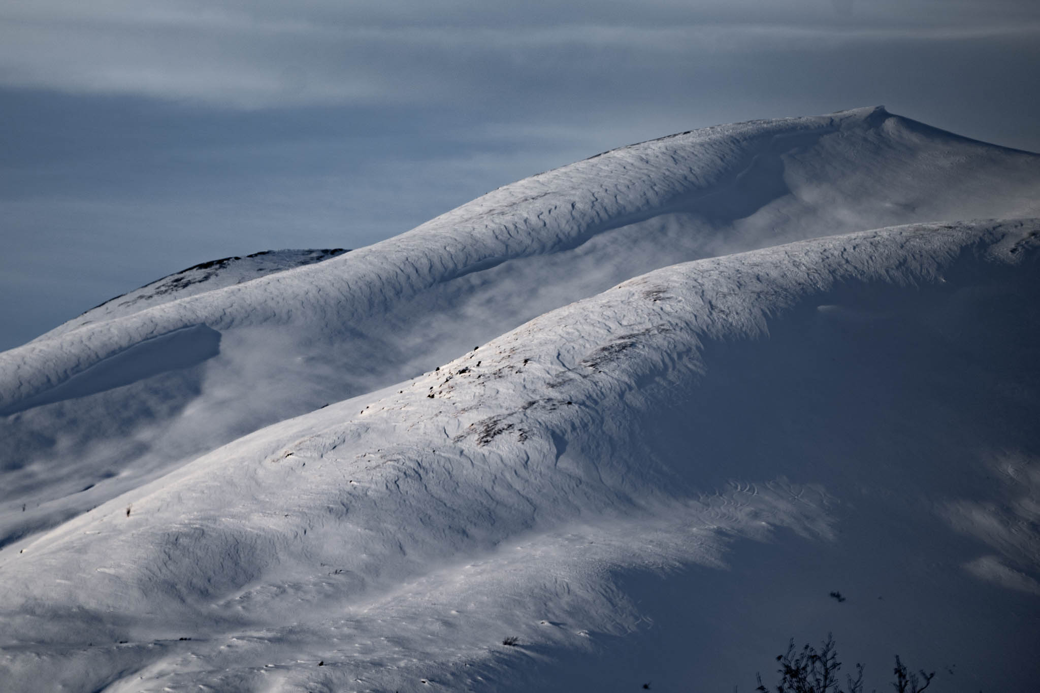
Wind effect on Hatch Peak, SE, 4000' plus.

Cable Valley, SW, 5000'. Natural, small storm slab. 2/10-11?
2/10-11? - Martin Mine, E, 4250'. storm slab release, D2
recent Rae Wallace ski tracks with sluffs. No slab avalanches observed.
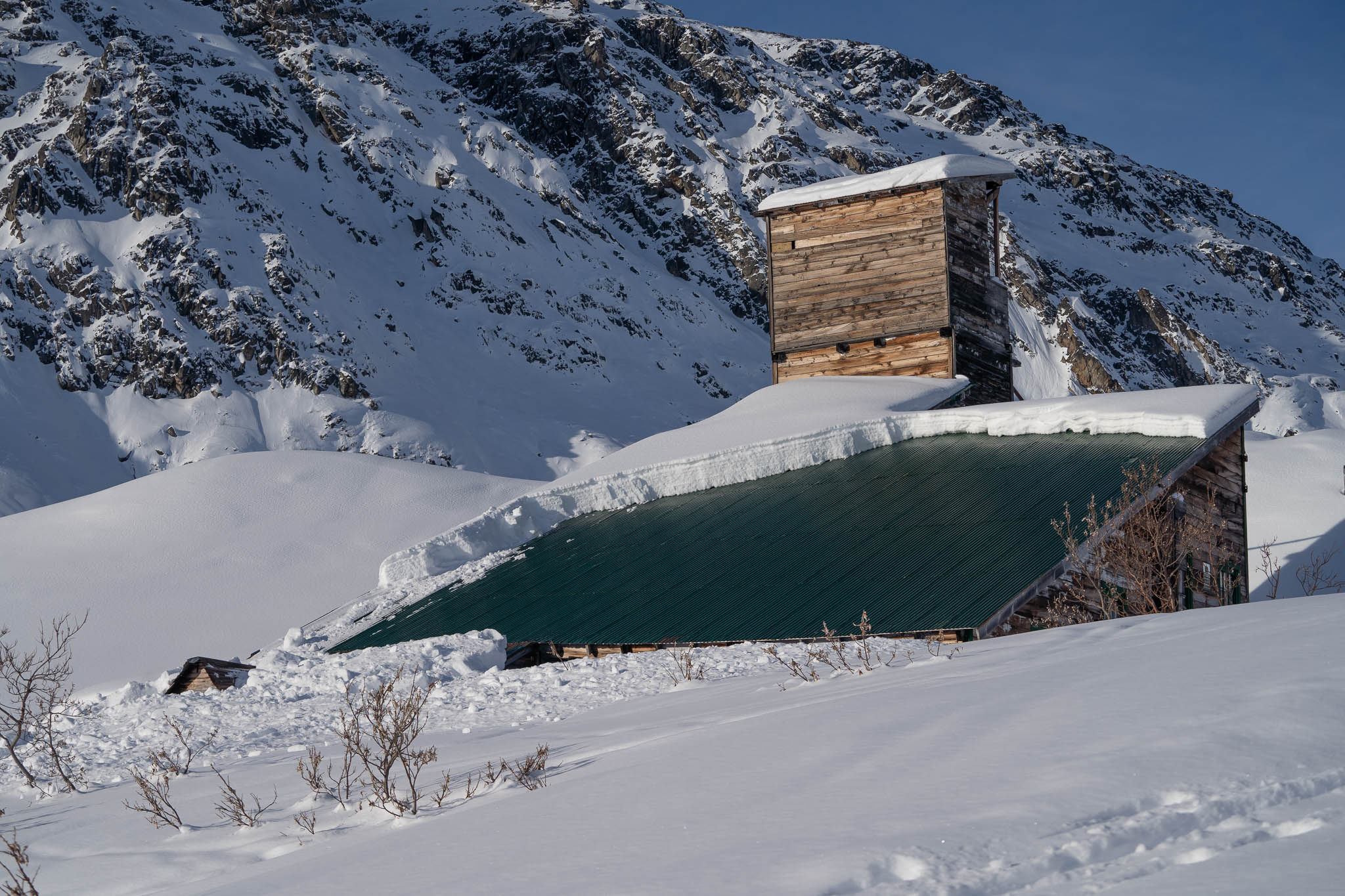
Gold Chord mine roofalanche.

2/10 - Marmot, intentionally triggered small, soft, wind slabs at ridgeline, SW, 4000'..
Government Peak, Natural avalanche, either storm slab or dry loose, possible cornice trigger. 2/10-11

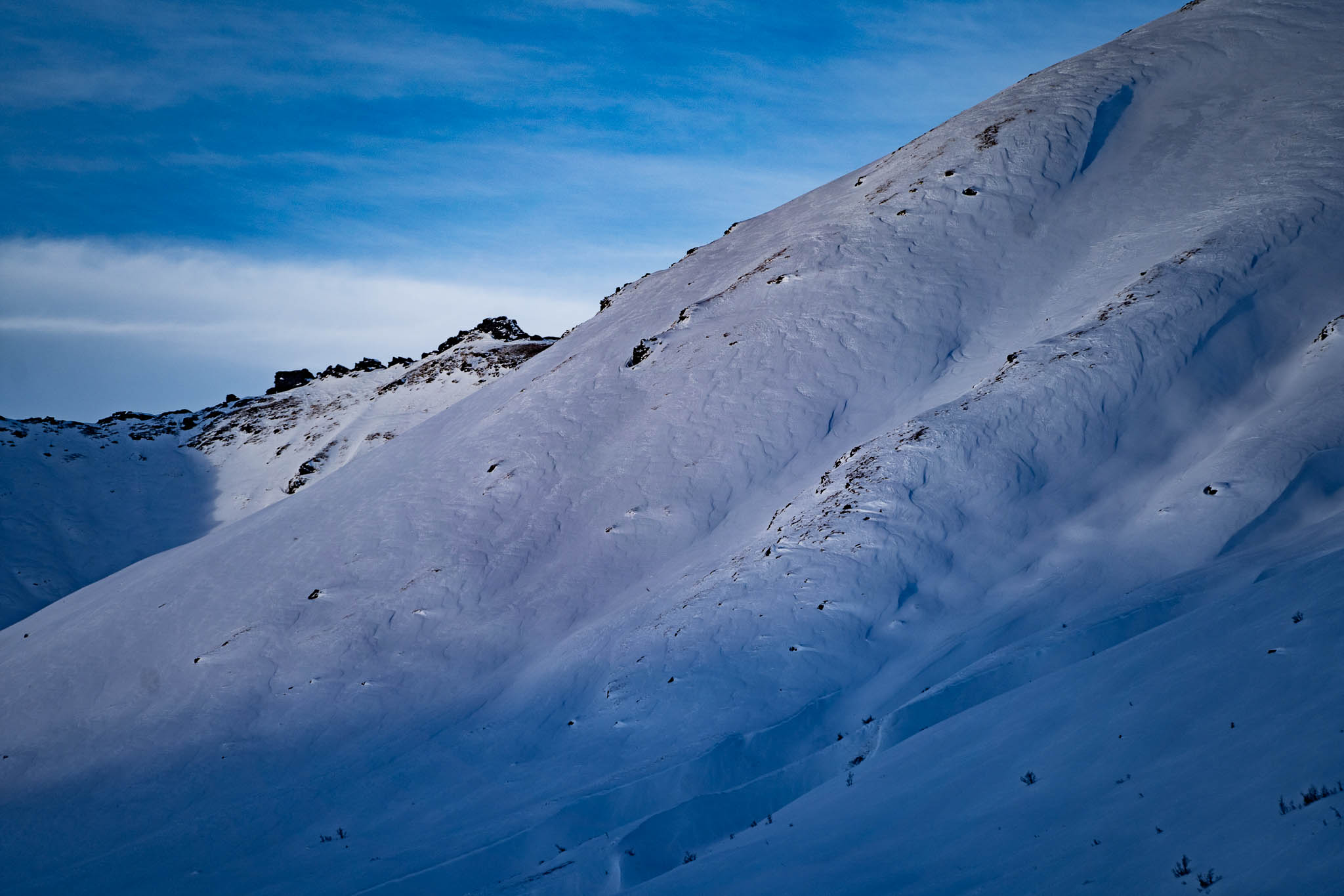
Gold Chord sluffs
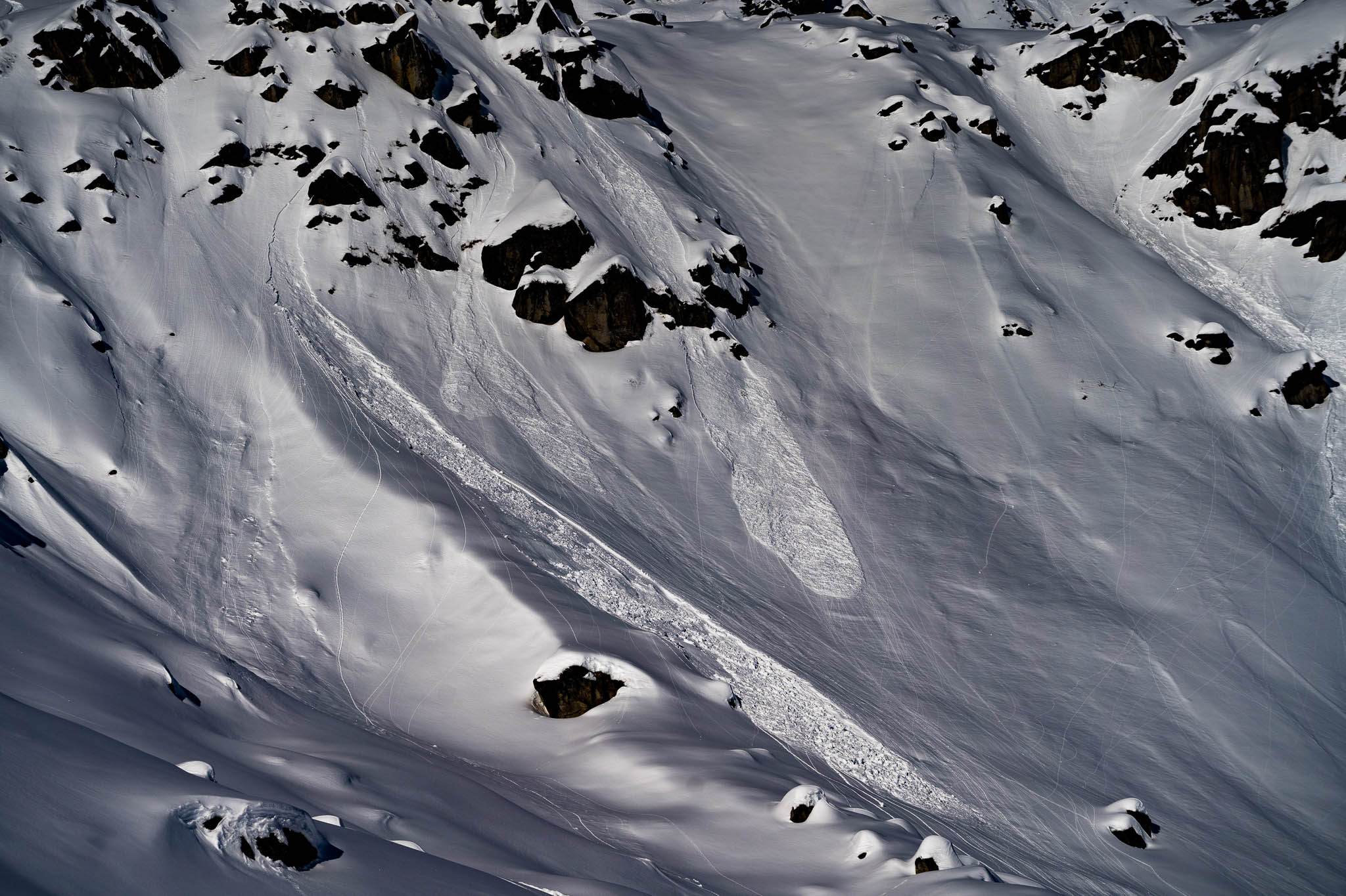
2/12 - Gold Chord, SE, 4100'. Direct solar gain yesterday and today triggered small dry loose avalanches. Some included 2" of moist snow at the surface.
4068 Wind Effect. Stiff snow overlying weaker snow could allow for human triggered small slabs.

Depth Hoar 4.0-5.0mm at base of the snowpack
Mid-pack Near Surface Facets (NSF's)
Goldchord-12-Feb