| Trigger | Natural | Remote Trigger | 0 |
| Avalanche Type | Wet Slab | Aspect | West Southwest |
| Elevation | unknown | Slope Angle | unknown |
| Crown Depth | unknown | Width | unknown |
| Vertical Run | unknown |
Avalanche: Summit
Location: Genral Observation of Summit Lake Area
Wind Loading at Upper and Mid Elevations. Point Release Loose Wet Snow slides on West and East Aspects. Natural Avalanches on South West and West Aspects(D-2). See Pictures below of wind, point releases and Natural Avalanche activity.
Obvious signs of instability
| Recent Avalanches? | Yes |
| Collapsing (Whumphing)? | No |
| Cracking (Shooting cracks)? | No |
Observer Comments
(Roller Balls) Point Release Avalanches and Natural avalanche activity.
See next observation for Natural Avalanche Activity outside of Summit Lake @ Lower Russian Lake Area.
Weather
Summit Lake: Mostly cloudy Temperature 40F, Total Snow Depth 43" (o.6" Water past 36 hours)
Fresno Weather Station: Temperature 26-28F Winds 15-35 Mph SSE-NE Peak gust 55 MPH NE
Active wind loading on West Aspects at upper and mid elevations.
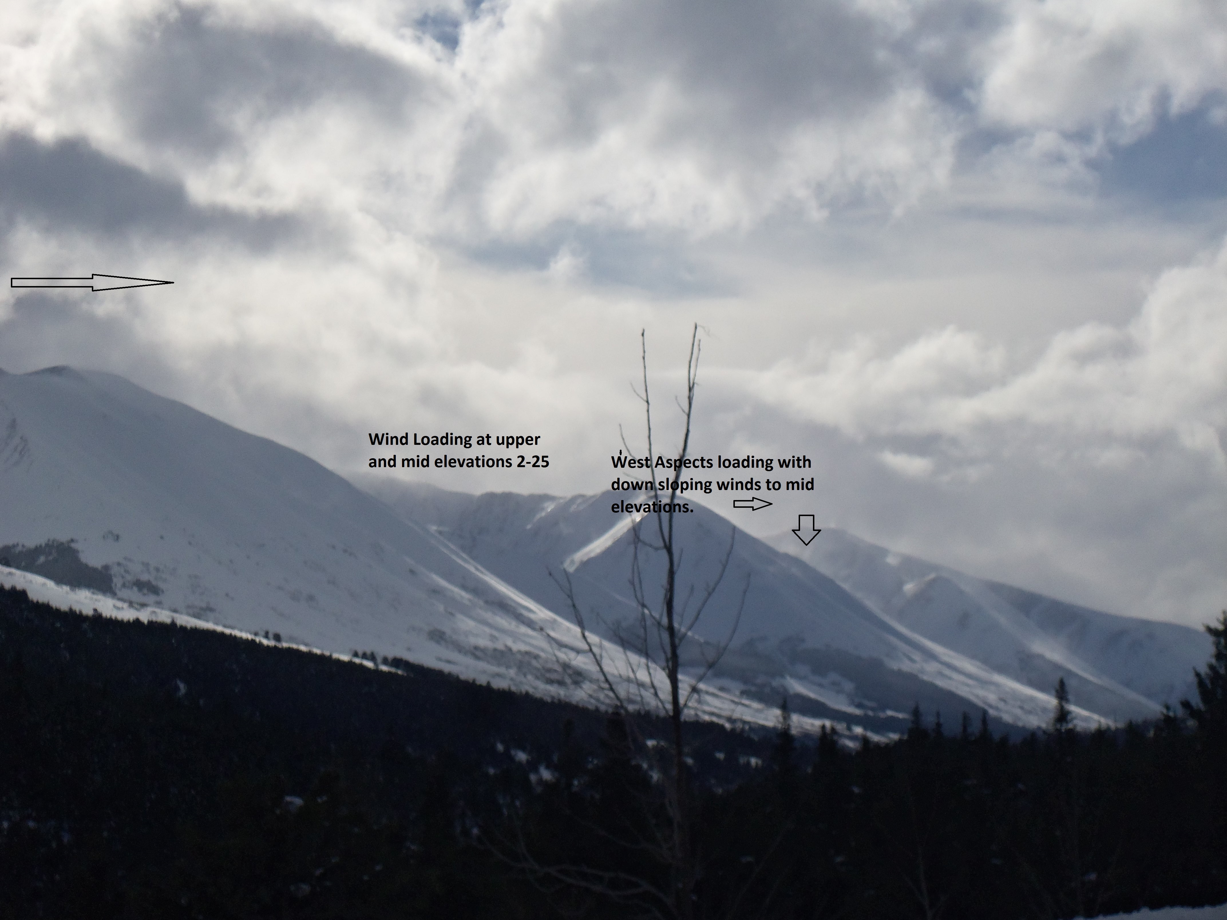
Wind Loading from SSE-NE at upper and mid elevations.
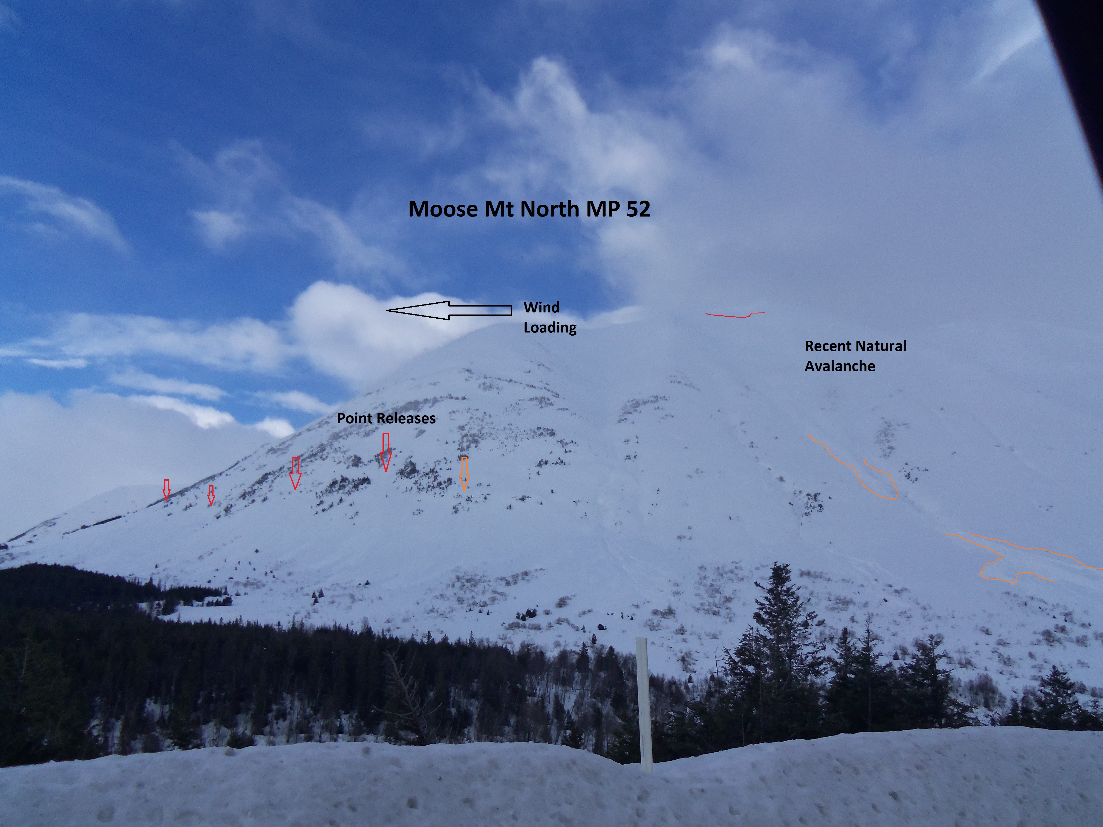
Point Release and natural avalanche on Moose Mt North MP 52

Fresno Peak Lower elevation point releases fairly wide spread on East Aspect
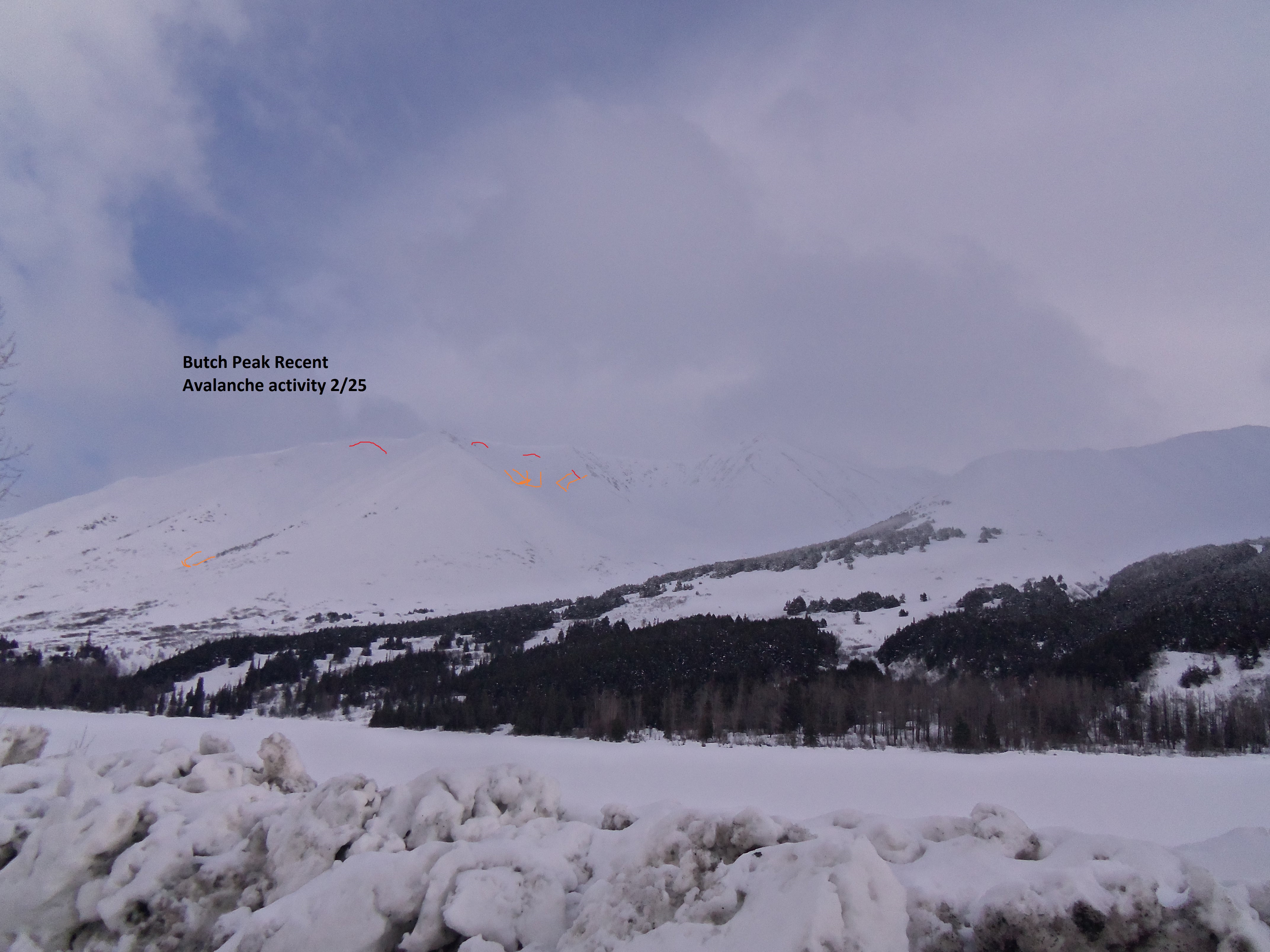
Natural Avlanches on Butch...Active windloading during observation at 2 PM.
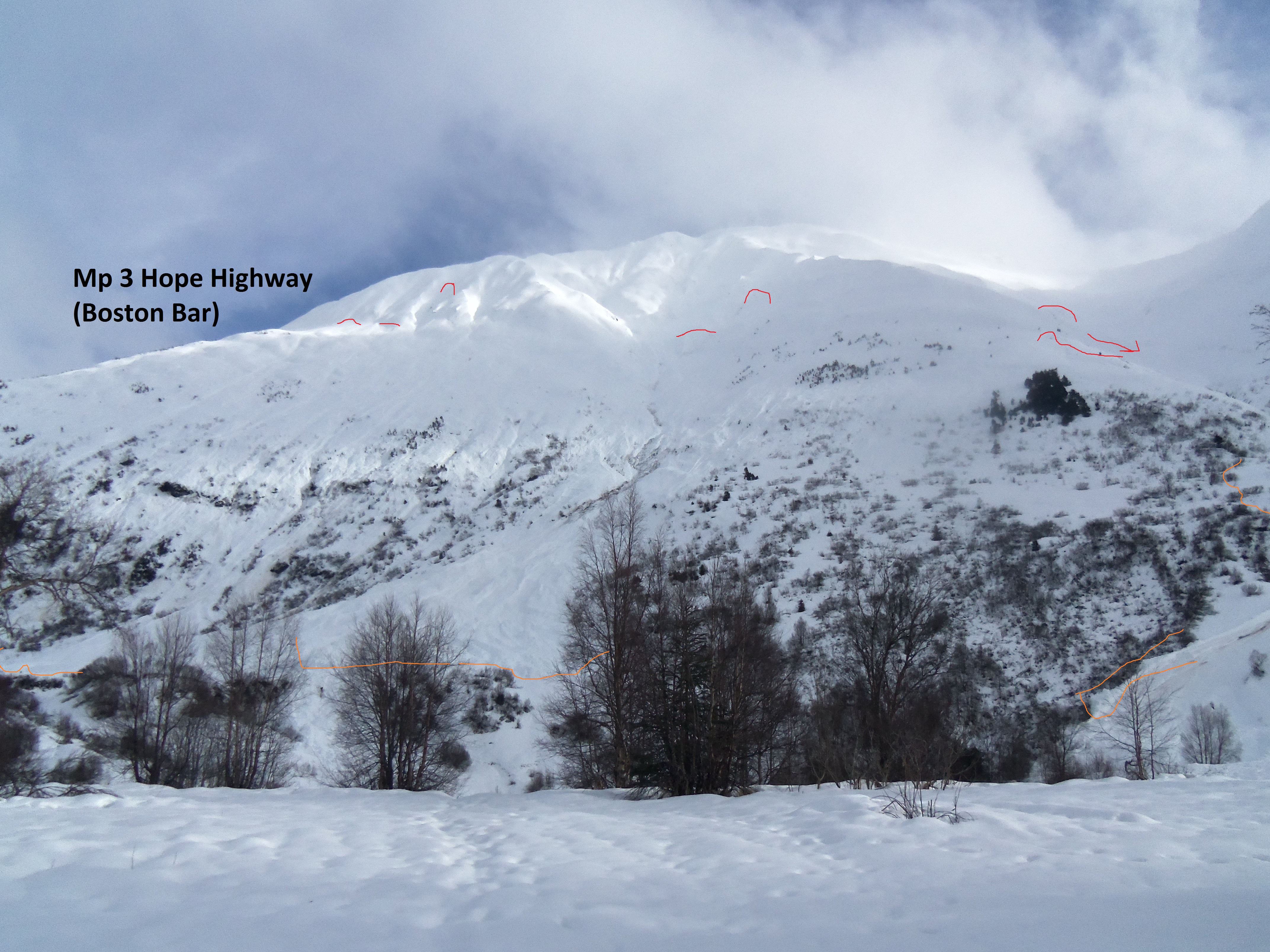
MP 3 Hope Highway Boston Bar. Numerous natural avalanches seen in this area. SW-W Aspects.