| Recent Avalanches? | Yes |
| Collapsing (Whumphing)? | No |
| Cracking (Shooting cracks)? | No |
Observation: Summit
Location: General Observation Summit Lake
Obvious signs of instability
Observer Comments
Wind loading on South and East facing slope. Natural Avalanche activity on S and E aspects across the Seward District from Summit Lake south to Seward.
Weather
Summit Lake: Clear, Windy, current temperature 20F. Past 24 hours Low -15F High 20F. Snow Depth 29"
Summit Lake (3800') Current Temperature 5F. Past 24 hours Low 1F High 10F.
Wind NW-NNW 10-24mph Gust to 32 MPH.
Active Wind loading today.
Small Slab avalanche possible cornice break.

Colorado Peak Avalanche from Manitoba Parking Area
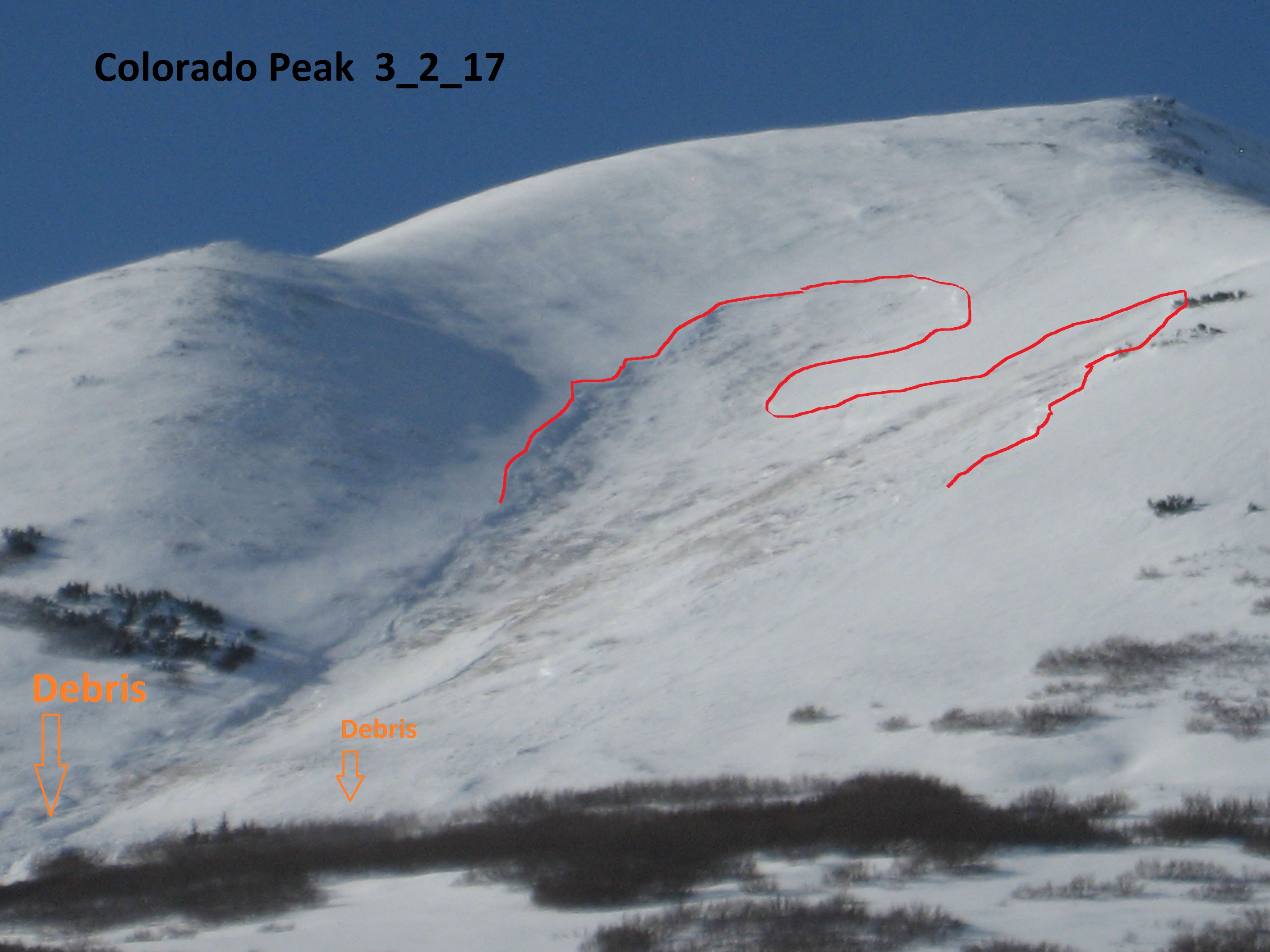
Colorado Peak 2nd avalanche to the south of Lower Summit Lake.
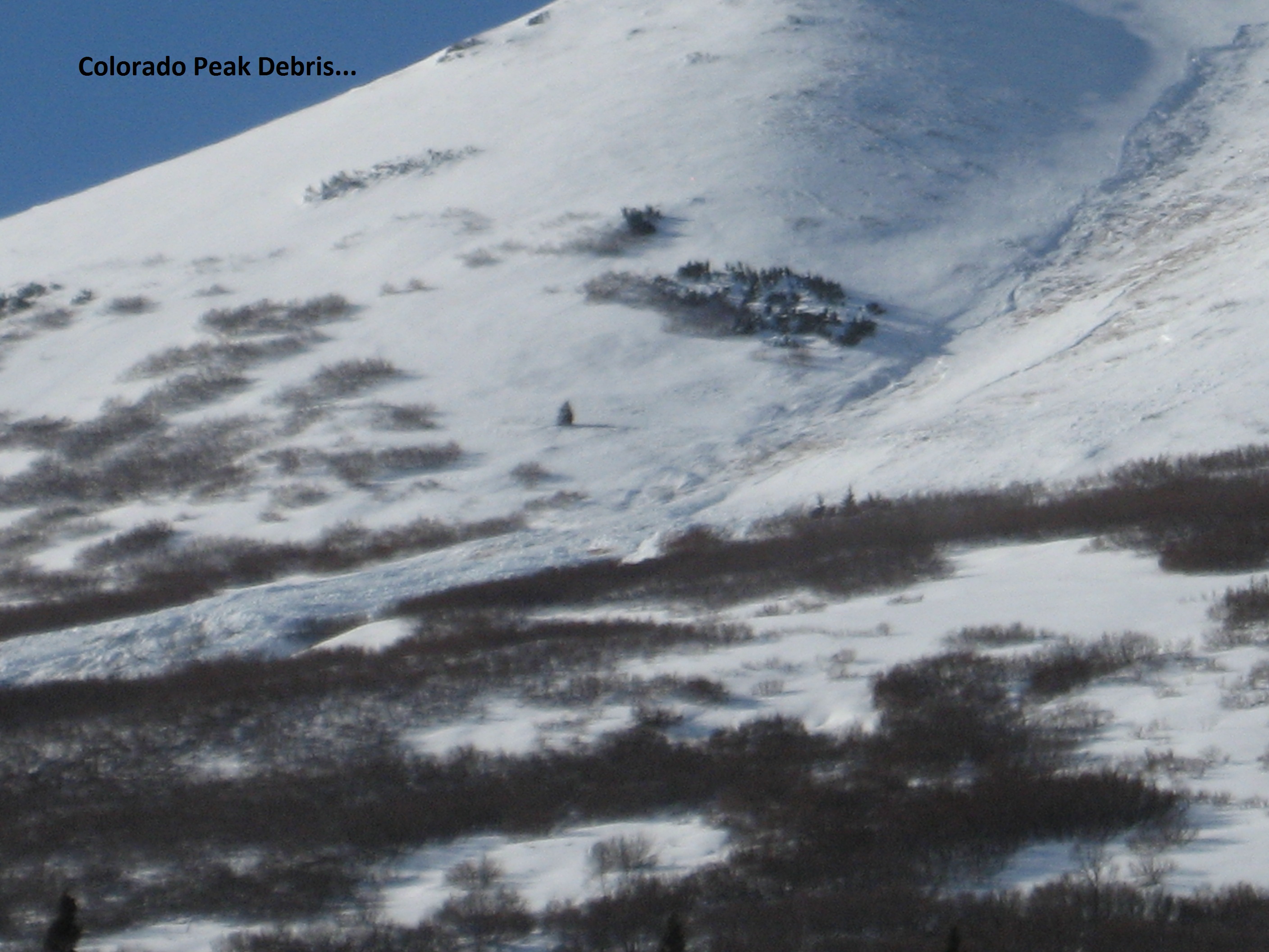
2nd Avalanche Debris field.

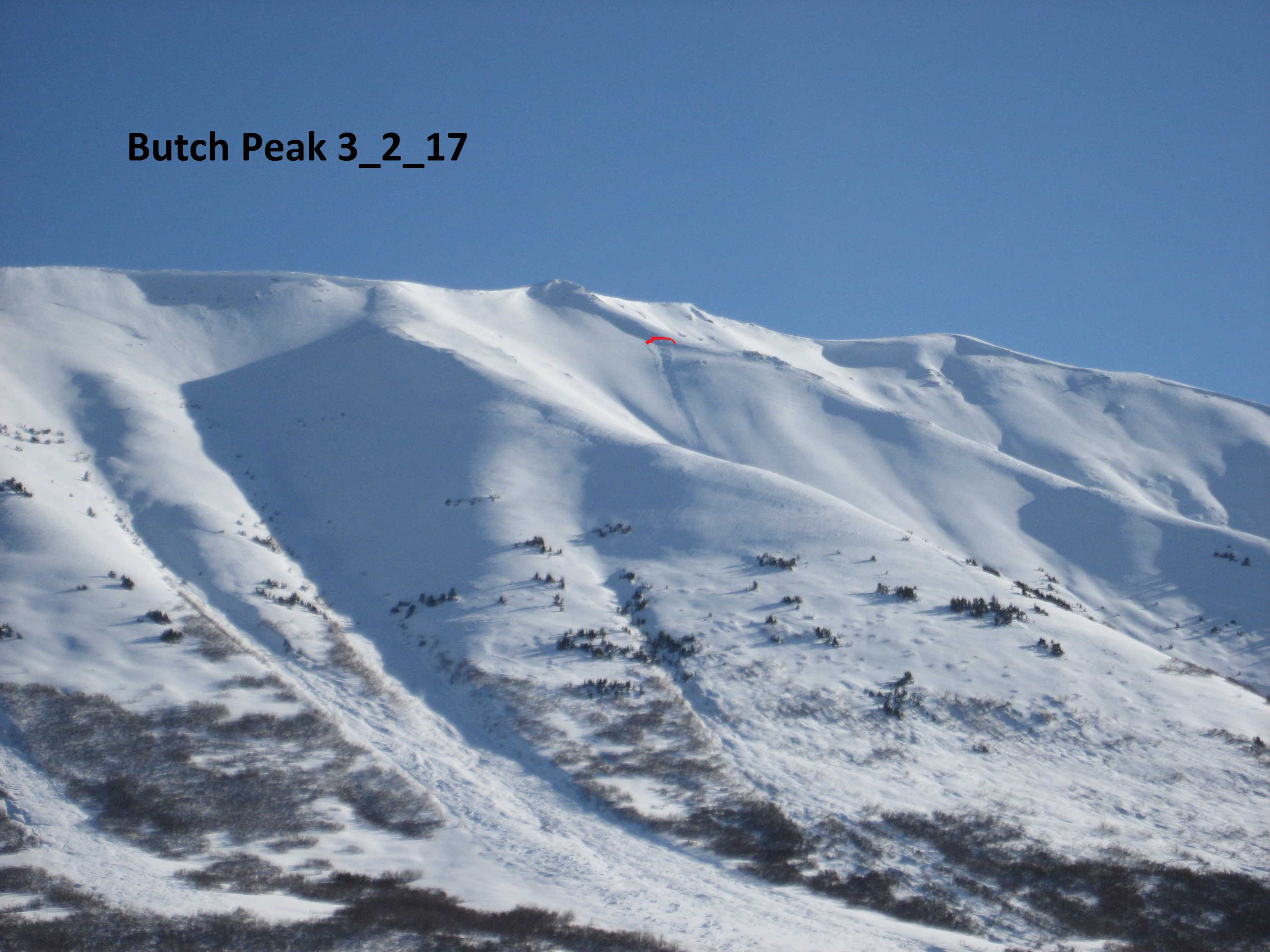
Gilpatrick Avalanche
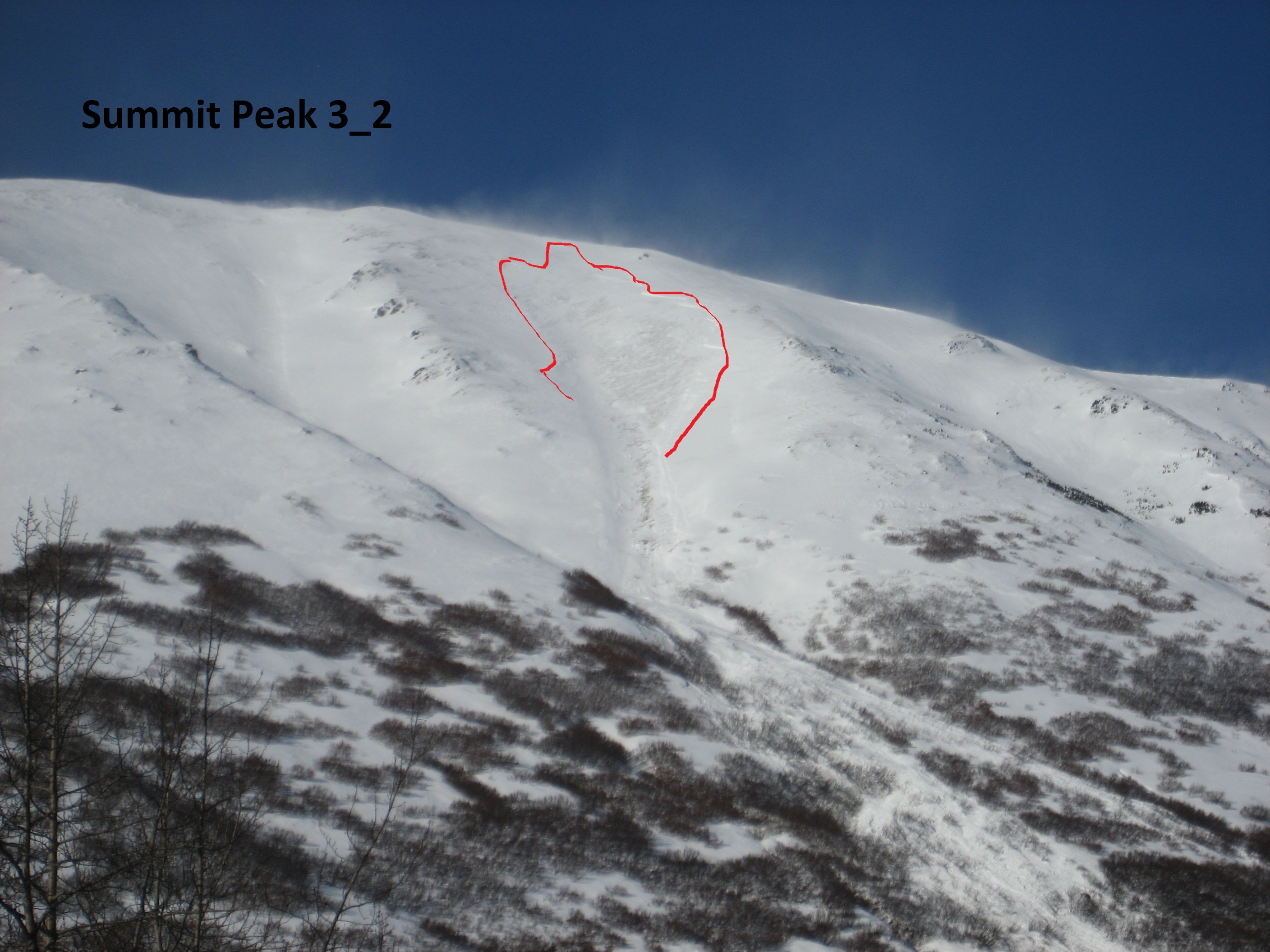
Summit Peak Avalanche
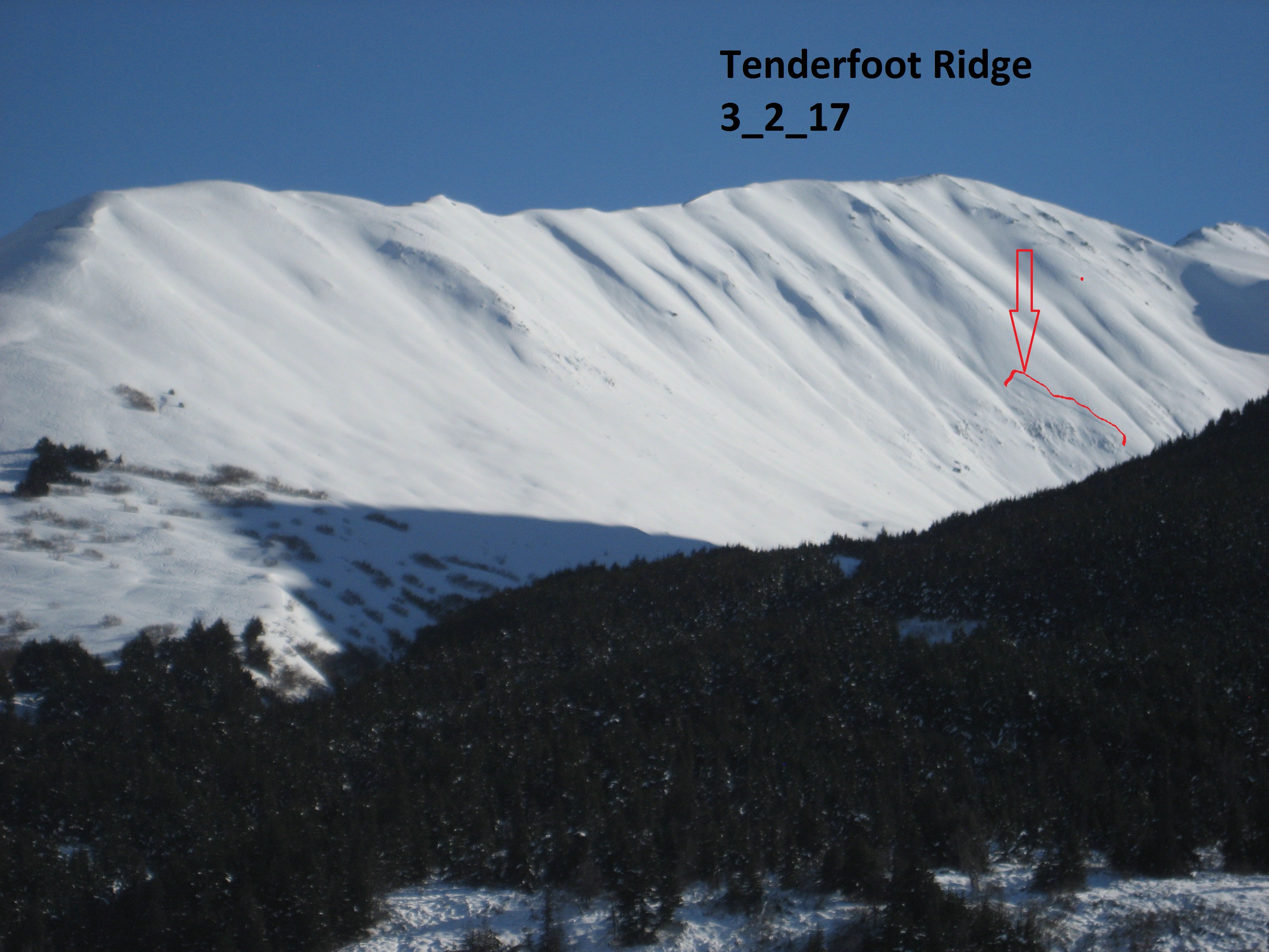
Tenderfoot Ridge Avalanche (Lower on the slope in steep terrain)

Active windloading 230pm.