| Recent Avalanches? | No |
| Collapsing (Whumphing)? | Yes |
| Cracking (Shooting cracks)? | Yes |
Observation: Summit
Location: Fresno SE Ridge
This storm brought in warm temps overnight without a decent freeze. With the day before being warm the snowpack hasn’t had a good freeze in a while. It seems water is working its way down the snowpack dissolving MFcr layers observed in a pit dug the week before. This could make the facets at the bottom of the snowpack more active.
Obvious signs of instability
Observer Comments
On the skin track up, I experienced several areas of cracking and collapsing on South and East Aspects propagating around 6ft around me.
Weather
Sky: Overcast New Snow: 5cm, Wind: Light, no transport, Air Temp: 0.5 C,
Snow surface
5cm Wet Pow
Snowpack
Test Pit: 33 Degree Slope, S Aspect 1892'
Snowpack: HS 110cm
Crystal ID/Hardness:
110-105cm, New Snow, F
105-95 MFcr P-
95cm-50cm Blend of mostly Melt Forms, 1 dissolving MFcr, F-1F
50-0cm F with 2 dissolving MFcr.
At Ground: Facets (Depth Hoar?) around 3-5mm. Sticks together barely (moist).
Temp Profile:
Surface: 0
100cm: -1
90cm: 0
80cm: 1.5
70cm: -1
60cm: 0
50cm: 0
40cm- 0
ECTX-
CT3 down 65cm on 50cm F Layer (Facets?)
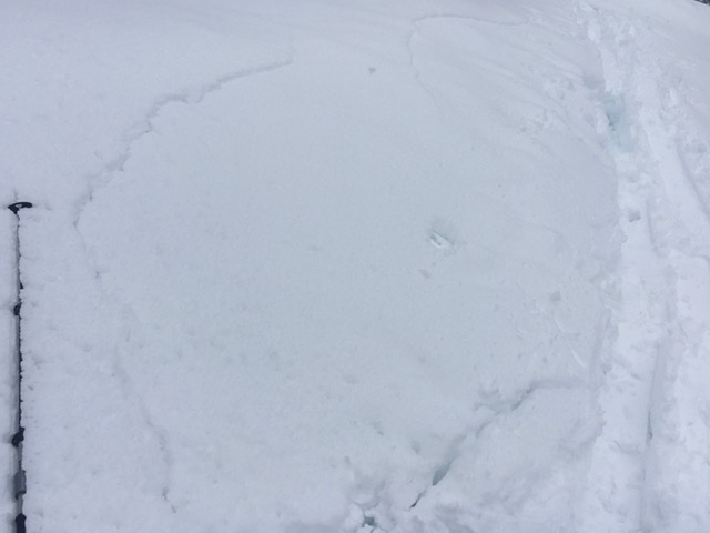
Collapsing on skin track up

Test Pit: Diagnal Line is the where I got CT3 50cm down