I say yes because there were soft and hard wind slabs that cracked around 3' from skis. Not critcal but on steeper more wind loaded features I would assume cracks to be larger and deeper.
Observation: Summit
Location: Fresno
Skinned to 2600′ looking to see how the snowpack was adjusting to new snow and wind loading. Also to make some fresh turns! Rode a E aspect. New snow was drifting into fresh slabs near the ridge. The storm had drifted snow just below the ridge, into gullies and below convexities. About 5-8cm new snow.
Observer Comments
Weather
Weather was not as gnarly as I thought it might be. All weather improved throughout the day. It was snowing steady a 1cm an hour for about 5 hours. Ridgetop winds moderate around 15mph from the south. 5-10mph winds mid mountain.
Snow surface
Snow surface was a mash up of fresh snow and 2cm soft wind slab. Harder wind slabs 2-6in thick and deposited snow in gullies had around 14in transported snow.
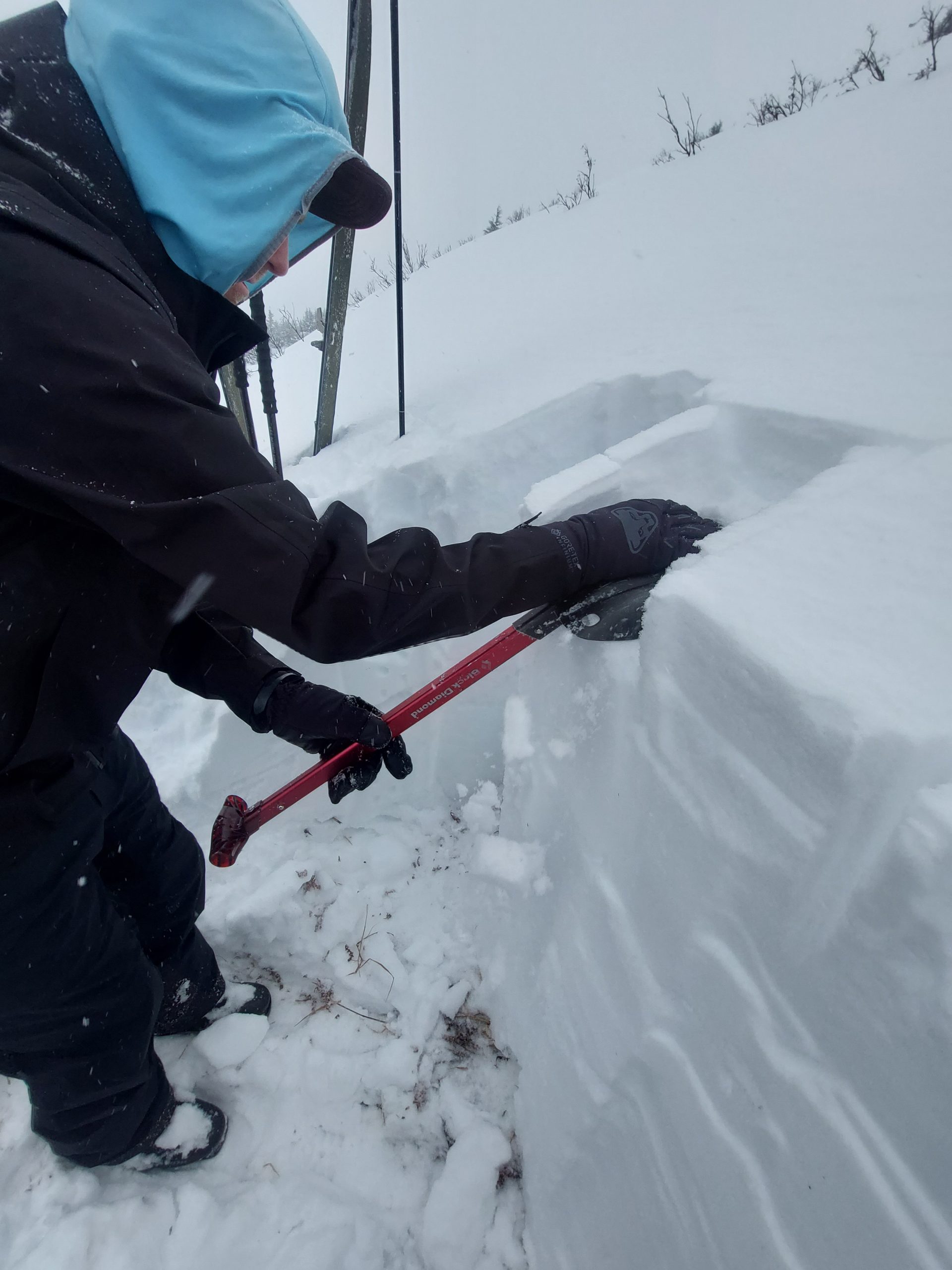
Snowpack
5-8cm new dry snow. 30cm snow above the buried surface hoar. With the short warm up yesterday the new snow bonded well. CT 24 collapsed the BSH. ECTN22 on BSH. Total snow pit depth 120cm. E aspect 1900' 30degree slope.
20230206_120544