| Trigger | Natural | Remote Trigger | Unknown |
| Avalanche Type | Soft Slab | Aspect | Northeast |
| Elevation | 3500ft | Slope Angle | unknown |
| Crown Depth | unknown | Width | unknown |
| Vertical Run | unknown |
Avalanche: Summit
Location: Fresno
Ascended an east facing sub-ridge of Fresno to the main ridge and traveled up to 3900′ to look into start zones. Descended near our uptrack. Variable surface conditions—none that were particularly pleasant skiing. Beautiful day!
Avalanche Details
Natural avalanche on Fresno likely occurred Monday during WNW wind event
Obvious signs of instability
| Recent Avalanches? | Yes |
| Collapsing (Whumphing)? | No |
| Cracking (Shooting cracks)? | No |
Observer Comments
Multiple avalanches that likely occurred the day before during the WNW winds Sunday night and Monday
We observed slab avalanches on Moose Mt, Tri-Tip, Butch, Fresno, Summit Peak, Silvertip shoulder, Wolverine, and Tincan (maybe just a loose snow avalanche? I could not see the crown). Most avalanches had a northern or slightly northern tilt to the start zone that released. We wondering if the more westerly winds were getting channeled from the south along hwy corridor similar to the way it happens in Turnagain Pass and then loading north facing start zones.
Wind transport observed - wind increased in the afternoon
Localized cracking on wind loaded pockets
Weather
Clear
Temperatures 4° while taking pictures near Summit Lake, teens while touring
Winds were WNW 5-15 gusts into the 20s
Snow surface
Variable
Very thin melt-freeze crust with wind textured on top of facets over a more supportable crust on solar aspects.
Breakable wind crust over a few inches of cold snow over more wind hardened snow or wind blow to no ski pen wind hardened surface on northerlies. Dense drifts and lots of wind texturing.
Snowpack
Loose facets under wind crust/slab while skinning and booting on east ridge
We dug one pit at 3700' on an east aspect, 20° slope. HS: 130 cm, dug to ground. There was a 1F wind compacted layer that was 1.5-15 cm deep (variable wind loading) over small facets and decomposing stellars CT12 (15 cm) down, CT4, CT5, ECTP17 (4 cm down), 35 cm down there was chaining small facets (.5-1 mm) over a decomposing melt-freeze crust, ECTP23 (x2), ECTP18, ECTX. 78 cm down there was another layer of chaining facets(.5-1.5mm), no test results. The basal facets (1-3 mm) are dry and loose. Where we found them over rocks they were slightly more defined compared with a deeper spot (160 cm) over heather where they showed more rounding. One of our focused questions were looking at where water will pool when/if we ever get a true warm up and looking at structure that could be somewhat similar to the avalanches on Summit Peak.
Crust south aspect 1200'

Surface conditions on the skin track and looking across the bowl

Anti boot tracks in the alpine
Wind transport on the ridge
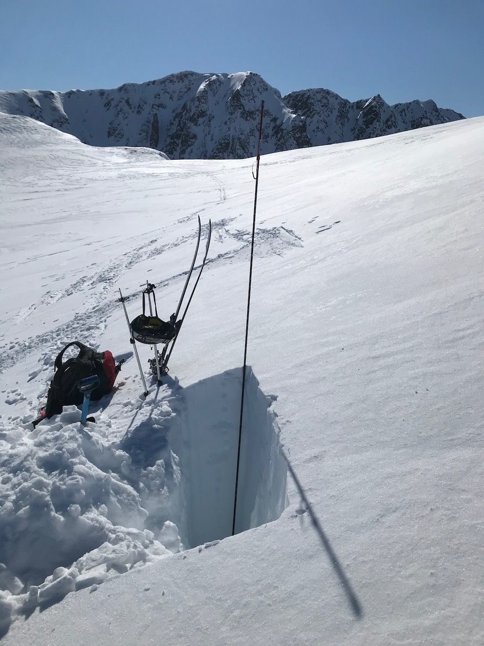
Pit @3700'

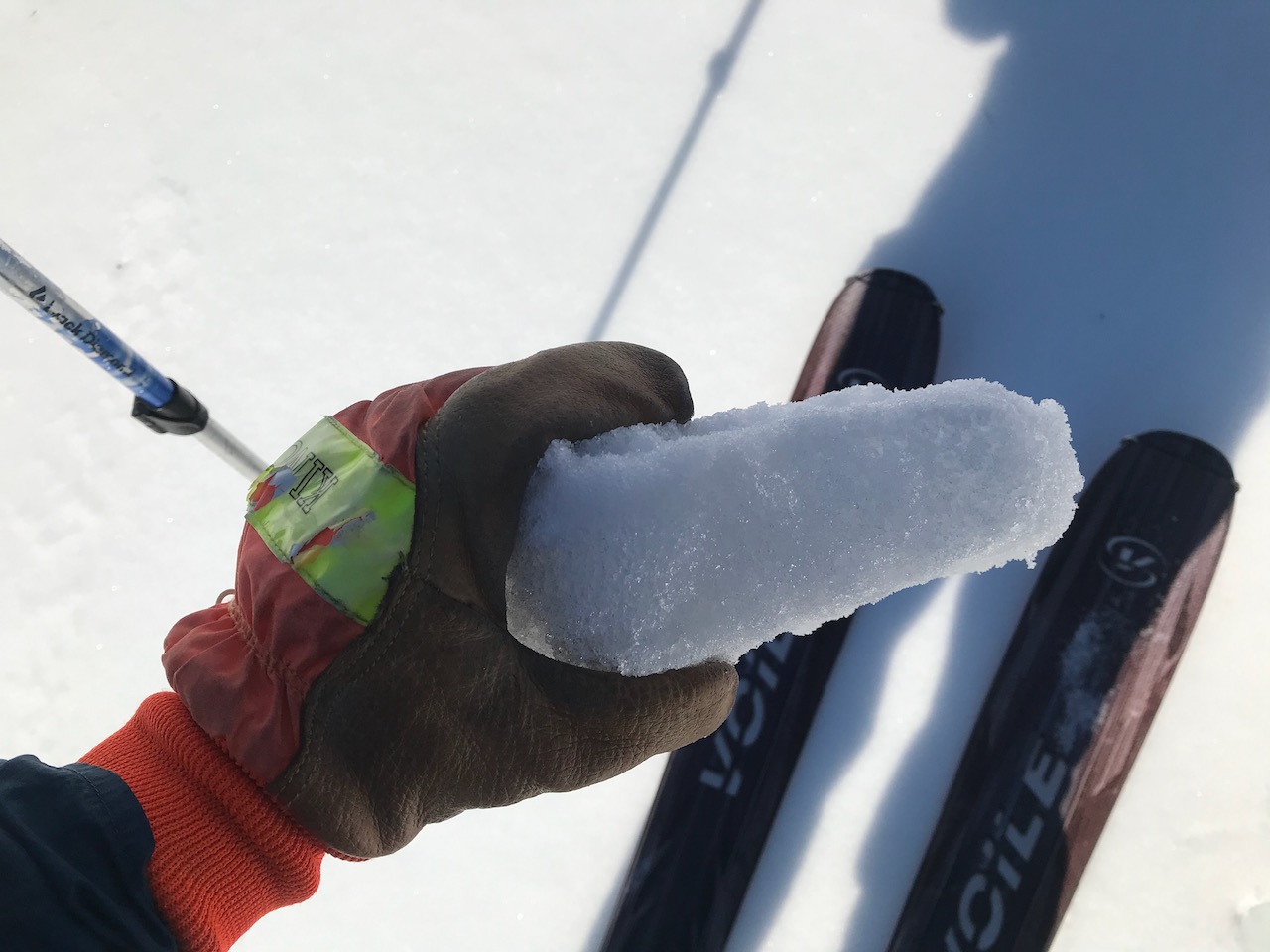
Basal facets on crystal card
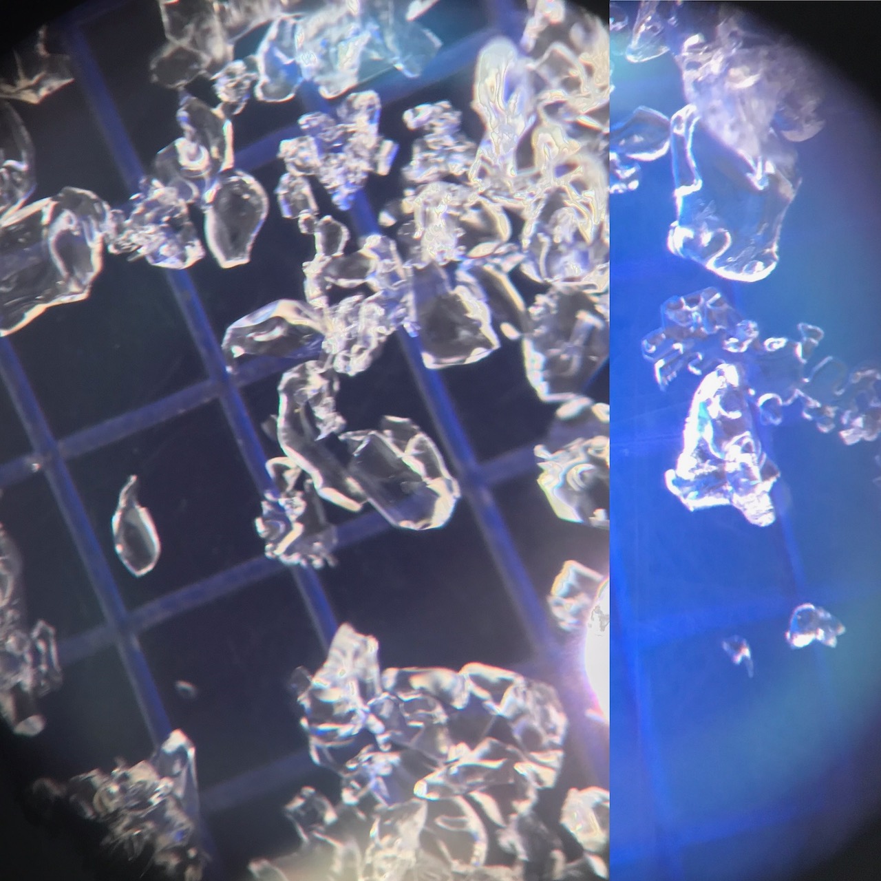
Basal facets up close from 130 cm on left, from 160 cm down on right
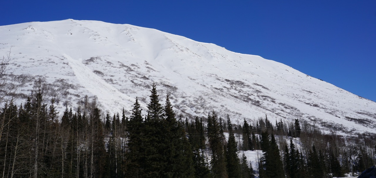
Fresno natural from WNW wind event
Tri-Tip natural avalanche
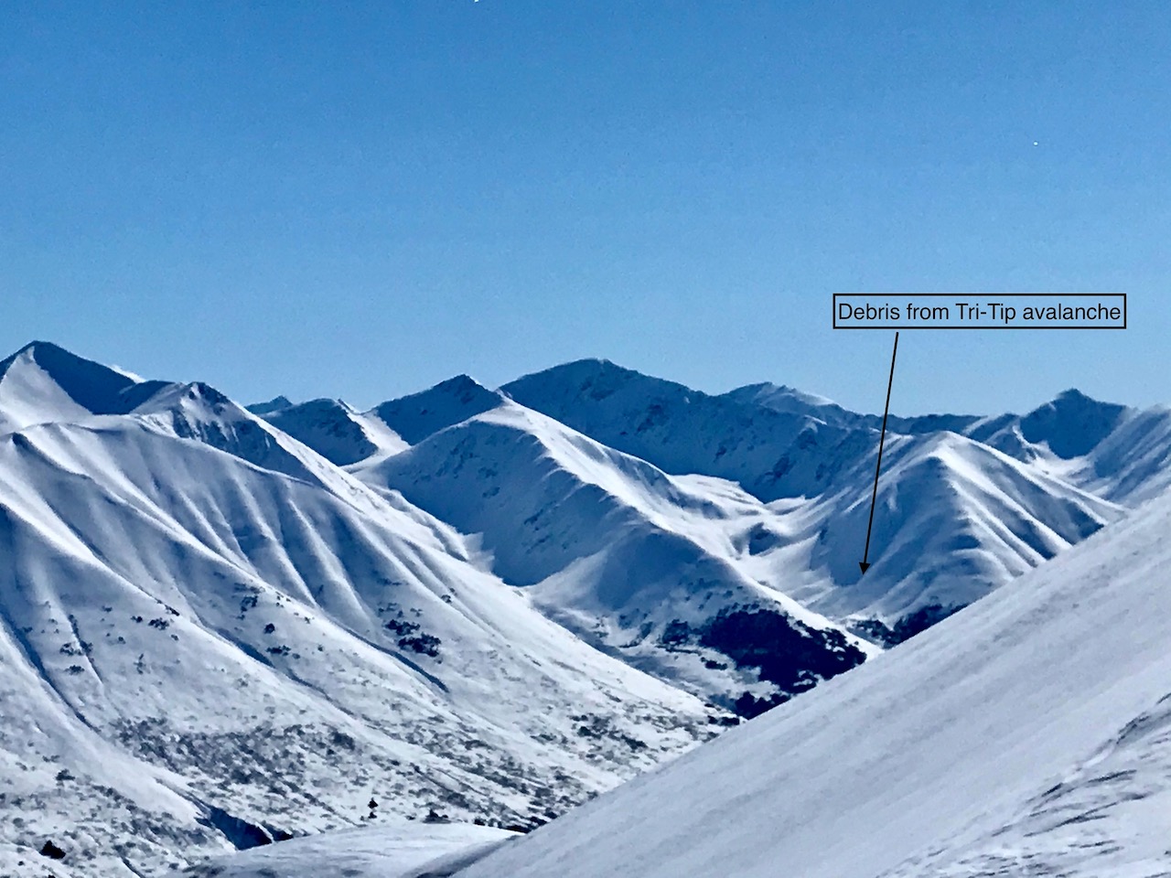
Debris from Tri-Tip

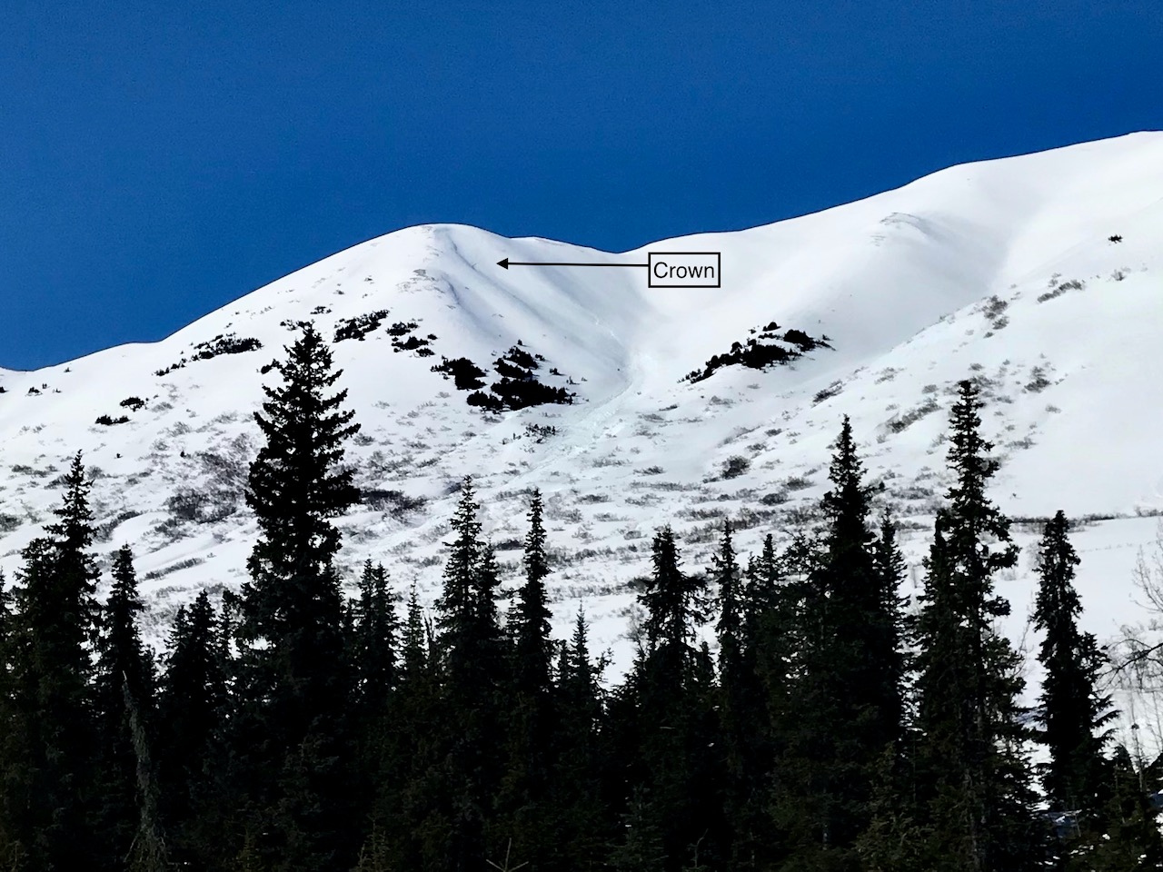
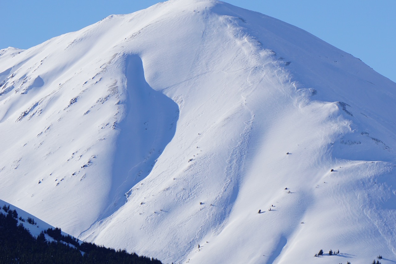
Summit peak natural avalanche that occurred sometime before noon on 4.5.21

Closer look at the crown Summit Peak avalanche
Summit peak 4.6.21

Avalanche on Moose mtn observed from pit location, likely occurred 4/5

View of 4/5 wind slab avalanche on Moose Mtn from the road