| Trigger | Natural | Remote Trigger | 0 |
| Avalanche Type | Hard Slab | Aspect | South Southeast |
| Elevation | 3700ft | Slope Angle | unknown |
| Crown Depth | unknown | Width | 1000ft |
| Vertical Run | 2000ft |
Avalanche: Summit
Location: Fresno
We ascended an East facing sub-ridge of Frenso and turned around due to increasing strong winds and shooting cracks. While we were taking off our skins before descent an avalanche released on a prominent East facing slope and funneled into a gully just North of our location. We descended our general route and regrouped around ~1600′. As we looked at the previous avalanche, a second natural released from the upper portion of the same gully, SE aspect. A large powder cloud caused us to move quickly down slope a few more hundred yards. When it stopped most of the debris funneled into the gully, but a portion may have crossed a small section of our skin track where debris crested onto the sub-ridge. This detail is unconfirmed. Both of these avalanches were much larger than we had expected. The second avalanche appeared to have entrained into old snow near the ground.
In hindsight we minimized the potential size of the avalanche hazard and the amount of snow being transported. Our route was not ideal for the conditions we encountered. We estimated that some of the gusts we experienced just before turning around were 40-50mph and likely much stronger near ridge tops. We were all familiar with this route and had previously measured slope angles to be less than 30 degrees where we intended to go. However we underestimated the overhead hazard and how far and fast a cold snow avalanche could run in the terrain we were in.

Avalanche Details
We witnessed three natural avalanches triggered by strong winds during our tour. The first was a small D1.5, 50' crown and ran 150' and released mid slope. The other two were much larger and starting zones were near ridge tops.
Obvious signs of instability
| Recent Avalanches? | Yes |
| Collapsing (Whumphing)? | No |
| Cracking (Shooting cracks)? | Yes |
Observer Comments
Natural avalanches, strong winds transporting snow, and shooting cracks
Weather
Overcast in the morning becoming partly cloudy by early afternoon
Moderate to Strong NW winds
Temps - mid 20F's
Snow surface
1500' - 6-8" loose snow in protected areas and wind stiffened snow everywhere else
Variable surfaces above 2000' - windslabs average 8-10" thick and pillowed up to 15" thick, exposed crusts and anti-tracks
Snowpack
Dug hand pits and found 5-8" of snow sitting on near surface facets on a firm curst. Above 2000' this snow was more reactive and slabs were 8-15" and sitting on facets on a crust. This crust was thin less than a cm, breakable. In some places this crust was blown clean and buried surface hoar was found within this crust, and suspect it was the MLK layer. We did not dig any test pits due to deteriorating conditions.
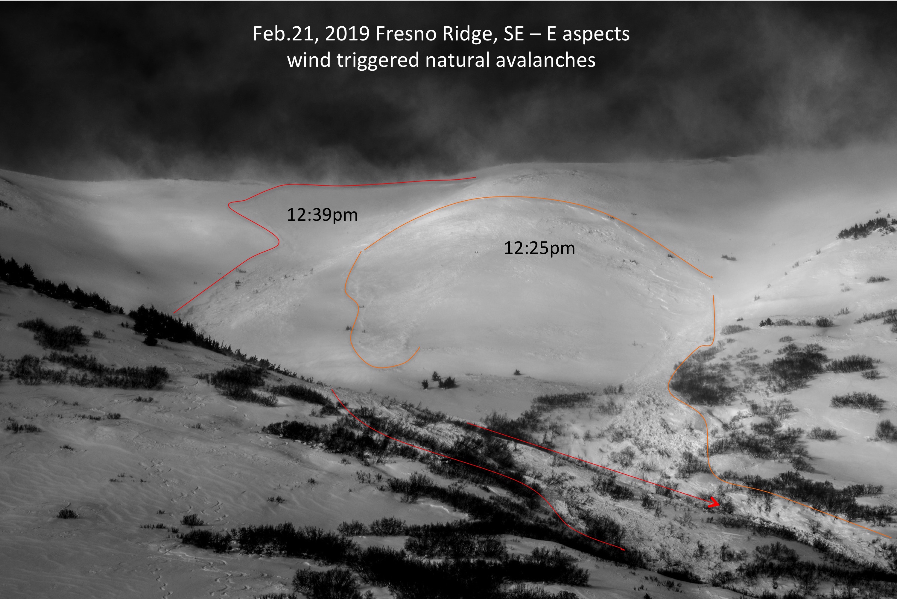
The avalanche on the right (orange) occurred while we were transitioning to ski. The avalanche on the left (red) occurred just after we descended.
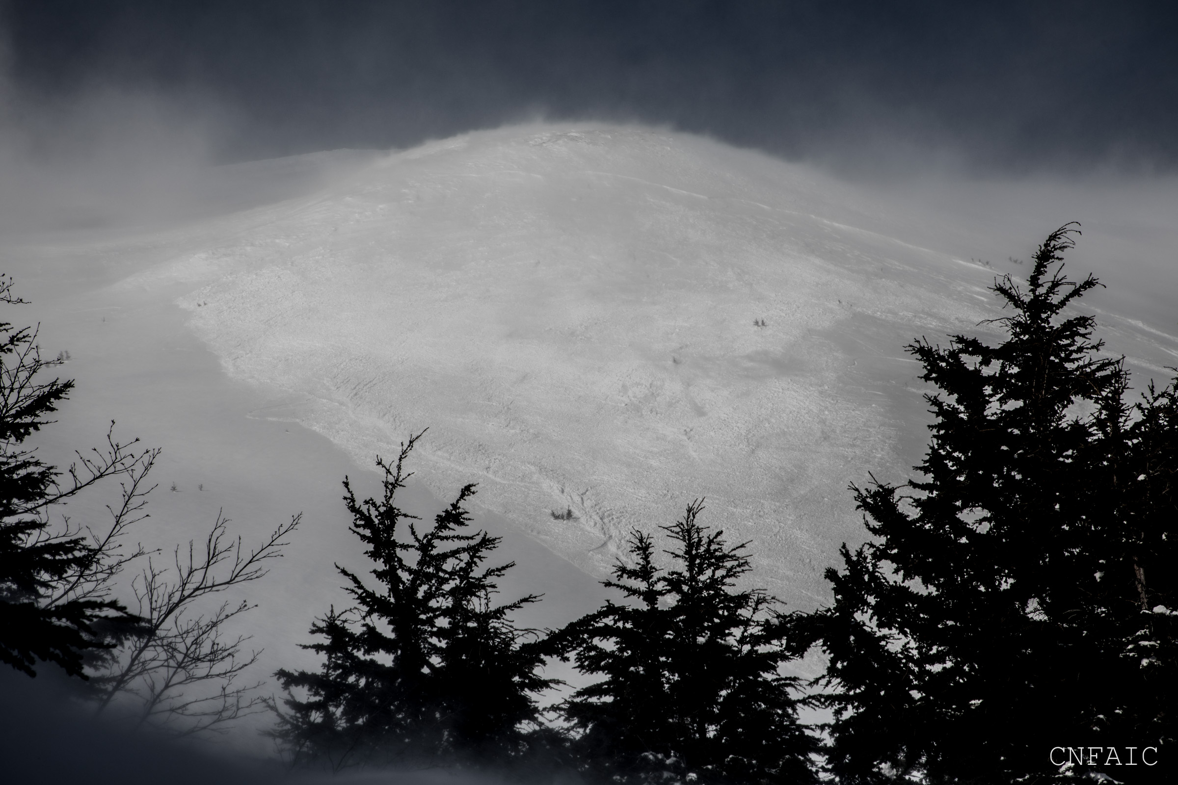
A view of the first avalanche crown from our transition spot.
A view of the debris from the first avalanche at our transition spot.

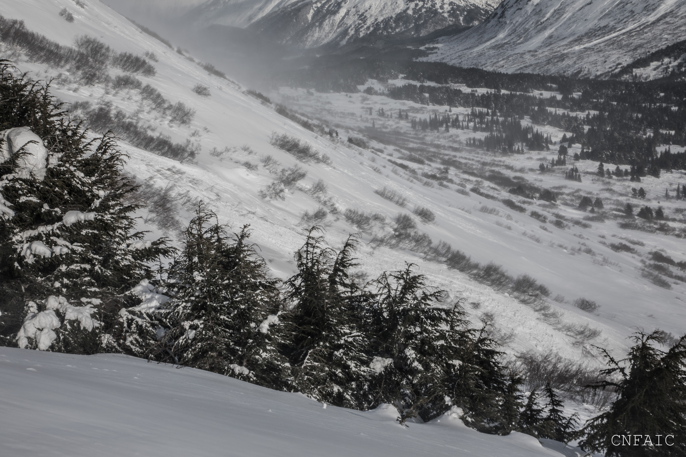
Powder blast from the second avalanche crossed over the terrain we descended
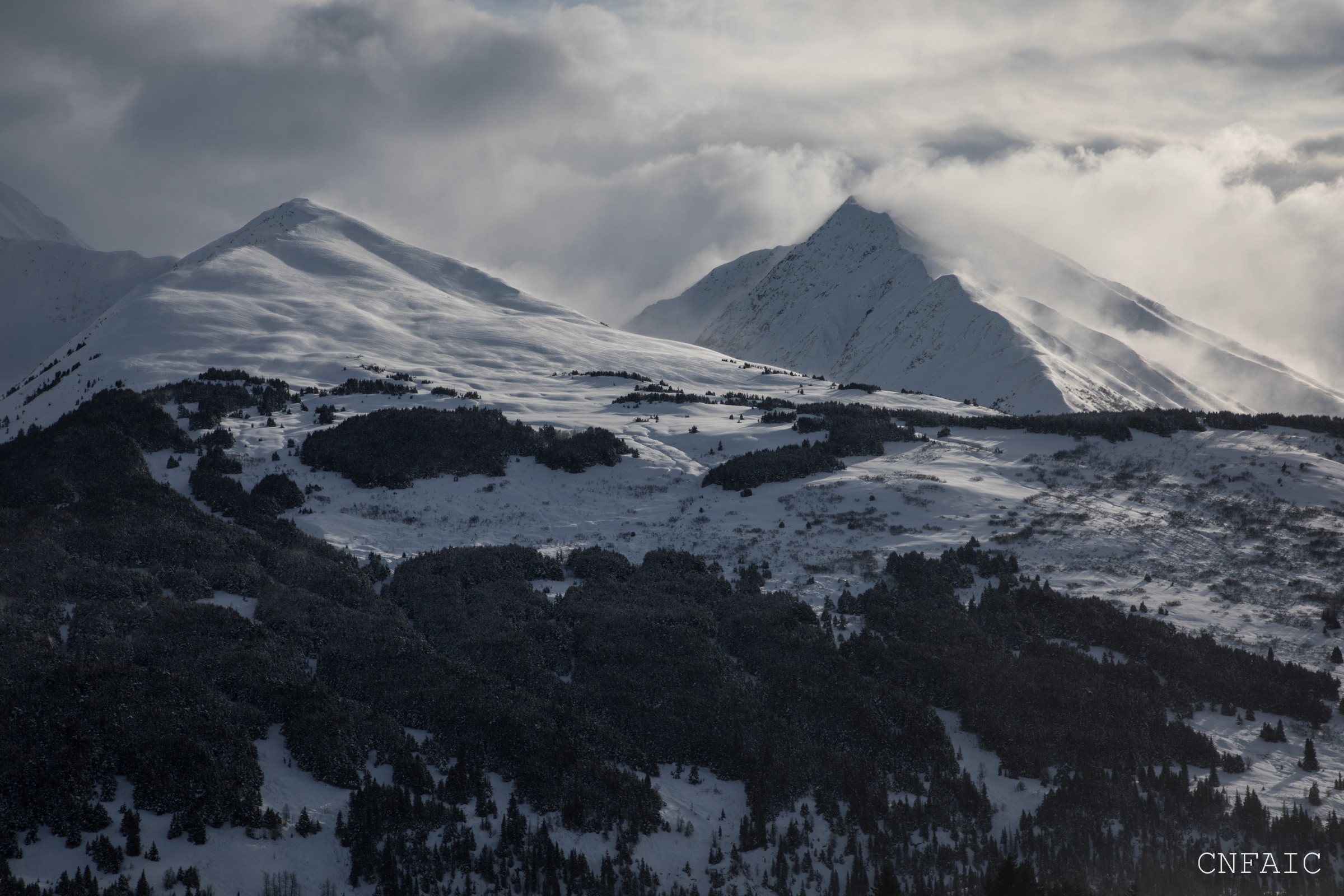
Winds blowing off of Manitoba and Spirit Walker

Shooting crack at 2400'

Shooting crack at ~2000'
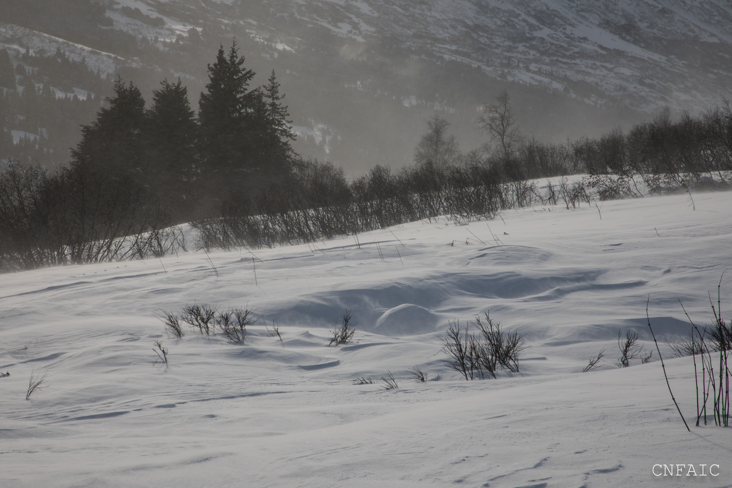
blowing snow at 1600' in lower valley bottom
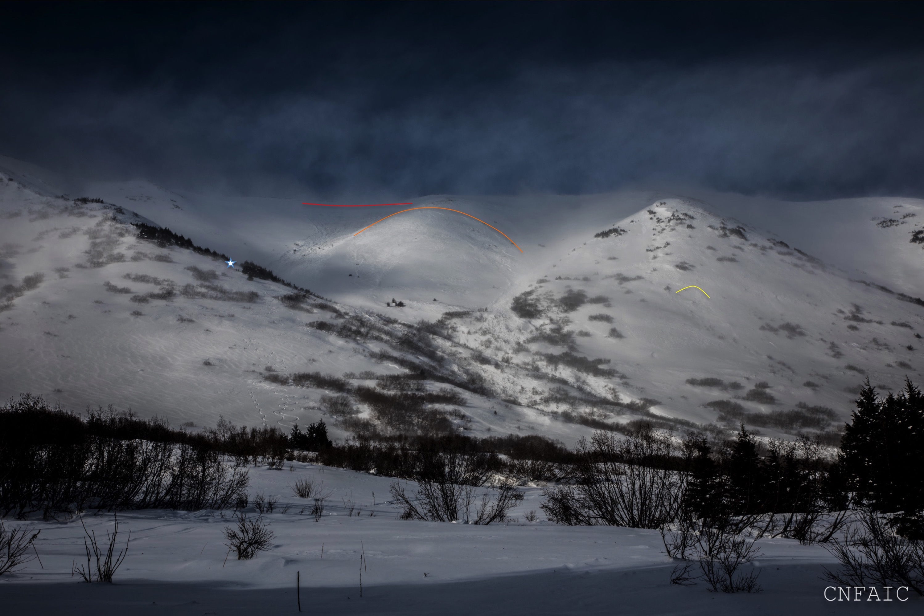
The star is the area where we turned around and descended. The yellow crown was a natural wind slab we noticed around 11:30am, orange crown released at 12:25pm and Red crown released at 12:39pm. Most of the debris funneled into the gully.