Sunny skies and warm temperatures. Afternoon was near 30F at 3,000' and 40F at 1,000'.
Winds were light from the South on Eddies ridge.
Observation: Turnagain
Location: Eddies
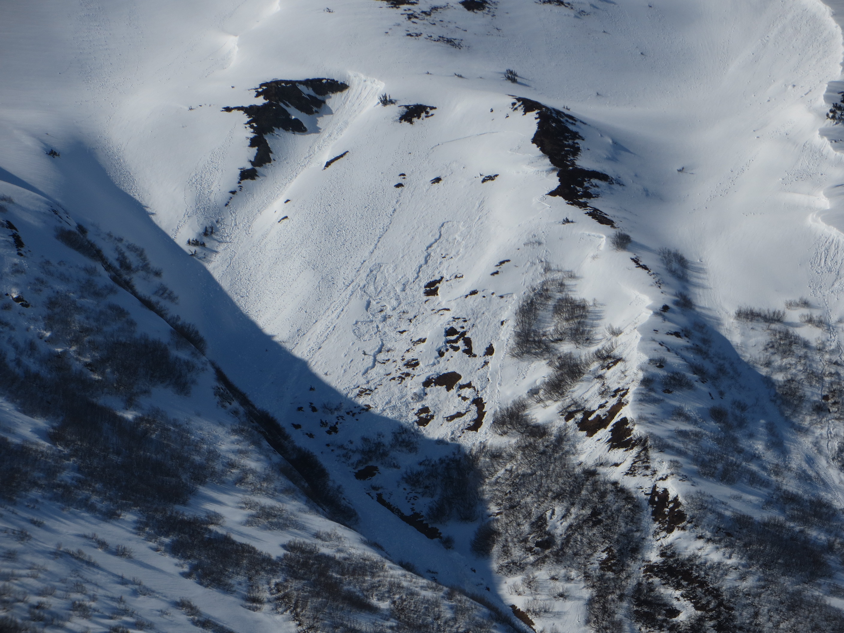
We went to the Eddies area today to investigate a deep slab avalanche that occurred two days ago on Saturday April 11th. This happened on one of the ‘usual suspect’ rolls on the West face at 1,900′. The slide was written up here:
https://www.cnfaic.org/observations/eddies-mtn-west-face-just-above-tree-line-first-big-convex-roller-to-the-right-of-skin-track/
The avalanche failed below the 4-6 feet of storm snow from 4/7-4/10. The weak layer was a 3cm layer of 1-2mm moist faceted grains. The faceted layer had already collapsed so was likely thicker pre-collapse. The collapse traveled nearly a mile and triggered several large avalanches from North, West and South slopes – impressive!!
Weather
Snow surface
6" of new - low density - snow from yesterday. There has been some wind damage in the higher elevation exposed areas but many places escaped the winds.
Snowpack
We dug in two spots today - West at 1900' and North at 1500'. These aspects were avalanching two days ago but appear to have gained strength. Wet snow can still be found below the storm snow (3-5' down).
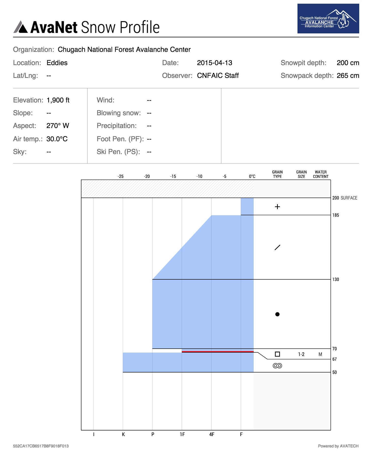
Crown Profile that goes with photo above
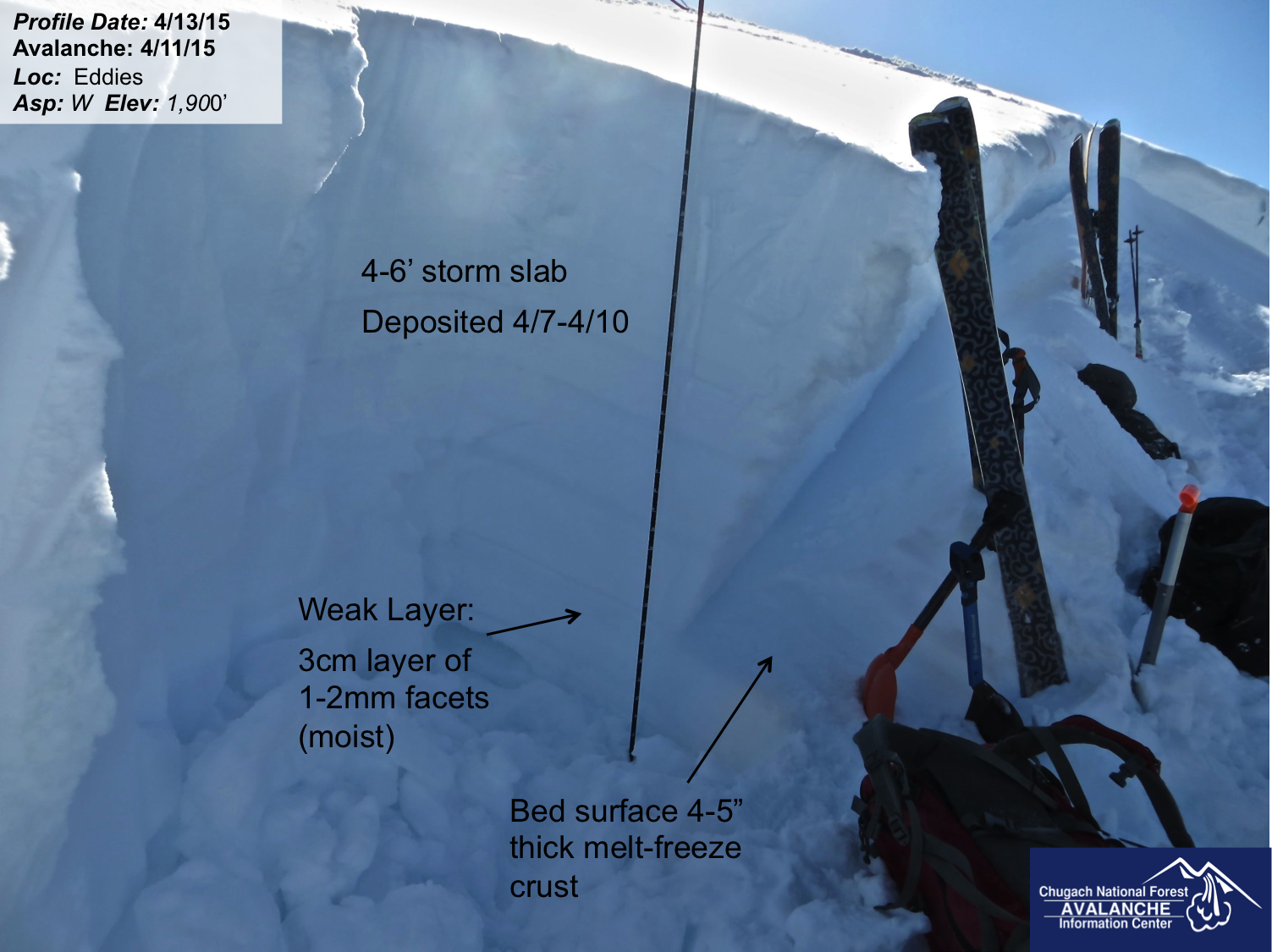
Crown profile of Eddies deep slab trigged on Saturday, April 11th

Pit at 1,600' on a North aspect

Eddies ridge and headwall
Wet loose avalanche on the SE face of Seattle Ridge from today, 4/13