| Recent Avalanches? | Yes |
| Collapsing (Whumphing)? | No |
| Cracking (Shooting cracks)? | No |
Observation: Turnagain
Location: Eddies
Eddies to 2600′
Obvious signs of instability
Observer Comments
No new slides today that we observed, but recent avalanche activity on Eddies and Sunnyside - as others have reported - is quite impressive!
Additionally, a small loose snow avalanche from Sharks Fin ridgeline released mid-storm on a steep SW aspect, and as it slid down the slope it triggered a small slab that looks to be similar to the other recent slides (~2' deep) in depth was triggered. This looked to be a D1.
Across Turnagain arm, a mid-elevation slab occurred in day(s) prior running into Peterson Creek (see photo below)
And finally, a dark glide crack was also seen on a steep face behind Penguin Ridge, that looks to be rather fresh given two weeks of snow... (see photo below)
Weather
The trend of BRRR at the car continued, with temps just below zero at the start and finish of the day. Few clouds, and felt above zero on the ridgeline with occasional NE light winds up high.
Snow surface
Surface hoar has formed on any non-treed areas of the route, from the trailhead to ridgeline, ranging in size from 3-6mm. It sat on soft snow along the entire route, with ski penetration 6-10" except a few spots above 2500' where there was just 2-3" of soft snow from the past week.
Snowpack
Dug several times along the route to see how surface hoar/facet layer cake is baking...
Pit #1: 2600', West aspect, 25 degree slope, Height of Snow (HS)=310cm. This pit was dug ~100 yards downhill of the upper debris pile from Thursday's slide, and ~50 yards from the edge of where runout continued down to the valley floor. Test results are below.
Pit #2: 2100', N aspect, 20 degree slope, HS = 195. This pit was 20' from the pit submitted on 11/27. Results are below, and while the tests failed with more taps at the 11/22 buried surface hoar interface today versus last week, they had more 'pop' this week.
Pit #3: Quick pit just deep enough to reach the 11/22 buried surface hoar at 1100' on a NW aspect. CT 17, 19 RP and ECTP 17 down 50cm from the surface. The snow above the 11/22 layer was fist -> 4 finger hard - softer than the other two locations - and the shovel had compressed more than half the block when failure occurred.
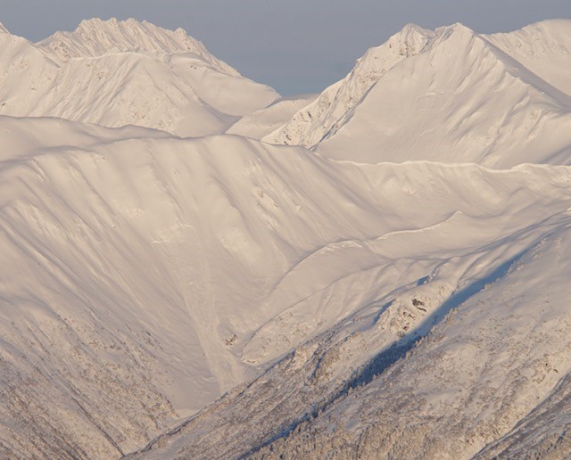
Recent slab from prior day(s) going into Peterson Creek

Previously reported slab on the far north end of Sunnyside

Two slabs on sunnyside near the weather station that were reported yesterday
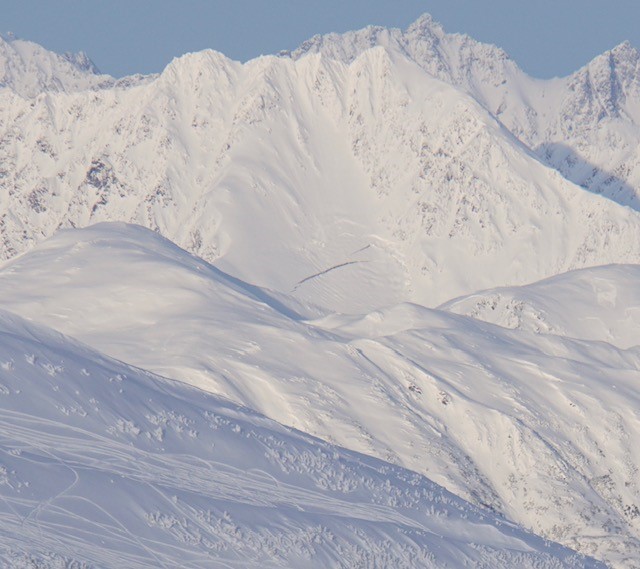
A rather brown glide crack... maybe on the move? ... across Turnagain arm and behind Penguin Ridge

Pit #1 near Thursday's Eddies avalanche

Pit #2 in a protected, representative location
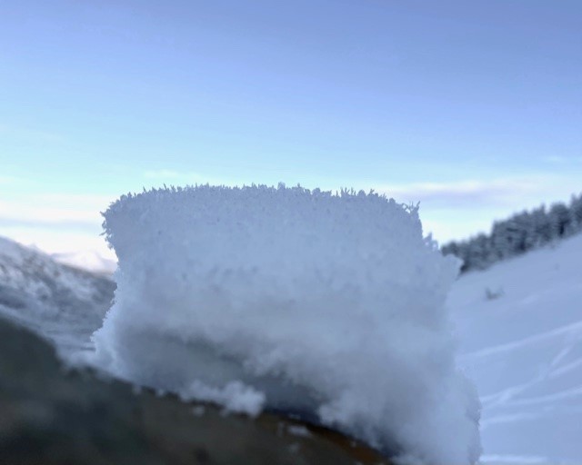
Widespread surface hoar!