| Recent Avalanches? | No |
| Collapsing (Whumphing)? | No |
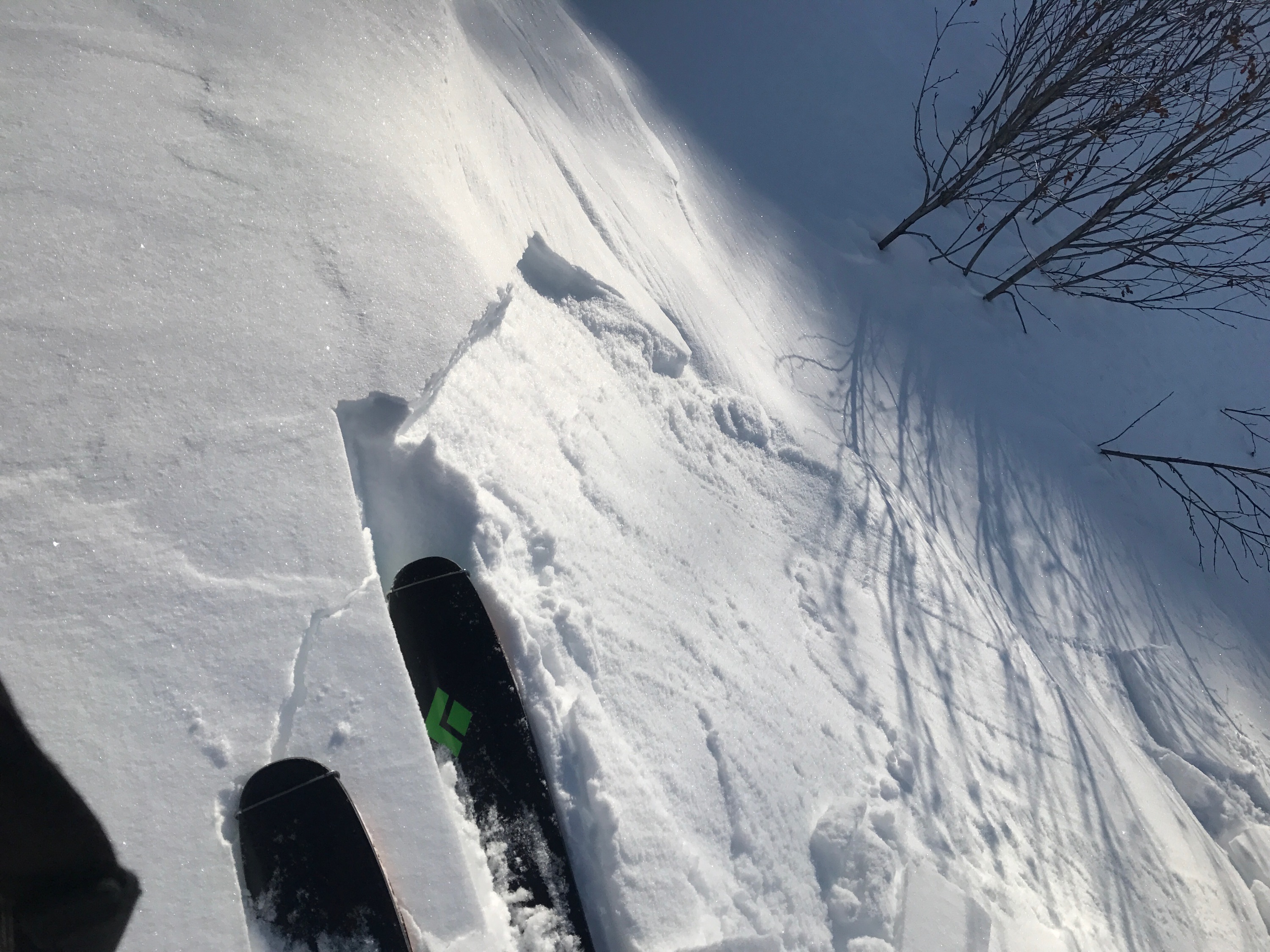
| Cracking (Shooting cracks)? | Yes |
Observation: Turnagain
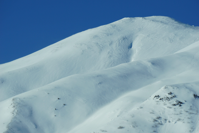
Location: Cornbiscuit
Road observations with a quick tour up the lower slopes of Cornbiscuit before the Monday storm.
Obvious signs of instability
Observer Comments
Only minor cracking along lower NW ridge of Cornbiscuit. However, we only ascended to 2,000'.
Weather
Sunny and light Westerly winds. Temperatures in the teens.
Snow surface
The bottom portion of Cornbiscuit has 3-4" of new snow from 2/23. Some wind effect down low, but we could see wind effect and variable conditions higher on slope. Top 6-8" is very loose snow.
Snowpack
Roughly 10-12" of loose snow on a 1-2" layer of faceted snow. The facets are 4F to Fist hard and sit on a very stout melt freeze crust. This set up is consistent with what has been reported from other mid-elevation slopes. Essentially, a very weak snowpack that was not affected enough by wind to have a slab on top.

Tincan Proper
Natural wind slab on South end of Seattle Ridge, ~3,500' SE aspect
Very small wind slab on lower Cornbiscuit

Anti-tracks on Tincan's Hippy Bowl
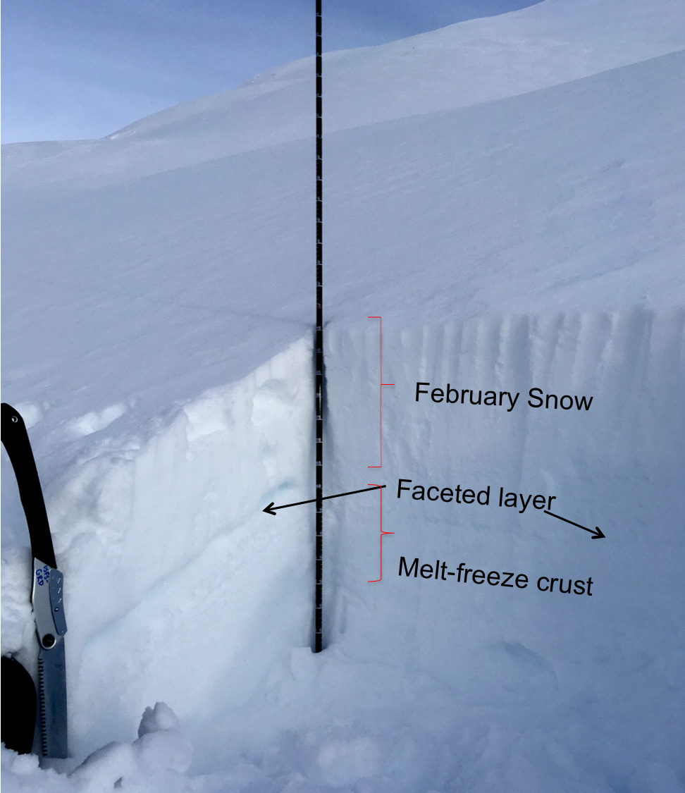
Snow pit at 2,000', West aspect