| Recent Avalanches? | Yes |
| Collapsing (Whumphing)? | No |
| Cracking (Shooting cracks)? | No |
Observation: Turnagain
Location: Cornbiscuit
Western face of Cornbiscuit to 3800′
Obvious signs of instability
Observer Comments
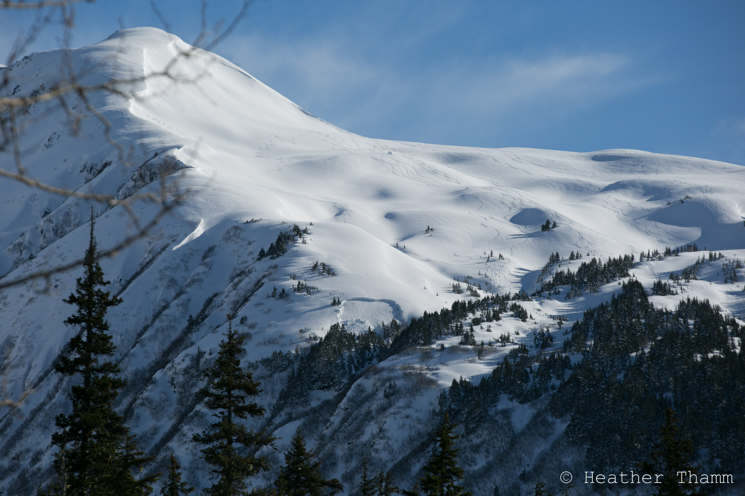
Several natural avalanches were present on the S. face of Magnum. Likely occurred near the end of the most recent storm (4/9)
Several large naturals(?) slab avalanche on Eddies. Occurred today around 3:15pm. Couldn't quite see the larger ones on the S. Face from the road.
Spoke with a group who were on Eddies today who said they felt a very loud (sounded like a Canon) collapse and felt the snowpack drop 1/2".
Spoke with a party of two who witnessed the event from Tincan today. They said all of the slides happened during the same event at around 3:15pm.
Weather
Temps: 25F - 40F
Wind: 5-15mph
Sky: Mostly sunny with scattered clouds
Precip: No Precip
Snow surface
1000'= 4" of melt/freeze crust on ground
2000' = 2" crust on surface of Southerly aspects. On shaded slopes 10" of new snow on 2' of moist saturated snow.
3000'= 2" crust on surface of Southerly aspects. On shaded slopes 1' of low density snow on denser layers below.
Snowpack
There is a mixed bag of ingredients below the surface of the snow depending on aspect and elevation.
Below 2500' on Cornbiscuit there is a slab about 10-15" thick sitting on very moist saturated snow. At 2100' there was a 2" curst capping the wet snow where it was starting to freeze. This wet snow is elevation dependent is a layer of concern where the slab is thicker like on the Northern side of the Pass. This is likely the weak layer that collapsed at Eddies today where 5 avalanches released in one single event. All of these avalanches occurred below 2200'. See photos
Above 2500' we dug two pits, one on a SW aspect and the other on a NW aspect. Both had very different structures.
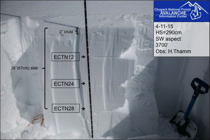
Pit at 3700', SW aspect, HS=290cm (See photo) Snowpack didn't show propagation potential in its current state. The top 26" slab had several density changes, likely several wind slabs stacked on top of each other from the recent snowfall (4/7-4/10) accompanied by strong winds. Should this aspect see rapid warming due to solar radiation these layer could become re-activated. At this time they appear to be bonding well.
Pit at 3100', NW aspect, HS=140cm (See photo) Snowpack had poor structure and failure occurred within a layer of facets between two crusts. The slab was 30" thick and most if it was pretty dense (1F-). This pit was dug near the NW shoulder on Cornbiscuit where it was likely very thin prior to the last 3 or 4 storms (3/14 - present.) This is a good example of weak faceted sitting within a curst sandwich hidden below a thick slab on Northern aspect.

S. face of Magnum, slabs likely released near the end of the storm on 4/9 or 4/10.

Poor structure was found on the NW shoulder of Cornbiscuit.
SW face of Cornbiscuit at 3700'
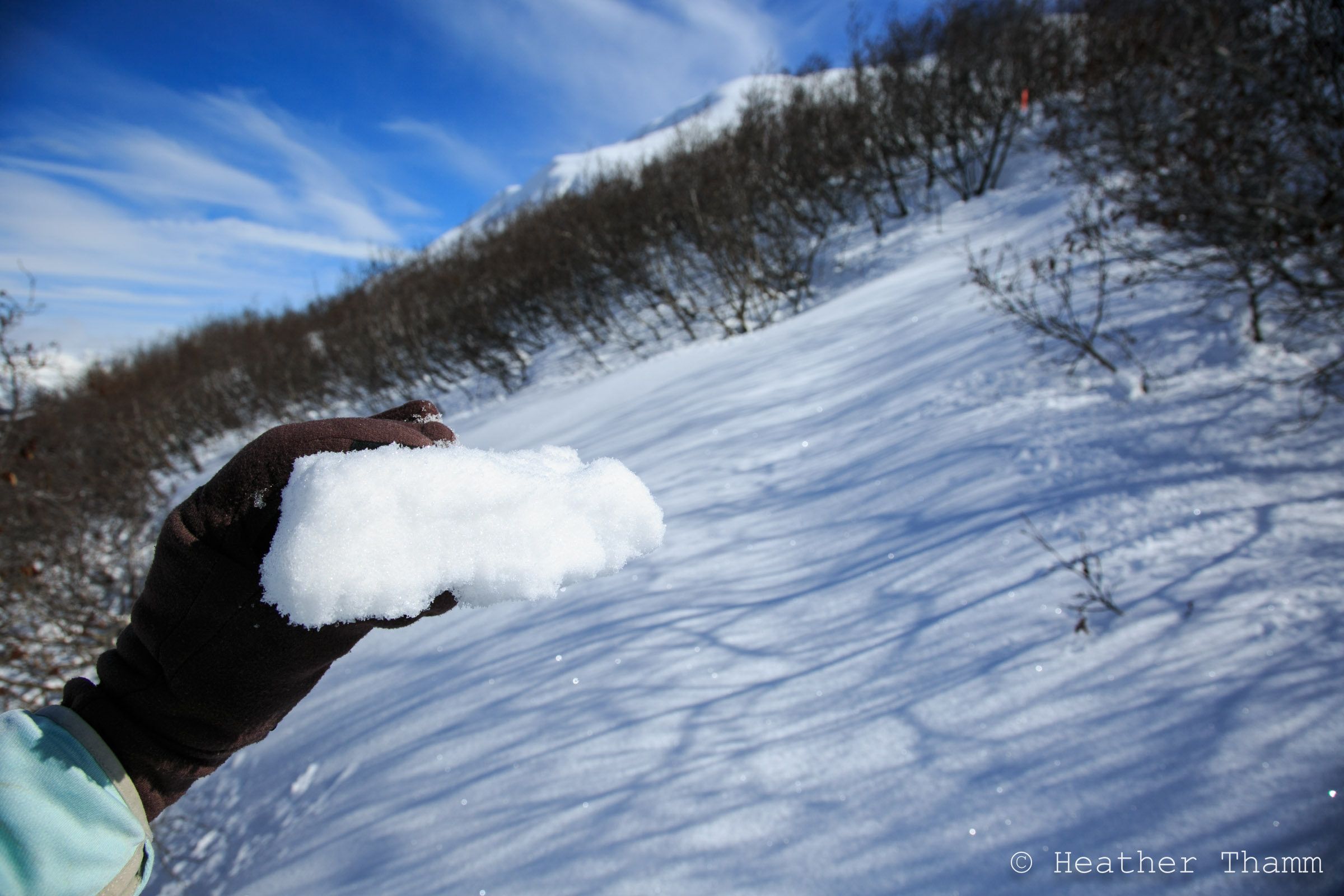
2" crust was found on all Southern aspects, but became moist by late afternoon.

≈2100 on a SW aspect of Eddies, Several large avalanches occurred today on Eddies S. Face and three smaller avalanches like this one were reported during the same incident.

Oblique angle of several avalanches that occurred today on Eddies S face.
This avalanche occurred during the same event as the one's above, but was on a NW aspect.

SW aspect of Skookum Valley as seen from the Seward Hwy near Ingram Cr. Several recent very large avalanches that likely occurred within the last 48 hours.