One whumph at lower elevation (around 2,00 feet?) when our party of 6 all grouped up on a low angle part of the up track, still in the thin alders.
Observation: Summit
Location: Colorado
Hiked up from the Manitoba parking lot with AGC Avy Level 2 class. Left cars around 10 am and returning around 4 pm.
Observer Comments
Weather
Temps in the single digits to mid teens. Calm all day with increasing clouds toward the afternoon.
Snow surface
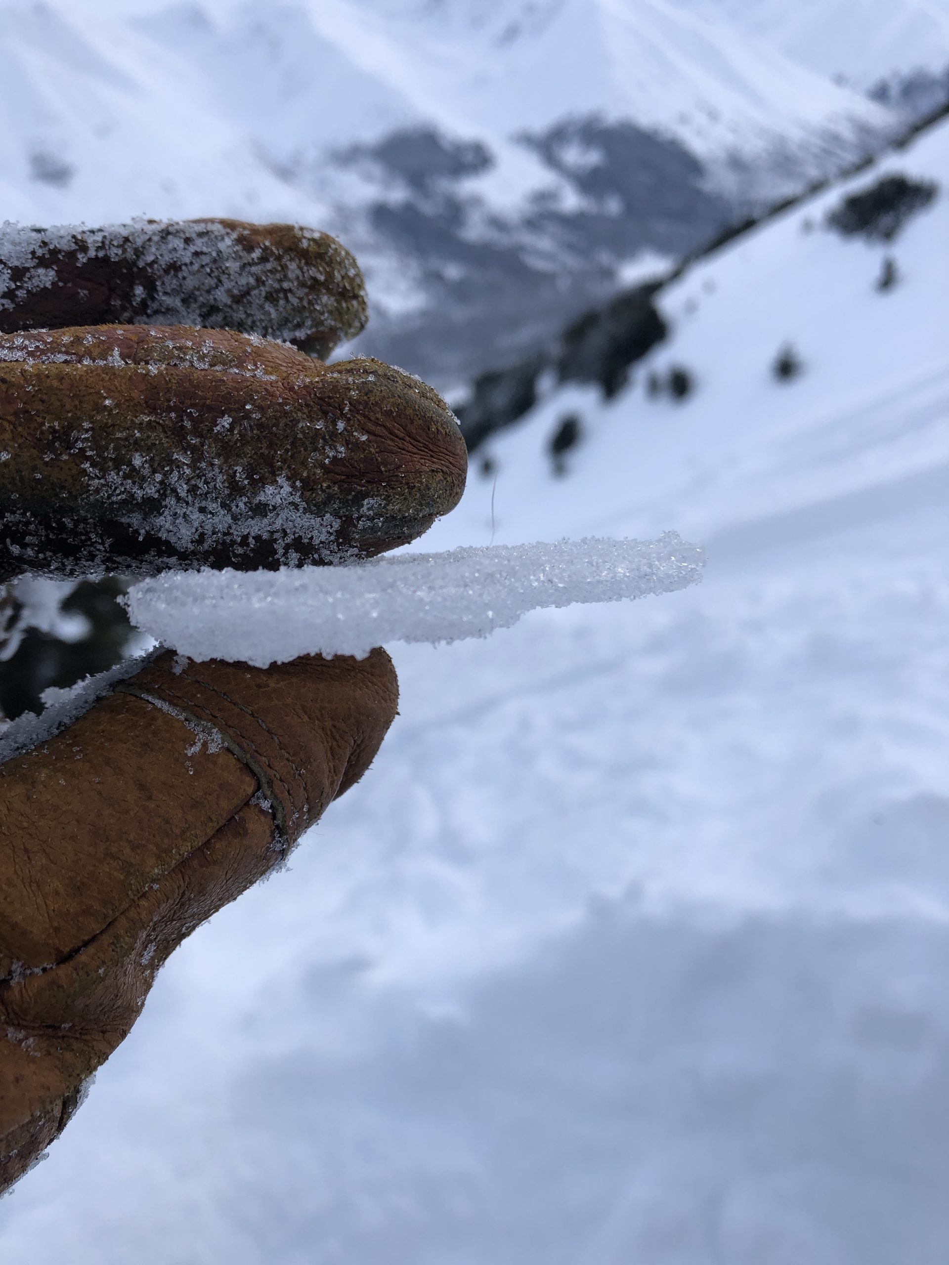
Some evidence of wind effect (rippling) high up on the ridges of Colorado, but no evidence of that from the road up to our high point of 2,800 feet. Snow surface was surface facets and 30 cm of soft snow.
Snowpack
Pretty uniform snow pack at lower elevations and easy to push an upside down ski pole all the way to the bottom. Up higher, there was a spatially inconsistent ice crust 35 cm down from the surface (see pit photos). Ski penetration was 30 cm and boot penetration was up to a meter. Our group dug multiple pits, but only reporting here for 3 that we dug; showing photos for just one of those since results were identical.
Pits 1 and 2 @2,500 feet: ECTX and ECTN24 on ice layer 35 cm down from surface. Also, propagation saw test was 35/100 on the crust layer 65 cm down and 75/100 on the ice layer 35 cm down.
Pit 3 @ 2,800 (see photo). ECTX.
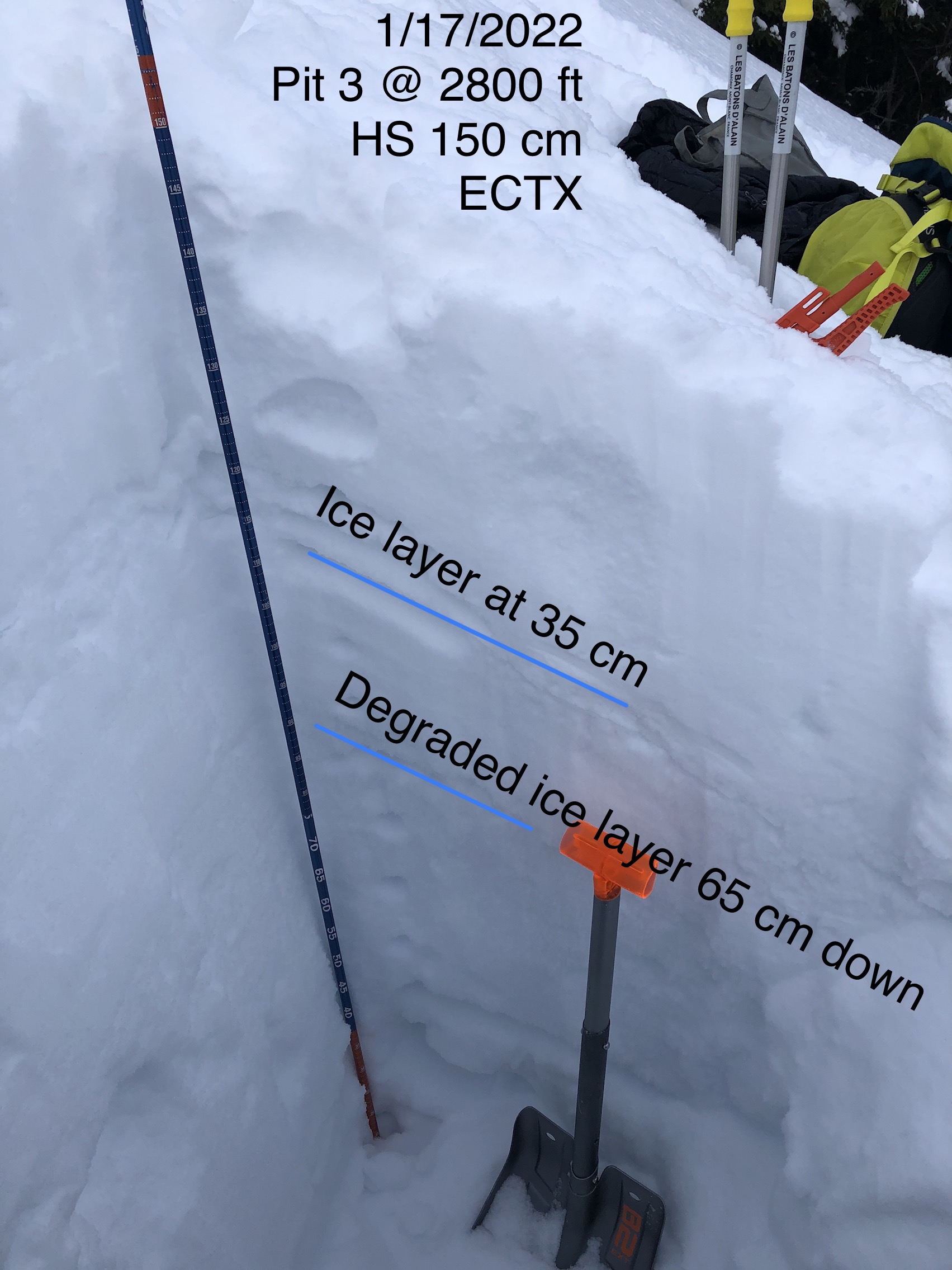
Pit 3 on east aspect of Colorado.
Ice layer at 35 cm down.

Snow surface on the up track.