Birch Trees Summit Lake Area - image 1
Wide Propogation
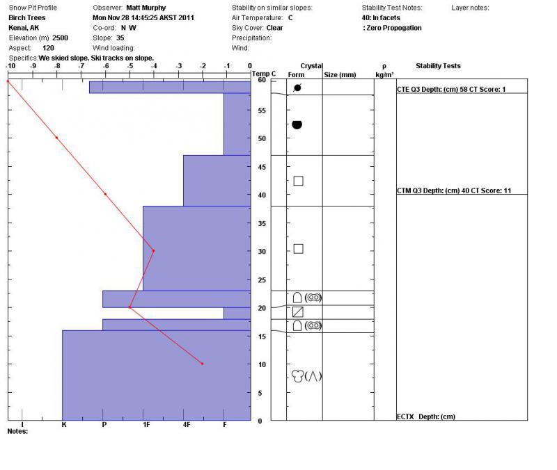
Big changes in snowpack in this location in the last two weeks. Snow changed
from a fairly good structured snowpack with rounds in the mid snowpack to a
faceted snowpack. The facet/melt freeze combo layer at and above the ground
interface is thicker. Plus there is a variable wind crust on the surface/near
the surface that ranged in depth from eggshell to 4 inches thick. It was very
slippery in many spots. We dug about 5-7 hand pits on the way up and found
facets in the mid snowpack at every location. The stability tests, however,
showed good stability.
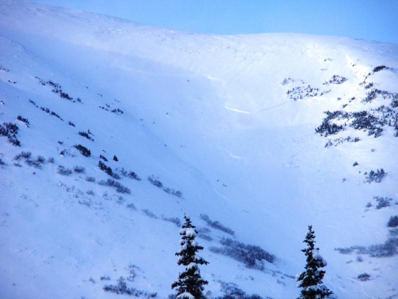
The photo is near Milepost 51 on the northern end of Fresno Ridge in the last
basin before on the lookers right before the Tributary Creek drainage. I’m not
sure when this avalance occured, but I’d guess it happened during yesterday’s
wind event. This picture shows bigger propogation than I would expect; so, it
was kind of a surprise to my general feel for the snowpack. This makes me
think there are some wild cards out there that will not react well to the big
warm wet storm that is being forecasted by the NWS.
Birch Trees Summit Lake Area - image 1
Wide Propogation