Clear, light wind up to 3800', -3*C
Strong winds flagging on upper elevation ridgelines, summits and through mid-upper elevation passes
Observation: Hatcher Pass
Location: Bennet's Ridge
Bennet’s Ridge to Sunnyside of Hatch Peak
Weather
Snow surface
Small near surface facets, 5-7" thick. A nice weak layer for wind slabs in the future.
Snowpack
No avalanches, whumphing or shooting cracks observed.
Wind slabs beginning to form over weak, near surface facets at mid to upper elevations and through passes. Suspecting overnight wind slab development reaching D1-2 in size and touchy to very sensitive to trigger. Some natural activity may be possible in the windiest areas which appear to be closer to the frontal mountains against Palmer and Wasilla and on the highest summits.
Instability tests indicated that the HZAC weak layers have stabilized over time and have become dormant. This does not mean that there is or can not be avalanche activity on this layer, it just means activity is limited in size and frequency.
Basal facets were round and moist, non-reactive.
Mid pack layers consisted of various crusts and thin faceted layers sandwiched between 1F cohesive snow. ECT and PST on these layers lacked propagation propensity, but should be further tested and watched. Any significant load could activate these layers.
Height of snow max 2.7 to 3 feet, with as little as 1 foot in the mid elevations. Bushes and grass are showing and in some cases limit your ability to travel.
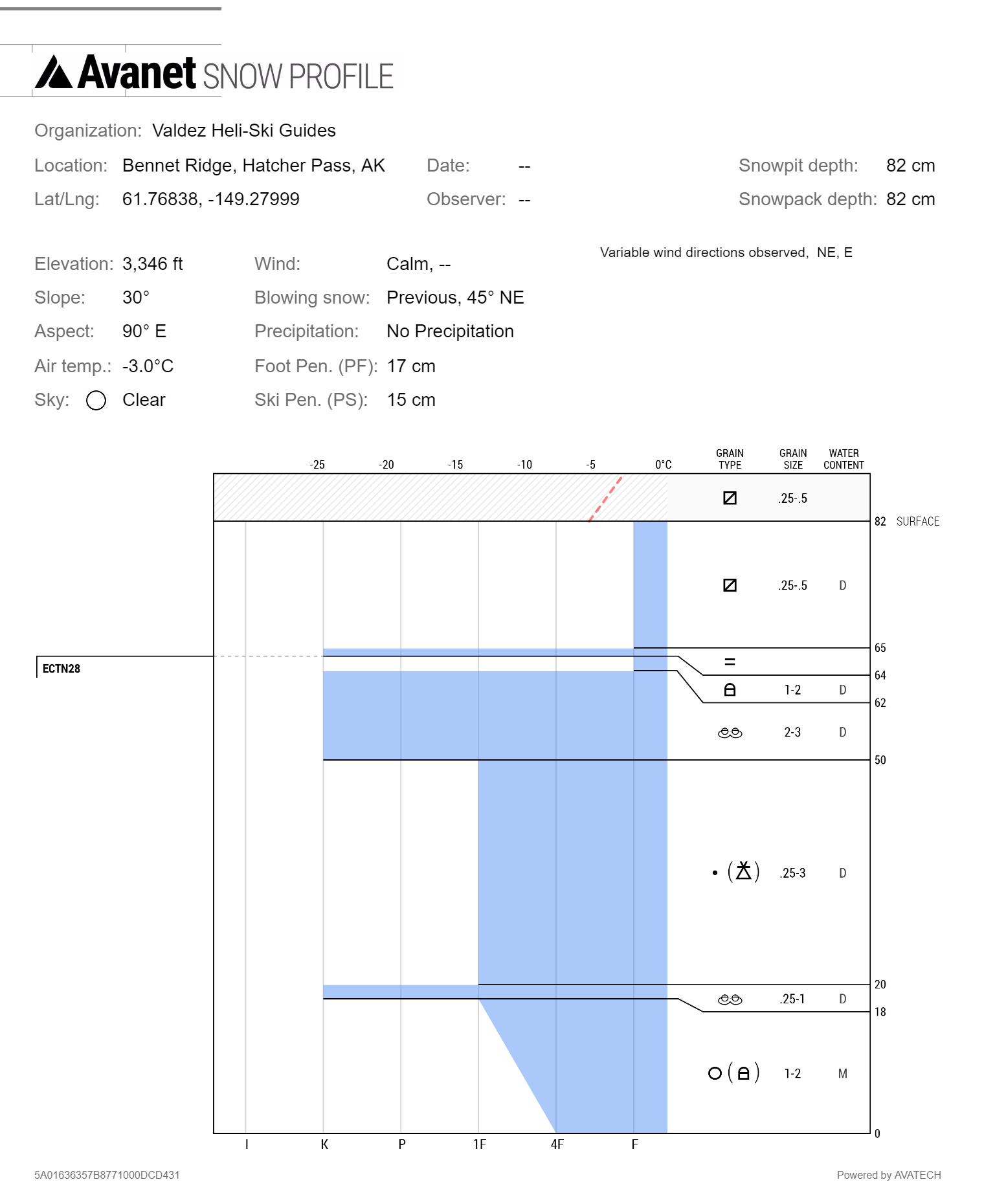
Bennet's Ridge Snow Profile 11/6/2017 - Jed Workman

rounded advanced facets