Naturals avalanches possible, Human triggered avalanches are likely on all aspects on slopes steeper than 35deg at mid and upper elevation.
Avalanche: Hatcher Pass
Location: Avalanche obs- post storm - Hatcher Pass
Travelled up and around Ray Wallace, Microdot, and Independence Mine observing recent avalanches post 3/19-20 storm. Numerous recent avalanches everywhere – wet loose, dry loose, soft slabs – mostly at mid and upper elevation on slopes 35 deg and steeper, all aspects.
Forecaster Comments
| Trigger | Skier | Remote Trigger | 0 |
| Avalanche Type | Soft Slab | Aspect | North Northwest |
| Elevation | 4000ft | Slope Angle | 38deg |
| Crown Depth | 12in | Width | 60ft |
| Vertical Run | 60ft |
Avalanche Details
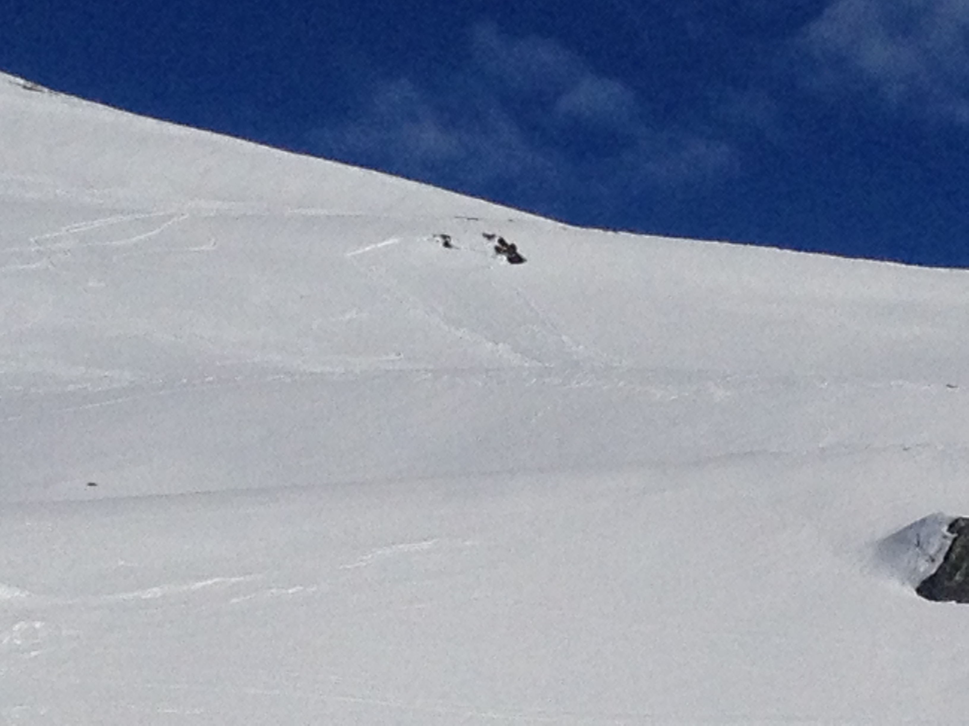
Observed solo skier trigger SS-AS-R2D2-I
Estimate from a distance 60ftx60ftx 12-18" crown depth
Triggered on 2nd turn, able to ski out- uninjured.
Most likely ran on surface hoar recently buried by last weekend's new snow.
Obvious signs of instability
| Recent Avalanches? | Yes |
| Collapsing (Whumphing)? | Yes |
| Cracking (Shooting cracks)? | No |
Observer Comments
Observed over 50 avalanches today from mid-storm 3/19, post storm 3/20-21, and today 3/22. Avalanches were widespread on all aspects mostly at mid (2500'-3500') and upper (3500'+) elevation on terrain 35deg and steeper. Observed dry loose and soft slabs on leeward- NE-N-NW-W and wet loose on E-SE-S-SW-W. Most avys went naturally within last 2 days. Also observed wet loose triggering soft slabs naturally.
Weather
12" new snow from 3/19, 3/20.
Max temps at 3500' have ranged btwe 40-46deg the past 3 days, yikes!
Winds gusted from 20-40mph for 12+ hrs post storm SE
Temps increased from 12deg F t0 30deg F during the storm.
Snow surface
wet! rollerball central
12" new snow has consolidated into 6"
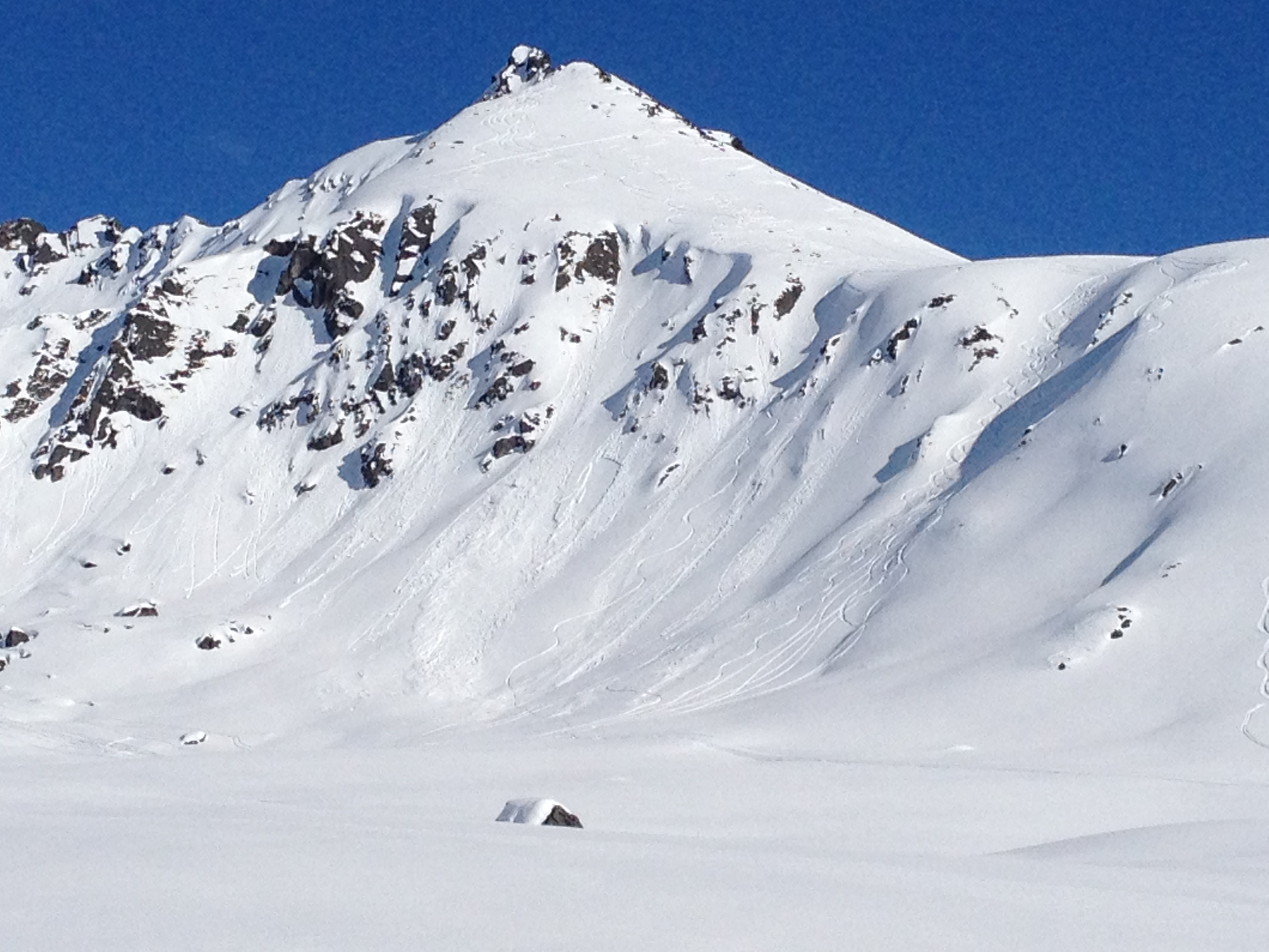
SS-ASr-R1D1-I Lower Marmot uptrack 3200'
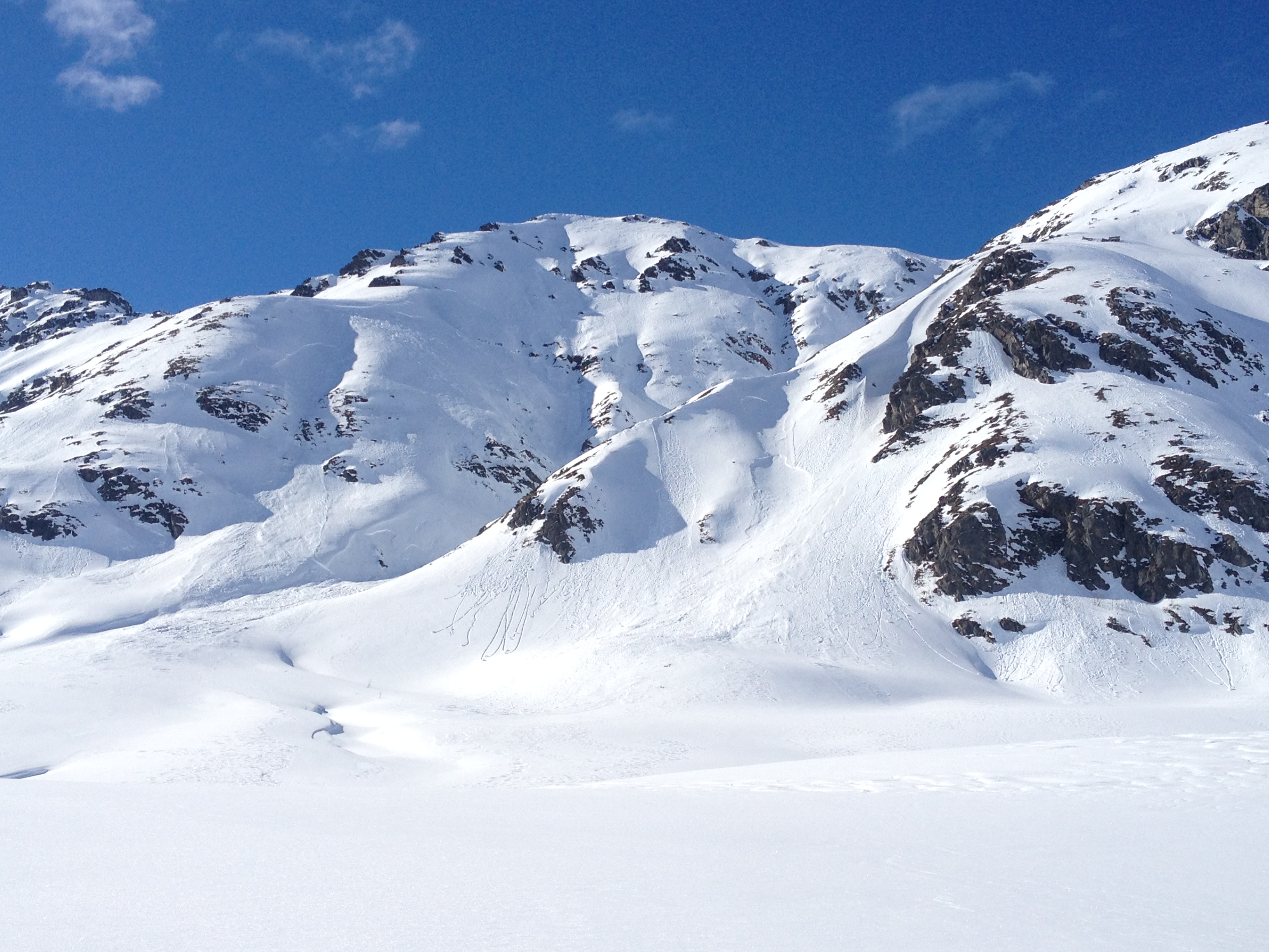
WL-N-R2D1-I Lower Skyscraper 3500' - (dozens of wet-loose observed - see person standing bottom left, building kicker)

Wet-loose triggered soft slab. WL/SS-N-R1D1.5-I Lower Marmot -lf of Lodge Slide 3200' W aspect

6" wet heavy snow (due to rapid temp increase)on top of last weeks lighter density snow- inverted!
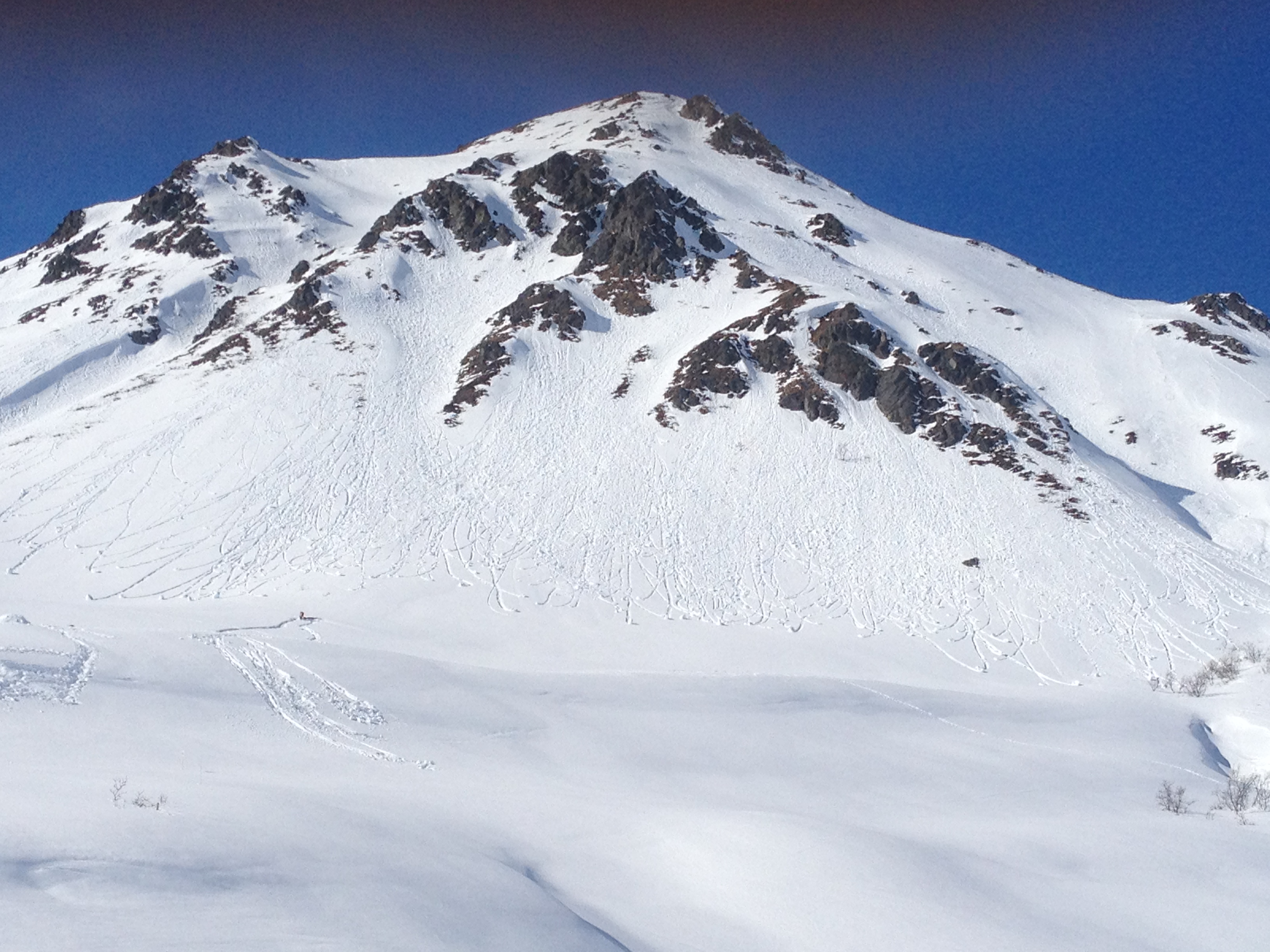
Mid-storm and post storm natural soft slabs, near Martin Mine NE 4000'
Natural wet-loose triggered soft slab 4000' NW lower Microdot
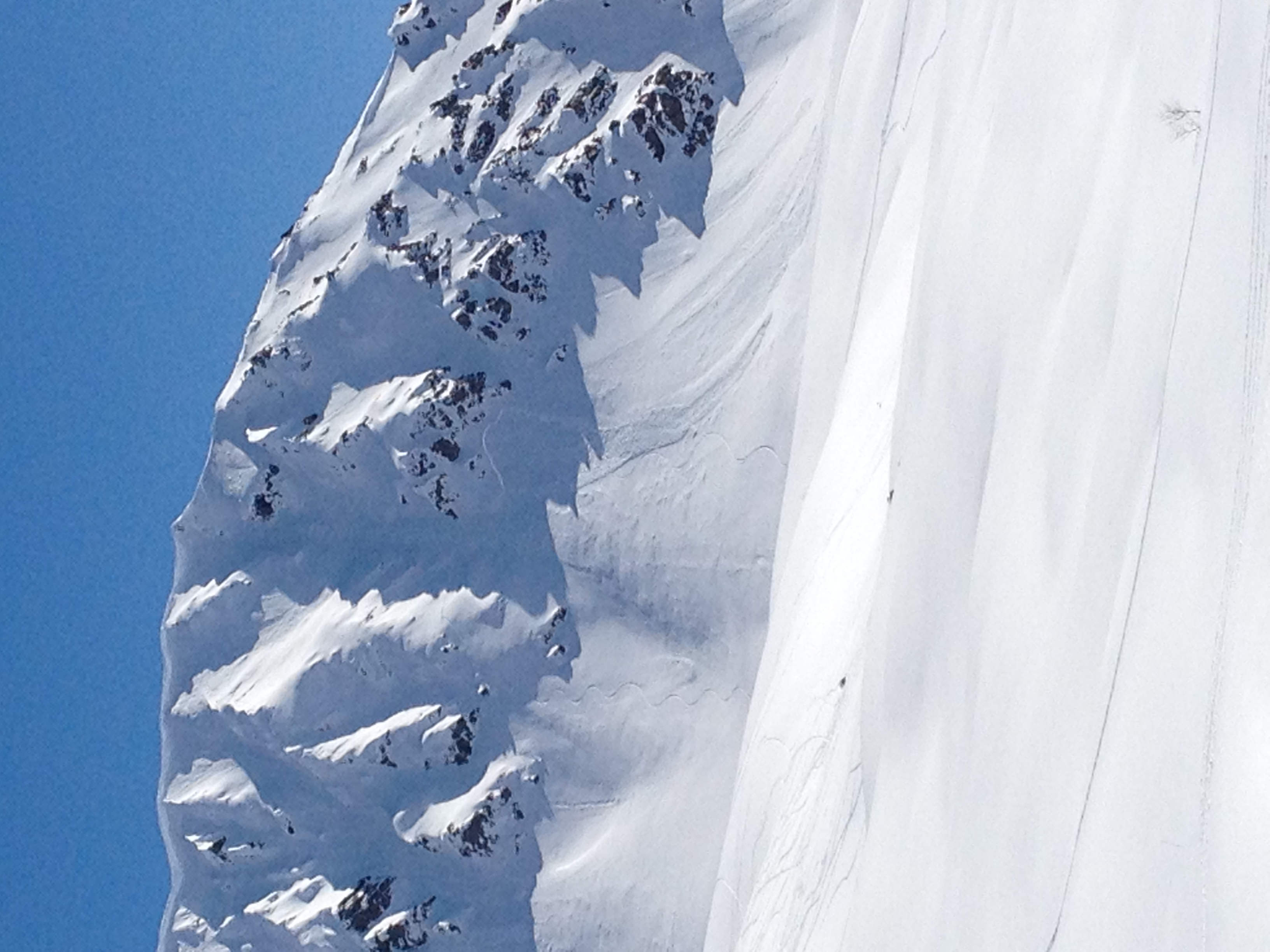
SS-AS-D2-I Human triggered soft slab 3/22 . Triggered on 2nd turn, skied out at bottom. Ray Wallace 3750' NW aspect