| Trigger | Natural | Remote Trigger | No |
| Avalanche Type | Wet Loose Snow | Aspect | South |
| Elevation | 4500ft | Slope Angle | unknown |
| Crown Depth | unknown | Width | unknown |
| Vertical Run | 1000ft |
Avalanche: Hatcher Pass
Location: 4068' to Peak 4600' to Skeetawk
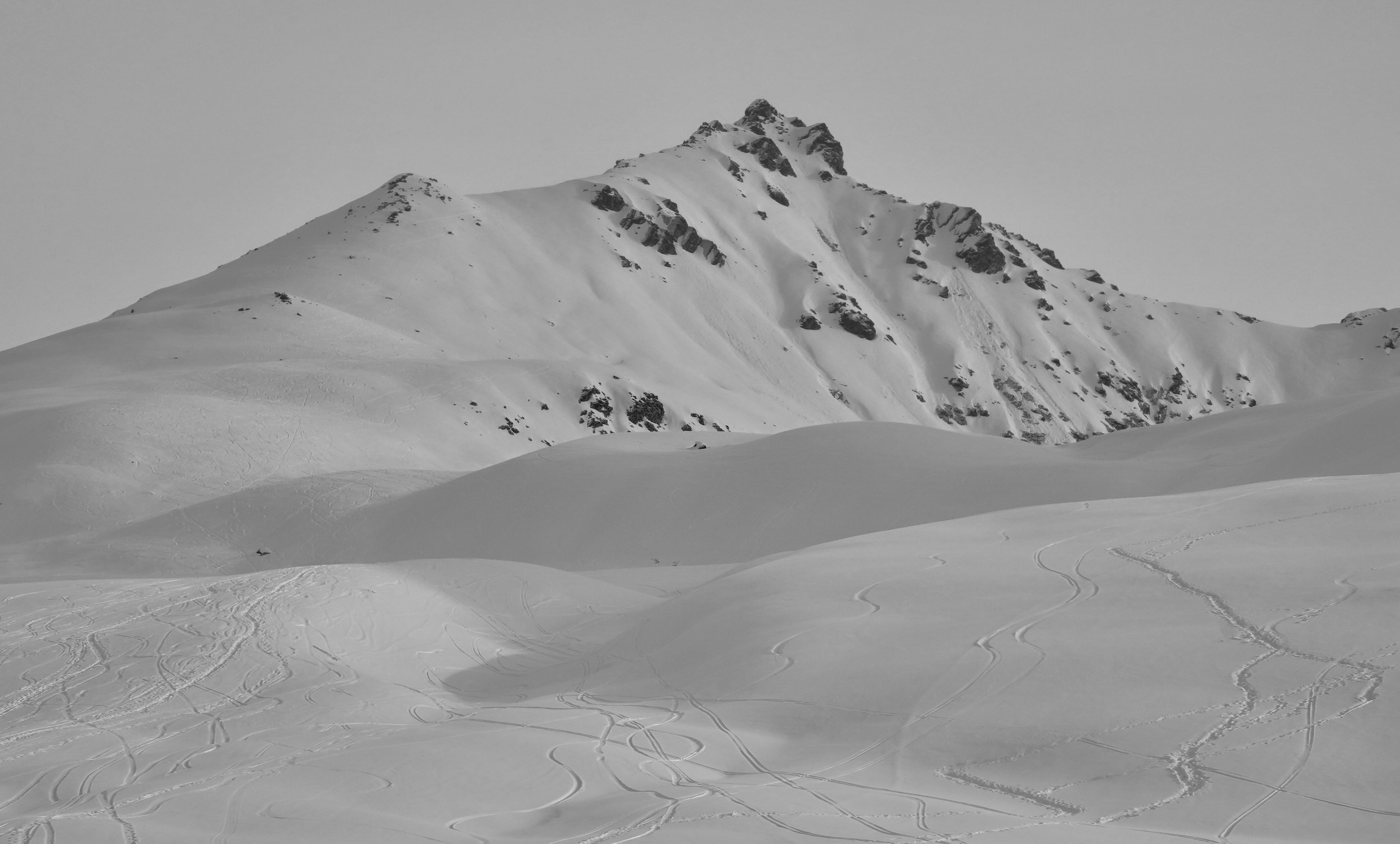
Today we toured from the Fishhook lot up 4068′ and back the ridge up to peak 4600′ then descended 4600′ down to Skeetawk. Our goal was to assess structure and stability on all aspects, look at how buried graupel has changed over the past couple days and observe crust formation on southerly aspects.
Avalanche Details
We observed a recent wet-loose on Microdot, likely from Thursday.
Obvious signs of instability
| Recent Avalanches? | Yes |
| Collapsing (Whumphing)? | No |
| Cracking (Shooting cracks)? | Yes |
Observer Comments
We saw one new wet loose on Microdot.
While traveling across the ridge from 4068' to 4600' we stepped on a previously wind loaded slope with a slab that has become more cohesive over the past few days with warm temps and sunshine. Cracks were approximately 5-10 feet long. The small slab we got to fracture and propagate was 6-12" deep, failing on graupel on a smooth crust. See video.
Weather
A beautiful day in Hatcher! There is 1-2 inches of new snow from last night, depth seemed pretty variable but generally deeper at higher elevation. Generally calm, there was a light breeze on the ridge. Temps were moderate peaking at 23 degrees at 4PM at 4500' and 24º at 1pm at 3500'. The sun was partially obscured by some light cloud cover and even with the clouds you can feel that the sun has it's spring power. Visibility was good throughout our whole tour.
Snow surface
The extra couple inches of snow last night improved the already good ski quality. There was not enough new snow to drastically improve places that were scoured to the old crust during the storm last Friday but anywhere that any amount of snow from the Friday storm stuck is skiing great. It is worth noting that on our exit we observed the surface snow was moist (could easily make a snowball) at 2800' on southerly slopes. Given the strength of sun this time of year I would suspect southerly slopes will soon be crusty. Storm snow from 3/23-24 is more cohesive on southerly aspects.
Snowpack
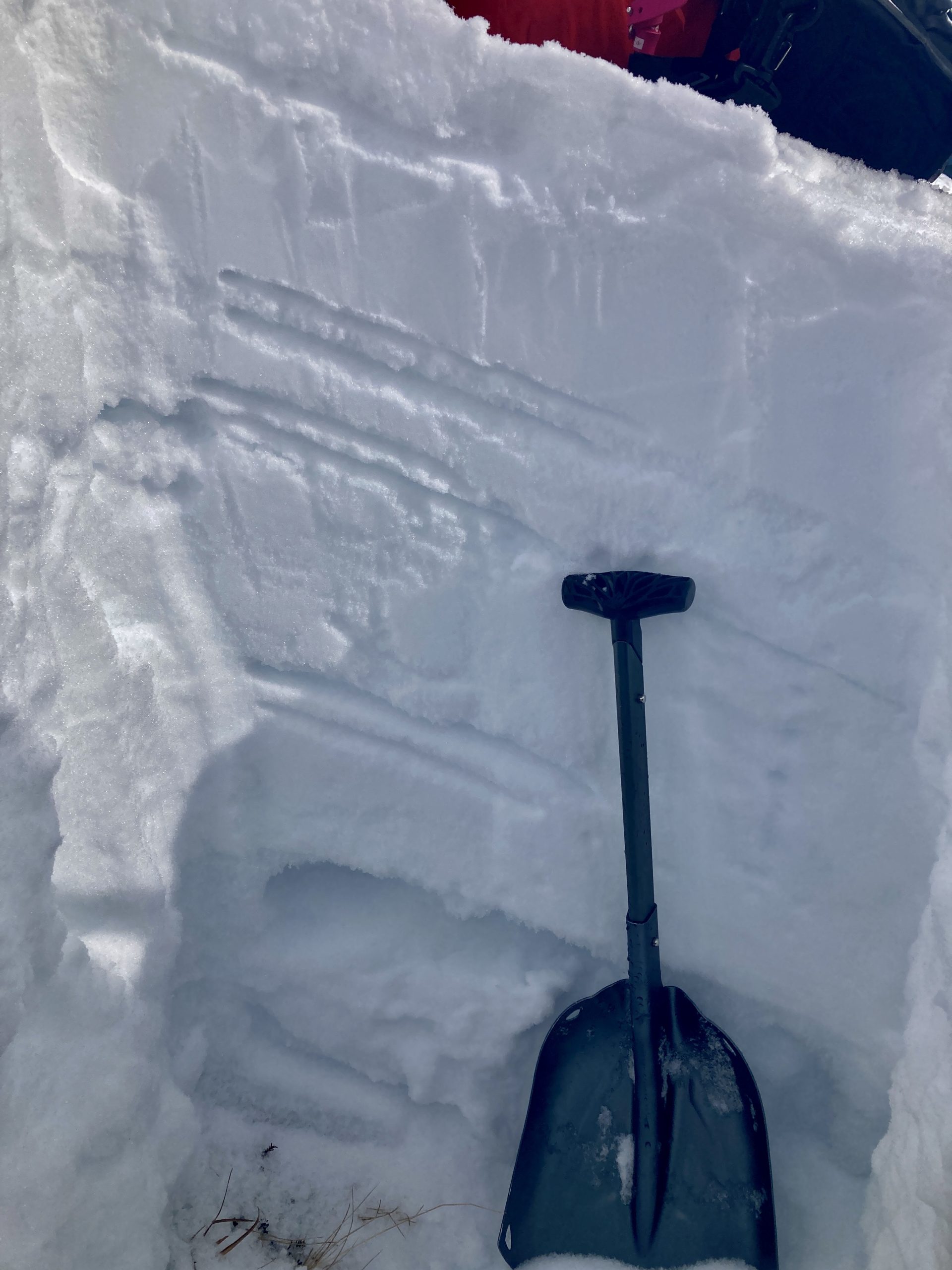
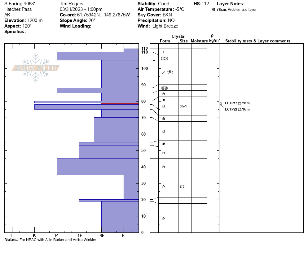
The structure in our pit on a SE slope at 4050' was poor. There is an almost comical amount of crusts in the snowpack (see photos) with some faceting between some of the crusts. We had two ECT failures (ECTP 17 and 22) 33 cm down between two close-together crusts, the bed surface being an icy drizzle crust. This weak layer will be one to watch when things get warmer and sunnier.
A second issue to pay attention to is the graupel layer from the Friday storm, today we were able to kick off small slabs on test slopes on this layer. The graupel layer has not been very reactive but you could trigger something in isolated locations.
See pit
3.31 Bottom of the pack- old depth hoar, facets, and rounding
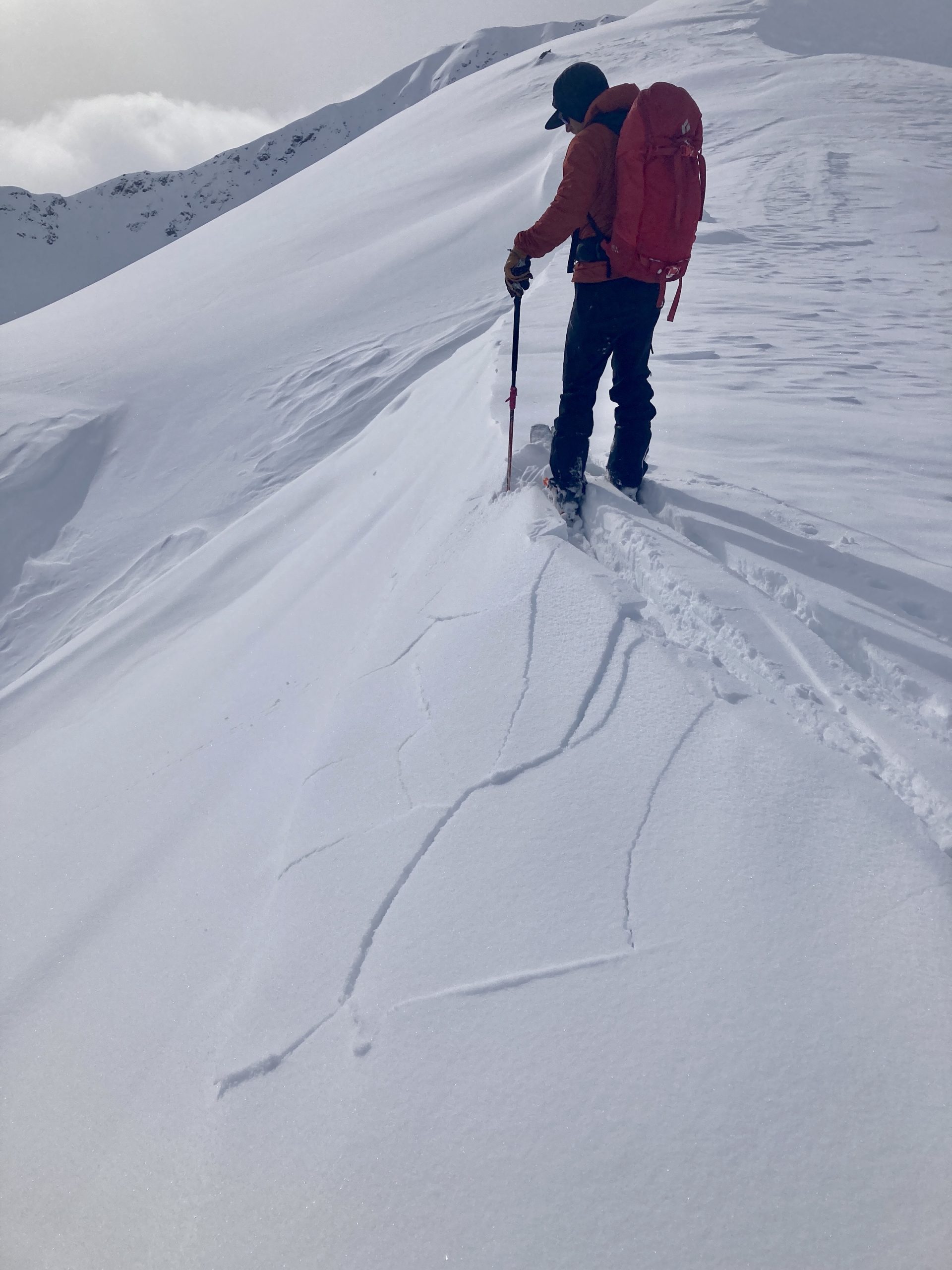
3.31 Cracking and Slab fracture and propagation , see video
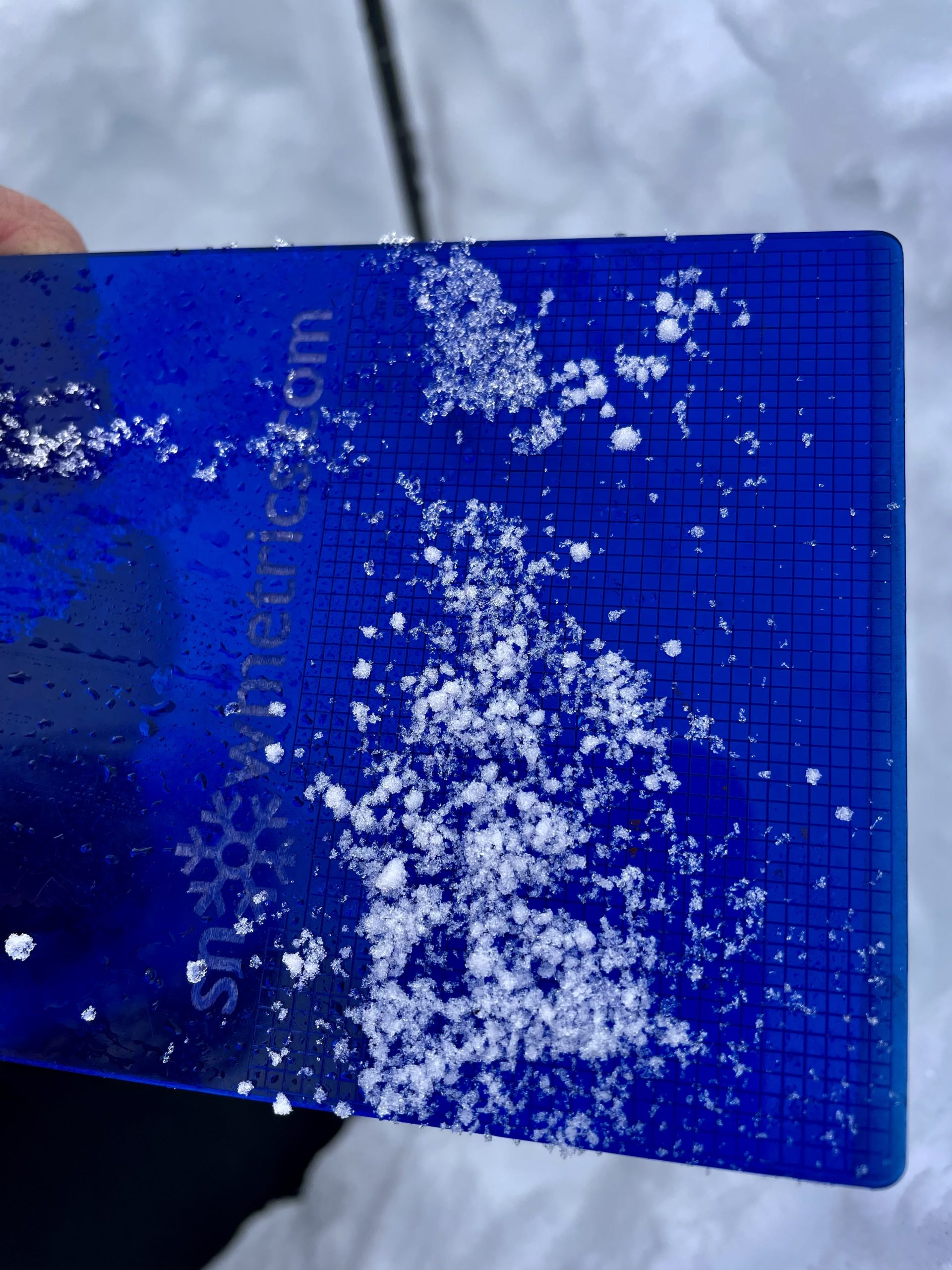
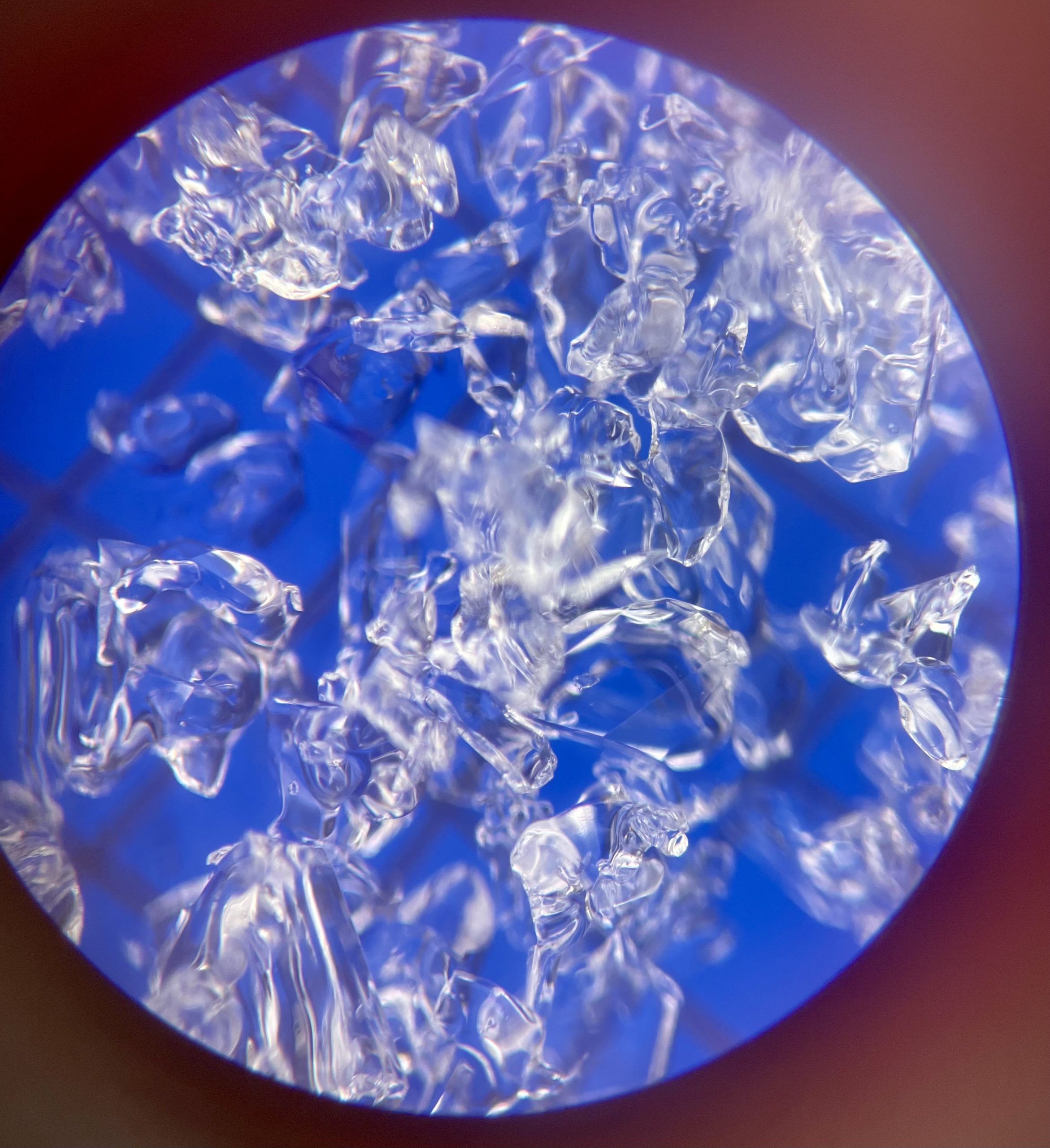
3.31 Graupel

3.31 Graupel
3.31pitsidewall
3.31 Suncrust
3.30 Natural wet -loose Microdot S aspect 4500'
S Facing 4068'-31-Mar
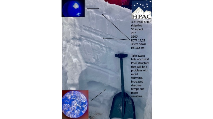
A ridiculous number of crusts exist in this pit!