Turnagain Pass Avalanche Forecast RSS

Archives
ARCHIVED FORECAST - All forecasts expire after 24 hours from the posting date/time.
Issued
Sun, February 18th, 2018 - 7:00AM
Expires
Mon, February 19th, 2018 - 7:00AM
Forecaster
Wendy Wagner
Avalanche risk The Bottom Line

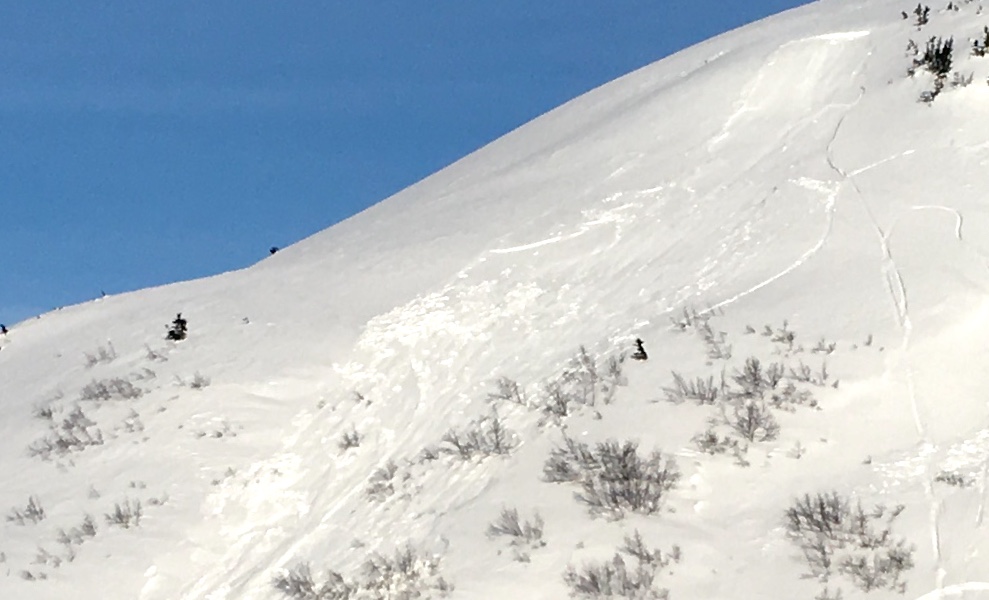
The avalanche danger is  MODERATE  above 1,000′ on all aspects. Human triggered slab avalanches 1-2′ thick or more remain possible. These could be either shallow old wind slabs or larger slabs that break in old weak layers deeper in the snowpack.  

The Summit Lake area has seen more avalanche activity over the past week. Take a look at the Summit Summary  HERE.  

Special Announcements

Hatcher Pass users – dangerous avalanche conditions exist in this area and several very close calls have occurred over the past few days. Please see the Hatcher Pass Avalanche Center forecast  before heading that way.

Thank you to all the folks that joined CNFAIC yesterday for our ‘beacon practice and avalanche rescue workshop’ at Turnagain Pass! Plus, big thanks to AMDS for hosting and providing a post-workshop BBQ!


Thanks to our sponsors!
Sun, February 18th, 2018
Alpine
Above 2,500'
Moderate (2)
Avalanche risk
Treeline
1,000'-2,500'
Moderate (2)
Avalanche risk
Below Treeline
Below 1,000'
Low (1)
Avalanche risk
Alpine
Above 2,500'
Avalanche risk
Moderate (2)
Treeline
1,000'-2,500'
Avalanche risk
Moderate (2)
Below Treeline
Below 1,000'
Avalanche risk
Low (1)
Danger Scale:
No Rating (0)
Low (1)
Moderate (2)
Considerable (3)
High (4)
Extreme (5)
Avalanche Problem 1
  • Persistent Slabs
    Persistent Slabs
  • Almost Certain
    Very Likely
    Likely
    Possible
    Unlikely
    Likelihood
  • Historic (D4-5)
    Very Large (D3)
    Large (D2)
    Small (D1)
    Size
Persistent Slabs
Persistent Slab avalanches are the release of a cohesive layer of snow (a slab) in the middle to upper snowpack, when the bond to an underlying persistent weak layer breaks. Persistent layers include: surface hoar, depth hoar, near-surface facets, or faceted snow. Persistent weak layers can continue to produce avalanches for days, weeks or even months, making them especially dangerous and tricky. As additional snow and wind events build a thicker slab on top of the persistent weak layer, this avalanche problem may develop into a Deep Persistent Slab.

Likelihood of Avalanches
Terms such as "unlikely", "likely", and "certain" are used to define the scale, with the chance of triggering or observing avalanches increasing as we move up the scale. For our purposes, "Unlikely" means that few avalanches could be triggered in avalanche terrain and natural avalanches are not expected. "Certain" means that humans will be able to trigger avalanches on many slopes, and natural avalanches are expected.

Size of Avalanches
Avalanche size is defined by the largest potential avalanche, or expected range of sizes related to the problem in question. Assigned size is a qualitative estimate based on the destructive classification system and requires specialists to estimate the harm avalanches may cause to hypothetical objects located in the avalanche track (AAA 2016, CAA 2014). Under this schema, "Small" avalanches are not large enough to bury humans and are relatively harmless unless they carry people over cliffs or through trees or rocks. Moving up the scale, avalanches become "Large" enough to bury, injure, or kill people. "Very Large" avalanches may bury or destroy vehicles or houses, and "Historic" avalanches are massive events capable of altering the landscape.

Signal Word Size (D scale) Simple Descriptor
Small 1 Unlikely to bury a person
Large 2 Can bury a person
Very Large 3 Can destroy a house
Historic 4 & 5 Can destroy part or all of a village
More info at Avalanche.org

Triggering a slab avalanche up to 2′ or more remains our main concern for folks getting out into the backcountry on this nice holiday weekend. These slabs are becoming difficult to trigger as time passes, but the possibility for a large and unmanageable slide remains. The most likely place to find these are slopes that have not seen significant traffic this season. Several layers of buried surface hoar and weak faceted snow exist in the snowpack. Between 1 and 2′ below the surface is the Jan 21 layer of buried surface hoar with weak facets directly below. This layer continues to show signs of reactivity. Yesterday a group in the Seattle Creek drainage (Main Bowl/1st Bowl area) reported widespread collapsing and cracking, presumably in the Jan 21st weak layer, at the mid-elevations.

Another thing to keep in mind is days are getting longer, allowing the sun to warm up Southerly slopes. Adding to this, a warm air mass moved in last night. These warmer temperatures can add to the instability of slabs that sit near the breaking point. The main point it, don’t let the mountains lure you into thinking the snowpack is stable.

Avalanche Problem 2
  • Wind Slabs
    Wind Slabs
  • Almost Certain
    Very Likely
    Likely
    Possible
    Unlikely
    Likelihood
  • Historic (D4-5)
    Very Large (D3)
    Large (D2)
    Small (D1)
    Size
Wind Slabs
Wind Slab avalanches are the release of a cohesive layer of snow (a slab) formed by the wind. Wind typically transports snow from the upwind sides of terrain features and deposits snow on the downwind side. Wind slabs are often smooth and rounded and sometimes sound hollow, and can range from soft to hard. Wind slabs that form over a persistent weak layer (surface hoar, depth hoar, or near-surface facets) may be termed Persistent Slabs or may develop into Persistent Slabs.

Likelihood of Avalanches
Terms such as "unlikely", "likely", and "certain" are used to define the scale, with the chance of triggering or observing avalanches increasing as we move up the scale. For our purposes, "Unlikely" means that few avalanches could be triggered in avalanche terrain and natural avalanches are not expected. "Certain" means that humans will be able to trigger avalanches on many slopes, and natural avalanches are expected.

Size of Avalanches
Avalanche size is defined by the largest potential avalanche, or expected range of sizes related to the problem in question. Assigned size is a qualitative estimate based on the destructive classification system and requires specialists to estimate the harm avalanches may cause to hypothetical objects located in the avalanche track (AAA 2016, CAA 2014). Under this schema, "Small" avalanches are not large enough to bury humans and are relatively harmless unless they carry people over cliffs or through trees or rocks. Moving up the scale, avalanches become "Large" enough to bury, injure, or kill people. "Very Large" avalanches may bury or destroy vehicles or houses, and "Historic" avalanches are massive events capable of altering the landscape.

Signal Word Size (D scale) Simple Descriptor
Small 1 Unlikely to bury a person
Large 2 Can bury a person
Very Large 3 Can destroy a house
Historic 4 & 5 Can destroy part or all of a village
More info at Avalanche.org

Lingering old wind slabs are scattered around the mountains. Although on the stubborn side, some of these slabs could still be triggered by a person. They are likely to be relatively hard and could break above you. The recent warm temperatures may also help to reactivate them. Watch for stiff snow over softer snow, pillowed surfaces and cracks in the snow that shoot out from you.

Wind slab avalanche, likely snowmachine triggered, from several days ago in 2nd Bowl in the Seattle Creek drainage.


Additional Concern
  • Deep Persistent Slabs
    Deep Persistent Slabs
Deep Persistent Slabs
Deep Persistent Slab avalanches are the release of a thick cohesive layer of hard snow (a slab), when the bond breaks between the slab and an underlying persistent weak layer deep in the snowpack. The most common persistent weak layers involved in deep, persistent slabs are depth hoar or facets surrounding a deeply buried crust. Deep Persistent Slabs are typically hard to trigger, are very destructive and dangerous due to the large mass of snow involved, and can persist for months once developed. They are often triggered from areas where the snow is shallow and weak, and are particularly difficult to forecast for and manage.
More info at Avalanche.org

Above 3,000′ in the Alpine, several old weak layers of facets and buried surface hoar sit near the ground and in the mid-pack. This structure is most pronounced in places with a thin overall snow cover, such as the South end of Turnagain Pass and the Summit Lake area.  As you plan your day, keep in mind that there are deeper persistent layers that could ‘wake up’ if you find a trigger spot in a shallow area. 

Weather
Sun, February 18th, 2018

Mostly sunny skies with thin high clouds were over the region yesterday. Ridgetop winds were light and variable. Temperatures climbed at the upper elevations in the afternoon due to solar radiation along with a very warm air mass streaming in. Sunburst weather station at 3,812′ reported 35F at 5pm and remains above 30F this morning.  

For today, partly cloudy skies are expected along with a chance for a few flurries this afternoon (trace accumulation possible). Ridgetop winds should increase slightly to ~5-10mph from the South and East. An inversion is in place this morning and temperatures in valley bottoms are between 5-15F, which are expected to increase to the low 30’sF through the day. Temperatures will remain warm at the mid to upper elevations.

For tomorrow, President’s Day, a return to sunny skies and light winds are forecast. The middle of the week may see an increase in NW winds, yet the mostly clear skies should remain.  

PRECIPITATION 24-hour data (6am – 6am)

  Temp Avg (F) Snow (in) Water (in) Snow Depth (in)
Center Ridge (1880′) 32   0   0   64  
Summit Lake (1400′) 13   0   0   24  
Alyeska Mid (1700′) 23   0   0   57  

RIDGETOP 24-hour data (6am – 6am)

  Temp Avg (F) Wind Dir Wind Avg (mph) Wind Gust (mph)
Sunburst (3812′) 29   SW   5   19  
Seattle Ridge (2400′) 29   E   6   16  
Observations
Recent Observations for Turnagain Pass
Date Region Location
05/22/23 Turnagain Avalanche: Tincan
05/12/23 Turnagain Avalanche: Tincan, Sunburst, Magnum, Cornbiscuit
05/07/23 Turnagain Observation: Tincan – Bear Tracks
05/05/23 Turnagain Observation: Seattle Ridge
05/02/23 Turnagain Observation: Cornbiscuit
05/02/23 Turnagain Observation: Seward Hwy Turnagain Pass
04/30/23 Turnagain Observation: Magnum
04/29/23 Turnagain Observation: Tincan
04/28/23 Turnagain Avalanche: Taylor Pass/Pastoral
04/28/23 Turnagain Avalanche: Tincan
Riding Areas
Updated Sat, September 23rd, 2023

Status of riding areas across the Chugach NF is managed by the Glacier and Seward Ranger Districts, not avalanche center staff. Riding area information is posted as a public service to our users and updated based on snow depth and snow density to prevent resource damage at trailhead locations. Riding area questions contact: mailroom_r10_chugach@fs.fed.us

Area Status Weather & Riding Conditions
Glacier District
Johnson Pass
Closed
Scheduled opening per Chugach National Forest plan December 1. Subject to adequate snow cover.
Placer River
Closed
Scheduled opening per Chugach National Forest plan December 1. Subject to adequate snow cover.
Skookum Drainage
Closed
Scheduled opening per Chugach National Forest plan December 1. Subject to adequate snow cover.
Turnagain Pass
Closed
Scheduled opening on the Wednesday before Thanksgiving per Chugach National Forest plan. Subject to adequate snow cover.
Twentymile
Closed
Scheduled opening per Chugach National Forest plan December 1. Subject to adequate snow cover.
Seward District
Carter Lake
Closed
Scheduled opening per Chugach National Forest plan December 1. Subject to adequate snow cover.
Lost Lake Trail
Closed
Scheduled opening per Chugach National Forest plan December 1. Subject to adequate snow cover.
Primrose Trail
Closed
Scheduled opening per Chugach National Forest plan December 1. Subject to adequate snow cover.
Resurrection Pass Trail
Closed
Scheduled opening per Chugach National Forest plan December 1. Subject to adequate snow cover.
Snug Harbor
Closed
Scheduled opening per Chugach National Forest plan December 1. Subject to adequate snow cover.
South Fork Snow River Corridor
Closed
Scheduled opening per Chugach National Forest plan December 1. Subject to adequate snow cover.
Summit Lake
Closed
Scheduled opening per Chugach National Forest plan December 1. Subject to adequate snow cover.

Subscribe to Turnagain Pass
Avalanche Forecast by Email

This is a general backcountry avalanche advisory issued for Turnagain Arm with Turnagain Pass as the core advisory area. This advisory does not apply to highways, railroads or operating ski areas.