Turnagain Pass RSS

Archives
ARCHIVED - Forecasts expire after 24 hours.
Issued
Fri, February 17th, 2017 - 7:00AM
Expires
Sat, February 18th, 2017 - 7:00AM
Forecaster
Wendy Wagner
Avalanche risk The Bottom Line

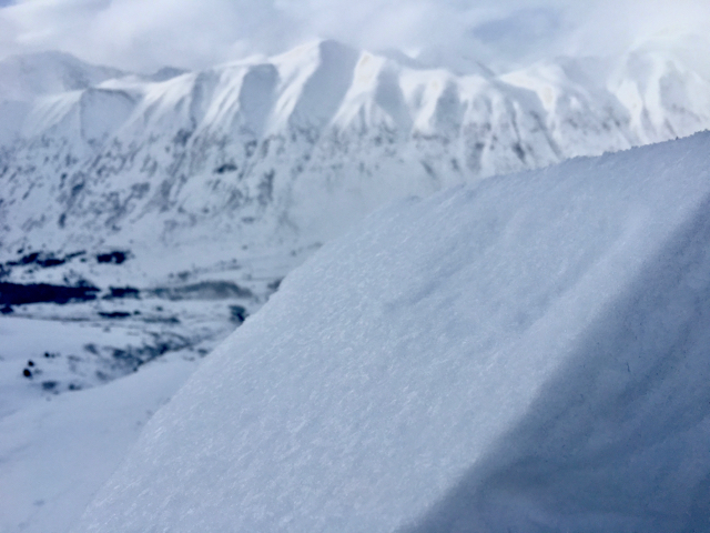
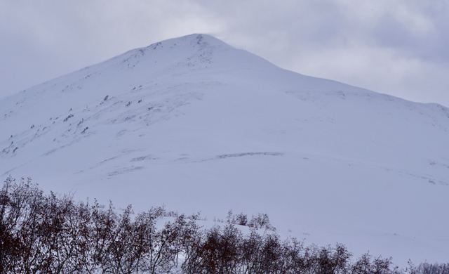
The avalanche danger is CONSIDERABLE on all slopes steeper than 35 degrees above 1,000′ in elevation. Slab avalanches anywhere between 1′ and 3+’ thick are likely to be triggered in the steeper terrain. These could be shallow fresh wind slabs or thicker, and more dangerous, slabs that break in buried weak layers. These larger slabs have the potential to be triggered remotely from the ridge, the side or from below. Cornice falls are also possible today and could trigger a large slab below.

The danger is MODERATE  danger below 1,000′ where an avalanche triggered above could wash debris into this lower zone.

*Today is a day to keep our terrain choices conservative and stick to mellow slopes away from runout zones from avalanche paths.

Special Announcements

Recent heavy precipitation, strong winds and warm temperatures have created dangerous conditions in the Southern Kenai; this  includes the  Seward zone (Lost Lake/Carter/etc).    Travel is not recommended in avalanche terrain.  Other regions throughout Southcentral, AK including Chugach State Park and Hatcher Pass have heightened avalanche conditions.

If you haven’t seen it yet, click  HERE  for a near miss report following a large avalanche triggered by a snowmachiner in Lynx Creek in early February. Luckily no one was caught in this avalanche. We want to extend a big thank you to all those involved and willing to share their story. These types of avalanche conditions continue to plague the region.

Fri, February 17th, 2017
Alpine
Above 2,500'
3 - Considerable
Avalanche risk
Treeline
1,000'-2,500'
3 - Considerable
Avalanche risk
Below Treeline
Below 1,000'
2 - Moderate
Avalanche risk
0 - No Rating
1 - Low
2 - Moderate
3 - Considerable
4 - High
5 - Extreme
Avalanche risk Avalanche risk Avalanche risk Avalanche risk Avalanche risk
Travel Advice Generally safe avalanche conditions. Watch for unstable snow on isolated terrain features. Heightened avalanche conditions on specific terrain features. Evaluate snow and terrain carefully; identify features of concern. Dangerous avalanche conditions. Careful snowpack evaluation, cautious route-finding, and conservative decision-making essential. Very dangerous avalanche conditions. Travel in avalanche terrain not recommended. Extraordinarily dangerous avalanche conditions. Avoid all avalanche terrain.
Likelihood of Avalanches Natural and human-triggered avalanches unlikely. Natural avalanches unlikely; human-triggered avalanches possible. Natural avalanches possible; human-triggered avalanches likely. Natural avalanches likely; human-triggered avalanches very likely. Natural and human-triggered avalanches certain.
Avalanche Size and Distribution Small avalanches in isolated areas or extreme terrain. Small avalanches in specific areas; or large avalanches in isolated areas. Small avalanches in many areas; or large avalanches in specific areas; or very large avalanches in isolated areas. Large avalanches in many areas; or very large avalanches in specific areas. Very large avalanches in many areas.
Avalanche Problem 1
  • Persistent Slabs
    Persistent Slabs
Persistent Slabs
Persistent Slab avalanches are the release of a cohesive layer of snow (a slab) in the middle to upper snowpack, when the bond to an underlying persistent weak layer breaks. Persistent layers include: surface hoar, depth hoar, near-surface facets, or faceted snow. Persistent weak layers can continue to produce avalanches for days, weeks or even months, making them especially dangerous and tricky. As additional snow and wind events build a thicker slab on top of the persistent weak layer, this avalanche problem may develop into a Deep Persistent Slab.
More info at Avalanche.org

Yesterday was the first day since the beginning of the Valentine’s Storm Cycle (beginning Monday, Feb 13th) that no natural avalanches were seen. The storm cycle is fading, but we did get another shot of snow last night, adding another 2-6″ to mountains. This last storm cycle has brought a total of 2-3′ of dense new snow to the area and simply put, the new snow is not bonding well with the old snow (seen in video). This is due to a weak layer of buried surface hoar along with near surface facets that is sandwiched between the new snow and old harder snow//crusts. Until proven otherwise, this weak interface is suspect to be on all aspects and elevations. 

Things to keep in mind with this ‘persistent slab’ avalanche problem:

  1. Human triggered slab avalanches (2-3′ deep) breaking in this layer are likely in terrain over 35 degrees
  2. Slabs can be triggered remotely, from the ridge, the side or below
  3. In terrain that saw high traffic last weekend, this layer will be more stubborn to trigger, but don’t let that lure you into thinking the pack has stabilized
  4. No obvious signs on instability, or red flags, may be present before a slab is triggered
  5. This is the kind of avalanche that could have several tracks on the slope before someone finds the right trigger point (thin ares of the slab). 

What can we do? Terrain management! Sticking to lower angle slopes (under 35 degress with nothing steeper above you) is recommended.

 
Photo below: A look at the bottom of the slab and the weak layer (buried surface hoar) shining in the sun.

Avalanche Problem 2
  • Wind Slabs
    Wind Slabs
Wind Slabs
Wind Slab avalanches are the release of a cohesive layer of snow (a slab) formed by the wind. Wind typically transports snow from the upwind sides of terrain features and deposits snow on the downwind side. Wind slabs are often smooth and rounded and sometimes sound hollow, and can range from soft to hard. Wind slabs that form over a persistent weak layer (surface hoar, depth hoar, or near-surface facets) may be termed Persistent Slabs or may develop into Persistent Slabs.
More info at Avalanche.org

WIND SLABS:
Strong winds have been impacting the mountains for 6 days now. Although we should see a decrease in ridgeop wind today, the Easterly flow should still be strong enough to load leeward slopes. Wind slabs from the past few days have been around 6″ to a foot thick and showing signs of bonding fairly well. However, the problem is this has made for a more solid slab out of the Valentine’s Storm snow that sits over the aforementioned buried surface hoar and facets. Nonetheless, fresh winds slabs should still be something to look for and if triggered, could step-down to the weak layer below. Watch for current wind loading and stiffer, hollow feeling snow over softer snow. 

CORNICES:
Cornices have grown substantially during the past week and could release naturally with the ongoing wind/snow. If you find yourself along a ridgeline, give them a wide berth as these could be quite touchy and have a good chance of triggering a slab below. Also, keep in mind if there are other groups underneath you in valley bottoms.

 Wind plume on the NW ridge of Magnum on Turnagain Pass. This was the theme of yesterday’s weather.


SUN?
If the sun comes out today, watch for quick changes in the snow surface and an increased change for triggering a slab. Moist to wet loose snow avalanches on Southerly aspects should be expected with the first shot of sunshine.

Additional Concern
  • Deep Persistent Slabs
    Deep Persistent Slabs
Deep Persistent Slabs
Deep Persistent Slab avalanches are the release of a thick cohesive layer of hard snow (a slab), when the bond breaks between the slab and an underlying persistent weak layer deep in the snowpack. The most common persistent weak layers involved in deep, persistent slabs are depth hoar or facets surrounding a deeply buried crust. Deep Persistent Slabs are typically hard to trigger, are very destructive and dangerous due to the large mass of snow involved, and can persist for months once developed. They are often triggered from areas where the snow is shallow and weak, and are particularly difficult to forecast for and manage.
More info at Avalanche.org

Weak snow (facets and depth hoar) in the lower layers of the snowpack continues to be a concern in our advisory area. Avalanches occurring in the upper layers of the pack have the potential to step down and release the entire snowpack in some places. If this does happen the volume will be large and could run long distances.  A few of the naturals throughout this last storm looked to have run into older faceted snow. The possibility of these large avalanches is another reason for conservative terrain choices. 

Several natural slab avalanches on a SE aspect of Fishes Breath in Girdwood Valley, including one that stepped down into an older layer of the snowpack. Photo courtesy of Mike Welch

Weather
Fri, February 17th, 2017

Mostly cloudy skies were over the area yesterday with light snow flurries in Girdwood and the North side of Turnagain Pass. During the overnight hours another pulse of moisture moved through adding 4-6″ of new snow in the Girdwood Valley, 2-3″ in Turnagain Pass and ~7″ at Summit Lake. Ridgetop winds continue to be strong during the past 24-hours from an Easterly direction with averages from 25-40mph and gusts to 57mph. Temperatures have been warm, low to mid 30’sF at sea level with a rain/snow mix, at 1,000′ in the upper 20’sF and around 20F along the ridgetops.  

For today, continued off-and-on instability showers are expected with similar warm temperatures and a rain/snow mix at sea level. Total snowfall expected is 2-4″ (.25 water) today and another 2-5″ (.3 water) tonight. There could also be some clearing skies in between these snow showers. Ridgetop winds should decrease slightly from the East and Southeast with averages in the 15-25mph range (still moderate to strong).

Looking ahead to the weekend, clearing skies and cooler temperatures with a few snow flurries are on tap. Stay tuned.  

PRECIPITATION 24-hour data (6am – 6am)

  Temp Avg (F) Snow (in) Water (in) Snow Depth (in)
Center Ridge (1880′) 30   2 0.2   75  
Summit Lake (1400′) 30 7   0.5   35  
Alyeska Mid (1700′) 29   4.6   0.37   70  

RIDGETOP 24-hour data (6am – 6am)

  Temp Avg (F) Wind Dir Wind Avg (mph) Wind Gust (mph)
Sunburst (3812′) 18   ENE   29   57  
Seattle Ridge (2400′) 23   Rimed   Rimed   Rimed  
Observations
Recent Observations for Turnagain Pass
Date Region Location
04/23/24 Turnagain Observation: Turnagain Sunny Side
04/21/24 Turnagain Observation: Bertha Creek
04/20/24 Turnagain Avalanche: Spokane Creek
04/16/24 Turnagain Observation: Cornbiscuit
04/15/24 Turnagain Observation: Taylor Pass
04/15/24 Turnagain Observation: Seward Highway – Tern Lake to Portage
04/14/24 Turnagain Observation: Sunburst
04/14/24 Turnagain Observation: Turnagain Pass Snomo
04/13/24 Turnagain Observation: Spokane Creek
04/11/24 Turnagain Observation: Tincan
Riding Areas

The riding areas page has moved. Please click here & update your bookmarks.


Subscribe to Turnagain Pass
Avalanche Forecast by Email

This is a general backcountry avalanche advisory issued for Turnagain Arm with Turnagain Pass as the core advisory area. This advisory does not apply to highways, railroads or operating ski areas.