Turnagain Pass RSS

Archives
ARCHIVED - Forecasts expire after 24 hours.
Issued
Tue, March 22nd, 2016 - 7:00AM
Expires
Wed, March 23rd, 2016 - 7:00AM
Forecaster
Graham Predeger
Avalanche risk The Bottom Line

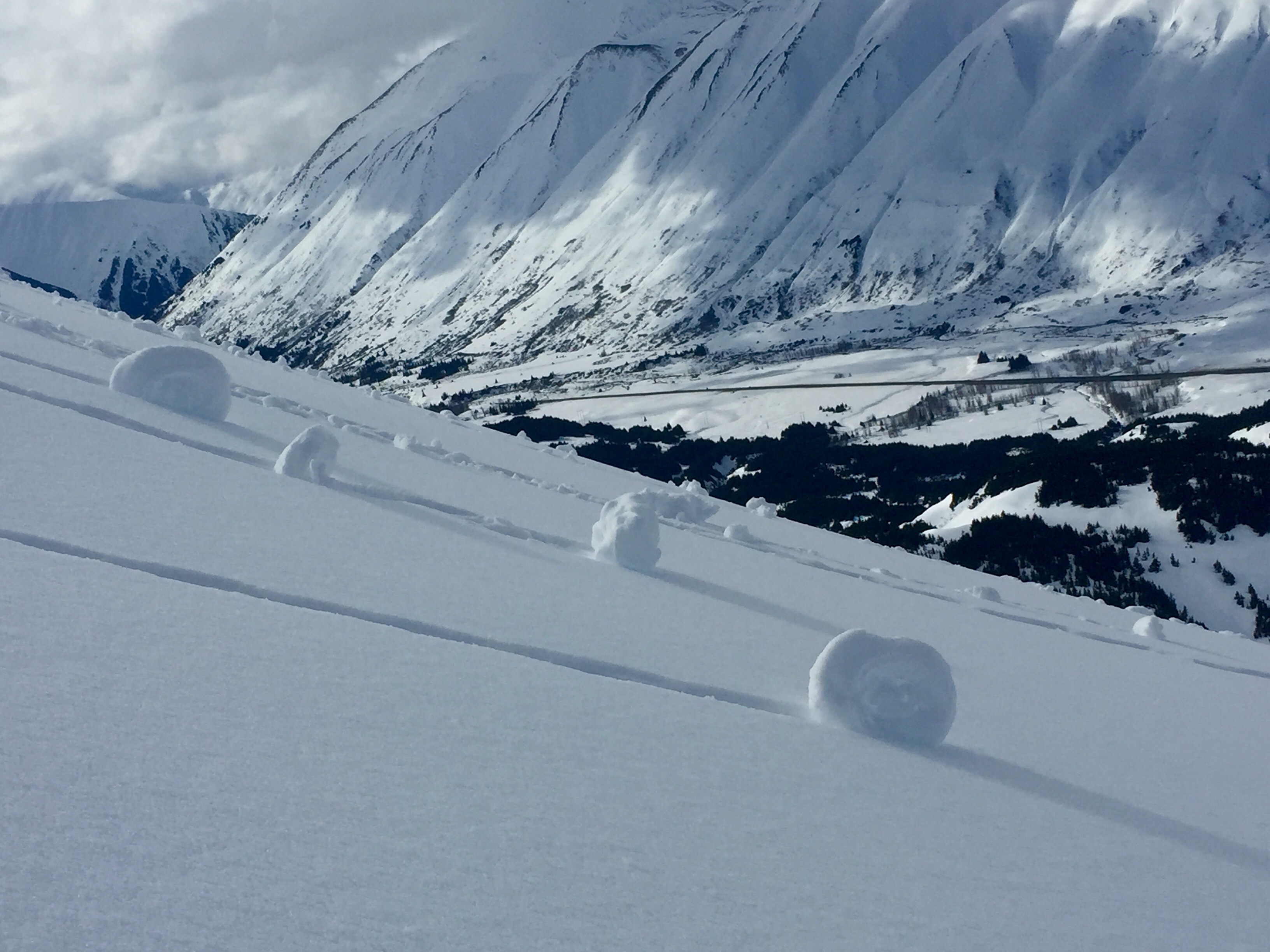
The avalanche danger is MODERATE above 1,000′ today.   Wet loose avalanches in steep terrain (greater than 35 degrees) will be possible to trigger and are producing enough mass to be problematic as the moist surface extends up to ridgetops in many locations around Turnagain Pass.   Cautious terrain evaluation is essential today in order to avoid being pushed into a terrain trap by wet, heavy moving snow.

Winds are unlikely to effect yesterday’s moist surface but any new snow and wind today will build in to shallow, but tender wind slabs in the alpine.   Cracks and cornices continue to warrant mention as well.   At least three new glide avalanches were observed yesterday, post-storm.

Special Announcements

Remember The Friends of the CNFAIC is part of  PICK.CLICK.GIVE. Your donations are greatly appreciated and integral to making the CNFAIC possible and sustainable.    Be part of the ‘Movement’! Thank you for your support!

Making plans for Arctic Man 2016? Don’t forget your beacon, shovel and probe! CNFAIC will be there all week and offering two FREE companion rescue workshops. Click  HERE  for more info. We hope to see you there!

Tue, March 22nd, 2016
Alpine
Above 2,500'
2 - Moderate
Avalanche risk
Treeline
1,000'-2,500'
2 - Moderate
Avalanche risk
Below Treeline
Below 1,000'
0 - No Rating
Avalanche risk
0 - No Rating
1 - Low
2 - Moderate
3 - Considerable
4 - High
5 - Extreme
Avalanche risk Avalanche risk Avalanche risk Avalanche risk Avalanche risk
Travel Advice Generally safe avalanche conditions. Watch for unstable snow on isolated terrain features. Heightened avalanche conditions on specific terrain features. Evaluate snow and terrain carefully; identify features of concern. Dangerous avalanche conditions. Careful snowpack evaluation, cautious route-finding, and conservative decision-making essential. Very dangerous avalanche conditions. Travel in avalanche terrain not recommended. Extraordinarily dangerous avalanche conditions. Avoid all avalanche terrain.
Likelihood of Avalanches Natural and human-triggered avalanches unlikely. Natural avalanches unlikely; human-triggered avalanches possible. Natural avalanches possible; human-triggered avalanches likely. Natural avalanches likely; human-triggered avalanches very likely. Natural and human-triggered avalanches certain.
Avalanche Size and Distribution Small avalanches in isolated areas or extreme terrain. Small avalanches in specific areas; or large avalanches in isolated areas. Small avalanches in many areas; or large avalanches in specific areas; or very large avalanches in isolated areas. Large avalanches in many areas; or very large avalanches in specific areas. Very large avalanches in many areas.
Avalanche Problem 1
  • Wet Loose
    Wet Loose
Wet Loose
Wet Loose avalanches are the release of wet unconsolidated snow or slush. These avalanches typically occur within layers of wet snow near the surface of the snowpack, but they may quickly gouge into lower snowpack layers. Like Loose Dry Avalanches, they start at a point and entrain snow as they move downhill, forming a fan-shaped avalanche. Other names for loose-wet avalanches include point-release avalanches or sluffs. Loose Wet avalanches can trigger slab avalanches that break into deeper snow layers.
More info at Avalanche.org

Observations from the field yesterday found a moist surface up to at least 3200’ in the wake of the Sunday/ Monday warm up.  Unfortunately this wasn’t only relegated to solar aspects but shadier north aspects were harboring a moist surface as well.  The weekend storm snow is settling out rather rapidly, compressing the several inches of cooler, low-density snow (from Saturday morning) into a thin weak layer 6-16” below the surface.  In steep terrain, wet-loose snow yesterday was easy to initiate, building enough mass and momentum that it could pose a problem for a skier in consequential terrain.  These are relatively small but heavy and powerful avalanches that are difficult to escape from.  Keep this in mind as you are travelling above any terrain traps such as gullies, trees, cliffs or glide cracks.  Snowmachiners: The surface is such right now that you can entrain a significant amount of heavy wet snow as you descend.  It’ll be prudent to ‘manage’ this heavy sluff and avoid terrain traps. 

Last night was the second night in a row where temperatures did not freeze overnight below about 2,000’ making for a punchy, rotten snowpack.  If temperatures do spike again today in the afternoon or we receive significant rain on snow, it’s entirely possible that wet loose avalanches could pull out dangerous wet slabs in this mid-elevation band.

Wet loose avalanches skiers-right of Todd’s run.  Eddies glide crack-complex in the background.


Roller balls are another good clue to a warming surface, primed for wet-loose avalanches.  

Avalanche Problem 2
  • Glide Avalanches
    Glide Avalanches
Glide Avalanches
Glide Avalanches are the release of the entire snow cover as a result of gliding over the ground. Glide avalanches can be composed of wet, moist, or almost entirely dry snow. They typically occur in very specific paths, where the slope is steep enough and the ground surface is relatively smooth. They are often proceeded by full depth cracks (glide cracks), though the time between the appearance of a crack and an avalanche can vary between seconds and months. Glide avalanches are unlikely to be triggered by a person, are nearly impossible to forecast, and thus pose a hazard that is extremely difficult to manage.
More info at Avalanche.org

Good visibility allowed us a look around yesterday to add to a growing list of glide avalanches across the region.  The post-storm tally was 3 new glides: Penguin ridge, Skookum Valley and Seattle ridge (N. of uptrack).  As long as glide cracks continue to open up, move and release, we will stress the importance of avoiding them, which is THE ONLY WAY TO MANAGE THIS AVALANCHE PROBLEM.  Remember, this is the entire winters snowpack releasing to the ground suddenly and without warning.  Simple avoidance of glide cracks continues to be the key.

CORNICES:  We did see some active cornice shedding during the heat of the day yesterday.  Take extra precautions when travelling around cornices as they tend to break much further back on ridges than often times expected.

Additional Concern
  • Wind Slabs
    Wind Slabs
Wind Slabs
Wind Slab avalanches are the release of a cohesive layer of snow (a slab) formed by the wind. Wind typically transports snow from the upwind sides of terrain features and deposits snow on the downwind side. Wind slabs are often smooth and rounded and sometimes sound hollow, and can range from soft to hard. Wind slabs that form over a persistent weak layer (surface hoar, depth hoar, or near-surface facets) may be termed Persistent Slabs or may develop into Persistent Slabs.
More info at Avalanche.org

Winds have been cranking enough in the alpine to transport any available snow into shallow wind slabs.  Likely these will be found somewhere above 3500’ today where the snow surface dries out.  2-4” of new snow forecasted and moderate easterly winds in the upper elevations today will add to existing wind slabs in the 1-2’ range.

Weather
Tue, March 22nd, 2016

The most notable aspect to yesterday’s weather was the warmth in the air.   40-degree temps are finally acting to melt out some of the SUV-swallowing potholes in the motorized lot at 1,000′.   Pavement is again visible!   Ridgetop temperatures spiked at 34 degrees in the afternoon on the top of Sunburst (3800′).   Just a trace of precip was measured yesterday morning before skies broke mostly sunny.   Winds were light (gusting into the 20’s) from the East before picking up overnight.

Today we can expect up to another half inch of water throughout the day with a rain/ snow line around 2,000′.   Winds will be from the east in the 20-30 mph range.   Temperatures will again be unseasonably warm in the high 30’s to low 40’s at 1,000′.

The well-developed low tracking North into the Gulf today may not influence us much tomorrow as a persistent upper level ridge looks to limit its advance onto the mainland.

PRECIPITATION 24-hour data (6am – 6am)

  Temp Avg (F) Snow (in) Water (in) Snow Depth (in)
Center Ridge (1880′) 39 0   .2   131  
Summit Lake (1400′)  39 0   .3    45
Alyeska Mid (1700′)  37  0  n/a 109  

RIDGETOP 24-hour data (6am – 6am)

  Temp Avg (F) Wind Dir Wind Avg (mph) Wind Gust (mph)
Sunburst (3812′)  30  ENE 17    49
Seattle Ridge (2400′)  33  SE 18   39  
Observations
Recent Observations for Turnagain Pass
Date Region Location
03/28/24 Turnagain Observation: Sunburst
03/27/24 Turnagain Observation: Tincan Trees
03/26/24 Turnagain Observation: Cornbiscuit
03/25/24 Turnagain Observation: Tincan
03/22/24 Turnagain Avalanche: Magnum Northwest Aspect
03/21/24 Turnagain Observation: Sunburst
03/21/24 Turnagain Observation: Tincan Proper North Aspect
03/20/24 Turnagain Avalanche: Seattle Creek Drainage
03/19/24 Turnagain Observation: Tincan CFR
03/18/24 Turnagain Avalanche: Tincan – Eddies – Seattle Ridge
Riding Areas

The riding areas page has moved. Please click here & update your bookmarks.


Subscribe to Turnagain Pass
Avalanche Forecast by Email

This is a general backcountry avalanche advisory issued for Turnagain Arm with Turnagain Pass as the core advisory area. This advisory does not apply to highways, railroads or operating ski areas.