Turnagain Pass RSS

Archives
ARCHIVED - Forecasts expire after 24 hours.
Issued
Wed, February 11th, 2015 - 7:00AM
Expires
Thu, February 12th, 2015 - 7:00AM
Forecaster
Heather Thamm
Avalanche risk The Bottom Line

Today the avalanche danger is MODERATE both in the Alpine and at Treeline.   Isolated wind slabs 6-12 € can be triggered on wind loaded features steeper than 35 °. If you see any obvious signs of instability like recent avalanches, shooting cracks or whoomphing sounds, avoid large steep slopes. With enough distance and momentum these wind slabs could entrain enough snow to bury a person.  

In the Portage Valley where more snow has fallen over the last 48 hours, the avalanche danger is closer to CONSIDERABLE. It is important for ice climbers to consider the overhead hazard above before selecting a route to climb.  

Wed, February 11th, 2015
Alpine
Above 2,500'
2 - Moderate
Avalanche risk
Treeline
1,000'-2,500'
2 - Moderate
Avalanche risk
Below Treeline
Below 1,000'
0 - No Rating
Avalanche risk
0 - No Rating
1 - Low
2 - Moderate
3 - Considerable
4 - High
5 - Extreme
Avalanche risk Avalanche risk Avalanche risk Avalanche risk Avalanche risk
Travel Advice Generally safe avalanche conditions. Watch for unstable snow on isolated terrain features. Heightened avalanche conditions on specific terrain features. Evaluate snow and terrain carefully; identify features of concern. Dangerous avalanche conditions. Careful snowpack evaluation, cautious route-finding, and conservative decision-making essential. Very dangerous avalanche conditions. Travel in avalanche terrain not recommended. Extraordinarily dangerous avalanche conditions. Avoid all avalanche terrain.
Likelihood of Avalanches Natural and human-triggered avalanches unlikely. Natural avalanches unlikely; human-triggered avalanches possible. Natural avalanches possible; human-triggered avalanches likely. Natural avalanches likely; human-triggered avalanches very likely. Natural and human-triggered avalanches certain.
Avalanche Size and Distribution Small avalanches in isolated areas or extreme terrain. Small avalanches in specific areas; or large avalanches in isolated areas. Small avalanches in many areas; or large avalanches in specific areas; or very large avalanches in isolated areas. Large avalanches in many areas; or very large avalanches in specific areas. Very large avalanches in many areas.
Avalanche Problem 1
  • Wind Slabs
    Wind Slabs
Wind Slabs
Wind Slab avalanches are the release of a cohesive layer of snow (a slab) formed by the wind. Wind typically transports snow from the upwind sides of terrain features and deposits snow on the downwind side. Wind slabs are often smooth and rounded and sometimes sound hollow, and can range from soft to hard. Wind slabs that form over a persistent weak layer (surface hoar, depth hoar, or near-surface facets) may be termed Persistent Slabs or may develop into Persistent Slabs.
More info at Avalanche.org

A much anticipated snow event has arrived in Southcentral Alaska. Total snowfall amounts vary in depth depending on proximity to a series of low-pressure systems tracking over Prince William Sound. In the last 48 hours snowfall totals ranging from 4-12” have been recorded, with the largest amount in Portage Valley.

  • 12” in Portage
  • 8” on Eddies
  • 5” on Center Ridge
  • 1” at Summit Lake
  • 4” at the top of Alyeska, Girdwood

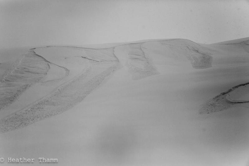
In addition to the arrival of new snow the most notable weather concern yesterday was a period of strong Eastern winds.  Yesterday moderate winds 10-20 mph increased to an average of 30mph for several hours in the evening with a few gusts reaching the 50’s on Sunburst.  

Windslabs

Touchy wind slabs are the primary concern for today. We have an “up-side-down,” very poor snow structure within the top 6-15” of the snowpack depending on location. Over the last two weeks cold temperatures have created a faceted weak layer (4” thick) sitting on a firm ice crust between 1500’ – 3000’. New snow over the last two days combined with strong Eastern winds has formed wind slabs along leeward aspects of ridgetops and terrain features. These wind slabs are likely to be in the 6–12” range depending on location, Eddies could be slightly larger. Expect these wind slabs to be predictably tender and easy to initiate. With this said there is a potential for these wind slabs to be stiffer and more supportable in places where winds were stronger, like along ridgetops. Avoid large sustained slopes where the starting zone have a stiff supportable pillow like appearance. Today might be a great day to enjoy lower angle powder while practicing safe travel protocols.

Be on the lookout for any obvious signs of instability:

Recent Avalanches: Small isolated human triggered avalanches were observed yesterday and are likely today on slopes steeper than 35°.

Collapsing: Listen for “woomphing” sounds in places where the snow is supportable and your weight could be enough to collapse the weak faceted snow below.

Shooting Cracks: Be on the look out for supportable pillow-like snow that produces shooting cracks underfoot.


Photo taken yesterday afternoon of the Southwest face of Maynard Mountain in Portage Valley. Notice the widespread natural avalanches along steep convex rolls. These are an example of the overhead hazard in Portage Valley that warrent extra caution for ice climbers or anyone recreating directly under a steep slope. 


Avalanche Problem 2
  • Storm Slabs
    Storm Slabs
Storm Slabs
Storm Slab avalanches are the release of a cohesive layer (a slab) of new snow that breaks within new snow or on the old snow surface. Storm-slabs typically last between a few hours and few days (following snowfall). Storm-slabs that form over a persistent weak layer (surface hoar, depth hoar, or near-surface facets) may be termed Persistent Slabs or may develop into Persistent Slabs.
More info at Avalanche.org

Soft Slabs

With the arrival of warmer temperatures and new snow, cohesive soft slabs are likely in areas more sheltered from the wind. Places where more than a few inches of new snow (such as Eddies and Tincan), watch for shallow soft slabs, as the new snow overlies very weak snow. These soft slabs are likely to be a low hazard today, but triggered in the wrong place could knock you over.  

Western aspect of Eddies just below 2000′. The snow yesterday proved to be very reactive to ski cutting on steep convex rollovers. Soft slabs were breaking directly under foot.

Weather
Wed, February 11th, 2015

The first of a series of low-pressure systems has pushed through Southcentral Alaska over the last two days leaving 4-12 € of snow behind, depending on location. Portage Valley has seen a total of 12″ of new snow over the last 48hours, and the Southern end of the Turnagain pass is closer to 5 € total. Temps have been warm, into the 20’s F along ridgetops and mid 30’sF near coastal areas. Light rain was observed along Turnagain Arm in the morning. East ridgetop winds were moderate in the morning (10-20 mph) and increased into the 30’s (mph) yesterday evening, with a peak gust of 56mph on Sunburst.

Overnight East winds decreased to 5-15mph along ridgetops. 2″ of new snow was recorded overnight in Turnagain Pass and temperatures are still relatively warm, just above freezing in coastal areas near sea level and mid 20’sF inland and above 1000′.

Today East winds are expected to remain light moderate (5-20mph.) Up to 2 inches of snow could fall today at higher elevations. This will most likely fall as light rain near sea level. Temperatures are supposed to stay warm along the coast, and at higher elevations temperatures should remain in the 20’sF

This low-pressure pattern appears to be on repeat as another waive of light precipitation move our direction. A few more inches of snow, and warm temperatures is expected over the next few days in Southcentral Alaska. Winds should remain light to moderate from the East and temps may increase slightly bringing rain/snowline a little higher in elevation.  

PRECIPITATION 24-hour data (6am – 6am)

  Temp Avg (F) Snow (in) Water (in) Snow Depth (in)
Center Ridge (1880′) 29   4   .3 36  
Summit Lake (1400′) 31   trace .01 8  
Alyeska Mid (1700′) 30   1 .08 26  

RIDGETOP 24-hour data (6am – 6am)

  Temp Avg (F) Wind Dir Wind Avg (mph) Wind Gust (mph)
Sunburst (3812′) 21    E 18   56  
Seattle Ridge (2400′) 23   Var.    11 22  
Observations
Recent Observations for Turnagain Pass
Date Region Location
04/16/24 Turnagain Observation: Cornbiscuit
04/15/24 Turnagain Observation: Taylor Pass
04/15/24 Turnagain Observation: Seward Highway – Tern Lake to Portage
04/14/24 Turnagain Observation: Sunburst
04/14/24 Turnagain Observation: Turnagain Pass Snomo
04/13/24 Turnagain Observation: Spokane Creek
04/11/24 Turnagain Observation: Tincan
04/10/24 Turnagain Avalanche: Seattle Ridge
04/10/24 Turnagain Observation: Cornbiscuit South Face
04/10/24 Turnagain Avalanche: Tincan
Riding Areas

The riding areas page has moved. Please click here & update your bookmarks.


Subscribe to Turnagain Pass
Avalanche Forecast by Email

This is a general backcountry avalanche advisory issued for Turnagain Arm with Turnagain Pass as the core advisory area. This advisory does not apply to highways, railroads or operating ski areas.