Turnagain Pass RSS

Archives
ARCHIVED - Forecasts expire after 24 hours.
Issued
Sat, February 1st, 2014 - 7:00AM
Expires
Sun, February 2nd, 2014 - 7:00AM
Forecaster
Wendy Wagner
Avalanche risk The Bottom Line

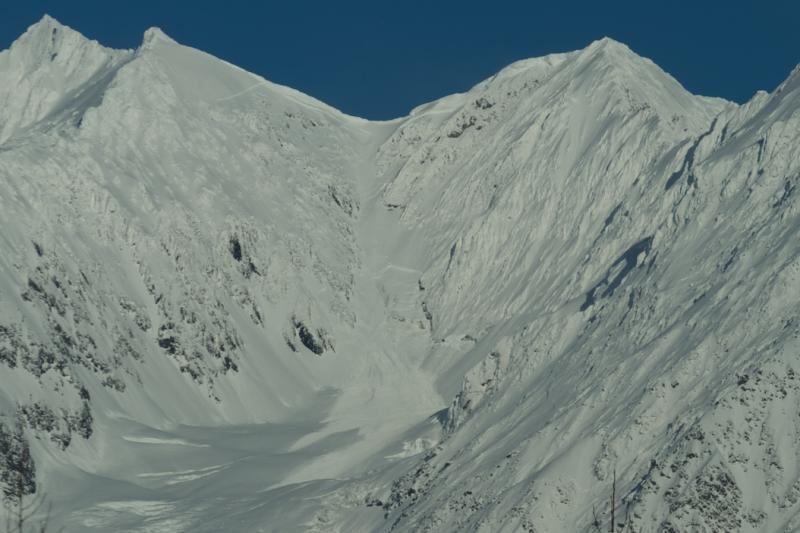
The avalanche danger is  MODERATE above treeline for deep slab and wind slab avalanches. At elevations above 3,000′, weak snow sits underneath a dense slab 3-6+’ thick creating the potential for a human triggered full-depth avalanche. The likelihood of triggering a deep slab is low but the consequences are high as these can be large and destructive slides. Also in the upper elevation exposed terrain, be on the lookout for old hard wind slabs or fresh slabs in the 6″ range. Below treeline the danger is LOW  where triggering an avalanche in unlikely.

Special Announcements
  • Coming up on Saturday, February 8th is the  Hatcher Pass Avalanche Center 2014 Fundraiser. An eventful evening with a slide show, live music, silent auction and more are on tap. Tickets are selling fast so get yours today and support avalanche information in the Hatcher Pass area!!
Sat, February 1st, 2014
Alpine
Above 2,500'
2 - Moderate
Avalanche risk
Treeline
1,000'-2,500'
1 - Low
Avalanche risk
Below Treeline
Below 1,000'
1 - Low
Avalanche risk
0 - No Rating
1 - Low
2 - Moderate
3 - Considerable
4 - High
5 - Extreme
Avalanche risk Avalanche risk Avalanche risk Avalanche risk Avalanche risk
Travel Advice Generally safe avalanche conditions. Watch for unstable snow on isolated terrain features. Heightened avalanche conditions on specific terrain features. Evaluate snow and terrain carefully; identify features of concern. Dangerous avalanche conditions. Careful snowpack evaluation, cautious route-finding, and conservative decision-making essential. Very dangerous avalanche conditions. Travel in avalanche terrain not recommended. Extraordinarily dangerous avalanche conditions. Avoid all avalanche terrain.
Likelihood of Avalanches Natural and human-triggered avalanches unlikely. Natural avalanches unlikely; human-triggered avalanches possible. Natural avalanches possible; human-triggered avalanches likely. Natural avalanches likely; human-triggered avalanches very likely. Natural and human-triggered avalanches certain.
Avalanche Size and Distribution Small avalanches in isolated areas or extreme terrain. Small avalanches in specific areas; or large avalanches in isolated areas. Small avalanches in many areas; or large avalanches in specific areas; or very large avalanches in isolated areas. Large avalanches in many areas; or very large avalanches in specific areas. Very large avalanches in many areas.
Avalanche Problem 1
  • Deep Persistent Slabs
    Deep Persistent Slabs
Deep Persistent Slabs
Deep Persistent Slab avalanches are the release of a thick cohesive layer of hard snow (a slab), when the bond breaks between the slab and an underlying persistent weak layer deep in the snowpack. The most common persistent weak layers involved in deep, persistent slabs are depth hoar or facets surrounding a deeply buried crust. Deep Persistent Slabs are typically hard to trigger, are very destructive and dangerous due to the large mass of snow involved, and can persist for months once developed. They are often triggered from areas where the snow is shallow and weak, and are particularly difficult to forecast for and manage.
More info at Avalanche.org

No new avalanche activity has been noted since the end of the warm, wet weather on Tuesday Jan 28th – but Kevin did get some great aerial shots of old avalanches from the Jan 17-27 cycle yesterday. There have been only a few folks getting out lately. I’m guessing this is due to the challenging travel conditions, which consist of negotiating a hard surface crust that extends up to 3,000′. Though the sun has been out it has not been able to soften the crust. There may be a few exceptions on steep southerly slopes receiving little wind and direct sun.

Snowpack below 3,000′:
The recent cold temperatures are freezing the snowpack more and more every day. There is still wet snow at the bottom of the pack but this continues to drain. The crust that was over a foot thick is getting thicker.

Snowpack above 3,000′:
This is where the deep slab primary concern comes into play. Though it has been a week since the last known deep slab avalanche (Goat Mtn in Girdwood Valley), it is still on our radar. This is simply because we know faceted snow exists under 3-6+’ of dense slab. A few ways of handling this problem is either to steer clear of steep slopes (35 degrees or steeper) at the upper elevations or hedge your bets by only exposing one person at a time. If the later is chosen, look for the safest ‘relative safe spot’ you can find to watch your buddy. If a deep slab is triggered it could run much further and propagate wider than expected. Lastly, be aware of shallow areas in the slab that can be trigger points – for example, rocks and the tops of rollovers.

Avalanche Problem 2
  • Wind Slabs
    Wind Slabs
Wind Slabs
Wind Slab avalanches are the release of a cohesive layer of snow (a slab) formed by the wind. Wind typically transports snow from the upwind sides of terrain features and deposits snow on the downwind side. Wind slabs are often smooth and rounded and sometimes sound hollow, and can range from soft to hard. Wind slabs that form over a persistent weak layer (surface hoar, depth hoar, or near-surface facets) may be termed Persistent Slabs or may develop into Persistent Slabs.
More info at Avalanche.org

Above 3,000′ the surface crust transitions to 4-6″ of soft wind affected snow over a dense base. Many exposed areas have been stripped by the wind and pockets of hard wind slab are scattered in catchment zones and the lee sides of ridges. If you are traveling in these upper elevations harboring dry snow, be on the lookout for older stiff wind slabs as well as any recent wind deposited snow. There is limited loose snow available for transport and I’d expect any fresh slabs to be mostly shallow (in the 6″ range or less). As always, be aware of any cracking in the snow around you.

Additional Concern
  • Announcement
    Announcement

With many days of unseasonably warm weather during January, some of us are wondering just where did we stack up in the monthly averages. There is more data to crunch so stay tuned – but we do have a few sets of interesting numbers. Below are graphs of precipitation, SWE (Snow Water Equivalent) and Temperature. 


Weather
Sat, February 1st, 2014

Mostly clear skies and sunshine prevailed again yesterday above the entrenched valley fog along Turnagain Arm. A  mild inversion is in place with temperatures during the past 24-hours in the low 20’s F at sea level to the upper 20’s F on ridgetops. Winds have been light from the Northwest averaging around 10mph.

Today it will be another mild day in the mountains. Skies should be mostly clear with possibly some high clouds and winds light from the Northwest. Temperatures look to stay in the mid 20’s F at all elevations.  

The blocking high pressure that has developed over mainland Alaska is expected to persist into next week – bringing us continued clear and cool weather. Models are showing a large low pressure system developing Sunday night through Tuesday south of the Aleutians. At this point, it doesn’t look like the low will be strong enough to push through the blocking high, limiting our chance for precipitation.

Observations
Recent Observations for Turnagain Pass
Date Region Location
04/23/24 Turnagain Observation: Turnagain Sunny Side
04/21/24 Turnagain Observation: Bertha Creek
04/20/24 Turnagain Avalanche: Spokane Creek
04/16/24 Turnagain Observation: Cornbiscuit
04/15/24 Turnagain Observation: Taylor Pass
04/15/24 Turnagain Observation: Seward Highway – Tern Lake to Portage
04/14/24 Turnagain Observation: Sunburst
04/14/24 Turnagain Observation: Turnagain Pass Snomo
04/13/24 Turnagain Observation: Spokane Creek
04/11/24 Turnagain Observation: Tincan
Riding Areas

The riding areas page has moved. Please click here & update your bookmarks.


Subscribe to Turnagain Pass
Avalanche Forecast by Email

This is a general backcountry avalanche advisory issued for Turnagain Arm with Turnagain Pass as the core advisory area. This advisory does not apply to highways, railroads or operating ski areas.