Turnagain Pass Avalanche Forecast RSS

Archives
ARCHIVED FORECAST - All forecasts expire after 24 hours from the posting date/time.
Issued
Sun, December 1st, 2019 - 7:00AM
Expires
Mon, December 2nd, 2019 - 7:00AM
Forecaster
Wendy Wagner
Avalanche risk The Bottom Line

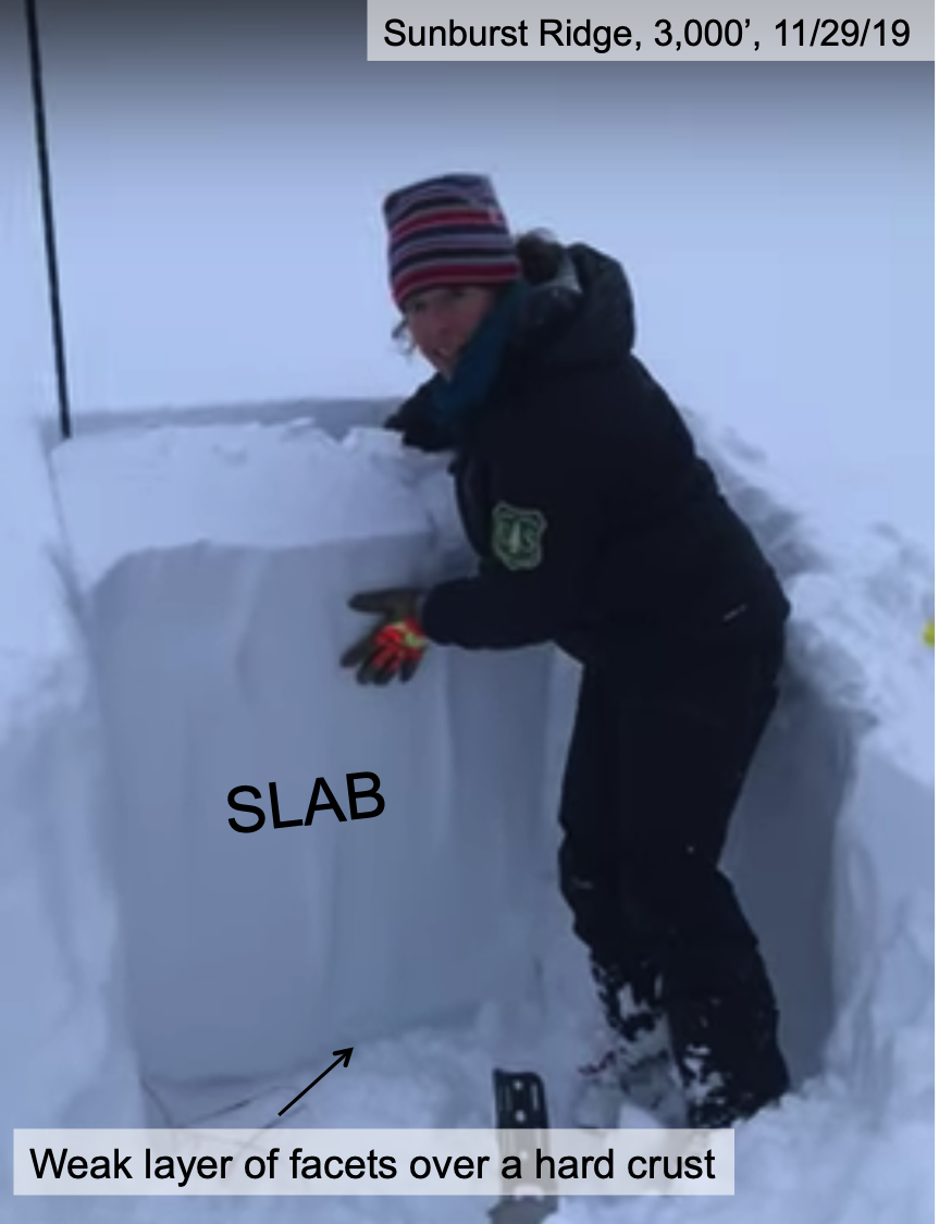
A MODERATE avalanche danger exists in the Turnagain Pass region above 2,500′. A few inches of new snow (2-5″) with moderate winds are expected to form small fresh wind slabs along the higher ridgelines by this afternoon. Additionally, a much larger avalanche may be possible to trigger above 3,000′ due to a suspected weak layer 1-3 feet below the snow surface.

Special Announcements

Headed to Hatcher Pass? Don’t forget to check hpavalanche.org and their Facebook page!

Tuesday, Dec 3rd: Turnagain Pass – Snow, Weather and Avalanches @ Ski AK
6:30pm – 8:00pm. Cost FREE!
Join CNFAIC forecasters for a look under the hood at the avalanche center. We’ll discuss current Turnagain Pass snow and avalanche conditions, how avalanche forecasts are produced and some tips on being your own avalanche forecaster.

Thanks to our sponsors!
Sun, December 1st, 2019
Alpine
Above 2,500'
Moderate (2)
Avalanche risk
Treeline
1,000'-2,500'
Low (1)
Avalanche risk
Below Treeline
Below 1,000'
No Rating (0)
Avalanche risk
Alpine
Above 2,500'
Avalanche risk
Moderate (2)
Treeline
1,000'-2,500'
Avalanche risk
Low (1)
Below Treeline
Below 1,000'
Avalanche risk
No Rating (0)
Danger Scale:
No Rating (0)
Low (1)
Moderate (2)
Considerable (3)
High (4)
Extreme (5)
Avalanche Problem 1
  • Wind Slabs
    Wind Slabs
  • Almost Certain
    Very Likely
    Likely
    Possible
    Unlikely
    Likelihood
  • Historic (D4-5)
    Very Large (D3)
    Large (D2)
    Small (D1)
    Size
Wind Slabs
Wind Slab avalanches are the release of a cohesive layer of snow (a slab) formed by the wind. Wind typically transports snow from the upwind sides of terrain features and deposits snow on the downwind side. Wind slabs are often smooth and rounded and sometimes sound hollow, and can range from soft to hard. Wind slabs that form over a persistent weak layer (surface hoar, depth hoar, or near-surface facets) may be termed Persistent Slabs or may develop into Persistent Slabs.

Likelihood of Avalanches
Terms such as "unlikely", "likely", and "certain" are used to define the scale, with the chance of triggering or observing avalanches increasing as we move up the scale. For our purposes, "Unlikely" means that few avalanches could be triggered in avalanche terrain and natural avalanches are not expected. "Certain" means that humans will be able to trigger avalanches on many slopes, and natural avalanches are expected.

Size of Avalanches
Avalanche size is defined by the largest potential avalanche, or expected range of sizes related to the problem in question. Assigned size is a qualitative estimate based on the destructive classification system and requires specialists to estimate the harm avalanches may cause to hypothetical objects located in the avalanche track (AAA 2016, CAA 2014). Under this schema, "Small" avalanches are not large enough to bury humans and are relatively harmless unless they carry people over cliffs or through trees or rocks. Moving up the scale, avalanches become "Large" enough to bury, injure, or kill people. "Very Large" avalanches may bury or destroy vehicles or houses, and "Historic" avalanches are massive events capable of altering the landscape.

Signal Word Size (D scale) Simple Descriptor
Small 1 Unlikely to bury a person
Large 2 Can bury a person
Very Large 3 Can destroy a house
Historic 4 & 5 Can destroy part or all of a village
More info at Avalanche.org

These first days of December are greeting us with our last chance of snow before we head into a cold dry spell for the remainder of the week. A low-pressure to our south will send moisture our way and we hope to squeak up to 5″ of snow out of it in some areas by tonight; late tonight into tomorrow morning an additional 5″ could fall. Portage Valley and Girdwood are favored, while Turnagain Pass may only see 2-4″ today. Associated easterly ridgetop winds will bump into the 30’s mph, which is relatively light. With the lighter wind flow, there is a chance an area could see well over 5″ of snow- we will cross our fingers!

Fresh wind slabs are likely to develop later today and tonight along the higher ridgelines. These should be on the smaller side, 4-8″ thick or so, and completely dependent on the amount of new snow and wind loading.

Slopes below 2,500′ are covered with a moist snowpack topped with a breakable crust. A few inches of snow above this should greatly increase the riding conditions at the mid elevations.

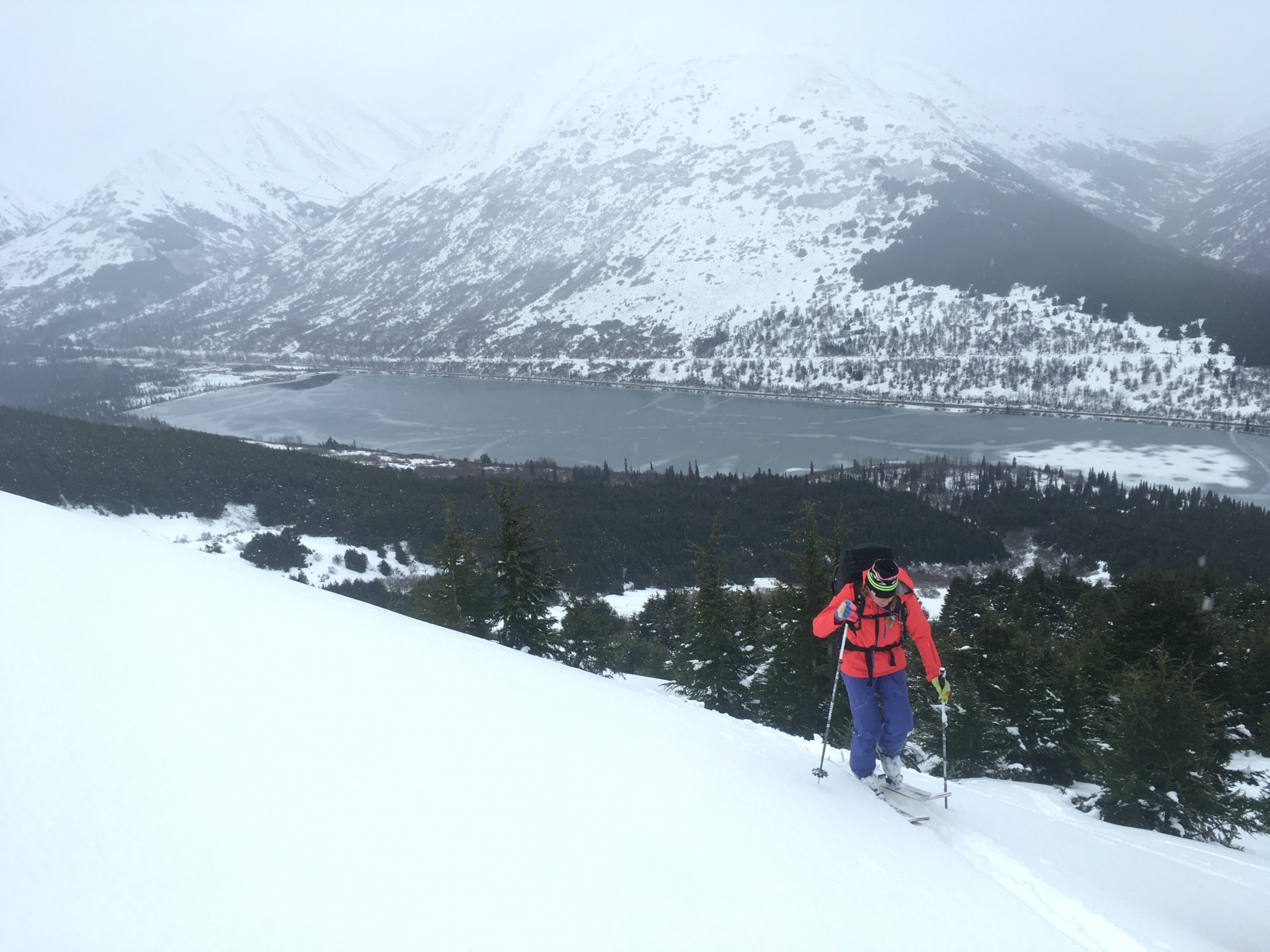
Alaska Avalanche School instructor Brooke Edwards climbs to 2,500′ on Tenderfoot Ridge in the Summit Lake area of the Kenai Mtns. Snow depth here is roughly 2 feet. Photo: Heather Thamm.

Avalanche Problem 2
  • Persistent Slabs
    Persistent Slabs
  • Almost Certain
    Very Likely
    Likely
    Possible
    Unlikely
    Likelihood
  • Historic (D4-5)
    Very Large (D3)
    Large (D2)
    Small (D1)
    Size
Persistent Slabs
Persistent Slab avalanches are the release of a cohesive layer of snow (a slab) in the middle to upper snowpack, when the bond to an underlying persistent weak layer breaks. Persistent layers include: surface hoar, depth hoar, near-surface facets, or faceted snow. Persistent weak layers can continue to produce avalanches for days, weeks or even months, making them especially dangerous and tricky. As additional snow and wind events build a thicker slab on top of the persistent weak layer, this avalanche problem may develop into a Deep Persistent Slab.

Likelihood of Avalanches
Terms such as "unlikely", "likely", and "certain" are used to define the scale, with the chance of triggering or observing avalanches increasing as we move up the scale. For our purposes, "Unlikely" means that few avalanches could be triggered in avalanche terrain and natural avalanches are not expected. "Certain" means that humans will be able to trigger avalanches on many slopes, and natural avalanches are expected.

Size of Avalanches
Avalanche size is defined by the largest potential avalanche, or expected range of sizes related to the problem in question. Assigned size is a qualitative estimate based on the destructive classification system and requires specialists to estimate the harm avalanches may cause to hypothetical objects located in the avalanche track (AAA 2016, CAA 2014). Under this schema, "Small" avalanches are not large enough to bury humans and are relatively harmless unless they carry people over cliffs or through trees or rocks. Moving up the scale, avalanches become "Large" enough to bury, injure, or kill people. "Very Large" avalanches may bury or destroy vehicles or houses, and "Historic" avalanches are massive events capable of altering the landscape.

Signal Word Size (D scale) Simple Descriptor
Small 1 Unlikely to bury a person
Large 2 Can bury a person
Very Large 3 Can destroy a house
Historic 4 & 5 Can destroy part or all of a village
More info at Avalanche.org

The high elevation snowpack continues to be on our minds. These are slopes above 3,000′ that harbor dry snow. So far this season we know of very few folks who have ventured into terrain above 3,000′. The issue is a layer of faceted snow that sits on a very hard melt-freeze crust near the base of the snowpack. The crust is widespread and found in every pit dug by forecasters and/or observers. The faceted layer on the other hand is the question. How widespread is it? We’ve only found it on Sunburst, so far… yet it is suspected to exist in upper Girdwood Valley and possibly region-wide. With such limited data at this time, our hackles must be up moving forward.

We’ll be speaking more to this as the skies clear this week and travel to our favorite upper elevation zones becomes possible.

Weather
Sun, December 1st, 2019

Yesterday:  Mostly overcast skies with the only precipitation recorded in the past 24-hours over Portage Valley and Turnagain Arm (.1-.25″ rain). Ridgetop winds were light with moderate gusts from an easterly direction. Temperature has cooled slightly and ridgelines are in the mid-low 20’s F this morning, while lower elevations sit in the mid-low 30’s F.

Today:  Cloudy skies with light snow showers will be over the region. Snow amounts look to be around 3-5″ for upper Girdwood valley and 2-4″ at Turnagain Pass and a trace in the Summit Lake zone. Rain/snow line should start around 1000′ and lower to 500′ by tonight. Winds are expected to be 15-35mph from the east along ridgelines.

Tomorrow:  Snowfall, to sea level, should continue though Monday morning with rapidly cooling temperatures. By midday the mountains should pick up another 3-5″ (possibly more) on top of what falls by tonight. Winds will switch to the northeast and increase through the day as skies begin to clear and we head into a cold clear period for the remainder of the week.

PRECIPITATION 24-hour data (6am – 6am)

Temp Avg (F) Snow (in) Water (in) Snow Depth (in)
Center Ridge (1880′) 34 0 0 11
Summit Lake (1400′) 33 0 0 7
Alyeska Mid (1700′) 33 0 0.1 17

RIDGETOP 24-hour data (6am – 6am)

Temp Avg (F) Wind Dir Wind Avg (mph) Wind Gust (mph)
Sunburst (3812′) 25 NE 9 27
Seattle Ridge (2400′) NA* NA* NA* NA*

*Seattle Ridge is not recording temperature and wind stopped recording at 10 pm on 11/28.

Observations
Recent Observations for Turnagain Pass
Date Region Location
05/22/23 Turnagain Avalanche: Tincan
05/12/23 Turnagain Avalanche: Tincan, Sunburst, Magnum, Cornbiscuit
05/07/23 Turnagain Observation: Tincan – Bear Tracks
05/05/23 Turnagain Observation: Seattle Ridge
05/02/23 Turnagain Observation: Cornbiscuit
05/02/23 Turnagain Observation: Seward Hwy Turnagain Pass
04/30/23 Turnagain Observation: Magnum
04/29/23 Turnagain Observation: Tincan
04/28/23 Turnagain Avalanche: Taylor Pass/Pastoral
04/28/23 Turnagain Avalanche: Tincan
Riding Areas
Updated Thu, June 01st, 2023

Status of riding areas across the Chugach NF is managed by the Glacier and Seward Ranger Districts, not avalanche center staff. Riding area information is posted as a public service to our users and updated based on snow depth and snow density to prevent resource damage at trailhead locations. Riding area questions contact: mailroom_r10_chugach@fs.fed.us

Area Status Weather & Riding Conditions
Glacier District
Johnson Pass
Closed
Closed May 15.
Placer River
Closed
Closed May 15.
Skookum Drainage
Closed
Will close to motorized use on April 1, 2023 per the National Forest Plan.
Turnagain Pass
Closed
Will close on June 1.
Twentymile
Closed
Scheduled closure May 1.
Seward District
Carter Lake
Closed
Scheduled closure May 1.
Lost Lake Trail
Closed
Scheduled closure May 1.
Primrose Trail
Closed
Scheduled closure May 1.
Resurrection Pass Trail
Closed
Closed to motorized use for the 2022/23 winter season per Forest Plan. Open next season.
Snug Harbor
Closed
Extended opening until May 15.
South Fork Snow River Corridor
Closed
Scheduled closure May 1.
Summit Lake
Closed
Scheduled closure May 1.

Subscribe to Turnagain Pass
Avalanche Forecast by Email

This is a general backcountry avalanche advisory issued for Turnagain Arm with Turnagain Pass as the core advisory area. This advisory does not apply to highways, railroads or operating ski areas.