Turnagain Pass RSS

Archives
ARCHIVED - Forecasts expire after 24 hours.
Issued
Thu, November 24th, 2022 - 7:00AM
Expires
Fri, November 25th, 2022 - 7:00AM
Forecaster
John Sykes
Avalanche risk The Bottom Line

Happy Thanksgiving!!!

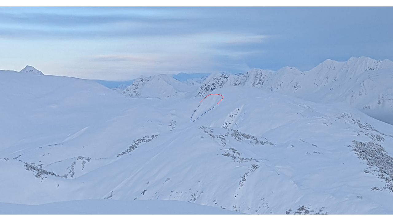
The avalanche danger is MODERATE above 1000′ today. It is possible to trigger a wind slab 1-2′ deep. Especially at higher elevations near ridgelines, convex rollovers, and gullies. Conditions could change quickly if the winds pick up because there is a lot of dry snow on the surface that could be blown into fresh wind slabs. There is also a weak layer of sugary faceted snow on the ground that could produce larger avalanches above 3000′. The avalanche danger is LOW below 1000′ today.

Special Announcements

Turnagain Pass Motorized Use: The Chugach National Forest has issued a closure order for the Turnagain Pass motorized area due to inadequate snow cover to protect forest resources. Currently around 20″ snow exists outside the motorized parking lot at the Pass. See the ‘Riding Areas’ tab below for the latest updates.

Hatcher Pass Thanksgiving Forecast: HPAC is issuing a special forecast for the holiday, if you are headed up to the Talkeetna’s check out the forecast here.

Avalanche Education Scholarships: Get your application in NOW! The Friends of the Chugach Avalanche Center hosts two different types of scholarships; the deadline is December 1st. Several opportunities are available. See details HERE. Help us spread the word!

New this season: we are adding the avalanche problem rose to our icons. We’ve posted a quick guide on how to use it (and its limitations) here.

Thu, November 24th, 2022
Alpine
Above 2,500'
2 - Moderate
Avalanche risk
Treeline
1,000'-2,500'
2 - Moderate
Avalanche risk
Below Treeline
Below 1,000'
1 - Low
Avalanche risk
0 - No Rating
1 - Low
2 - Moderate
3 - Considerable
4 - High
5 - Extreme
Avalanche risk Avalanche risk Avalanche risk Avalanche risk Avalanche risk
Travel Advice Generally safe avalanche conditions. Watch for unstable snow on isolated terrain features. Heightened avalanche conditions on specific terrain features. Evaluate snow and terrain carefully; identify features of concern. Dangerous avalanche conditions. Careful snowpack evaluation, cautious route-finding, and conservative decision-making essential. Very dangerous avalanche conditions. Travel in avalanche terrain not recommended. Extraordinarily dangerous avalanche conditions. Avoid all avalanche terrain.
Likelihood of Avalanches Natural and human-triggered avalanches unlikely. Natural avalanches unlikely; human-triggered avalanches possible. Natural avalanches possible; human-triggered avalanches likely. Natural avalanches likely; human-triggered avalanches very likely. Natural and human-triggered avalanches certain.
Avalanche Size and Distribution Small avalanches in isolated areas or extreme terrain. Small avalanches in specific areas; or large avalanches in isolated areas. Small avalanches in many areas; or large avalanches in specific areas; or very large avalanches in isolated areas. Large avalanches in many areas; or very large avalanches in specific areas. Very large avalanches in many areas.
Recent Avalanches

Seattle Ridge

Despite pretty good visibility yesterday we only observed 1 slab avalanche in the recent storm snow. This was located along Seattle Ridge between Main Bowl and Pyramid Peak at about 3000′ on a W aspect. From afar the avalanche appeared to be a wind slab that released along a steep convexity on a wind loaded aspect. It was a soft slab that ran about 150′ vertical feet.

Soft slab avalanche from wind transported new snow along Seattle Ridge. Approximate location of crown shown with red line and avalanche debris shown with blue line. Photo 11.23.22

Avalanche Problem 1
  • Wind Slabs
    Wind Slabs
  • Aspect/Elevation
  • Certain
    Very Likely
    Likely
    Possible
    Unlikely
    Likelihood
  • Historic (D4-5)
    Very Large (D3)
    Large (D2)
    Small (D1)
    Size
Wind Slabs
Wind Slab avalanches are the release of a cohesive layer of snow (a slab) formed by the wind. Wind typically transports snow from the upwind sides of terrain features and deposits snow on the downwind side. Wind slabs are often smooth and rounded and sometimes sound hollow, and can range from soft to hard. Wind slabs that form over a persistent weak layer (surface hoar, depth hoar, or near-surface facets) may be termed Persistent Slabs or may develop into Persistent Slabs.

Aspect/Elevation of the Avalanche Problem
Specialists develop a graphic representation of the potential distribution of a particular avalanche problem across the topography. This aspect/elevation rose is used to indicate where the particular avalanche problem is thought to exist on all elevation aspects. Areas where the avalanche problem is thought to exist are colored grey, and it is less likely to be encountered in areas colored white.

Likelihood of Avalanches
Terms such as "unlikely", "likely", and "certain" are used to define the scale, with the chance of triggering or observing avalanches increasing as we move up the scale. For our purposes, "Unlikely" means that few avalanches could be triggered in avalanche terrain and natural avalanches are not expected. "Certain" means that humans will be able to trigger avalanches on many slopes, and natural avalanches are expected.

Size of Avalanches
Avalanche size is defined by the largest potential avalanche, or expected range of sizes related to the problem in question. Assigned size is a qualitative estimate based on the destructive classification system and requires specialists to estimate the harm avalanches may cause to hypothetical objects located in the avalanche track (AAA 2016, CAA 2014). Under this schema, "Small" avalanches are not large enough to bury humans and are relatively harmless unless they carry people over cliffs or through trees or rocks. Moving up the scale, avalanches become "Large" enough to bury, injure, or kill people. "Very Large" avalanches may bury or destroy vehicles or houses, and "Historic" avalanches are massive events capable of altering the landscape.

Signal Word Size (D scale) Simple Descriptor
Small 1 Unlikely to bury a person
Large 2 Can bury a person
Very Large 3 Can destroy a house
Historic 4 & 5 Can destroy part or all of a village
More info at Avalanche.org

Thanks to the 12-14″ of new snow yesterday we have lots of loose snow at the surface available for wind transport. At higher elevations the new snow is dryer and we saw some evidence yesterday that it had been transported by the wind along exposed ridgelines. However, the lack of avalanche activity observed yesterday indicates that the new snow is bonding well to the old snow surface and wind slabs are isolated to more exposed features at higher elevations. Winds are expected to remain light today, but new slab avalanches could develop very quickly if you find yourself travelling in an area where wind speeds are strong enough to transport snow.

To assess the potential for wind slabs you can use small test slopes to check whether the surface snow is cracking or feels like it is not bonded well to the snow underneath. Wind slabs could fail at the interface with the old snow (1 – 2′ deep) or you could see wind slabs failing within the new snow (0.5 – 1′ deep). You are most likely to find a wind slab on slopes below ridgelines, on steep convex terrain features, or in cross loaded gullies. Look for signs of wind transport on the snow surface to show you which aspects are likely to be wind loaded in the area you are travelling.

Avalanche Problem 2
  • Persistent Slabs
    Persistent Slabs
  • Aspect/Elevation
  • Certain
    Very Likely
    Likely
    Possible
    Unlikely
    Likelihood
  • Historic (D4-5)
    Very Large (D3)
    Large (D2)
    Small (D1)
    Size
Persistent Slabs
Persistent Slab avalanches are the release of a cohesive layer of snow (a slab) in the middle to upper snowpack, when the bond to an underlying persistent weak layer breaks. Persistent layers include: surface hoar, depth hoar, near-surface facets, or faceted snow. Persistent weak layers can continue to produce avalanches for days, weeks or even months, making them especially dangerous and tricky. As additional snow and wind events build a thicker slab on top of the persistent weak layer, this avalanche problem may develop into a Deep Persistent Slab.

Aspect/Elevation of the Avalanche Problem
Specialists develop a graphic representation of the potential distribution of a particular avalanche problem across the topography. This aspect/elevation rose is used to indicate where the particular avalanche problem is thought to exist on all elevation aspects. Areas where the avalanche problem is thought to exist are colored grey, and it is less likely to be encountered in areas colored white.

Likelihood of Avalanches
Terms such as "unlikely", "likely", and "certain" are used to define the scale, with the chance of triggering or observing avalanches increasing as we move up the scale. For our purposes, "Unlikely" means that few avalanches could be triggered in avalanche terrain and natural avalanches are not expected. "Certain" means that humans will be able to trigger avalanches on many slopes, and natural avalanches are expected.

Size of Avalanches
Avalanche size is defined by the largest potential avalanche, or expected range of sizes related to the problem in question. Assigned size is a qualitative estimate based on the destructive classification system and requires specialists to estimate the harm avalanches may cause to hypothetical objects located in the avalanche track (AAA 2016, CAA 2014). Under this schema, "Small" avalanches are not large enough to bury humans and are relatively harmless unless they carry people over cliffs or through trees or rocks. Moving up the scale, avalanches become "Large" enough to bury, injure, or kill people. "Very Large" avalanches may bury or destroy vehicles or houses, and "Historic" avalanches are massive events capable of altering the landscape.

Signal Word Size (D scale) Simple Descriptor
Small 1 Unlikely to bury a person
Large 2 Can bury a person
Very Large 3 Can destroy a house
Historic 4 & 5 Can destroy part or all of a village
More info at Avalanche.org

At the very bottom of the snowpack we have been tracking a layer of facets that produced large avalanches during multiple storm cycles in early November. Now that the snowpack is quite wet and includes multiple thick melt freeze crusts below 3000′ the likelihood of triggering an avalanche on this weak layer is pretty low. In the alpine above 3000′ those melt freeze crusts are much thinner or don’t exists at all and it would still be possible to trigger an avalanche on this persistent weak layer. Your ability to impact this layer and release a large avalanche is more likely in areas with a thinner snowpack, like the Johnson Pass area or Crow Pass area. Outside our forecast zone, Summit Lake is another area that is more likely to harbor this week layer longer due to their thinner snowpack.

Since the snowpack is only about 3 feet deep right now it is not too hard to dig down to the ground and take a look at this weak layer before you commit to big terrain features in the alpine. An extended column test or compression test are good ways to check whether this weak layer is reactive in the location you are travelling. On Tuesday on Magnum at 3200′ Andrew had this layer fail in his snowpit tests (see ob here), so it is probably still reactive in some areas.

You can see the video from Seattle Ridge here if it does not load in your web browser.

Weather
Thu, November 24th, 2022

Yesterday: Snowfall tapered off yesterday morning after dropping about a foot of snow in Turnagain Pass. The snow was moist at the road elevation (1000′) and got progressively dryer at higher elevations. Cloud cover lifted in the late morning and stayed overcast for the rest of the day. Wind speeds decreased as the snowfall stopped with averages dropping from the teens to single digits and remaining in the single digits overnight. Wind gusts yesterday morning reached around 30 mph but decreased in the afternoon to around 15 mph. Temperatures remained relatively warm yesterday with averages in the mid to upper 20s. Overnight temperatures dipped slightly to 20-25 degrees F.

Today: We should see light winds out of the NW during the morning with averages in the single digits and gusts into the mid teens. Winds will switch to the SE in the afternoon and remain light. Cloud cover will increase in the afternoon and evening with a chance of light snowfall later in the day. Snow accumulation is expected to be less than 2″ and fall mostly later in the day and overnight. Temperatures should remain in the low to mid twenties or upper teens throughout the day.

Tomorrow: After a brief pulse of snowfall overnight with little accumulation the wind direction will switch back to NW on Friday and wind speeds will increase to 15-20 mph with gusts to 30-40 mph. Cloud cover should decrease as the winds switch to NW and no new snowfall is expected later Friday or Saturday. Temperatures are expected to decrease Friday and continue to cool down reaching single digits throughout the weekend.

PRECIPITATION 24-hour data (6am – 6am)

Temp Avg (F) Snow (in) Water (in) Snow Depth (in)
Center Ridge (1880′) 29 4 0.3″ 24
Summit Lake (1400′) 24 1 0.1″ 12
Alyeska Mid (1700′) 24 1 0.1″ 21
Bear Valley (Portage) (132′) 29 0 0″

RIDGETOP 24-hour data (6am – 6am)

Temp Avg (F) Wind Dir Wind Avg (mph) Wind Gust (mph)
Sunburst (3812′) 24 WNW 10 31
Seattle Ridge (2400′)
Observations
Recent Observations for Turnagain Pass
Date Region Location
04/21/24 Turnagain Observation: Bertha Creek
04/20/24 Turnagain Avalanche: Spokane Creek
04/16/24 Turnagain Observation: Cornbiscuit
04/15/24 Turnagain Observation: Taylor Pass
04/15/24 Turnagain Observation: Seward Highway – Tern Lake to Portage
04/14/24 Turnagain Observation: Sunburst
04/14/24 Turnagain Observation: Turnagain Pass Snomo
04/13/24 Turnagain Observation: Spokane Creek
04/11/24 Turnagain Observation: Tincan
04/10/24 Turnagain Avalanche: Seattle Ridge
Riding Areas

The riding areas page has moved. Please click here & update your bookmarks.


Subscribe to Turnagain Pass
Avalanche Forecast by Email

This is a general backcountry avalanche advisory issued for Turnagain Arm with Turnagain Pass as the core advisory area. This advisory does not apply to highways, railroads or operating ski areas.