Turnagain Pass
|
|
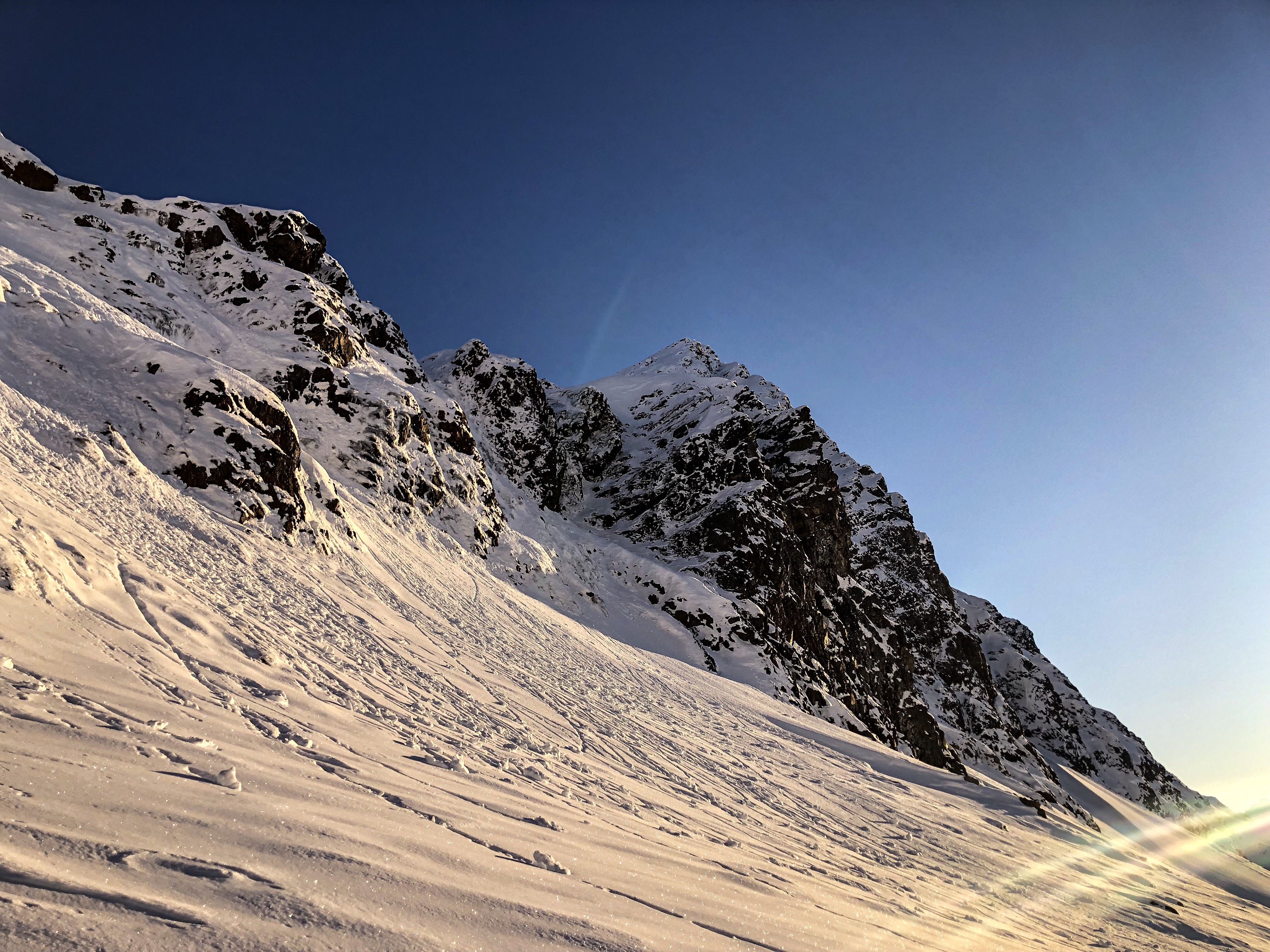
We continue to watch the weather with hopes for a colder storm, #snowtosealevel. After a partly sunny Veterans Day the forecast for this week looks to have precipitation but not snow producing temps. Upper elevation terrain (above 4000′) received a little new snow this past week. Sunshine and warmer temperatures on Friday and Saturday caused point releases and shallow slab avalanches on SW aspects in the Crow Pass area. If you do venture out in the high country check out the Jewel Glacier observation and pay attention to changing conditions. There was surface hoar observed above 4,500′. If more snow falls on top of this layer, look for signs of instability. Remember if there is enough snow to ride there is enough snow to slide!
As we wait for snow and get our heads back in avalanche mode our next reminder for the winter is to always GET the Picture. Mother Nature gives great clues to help us know the snowpack is unstable.
Every time you go out be on the lookout for these Red flag warnings:
- Recent avalanches (24-48 hrs)
- Cracks in the snow that shoot out from you
- Whumpfing (collapsing) of the snowpack
- Rapid changes in weather (snow/rain/wind/temperature)
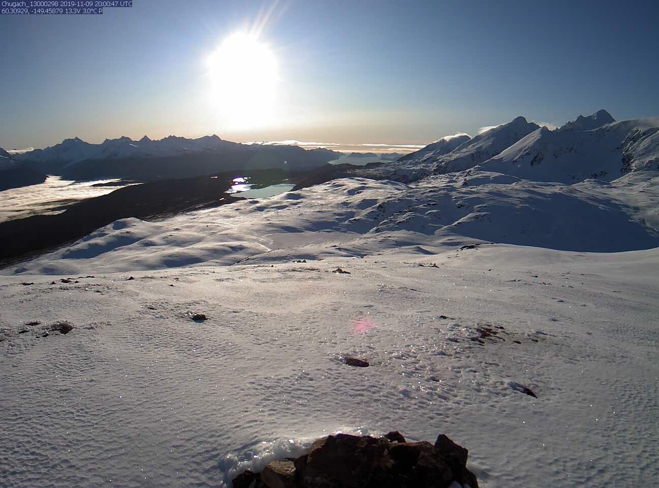
Roller balls, Jewel Glacier, November 9th. Photo: Eric Roberts
Lost Lake webcam, November 9th.
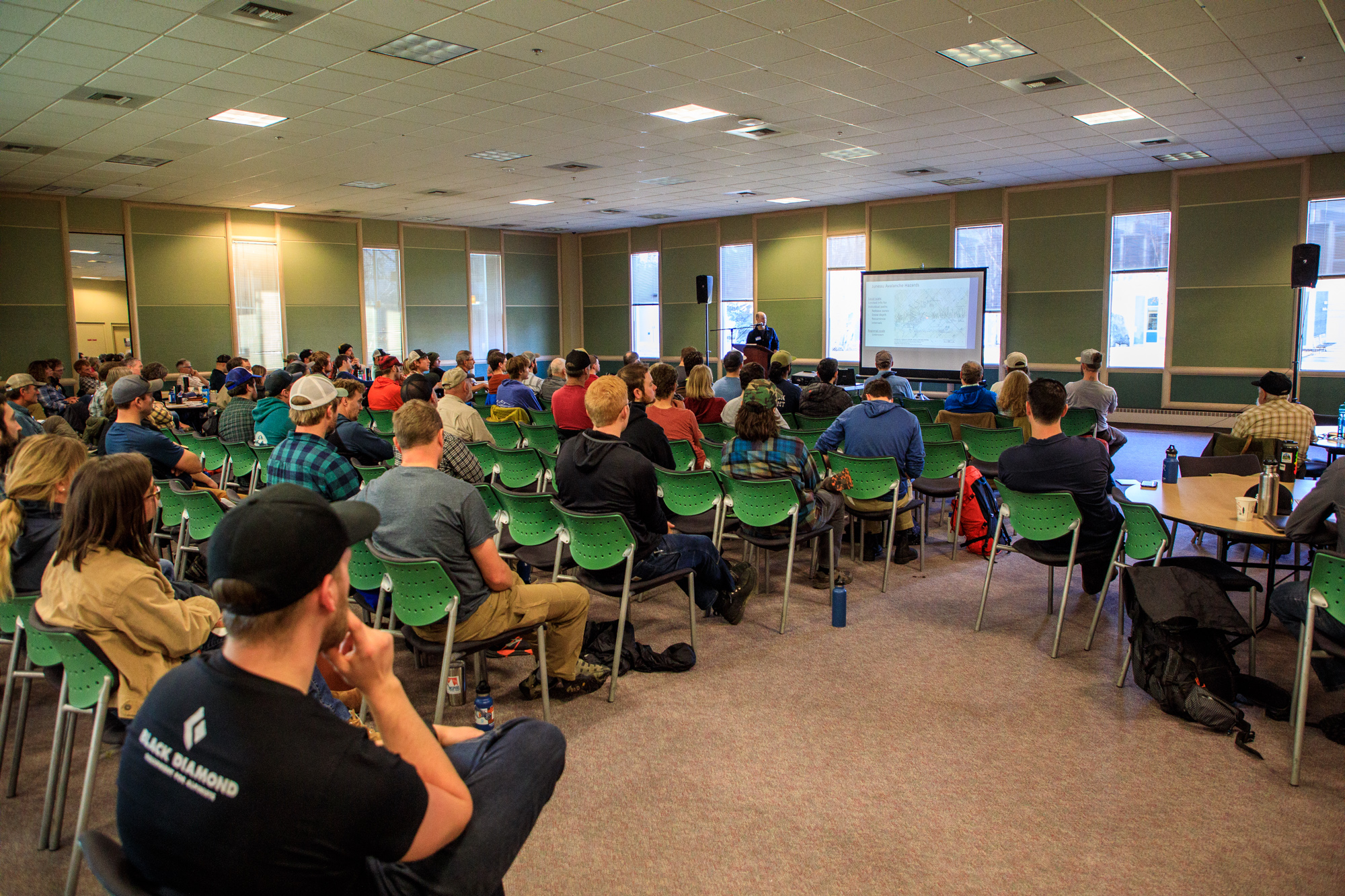
Thanks to all that attended the 7th annual Southcentral Alaska Avalanche Workshop! Photo: Heather Thamm

Recent landslide, Upper 20 mile. Photo: Kellie Okonek
Getting your pack ready for the season? Suggestions for snowmachiners and skiers. Is your beacon ready to use?
Avalanche Center Operations: Daily avalanche forecasts are planned to begin during Thanksgiving week – unless abundant November snowfall demands an earlier start. #prayforsnow and #knowbeforeyougo
Getting into the mountains? Please send us your snow/avalanche reports so we can post them on our observation page! Simply click ‘submit observation’ under the Observation tab. This is a huge benefit for the community and our forecasters.
*Keep tabs on early season conditions and events on Facebook and follow us on Instagram.*
If you are heading to Hatcher Pass don’t forget to check the NEW hpavalanche.org and their Facebook page.
Thursday, Nov 14: Snow Stories 2.0
8-10pm, Beartooth Theater, $20
Please join us in getting stoked to stay safe as emcee Brooke Edwards hosts an exceptional line of up lessons learned in the backcountry by storytellers: Roman Dial, Leighan Falley, Paul Thacker, Kellie Okonek, and Carl Tobin. Tickets available at the Beartooth website and box office. Hope to see you all there!!!
