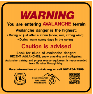
SPRINGTIME AVALANCHE TIPS – Timing is everything! The spring transition can have an unexpected effect on snowpack characteristics. Stable snow can become weak and hazardous in a matter of hours. What to look for? Ask yourself these questions: Am I dealing with winter snow (cold and dry) or spring/summer snow (wet, warm and/or crusty and refrozen)? Or is it some combination? What weather factors have affected the snowpack today and recently?
Remember the Red Flags that indicate instability!
- Are there recent avalanches? What kind?
- Cracking in the snow? Collapsing?
- New snow? Rain? What elevation?
- Wind loading? How strong for how long?
- Rapid warming? Did it freeze last night? How many nights with no freeze? How deep are you sinking into mushy wet snow?
On any given day conditions can range from warm and sunny T-shirt weather, to pouring rain, to cold and snowy mid-winter conditions. Being able to recognize and respond to specific avalanche concerns is key in making effective decisions in avalanche terrain.
Hiking on summer trails during the springtime warm-up (including the Byron Glacier trail, Crow Pass, Devil’s Pass, Russian Lakes trail and Crescent Creek trail) can be very dangerous. Extra caution is advised for trails that cross under avalanche paths. Avoid being under large snow covered slopes this spring as avalanche hazard does remain. Most common times for natural springtime avalanches are during sunny afternoons/evenings or periods of warm rainy weather. Know that an avalanche occurring above you could send debris to snow-free zones and valley floors.
Make sure you consider avalanche danger before using hiking trails.
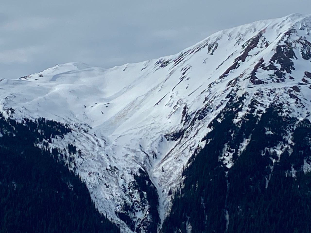
Loose Snow Avalanches: Both dry and wet loose avalanches are common springtime avalanche concerns. Pay close attention in steep terrain, especially when the sun first hits freshly fallen snow. Remember loose avalanches can be particularly hazardous if they push you into a terrain trap. Wet loose avalanches can trigger wet slabs on the slopes below.

Wet loose avalanches on Butch in Summit Lake 4.17.20.
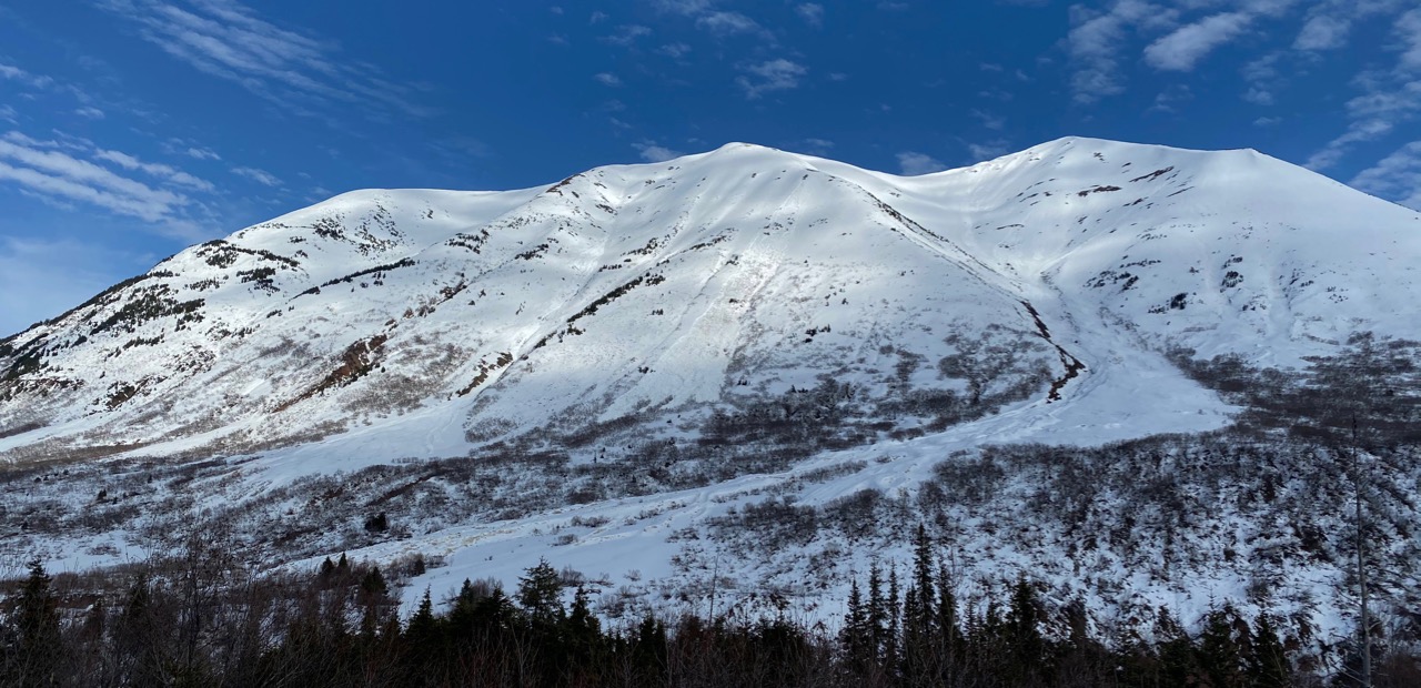
Wet Slab Avalanches: Wet slab avalanches are a combination of a slab, a weak layer or interface and water percolating down to the weak layer or interface. Often times there is a crust involved as the bed surface or some harder layer that the water lubricates. As temperatures rise and/or rain falls at upper elevations these could happen even on the Northerly slopes. These tend to be large and destructive when water is first being rapidly introduced to a somewhat drier snowpack.

Wet slab triggered by a wet loose avalanche, Boston Bar above Six Mile Creek. 4.17.20
Dry Slab Avalanches: It is still possible to get significant snowfall this time of year. If it is raining hard at lower elevations depending on the temperature it may being snowing hard up high. Pay attention to how much new snow has fallen and what surface it is sitting on. Is there a foot of new snow sitting on surface hoar or facets or a hard crust or over wet snow? Even without a persistent weak layer between the slab and the bed surface, it is still possible to trigger dangerous slab avalanches. These slabs may also be tender and reactive right as they start to warm in the spring sun or with a rapid temperature rise.

Storm slab triggered on Wolverine. 4.10.20. Photo: Mike Records. This occurred prior to the recent warm up.
Wind Slabs: It is also important to continue to pay attention to wind direction and loading patterns. New snow or older dry loose snow can quickly be loaded on leeward slopes and form touchy wind slabs. Look for areas of pillowed snow and watch for cracking. Again, you may be seeing a rain storm and forget that it is actually snowing and blowing up high. Check the weather page! What direction has the wind been blowing from? How strong for how long?
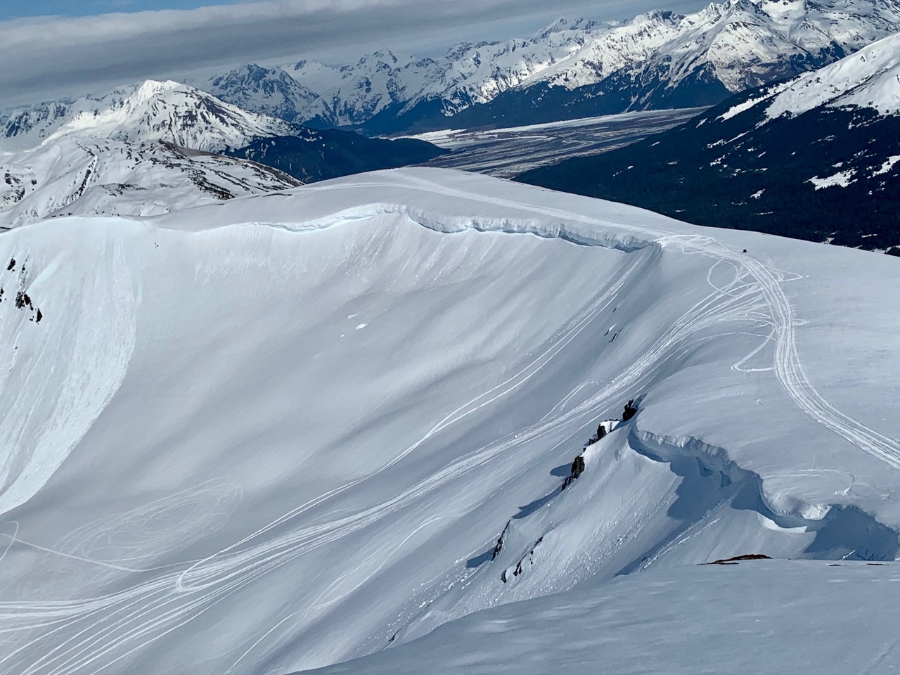
Cornices: Some slopes still have large cornices looming above them. Knowing exactly what will tip the scales is difficult. Some factors that contribute to cornice fall are direct sun, heat from rising temperatures, and new snow with wind. Give cornices a wide berth and take measures to minimize your exposure beneath them. Remember they have a tendency to break much further back than expected.

Cornices and wet loose activity in Warm-up Bowl. 4.17.20
Glide Avalanches: Glide cracks are appearing and we have had releases this week. Remember glide avalanches are very unpredictable, not triggered by humans and that they are the entire snowpack sliding to the ground. Avoid travel under glide cracks.

Glide avalanches and wet loose avalanches on Wolverine and Shark’s Fin. 4.17.20
Below are some ways to both anticipate and deal with the above mentioned avalanche concerns:
- Watch for the “shed cycle or complete melt-down” on the higher elevation slopes still holding snow. This happens when the dry snowpack transitions to wet. The snowpack becomes mushy, saturated and unsupportable. Wet avalanches often begin to release near the ground as; wet slabs, wet loose avalanches and glide avalanches. Anticipate this by keeping an eye on the ridgetop weather stations (click HERE). Avalanche activity often follows 3 or 4 consecutive nights of no re-freeze at the higher elevations. Rain can accelerate the avalanche cycle. Careful route planning to stay out from under slopes with wet and rotten snow is essential during this period.

‘Shed cycle’ is beginning, large wet loose avalanche on Seattle Ridge. 4.17.20

Very large wet slab avalanche in Crow Creek. 4.16.20
- Sinking into wet and rotten snow on skis or a snowmachine or over your boot tops is a sign that it’s time to exit the area. Following the aspects as the sun heats up the slopes over the course of the day, East to South then West, can make for great riding/skiing days, ending in sunny tailgating! High elevation North slopes may still have winter like conditions but may also become wet if the temperatures rise enough.
- Keep in mind, cloud cover ‘holds in the heat’ and can dramatically limit overnight refreezing. A shallow to no refreeze will not only give daytime heating a jump start on weakening the pack, but can produce less than stellar riding conditions.
- Beware of warm storms where rain is falling on snow, especially when rain is falling on cold dry snow. This can quickly increase the avalanche danger.
- Stay off of CORNICES. When approaching from the side or above, make sure you can see where the cornice ends and the underlying terrain begins. If you can’t see that transition area, move away from the edge. If you find you and your group below cornices, expose only one person at a time and move efficiently through those areas.
- As always wear avalanche rescue gear and practice safe travel protocols!
- Lastly, don’t forget to plan your route back to the car. Does it take you under slopes that were frozen and safe earlier in the day, but now have been cooking in the sun waiting to slide on your return? Under cornices?

How deep are you sinking into the snowpack? Pay close attention to overnight freezing, rising temperatures and changing surface conditions!

Until next season, be safe, stay healthy, and have a great summer! –Wendy, Aleph, Ryan and Graham