Turnagain Pass RSS

Archives
ARCHIVED - Forecasts expire after 24 hours.
Issued
Sat, April 13th, 2019 - 7:00AM
Expires
Sun, April 14th, 2019 - 7:00AM
Forecaster
Wendy Wagner
Avalanche risk The Bottom Line

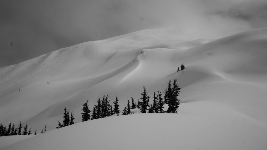
The avalanche danger will be CONSIDERABLE at the upper elevations today.  On northerly aspects, dry snow and winter conditions exist. Triggering a slab avalanche 1-3′ thick is possible and very cautious travel and snowpack evaluation is recommended.  On southerly aspects, sunny skies and daytime warming are expected to create natural wet loose avalanches in Thursday’s new snow and human triggered wet sluffs are likely. A MODERATE danger for wet loose avalanches exists in the mid elevations. Give cornices a wide berth as they have grown and limit/avoid travel under glide cracks.  

PORTAGE VALLEY:    Cornice fall and/or avalanches from above have the potential to send debris to valley bottoms and through snow-free zones. Travel along hiking trails, such as the Byron Glacier Trail with steep slopes overhead, is not recommended this afternoon/evening during the heat of the day.  

LOST LAKE / SEWARD:   Above treeline, watch for natural or human triggered wet/moist snow avalanches on steep southerly aspects and human triggered dry slab avalanches on northerly aspects. Heads up in this zone as well!

Special Announcements
  • Daily advisories will end tomorrow (Sunday Apr 14th). For the remainder of April, advisories will be posted 4 days/week (on Tues, Thur, Sat and Sun). The avalanche center will close for the season on Saturday, April 27th when we will post our springtime tips. Thank you everyone for tuning in!
  • Help us help you! Please join the US and Canada in a joint survey looking into how to better serve you €“ the users!! We want to hear from all backcountry recreationalists, especially those that are just beginning to use the avalanche forecast. The survey takes about 30 minutes. Keep in mind those minutes could make a huge difference in making changes to how avalanche danger is conveyed and ultimately save more lives.

    Survey link:  HERE.   (Participants will also be entered to win $500, so don’t delay!)

Sat, April 13th, 2019
Alpine
Above 2,500'
3 - Considerable
Avalanche risk
Treeline
1,000'-2,500'
2 - Moderate
Avalanche risk
Below Treeline
Below 1,000'
0 - No Rating
Avalanche risk
0 - No Rating
1 - Low
2 - Moderate
3 - Considerable
4 - High
5 - Extreme
Avalanche risk Avalanche risk Avalanche risk Avalanche risk Avalanche risk
Travel Advice Generally safe avalanche conditions. Watch for unstable snow on isolated terrain features. Heightened avalanche conditions on specific terrain features. Evaluate snow and terrain carefully; identify features of concern. Dangerous avalanche conditions. Careful snowpack evaluation, cautious route-finding, and conservative decision-making essential. Very dangerous avalanche conditions. Travel in avalanche terrain not recommended. Extraordinarily dangerous avalanche conditions. Avoid all avalanche terrain.
Likelihood of Avalanches Natural and human-triggered avalanches unlikely. Natural avalanches unlikely; human-triggered avalanches possible. Natural avalanches possible; human-triggered avalanches likely. Natural avalanches likely; human-triggered avalanches very likely. Natural and human-triggered avalanches certain.
Avalanche Size and Distribution Small avalanches in isolated areas or extreme terrain. Small avalanches in specific areas; or large avalanches in isolated areas. Small avalanches in many areas; or large avalanches in specific areas; or very large avalanches in isolated areas. Large avalanches in many areas; or very large avalanches in specific areas. Very large avalanches in many areas.
Avalanche Problem 1
  • Persistent Slabs
    Persistent Slabs
  • Certain
    Very Likely
    Likely
    Possible
    Unlikely
    Likelihood
  • Historic (D4-5)
    Very Large (D3)
    Large (D2)
    Small (D1)
    Size
Persistent Slabs
Persistent Slab avalanches are the release of a cohesive layer of snow (a slab) in the middle to upper snowpack, when the bond to an underlying persistent weak layer breaks. Persistent layers include: surface hoar, depth hoar, near-surface facets, or faceted snow. Persistent weak layers can continue to produce avalanches for days, weeks or even months, making them especially dangerous and tricky. As additional snow and wind events build a thicker slab on top of the persistent weak layer, this avalanche problem may develop into a Deep Persistent Slab.

Likelihood of Avalanches
Terms such as "unlikely", "likely", and "certain" are used to define the scale, with the chance of triggering or observing avalanches increasing as we move up the scale. For our purposes, "Unlikely" means that few avalanches could be triggered in avalanche terrain and natural avalanches are not expected. "Certain" means that humans will be able to trigger avalanches on many slopes, and natural avalanches are expected.

Size of Avalanches
Avalanche size is defined by the largest potential avalanche, or expected range of sizes related to the problem in question. Assigned size is a qualitative estimate based on the destructive classification system and requires specialists to estimate the harm avalanches may cause to hypothetical objects located in the avalanche track (AAA 2016, CAA 2014). Under this schema, "Small" avalanches are not large enough to bury humans and are relatively harmless unless they carry people over cliffs or through trees or rocks. Moving up the scale, avalanches become "Large" enough to bury, injure, or kill people. "Very Large" avalanches may bury or destroy vehicles or houses, and "Historic" avalanches are massive events capable of altering the landscape.

Signal Word Size (D scale) Simple Descriptor
Small 1 Unlikely to bury a person
Large 2 Can bury a person
Very Large 3 Can destroy a house
Historic 4 & 5 Can destroy part or all of a village
More info at Avalanche.org

Today is the first sunny day after a storm. That’s red flag #1. Sunny skies and daytime heating, red flag #2. The #3 red flag… a layer of weak faceted snow under the new snow on upper elevation northerly aspects. That said, there are a number of avalanche issues today. The good news is, many of them are easy to see and avoid. The one exception is the dry slab avalanche potential on high north aspects. It may be snow-free in the parking lots, but the mountains received between 1-2+’ of new snow with strong wind above 2,500′. For those seeking the dry powder, this is the most likely place to get into trouble. See the National Avalanche Center Director Karl Birkeland’s video below from Tincan yesterday. A winter mindset is crucial for those heading to upper elevation northerly aspects. 

What we can do is watch for recent slab avalanches and cracking or collapsing (whumpfing) in the snowpack; yet these obvious signs of instability are likely not to be present. Digging a pit, as Karl did, and testing the weak layer is a great way to assess the snowpack as long as your pit reflects the same aspect/elevation of the slope in question. But really, it’s tough to know how dangerous a slope is with this set up. It could be the 2nd or 12th person on it before it slides, or it may not slide at all. Sticking to lower angle terrain with nothing steep above is a good option. Waiting a couple days for the pack to adjust is another good option. It’s spring and we all want to end the season making it back to the parking lot. 

Cornice falls:  Cornices just got bigger and warming will help destabilize them further. Give them an extra wide berth and be careful not to mess with them if anyone is below.

Video link HERE.


Avalanche Problem 2
  • Wet Loose
    Wet Loose
  • Certain
    Very Likely
    Likely
    Possible
    Unlikely
    Likelihood
  • Historic (D4-5)
    Very Large (D3)
    Large (D2)
    Small (D1)
    Size
Wet Loose
Wet Loose avalanches are the release of wet unconsolidated snow or slush. These avalanches typically occur within layers of wet snow near the surface of the snowpack, but they may quickly gouge into lower snowpack layers. Like Loose Dry Avalanches, they start at a point and entrain snow as they move downhill, forming a fan-shaped avalanche. Other names for loose-wet avalanches include point-release avalanches or sluffs. Loose Wet avalanches can trigger slab avalanches that break into deeper snow layers.

Likelihood of Avalanches
Terms such as "unlikely", "likely", and "certain" are used to define the scale, with the chance of triggering or observing avalanches increasing as we move up the scale. For our purposes, "Unlikely" means that few avalanches could be triggered in avalanche terrain and natural avalanches are not expected. "Certain" means that humans will be able to trigger avalanches on many slopes, and natural avalanches are expected.

Size of Avalanches
Avalanche size is defined by the largest potential avalanche, or expected range of sizes related to the problem in question. Assigned size is a qualitative estimate based on the destructive classification system and requires specialists to estimate the harm avalanches may cause to hypothetical objects located in the avalanche track (AAA 2016, CAA 2014). Under this schema, "Small" avalanches are not large enough to bury humans and are relatively harmless unless they carry people over cliffs or through trees or rocks. Moving up the scale, avalanches become "Large" enough to bury, injure, or kill people. "Very Large" avalanches may bury or destroy vehicles or houses, and "Historic" avalanches are massive events capable of altering the landscape.

Signal Word Size (D scale) Simple Descriptor
Small 1 Unlikely to bury a person
Large 2 Can bury a person
Very Large 3 Can destroy a house
Historic 4 & 5 Can destroy part or all of a village
More info at Avalanche.org

New snow + Sunshine + light winds = wet loose sluffs on steep southerly facing slopes. 

As the day warms up, be extra cautious of steep sunny slopes. Both natural and human triggered wet sluffs composed of the new snow will be likely, especially at the upper elevations. Depending on the amount of new snow, these could be larger than expected and run to valley bottoms in places. Considering exit routes will be key, as we don’t want to be caught in the gun barrel at the wrong time of day. Roughly 10″ of new moist snow was reported near treeline (~2,000′) on Tincan yesterday and a small dose of afternoon heating induced a few roller balls and small sluffs; we are expecting a larger shock from the sun today.

If you’re wondering how the snow surface is, APU Snow Science students reported mid elevations to be “grabby cream cheese”, while lower elevations were “wet corn-like conditions”.


Mini wet loose sluffs that were skier triggered on the steeper portions of Tincan’s Common Bowl. 


Roller balls along CFR ridge on Tincan yesterday afternoon (Photo: APU Snow Science course).


Enough snow accumulated to create new wind patterns along the snow surface (Tincan near Treeline).


Seattle Ridge up-track, new wet snow will a few roller balls triggered by the sun yesterday afternoon.

Additional Concern
  • Glide Avalanches
    Glide Avalanches
Glide Avalanches
Glide Avalanches are the release of the entire snow cover as a result of gliding over the ground. Glide avalanches can be composed of wet, moist, or almost entirely dry snow. They typically occur in very specific paths, where the slope is steep enough and the ground surface is relatively smooth. They are often proceeded by full depth cracks (glide cracks), though the time between the appearance of a crack and an avalanche can vary between seconds and months. Glide avalanches are unlikely to be triggered by a person, are nearly impossible to forecast, and thus pose a hazard that is extremely difficult to manage.
More info at Avalanche.org

Glide cracks are likely to be somewhat obscured as the new snow has been filling them in. However, if you do see a crack it is likely moving and a sign to avoid traveling under it. It has been several days now since we know of any cracks that have released into avalanches, but that’s not to say one could pop out today and catch someone in the wrong place at the wrong time. Keep your eyes out!

Weather
Sat, April 13th, 2019

Yesterday:   Cloudy skies becoming partly cloudy over the area as a frontal system moved out midday. Light precipitation was seen before noon adding 1-2″ of snow above 2,000′ in Girdwood Valley and around 1″ at the higher elevations at Turnagain. Ridgetop winds were easterly averaging in the 5-15mph range with gusts into the 20’s. Temperatures were in the mid 20’sF along ridgelines and 30’sF at 1,000′.

Today:   Mostly sunny skies are expected over the region. Ridgetop winds should be light (~5mph) and from the east. Temperatures have cooled to 30F at most elevations below 2,500′ and should climb into the mid 30’s to 40F by the afternoon. Above 2,500′, temperatures should climb to near 30F.  

Tomorrow:   Another sunny day is on tap for Sunday as well as Monday and Tuesday. Each day looks to get progressively warmer despite cool nights with freezing temperatures. Hints of another system moving through are showing for Wednesday/Thursday.  

*Seattle Ridge wind sensor was rimed over yesterday morning and data only exists from 1pm till 6am.

PRECIPITATION 24-hour data (6am – 6am)

  Temp Avg (F) Snow (in) Water (in) Snow Depth (in)
Center Ridge (1880′) 34   trace   0.1   65  
Summit Lake (1400′) 35   0   0.1   18  
Alyeska Mid (1700′) 34   1   0.2   59  

RIDGETOP 24-hour data (6am – 6am)

  Temp Avg (F) Wind Dir Wind Avg (mph) Wind Gust (mph)
Sunburst (3812′) 24   NE   9   25  
Seattle Ridge (2400′) 30   SE   8*   18*  
Observations
Recent Observations for Turnagain Pass
Date Region Location
03/27/24 Turnagain Observation: Tincan Trees
03/26/24 Turnagain Observation: Cornbiscuit
03/25/24 Turnagain Observation: Tincan
03/22/24 Turnagain Avalanche: Magnum Northwest Aspect
03/21/24 Turnagain Observation: Sunburst
03/21/24 Turnagain Observation: Tincan Proper North Aspect
03/20/24 Turnagain Avalanche: Seattle Creek Drainage
03/19/24 Turnagain Observation: Tincan CFR
03/18/24 Turnagain Avalanche: Tincan – Eddies – Seattle Ridge
03/18/24 Turnagain Observation: Tincan
Riding Areas

The riding areas page has moved. Please click here & update your bookmarks.


Subscribe to Turnagain Pass
Avalanche Forecast by Email

This is a general backcountry avalanche advisory issued for Turnagain Arm with Turnagain Pass as the core advisory area. This advisory does not apply to highways, railroads or operating ski areas.