Turnagain Pass RSS

Archives
ARCHIVED - Forecasts expire after 24 hours.
Issued
Thu, March 19th, 2020 - 7:00AM
Expires
Fri, March 20th, 2020 - 7:00AM
Forecaster
Aleph Johnston-Bloom
Avalanche risk The Bottom Line

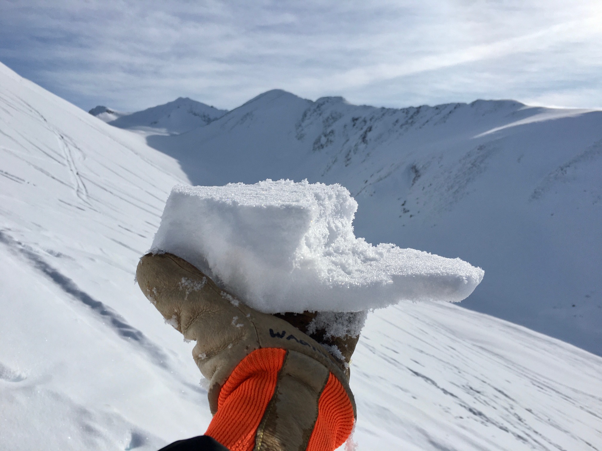
Today the avalanche danger is MODERATE.  Human triggered wet loose avalanches will be possible if sun crusts deteriorate on solar aspects, especially in steep rocky areas. Triggering a dry loose avalanche is possible on protected shaded aspects. As always give cornices and glide cracks a wide berth. Pay attention to changing surface conditions. There is a chance that wet loose avalanches will release naturally in the afternoon on steep sunny slopes.

SUMMIT LAKE to SEWARD: Extra caution is advised. In much of this terrain the overall snowpack is thinner and triggering a large slab avalanche is possible due to a weaker snowpack.

Special Announcements

If you are heading out in the mountains please let us know what you are seeing. The CNFAIC will continue to produce daily avalanche forecasts, under current guidance from the USDA, and so long as the health of our small staff remains intact. Our field operations are being impacted, so your information is invaluable. Even if all you have to report is that you did not see any avalanches or that you did not see any signs of instability, please take the time to send that important info! And of course, you can always choose to remain anonymous. Submit an observation on our observation page or send an email to staff@chugachavalanche.org. Play safe and stay healthy.

Thu, March 19th, 2020
Alpine
Above 2,500'
2 - Moderate
Avalanche risk
Treeline
1,000'-2,500'
2 - Moderate
Avalanche risk
Below Treeline
Below 1,000'
2 - Moderate
Avalanche risk
0 - No Rating
1 - Low
2 - Moderate
3 - Considerable
4 - High
5 - Extreme
Avalanche risk Avalanche risk Avalanche risk Avalanche risk Avalanche risk
Travel Advice Generally safe avalanche conditions. Watch for unstable snow on isolated terrain features. Heightened avalanche conditions on specific terrain features. Evaluate snow and terrain carefully; identify features of concern. Dangerous avalanche conditions. Careful snowpack evaluation, cautious route-finding, and conservative decision-making essential. Very dangerous avalanche conditions. Travel in avalanche terrain not recommended. Extraordinarily dangerous avalanche conditions. Avoid all avalanche terrain.
Likelihood of Avalanches Natural and human-triggered avalanches unlikely. Natural avalanches unlikely; human-triggered avalanches possible. Natural avalanches possible; human-triggered avalanches likely. Natural avalanches likely; human-triggered avalanches very likely. Natural and human-triggered avalanches certain.
Avalanche Size and Distribution Small avalanches in isolated areas or extreme terrain. Small avalanches in specific areas; or large avalanches in isolated areas. Small avalanches in many areas; or large avalanches in specific areas; or very large avalanches in isolated areas. Large avalanches in many areas; or very large avalanches in specific areas. Very large avalanches in many areas.
Avalanche Problem 1
  • Wet Loose
    Wet Loose
  • Certain
    Very Likely
    Likely
    Possible
    Unlikely
    Likelihood
  • Historic (D4-5)
    Very Large (D3)
    Large (D2)
    Small (D1)
    Size
Wet Loose
Wet Loose avalanches are the release of wet unconsolidated snow or slush. These avalanches typically occur within layers of wet snow near the surface of the snowpack, but they may quickly gouge into lower snowpack layers. Like Loose Dry Avalanches, they start at a point and entrain snow as they move downhill, forming a fan-shaped avalanche. Other names for loose-wet avalanches include point-release avalanches or sluffs. Loose Wet avalanches can trigger slab avalanches that break into deeper snow layers.

Likelihood of Avalanches
Terms such as "unlikely", "likely", and "certain" are used to define the scale, with the chance of triggering or observing avalanches increasing as we move up the scale. For our purposes, "Unlikely" means that few avalanches could be triggered in avalanche terrain and natural avalanches are not expected. "Certain" means that humans will be able to trigger avalanches on many slopes, and natural avalanches are expected.

Size of Avalanches
Avalanche size is defined by the largest potential avalanche, or expected range of sizes related to the problem in question. Assigned size is a qualitative estimate based on the destructive classification system and requires specialists to estimate the harm avalanches may cause to hypothetical objects located in the avalanche track (AAA 2016, CAA 2014). Under this schema, "Small" avalanches are not large enough to bury humans and are relatively harmless unless they carry people over cliffs or through trees or rocks. Moving up the scale, avalanches become "Large" enough to bury, injure, or kill people. "Very Large" avalanches may bury or destroy vehicles or houses, and "Historic" avalanches are massive events capable of altering the landscape.

Signal Word Size (D scale) Simple Descriptor
Small 1 Unlikely to bury a person
Large 2 Can bury a person
Very Large 3 Can destroy a house
Historic 4 & 5 Can destroy part or all of a village
More info at Avalanche.org

Temperatures in the Alpine have been above freezing (32°F) for a few hours already and today is forecast to be the one of warmest days we have seen in the forecast area. However, sky cover and the timing of an approaching front will also be factors in today’s avalanche issues. It could cloud up, be windy and cool off faster than expected. If stays warm enough and sunny enough and the sun crust that has formed on steep solar aspects softens up, human triggered wet loose avalanches will be a concern. Pay attention to surface conditions and what type of terrain is above you. Steep rocky areas are likely starting zones for wet loose avalanches. If the surface of the snow is warming, you start to see small roller balls and/or small natural loose snow avalanches it’s time to switch to a shadier slope. Wet loose snow avalanches are notorious for being ‘heavier’ and larger than expected and can easily knock someone off their feet or machine and plow down to the valley bottom. These wet loose avalanches also have the potential to trigger slab avalanches, especially in areas with a shallow snowpack.

New snow on a sun crust at 2,500′. Snow was warming and sticking to crust yesterday, 3.18.20. If the crust deteriorates today, wet loose avalanches will become an issue. 

Wind slabs:  Look for small wind slabs in steep leeward terrain that may have formed yesterday with the northwest winds.

Loose dry snow avalanches:  Triggering sluffs on steep shaded, wind protected slopes is possible.

Cornices: Give cornices a wide berth and limit your time traveling underneath them.

Glide cracks: Avoid travel below glide cracks. Remember these are totally unpredictable and could release at any time.

Avalanche Problem 2
  • Persistent Slabs
    Persistent Slabs
  • Certain
    Very Likely
    Likely
    Possible
    Unlikely
    Likelihood
  • Historic (D4-5)
    Very Large (D3)
    Large (D2)
    Small (D1)
    Size
Persistent Slabs
Persistent Slab avalanches are the release of a cohesive layer of snow (a slab) in the middle to upper snowpack, when the bond to an underlying persistent weak layer breaks. Persistent layers include: surface hoar, depth hoar, near-surface facets, or faceted snow. Persistent weak layers can continue to produce avalanches for days, weeks or even months, making them especially dangerous and tricky. As additional snow and wind events build a thicker slab on top of the persistent weak layer, this avalanche problem may develop into a Deep Persistent Slab.

Likelihood of Avalanches
Terms such as "unlikely", "likely", and "certain" are used to define the scale, with the chance of triggering or observing avalanches increasing as we move up the scale. For our purposes, "Unlikely" means that few avalanches could be triggered in avalanche terrain and natural avalanches are not expected. "Certain" means that humans will be able to trigger avalanches on many slopes, and natural avalanches are expected.

Size of Avalanches
Avalanche size is defined by the largest potential avalanche, or expected range of sizes related to the problem in question. Assigned size is a qualitative estimate based on the destructive classification system and requires specialists to estimate the harm avalanches may cause to hypothetical objects located in the avalanche track (AAA 2016, CAA 2014). Under this schema, "Small" avalanches are not large enough to bury humans and are relatively harmless unless they carry people over cliffs or through trees or rocks. Moving up the scale, avalanches become "Large" enough to bury, injure, or kill people. "Very Large" avalanches may bury or destroy vehicles or houses, and "Historic" avalanches are massive events capable of altering the landscape.

Signal Word Size (D scale) Simple Descriptor
Small 1 Unlikely to bury a person
Large 2 Can bury a person
Very Large 3 Can destroy a house
Historic 4 & 5 Can destroy part or all of a village
More info at Avalanche.org

In areas with a thinner snowpack, including Crow Pass, the southern edge of the forecast zone and Summit lake, weak snow (both surface hoar and facets) is buried 1-2′ below the surface. Facets are the suspected weak layer in the large skier triggered avalanche that occurred Monday in West Groundhog Creek. This setup continues to be a concern for these peripheral areas and extra caution is advised for triggering a large slab avalanche.

Video link HERE.

Weather
Thu, March 19th, 2020

Yesterday: Skies were partly cloudy with valley fog in some areas. Temperatures were in the 20°Fs to mid 30°Fs. Winds were westerly 5-15 mph with gusts into the 20s. Mid morning AKRR MP 43 weather station had a couple hours of northwest winds averaging in the 20s and 30s with gusts as high as 60 mph. Winds were calm overnight. Skies were partly cloudy overnight with valley fog. Temperatures were in the mid 20°Fs to mid 30°Fs overnight with a slight inversion in place.

Today: Skies will be partly sunny with valley fog in the morning. There is chance of rain/snow showers in the late afternoon. With the inversion still in place, temperatures are already above freezing in the Alpine and are in the 20°Fs at sea level. Temperatures are forecast to be in the mid 30°Fs to low 40°Fs during the day from sea level to the upper elevations before starting to cool in the evening. Winds will be easterly 5-15 mph with gusts into the 20s. Snow showers are in the forecast overnight with temperatures in the 20°Fs. Skies should clear off early Friday morning.

Tomorrow: Mostly sunny skies with temperatures in the 20°Fs to mid 30°Fs and light west winds. Clouds build overnight with snow in the forecast for Saturday.

PRECIPITATION 24-hour data (6am – 6am)

Temp Avg (F) Snow (in) Water (in) Snow Depth (in)
Center Ridge (1880′) 28 0 0 66
Summit Lake (1400′) 27 0 0 31
Alyeska Mid (1700′) 26 0 0 76

RIDGETOP 24-hour data (6am – 6am)

Temp Avg (F) Wind Dir Wind Avg (mph) Wind Gust (mph)
Sunburst (3812′) 24 W 7 17
Seattle Ridge (2400′) 24 VAR 3 11
Observations
Recent Observations for Turnagain Pass
Date Region Location
03/28/24 Turnagain Observation: Sunburst
03/27/24 Turnagain Observation: Tincan Trees
03/26/24 Turnagain Observation: Cornbiscuit
03/25/24 Turnagain Observation: Tincan
03/22/24 Turnagain Avalanche: Magnum Northwest Aspect
03/21/24 Turnagain Observation: Sunburst
03/21/24 Turnagain Observation: Tincan Proper North Aspect
03/20/24 Turnagain Avalanche: Seattle Creek Drainage
03/19/24 Turnagain Observation: Tincan CFR
03/18/24 Turnagain Avalanche: Tincan – Eddies – Seattle Ridge
Riding Areas

The riding areas page has moved. Please click here & update your bookmarks.


Subscribe to Turnagain Pass
Avalanche Forecast by Email

This is a general backcountry avalanche advisory issued for Turnagain Arm with Turnagain Pass as the core advisory area. This advisory does not apply to highways, railroads or operating ski areas.