Turnagain Pass |
Archives |
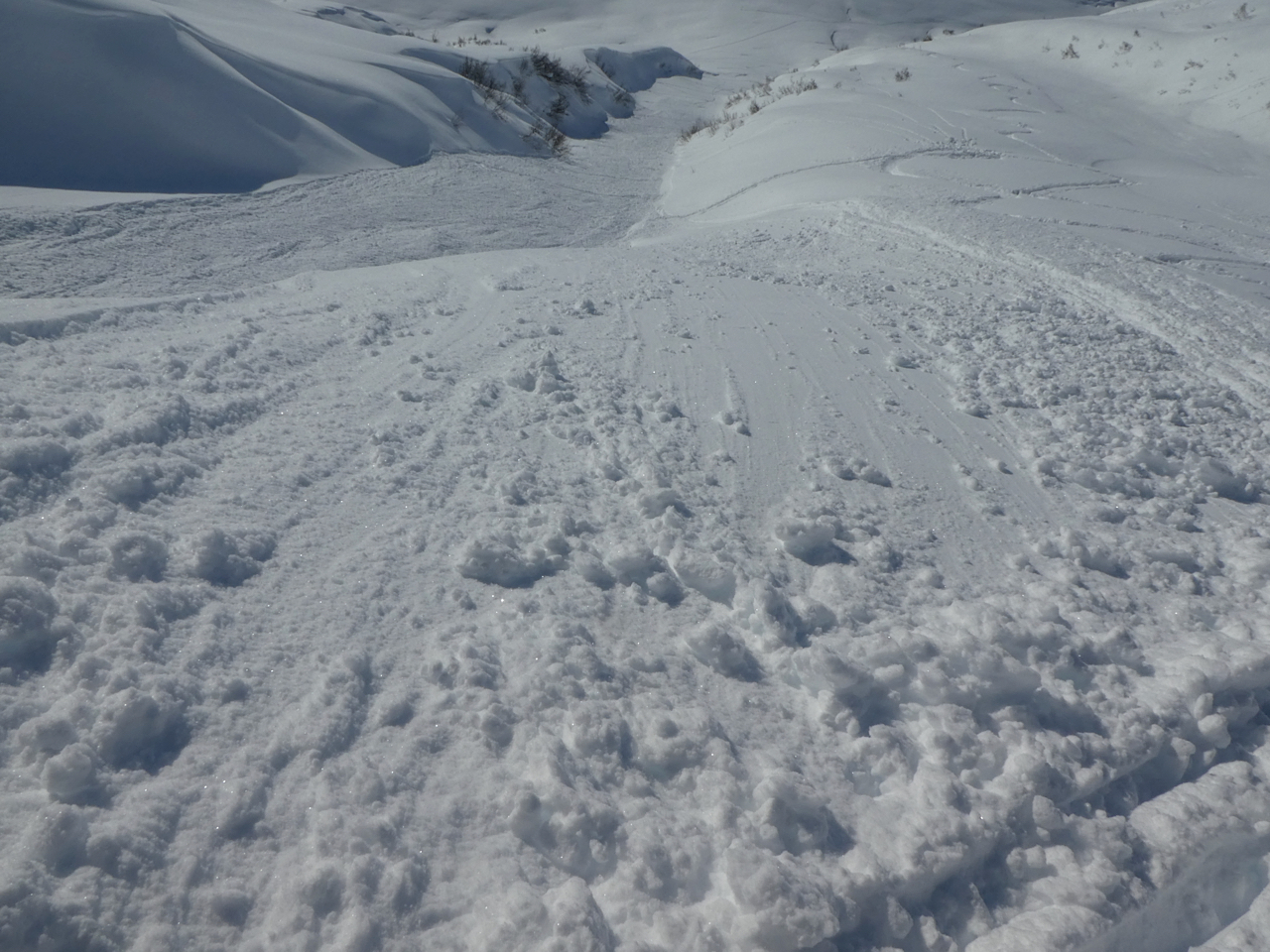
The avalanche danger will be CONSIDERABLE at all elevations as a storm passes through our area today. Strong winds and periods of heavy snow will make human triggered avalanches 1-2′ deep likely, with natural activity possible. This storm will add stress to weak layers buried in the upper snowpack, making it possible that we will see larger avalanches failing 2-4′ deep. Be aware of increasing danger through the day, and use extra caution traveling on or below steep terrain.
PORTAGE/PLACER VALLEYS: These areas continue to see much heavier precipitation than the rest of the advisory area, and that will once again be the case today. With up to another foot of snow and strong winds in these zones, we are headed closer to HIGH danger for Portage and Placer. Travel in avalanche terrain is not recommended today.
SUMMIT LAKE: The Summit Lake area will see strong easterly winds today, which will load a weak snowpack that is likely to produce avalanches. Use extra caution if you plan to get out in this area today.
Join us TONIGHT for Snowball! Dance to lively music by the Jangle Bees, bid on the silent auction, and enjoy 49th State Brewing libations and decadent desserts. Bring your sweetie or your best backcountry partners—or find new ones on the dance floor. All proceeds from this event benefit the Friends of the Chugach Avalanche Center and the Alaska Avalanche School, so you can let loose knowing it’s for a great cause! Tickets are limited, so get yours soon. Click here for tickets and more information.
Travel Advice | Generally safe avalanche conditions. Watch for unstable snow on isolated terrain features. | Heightened avalanche conditions on specific terrain features. Evaluate snow and terrain carefully; identify features of concern. | Dangerous avalanche conditions. Careful snowpack evaluation, cautious route-finding, and conservative decision-making essential. | Very dangerous avalanche conditions. Travel in avalanche terrain not recommended. | Extraordinarily dangerous avalanche conditions. Avoid all avalanche terrain. |
Likelihood of Avalanches | Natural and human-triggered avalanches unlikely. | Natural avalanches unlikely; human-triggered avalanches possible. | Natural avalanches possible; human-triggered avalanches likely. | Natural avalanches likely; human-triggered avalanches very likely. | Natural and human-triggered avalanches certain. |
Avalanche Size and Distribution | Small avalanches in isolated areas or extreme terrain. | Small avalanches in specific areas; or large avalanches in isolated areas. | Small avalanches in many areas; or large avalanches in specific areas; or very large avalanches in isolated areas. | Large avalanches in many areas; or very large avalanches in specific areas. | Very large avalanches in many areas. |
Skiers reported high volume dry loose avalanches getting big enough to bury a person on the Library yesterday. The last known slab avalanche in our advisory area was a large skier-triggered avalanche on Eddie’s on Saturday.
Dry Loose debris piled up deep enough to bury a person in the Library yesterday. Photo: Adrian Beebee. 02.13.2023
Signal Word | Size (D scale) | Simple Descriptor |
Small | 1 | Unlikely to bury a person |
Large | 2 | Can bury a person |
Very Large | 3 | Can destroy a house |
Historic | 4 & 5 | Can destroy part or all of a village |
Active weather returns to the area today and avalanche danger is on the rise. We should see 2-4″ snow in Girdwood, 3-6″ at Turnagain Pass, and 6-12+” in Portage and Placer. Unfortunately the bigger factor will be the strong easterly winds, with sustained speeds of 20-40 mph and gusts of 40-50 mph today into tonight. There is plenty of soft snow already on the ground waiting to be blown into touchy wind slabs, and it is likely a person will be able to trigger an avalanche 1-2′ deep or deeper as the wind continues to go to work today.
Expect to find the most dangerous conditions just below ridgelines, in steep gullies, and on convex rolls. With winds this strong natural activity is certainly not out of the question, and for this Valentine’s Day we may be flirting with high danger as active weather continues through the day. Expect more dangerous conditions in the areas seeing the most intense precipitation along with these strong winds (i.e. Portage and Placer valleys). Safe travel today will require extra caution, avoiding traveling on or below steep avalanche terrain. In addition to the avalanche problems related to the new and windblown snow, we are also dealing with some questionable layers buried a few feet below the surface which may produce larger avalanches today. More on this in Problem 2 below.
Cornices: As strong winds continue through today, cornices are becoming larger and are more likely to fail naturally. Give them plenty of space if you are traveling along ridgelines, and limit time spent below them.
Dry Loose Avalanches (Sluffs): Yesterday skiers reported high-volume sluffs in steep terrain in the Library. For steep slopes sheltered from the winds, we can expect to see similar activity today. These are especially concerning in terrain with high-consequence features like cliffs, rocks, trees, or gullies.
There is plenty of soft snow sitting on the ground waiting to be blown into sensitive wind slabs today. Photo: Adrian Beebee, 02.13.2023.
Signal Word | Size (D scale) | Simple Descriptor |
Small | 1 | Unlikely to bury a person |
Large | 2 | Can bury a person |
Very Large | 3 | Can destroy a house |
Historic | 4 & 5 | Can destroy part or all of a village |
In addition to the new snow issues mentioned in Problem 1 above, we are also dealing with some potentially problematic layers buried 2-4′ deep. The interface between last week’s storm snow and the older snow surface has produced the most recent avalanche activity (a skier-triggered avalanche on Eddie’s last Saturday). That storm buried a layer of low-density snow sitting on a crust up to about 2000′, and there may be some spotty surface hoar at that interface in some areas. There is still some uncertainty with this layer while we try to get an idea of how reactive it still is. With an intense loading event underway, this layer will be seeing more stress and will be a little more likely to produce avalanches. In addition to that 2/5 interface, we are still keeping the 1/10 buried surface hoar layer on the radar. This layer is becoming less and less likely to make avalanches, but again, with active loading today it should be treated with a little extra caution.
For areas with a thinner snowpack (Silvertip, Summit), the weak layers near the bottom of the snowpack are still a factor in our terrain choices. This includes the weak snow around the Thanksgiving crust, as well as faceted snow at the bottom of the snowpack. Luckily these layers do not seem to be a factor in our core advisory area, but they are still a concern around the periphery.
Yesterday: Skies were mostly sunny until mid-afternoon when the clouds moved back in. Winds were light out of the west at 5-10 mph until late last night when they picked up out of the east. For the past 8 hours or so winds have been blowing 10-20 mph with gusts of 25-45 mph. We’ve picked up a trace of precipitation, with 0.2” in Portage and snow to sea level.
Today: A system is moving through the area today, bringing snow showers and strong easterly winds. We should see 2-4” snow in Girdwood, 3-6” at Turnagain Pass, and 6-12” in Portage and Placer and snow to sea level. Winds will be at 20-40 mph with gusts of 30-50 mph out of the east. High temperatures should be in the low to mid 20’s F, with overnight lows dropping down the mid teens to low 20’s F. Skies should be mostly cloudy with an occasional hole in the clouds.
Tomorrow: We could see a couple more inches of snow tonight before the storm passes. Winds are expected to die down overnight, with light westerly winds expected tomorrow. Skies should be partly to mostly sunny with a good chance for lingering low-level clouds through the day. High temperatures should be in the low to mid 20’s F, with lows dropping into the low to mid teens.
PRECIPITATION 24-hour data (6am – 6am)
Temp Avg (F) | Snow (in) | Water (in) | Snow Depth (in) | |
---|---|---|---|---|
Center Ridge (1880′) | 15 | 0 | 0 | 69 |
Summit Lake (1400′) | 10 | 0 | 0 | 37 |
Alyeska Mid (1700′) | 16 | 2 | 0.15 | 71 |
Bear Valley – Portage (132′) | 23 | 3 | 0.28 | – |
RIDGETOP 24-hour data (6am – 6am)
Temp Avg (F) | Wind Dir | Wind Avg (mph) | Wind Gust (mph) | |
---|---|---|---|---|
Sunburst (3812′) | 7 | ENE | 7 | 34 |
Seattle Ridge (2400′) | 9 | NW-SE* | 4 | 21 |
*Westerly winds shifted directions yesterday evening.
Date | Region | Location | Observer |
---|---|---|---|
10/27/24 | Turnagain | Observation: Tincan | Michael Kerst |
10/21/24 | Turnagain | Observation: Turnagain Pass Road Observation | Trevor Clayton |
10/19/24 | Turnagain | Observation: Tincan – Below Todds Run | Andy Moderow |
10/18/24 | Turnagain | Observation: Taylor Pass | Eli Neuffer |
10/15/24 | Turnagain | Observation: Tincan Common | John Sykes Forecaster |
10/14/24 | Turnagain | Avalanche: Tincan | CNFAC Staff |
05/13/24 | Turnagain | Observation: Eddie’s, Sunburst, Seattle, Cornbiscuit, Pete’s South | H Thamm |
05/13/24 | Turnagain | Observation: Turnagain Pass non-motorized side | Amy Holman |
05/12/24 | Turnagain | Observation: Warm up Bowl | Tony Naciuk |
05/07/24 | Turnagain | Observation: Turnagain Pass Wet Slabs | A S |
The riding areas page has moved. Please click here & update your bookmarks.
Subscribe to Turnagain Pass
Avalanche Forecast by Email