Turnagain Pass RSS

Archives
ARCHIVED - Forecasts expire after 24 hours.
Issued
Sun, February 9th, 2020 - 7:00AM
Expires
Mon, February 10th, 2020 - 7:00AM
Forecaster
Ryan Van Luit
Avalanche risk The Bottom Line

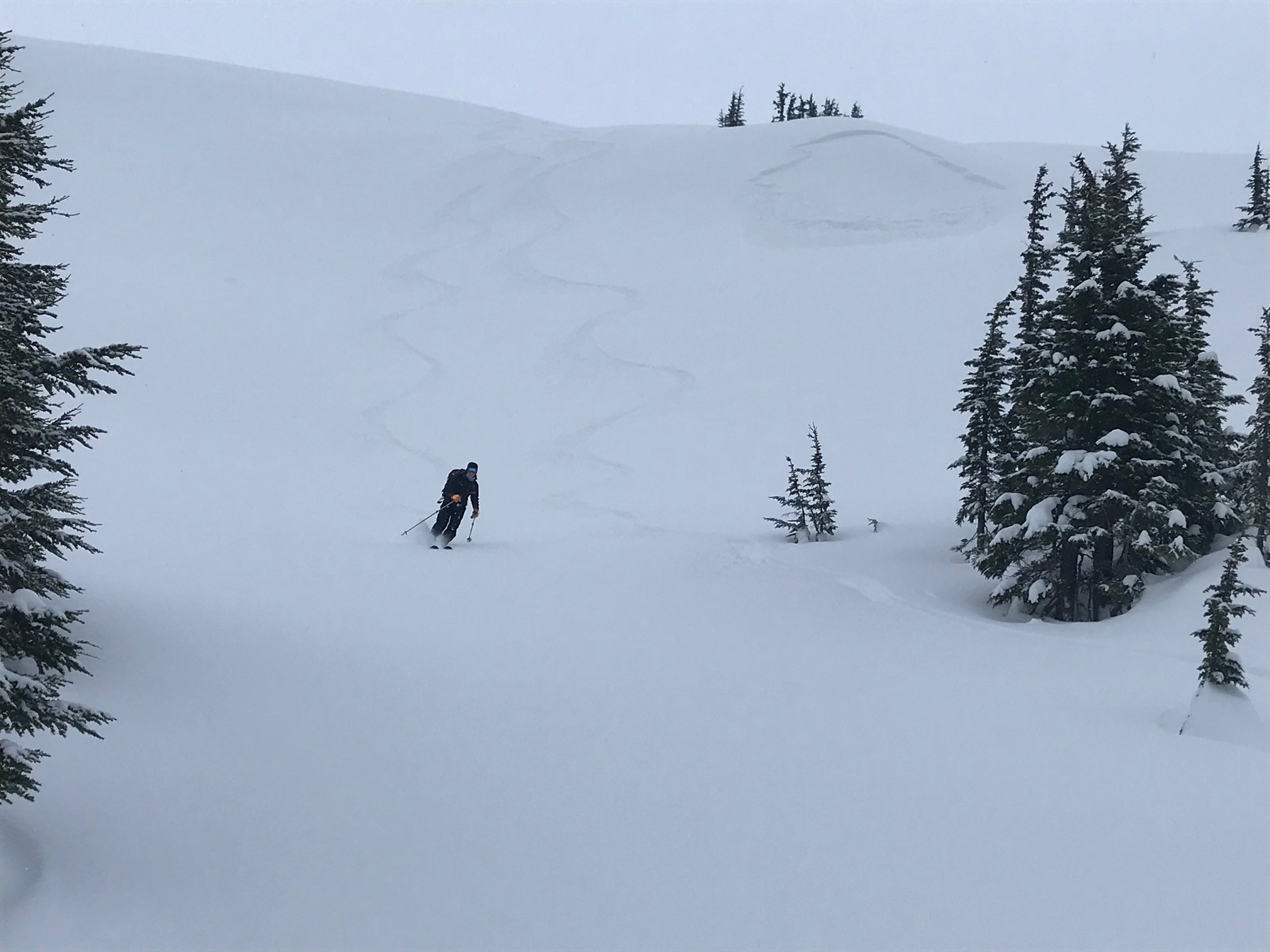
The avalanche danger is CONSIDERABLE above 1,000′. Triggering a large and dangerous slab avalanche 2-3′ thick remains likely and could be triggered remotely. Additionally, it’s still possible for a person to trigger a wind slab near ridges and gullies.  Cautious route-finding and conservative decision making are essential today.

Special Announcements

Do you have your Snowball ticket??? For the Love of Snow, Let’s Dance! Valentine’s Day – February 14, 2020. 7-11 pm at 49th State Brewing Co. in Anchorage. I Like Robots will be rockin’ our favorite 80’s tunes! Awesome silent auction and costume contest, so break out your best 80’s fashion and snow gear! $35 tickets on sale at www.AlaskaAvalanche.org/events/snowball. Bring your sweethearts, bring your buddies, or find new ones on the dance floor… Proceeds support Friends of the Chugach Avalanche Center and the Alaska Avalanche School.

Sun, February 9th, 2020
Alpine
Above 2,500'
3 - Considerable
Avalanche risk
Treeline
1,000'-2,500'
3 - Considerable
Avalanche risk
Below Treeline
Below 1,000'
2 - Moderate
Avalanche risk
0 - No Rating
1 - Low
2 - Moderate
3 - Considerable
4 - High
5 - Extreme
Avalanche risk Avalanche risk Avalanche risk Avalanche risk Avalanche risk
Travel Advice Generally safe avalanche conditions. Watch for unstable snow on isolated terrain features. Heightened avalanche conditions on specific terrain features. Evaluate snow and terrain carefully; identify features of concern. Dangerous avalanche conditions. Careful snowpack evaluation, cautious route-finding, and conservative decision-making essential. Very dangerous avalanche conditions. Travel in avalanche terrain not recommended. Extraordinarily dangerous avalanche conditions. Avoid all avalanche terrain.
Likelihood of Avalanches Natural and human-triggered avalanches unlikely. Natural avalanches unlikely; human-triggered avalanches possible. Natural avalanches possible; human-triggered avalanches likely. Natural avalanches likely; human-triggered avalanches very likely. Natural and human-triggered avalanches certain.
Avalanche Size and Distribution Small avalanches in isolated areas or extreme terrain. Small avalanches in specific areas; or large avalanches in isolated areas. Small avalanches in many areas; or large avalanches in specific areas; or very large avalanches in isolated areas. Large avalanches in many areas; or very large avalanches in specific areas. Very large avalanches in many areas.
Recent Avalanches

Observers remotely triggered a small soft slab yesterday at 2000′ on a northwest aspect of Eddies.  The avalanche was estimated at 30′ wide and ran 40′ vertical.  The slope angle was 38 degrees and the thickest part of the crown was 12″.

Investigating the small remotely triggered soft slab avalanche on Eddies.  Notice how soft the bed surface is, indicated by the trail breaking on approach to the crown.  2.8.2020 . Photo: H. Thamm

Above is a small remotely triggered soft slab avalanche at 2000′ on a northwest aspect of Eddies.  The skiers were on a 32 degree slope when the avalanche was remotely triggered. The steepest part of the avalanche bed surface was 38 degrees.   2.8.2020 . Photo:  CNFAIC Archive

Avalanche Problem 1
  • Persistent Slabs
    Persistent Slabs
  • Certain
    Very Likely
    Likely
    Possible
    Unlikely
    Likelihood
  • Historic (D4-5)
    Very Large (D3)
    Large (D2)
    Small (D1)
    Size
Persistent Slabs
Persistent Slab avalanches are the release of a cohesive layer of snow (a slab) in the middle to upper snowpack, when the bond to an underlying persistent weak layer breaks. Persistent layers include: surface hoar, depth hoar, near-surface facets, or faceted snow. Persistent weak layers can continue to produce avalanches for days, weeks or even months, making them especially dangerous and tricky. As additional snow and wind events build a thicker slab on top of the persistent weak layer, this avalanche problem may develop into a Deep Persistent Slab.

Likelihood of Avalanches
Terms such as "unlikely", "likely", and "certain" are used to define the scale, with the chance of triggering or observing avalanches increasing as we move up the scale. For our purposes, "Unlikely" means that few avalanches could be triggered in avalanche terrain and natural avalanches are not expected. "Certain" means that humans will be able to trigger avalanches on many slopes, and natural avalanches are expected.

Size of Avalanches
Avalanche size is defined by the largest potential avalanche, or expected range of sizes related to the problem in question. Assigned size is a qualitative estimate based on the destructive classification system and requires specialists to estimate the harm avalanches may cause to hypothetical objects located in the avalanche track (AAA 2016, CAA 2014). Under this schema, "Small" avalanches are not large enough to bury humans and are relatively harmless unless they carry people over cliffs or through trees or rocks. Moving up the scale, avalanches become "Large" enough to bury, injure, or kill people. "Very Large" avalanches may bury or destroy vehicles or houses, and "Historic" avalanches are massive events capable of altering the landscape.

Signal Word Size (D scale) Simple Descriptor
Small 1 Unlikely to bury a person
Large 2 Can bury a person
Very Large 3 Can destroy a house
Historic 4 & 5 Can destroy part or all of a village
More info at Avalanche.org

Winds have calmed down overnight and full cloud cover will likely make way for some sunny periods today.  The forecast area accumulated of 4-6″ of snow in the last 24 hours.  Temperatures are forecast to reach into the upper 20’s F and winds will remain calm.  It’s likely going to be another beautiful day to be out.

Right now, the “formula” for large avalanches exists throughout the advisory area.  The snowpack consists of a distinct slab over widespread weak layers 2-3′ below the surface.  It’s likely a person could trigger one of these avalanches, especially on or near steeper terrain.  If triggered, the resulting avalanche could be large and run long distances.  The chances to trigger these large persistent slab avalanches increase as you reach into, or near, terrain with slope angles above 30 degrees.  Cautious travel advice suggests to remain away from the runout of steep slopes, and avoid traveling on or near steeper slopes.

This image shows common testpit results throughout the area.  Difficult to trigger, but the dense slab propagates and fails on a planar bed surface.  2.8.2020 . Photo:  CNFAIC Archive


Avalanche Problem 2
  • Wind Slabs
    Wind Slabs
  • Certain
    Very Likely
    Likely
    Possible
    Unlikely
    Likelihood
  • Historic (D4-5)
    Very Large (D3)
    Large (D2)
    Small (D1)
    Size
Wind Slabs
Wind Slab avalanches are the release of a cohesive layer of snow (a slab) formed by the wind. Wind typically transports snow from the upwind sides of terrain features and deposits snow on the downwind side. Wind slabs are often smooth and rounded and sometimes sound hollow, and can range from soft to hard. Wind slabs that form over a persistent weak layer (surface hoar, depth hoar, or near-surface facets) may be termed Persistent Slabs or may develop into Persistent Slabs.

Likelihood of Avalanches
Terms such as "unlikely", "likely", and "certain" are used to define the scale, with the chance of triggering or observing avalanches increasing as we move up the scale. For our purposes, "Unlikely" means that few avalanches could be triggered in avalanche terrain and natural avalanches are not expected. "Certain" means that humans will be able to trigger avalanches on many slopes, and natural avalanches are expected.

Size of Avalanches
Avalanche size is defined by the largest potential avalanche, or expected range of sizes related to the problem in question. Assigned size is a qualitative estimate based on the destructive classification system and requires specialists to estimate the harm avalanches may cause to hypothetical objects located in the avalanche track (AAA 2016, CAA 2014). Under this schema, "Small" avalanches are not large enough to bury humans and are relatively harmless unless they carry people over cliffs or through trees or rocks. Moving up the scale, avalanches become "Large" enough to bury, injure, or kill people. "Very Large" avalanches may bury or destroy vehicles or houses, and "Historic" avalanches are massive events capable of altering the landscape.

Signal Word Size (D scale) Simple Descriptor
Small 1 Unlikely to bury a person
Large 2 Can bury a person
Very Large 3 Can destroy a house
Historic 4 & 5 Can destroy part or all of a village
More info at Avalanche.org

Although the winds have calmed overnight, yesterday the wind moved fresh snow around in exposed areas at all elevations.  Because the snowpack is still adjusting to these small to large wind slabs, it remains possible for a human to trigger them.  These wind slabs are formed in the lee of ridges, and where the winds have cross loaded gullies.  Remain alert for stiffening snowpack and shooting cracks, signs you may be on a wind slab.  Conservative decision making and cautious route selection is advised.

Cornices:  Cornices have developed over the last day and are still adjusting.  Even a small piece of cornice falling could trigger an avalanche below.

Weather
Sun, February 9th, 2020

Yesterday: Yesterday saw intermittent snowfall above 500′ and a rain/snow mix below. 4-6″ of snow accumulated into the early evening. Winds were easterly from 25-35mph with strong gusts. Temperatures reached to the low 30’s°F at 1,000′.

Today:  Partly sunny skies with a chance of isolated snow showers.  Temperatures today are expected to range from about 24°F – 35°F.  Winds will be out of the south from 5-10 mph.

Tomorrow:  Mostly sunny, with a high near 27°F and lows in the single digits on Monday night.  Winds are predicted to shift to westerly from 5 to 10 mph.

PRECIPITATION 24-hour data (6am – 6am)

Temp Avg (F) Snow (in) Water (in) Snow Depth (in)
Center Ridge (1880′) 30 2 0.2 56
Summit Lake (1400′) 30 4 0.2 23
Alyeska Mid (1700′) 29 6 0.51 61

RIDGETOP 24-hour data (6am – 6am)

Temp Avg (F) Wind Dir Wind Avg (mph) Wind Gust (mph)
Sunburst (3812′) 21 VAR 23 62
Seattle Ridge (2400′) 24 SE 5 29
Observations
Recent Observations for Turnagain Pass
Date Region Location
03/27/24 Turnagain Observation: Tincan Trees
03/26/24 Turnagain Observation: Cornbiscuit
03/25/24 Turnagain Observation: Tincan
03/22/24 Turnagain Avalanche: Magnum Northwest Aspect
03/21/24 Turnagain Observation: Sunburst
03/21/24 Turnagain Observation: Tincan Proper North Aspect
03/20/24 Turnagain Avalanche: Seattle Creek Drainage
03/19/24 Turnagain Observation: Tincan CFR
03/18/24 Turnagain Avalanche: Tincan – Eddies – Seattle Ridge
03/18/24 Turnagain Observation: Tincan
Riding Areas

The riding areas page has moved. Please click here & update your bookmarks.


Subscribe to Turnagain Pass
Avalanche Forecast by Email

This is a general backcountry avalanche advisory issued for Turnagain Arm with Turnagain Pass as the core advisory area. This advisory does not apply to highways, railroads or operating ski areas.