Turnagain Pass RSS

Archives
ARCHIVED - Forecasts expire after 24 hours.
Issued
Mon, January 2nd, 2023 - 7:00AM
Expires
Tue, January 3rd, 2023 - 7:00AM
Forecaster
Andrew Schauer
Avalanche risk The Bottom Line

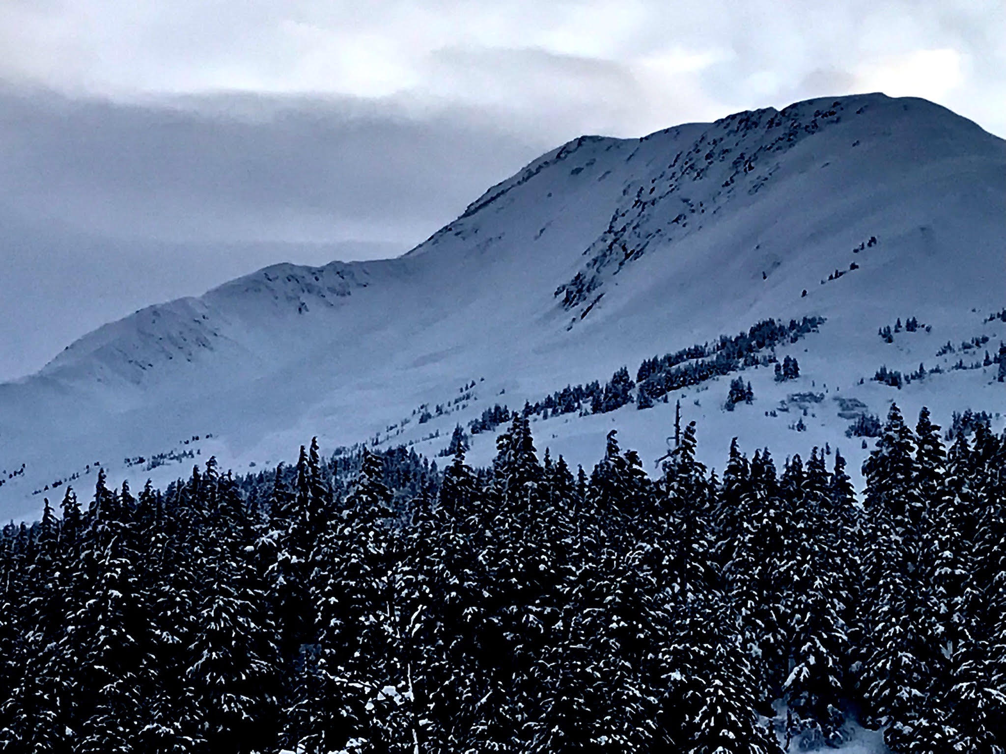
The avalanche danger is CONSIDERABLE above 1000′. Dangerous avalanche conditions will continue as strong easterly winds and continued light snowfall continue today. It is likely a person can trigger an avalanche 2-3′ deep or deeper in the new snow from the past two days, and natural avalanches are possible. An avalanche failing within the new snow may step down to a deeper weak layer, making a very large avalanche. Cautious route finding is key today, which means avoiding traveling on or below steep terrain. The danger is MODERATE below 1000′, where the main concerns will be loose wet avalanches and the potential for larger avalanches failing in upper elevations and running below treeline.

Special Announcements

Join us at the Girdwood Brewing Co. from 5:30-7:00 p.m. on Thursday, Jan. 19 for the second Forecaster Chat of the season. CNFAIC forecaster Andrew Schauer will open the night with an overview of the state of the snowpack, followed by a discussion on how safe terrain management changes depending on the type of avalanche problem at hand. More details here.

Mon, January 2nd, 2023
Alpine
Above 2,500'
3 - Considerable
Avalanche risk
Treeline
1,000'-2,500'
3 - Considerable
Avalanche risk
Below Treeline
Below 1,000'
2 - Moderate
Avalanche risk
0 - No Rating
1 - Low
2 - Moderate
3 - Considerable
4 - High
5 - Extreme
Avalanche risk Avalanche risk Avalanche risk Avalanche risk Avalanche risk
Travel Advice Generally safe avalanche conditions. Watch for unstable snow on isolated terrain features. Heightened avalanche conditions on specific terrain features. Evaluate snow and terrain carefully; identify features of concern. Dangerous avalanche conditions. Careful snowpack evaluation, cautious route-finding, and conservative decision-making essential. Very dangerous avalanche conditions. Travel in avalanche terrain not recommended. Extraordinarily dangerous avalanche conditions. Avoid all avalanche terrain.
Likelihood of Avalanches Natural and human-triggered avalanches unlikely. Natural avalanches unlikely; human-triggered avalanches possible. Natural avalanches possible; human-triggered avalanches likely. Natural avalanches likely; human-triggered avalanches very likely. Natural and human-triggered avalanches certain.
Avalanche Size and Distribution Small avalanches in isolated areas or extreme terrain. Small avalanches in specific areas; or large avalanches in isolated areas. Small avalanches in many areas; or large avalanches in specific areas; or very large avalanches in isolated areas. Large avalanches in many areas; or very large avalanches in specific areas. Very large avalanches in many areas.
Recent Avalanches

We have limited info following the New Year’s storm, but we know there was at least one very large avalanche on Todd’s Run on the northwest side of Tincan. One group reported seeing very little fresh activity around Tincan during some periods of decent visibility yesterday (details here), and we have sparse data beyond that.

The debris from this very large avalanche in Todd’s Run made it far into the runout zone. It is hard to see in the photo, but the shaded area at the bottom of the bowl extending towards the left edge of the frame is all avalanche debris. Photo: Gabby Markel, 01.01.2023.

Avalanche Problem 1
  • Storm Slabs
    Storm Slabs
  • Aspect/Elevation
  • Certain
    Very Likely
    Likely
    Possible
    Unlikely
    Likelihood
  • Historic (D4-5)
    Very Large (D3)
    Large (D2)
    Small (D1)
    Size
Storm Slabs
Storm Slab avalanches are the release of a cohesive layer (a slab) of new snow that breaks within new snow or on the old snow surface. Storm-slabs typically last between a few hours and few days (following snowfall). Storm-slabs that form over a persistent weak layer (surface hoar, depth hoar, or near-surface facets) may be termed Persistent Slabs or may develop into Persistent Slabs.

Aspect/Elevation of the Avalanche Problem
Specialists develop a graphic representation of the potential distribution of a particular avalanche problem across the topography. This aspect/elevation rose is used to indicate where the particular avalanche problem is thought to exist on all elevation aspects. Areas where the avalanche problem is thought to exist are colored grey, and it is less likely to be encountered in areas colored white.

Likelihood of Avalanches
Terms such as "unlikely", "likely", and "certain" are used to define the scale, with the chance of triggering or observing avalanches increasing as we move up the scale. For our purposes, "Unlikely" means that few avalanches could be triggered in avalanche terrain and natural avalanches are not expected. "Certain" means that humans will be able to trigger avalanches on many slopes, and natural avalanches are expected.

Size of Avalanches
Avalanche size is defined by the largest potential avalanche, or expected range of sizes related to the problem in question. Assigned size is a qualitative estimate based on the destructive classification system and requires specialists to estimate the harm avalanches may cause to hypothetical objects located in the avalanche track (AAA 2016, CAA 2014). Under this schema, "Small" avalanches are not large enough to bury humans and are relatively harmless unless they carry people over cliffs or through trees or rocks. Moving up the scale, avalanches become "Large" enough to bury, injure, or kill people. "Very Large" avalanches may bury or destroy vehicles or houses, and "Historic" avalanches are massive events capable of altering the landscape.

Signal Word Size (D scale) Simple Descriptor
Small 1 Unlikely to bury a person
Large 2 Can bury a person
Very Large 3 Can destroy a house
Historic 4 & 5 Can destroy part or all of a village
More info at Avalanche.org

Precipitation is tapering off this morning, but the avalanche conditions will remain dangerous through the day. Since Saturday night, the mountains have received a heavy dose of water, with the following storm totals:

  • Girdwood: 2.2″ Snow water Equivalent (SWE)/ 1.5-2′ snow
  • Portage: 4.2″ SWE/ 3.5-4′ snow
  • Turnagain Pass: 1.9″ SWE/ 1.5′ snow

We’ve seen mixed rain and snow up to around 1300-1400′ for most of this storm, with all of that precipitation falling as rain below around 1000′. It is looking like snow will continue to trickle in today, with another 3-6″ possible above 1000′ by the end of the day. Winds are expected to continue to blow 20-30 mph out of the east with gusts around 40-45 mph through the day. Natural avalanches will become slightly less likely as precipitation shuts off, but human triggered avalanches remain likely today. In addition to the potential for large storm slab avalanches, we can expect to see touchy wind slabs forming near ridgelines, in cross-loaded gullies, and on convex rolls. We may also see avalanches failing on weak layers buried by last week’s storm, or even stepping down to a layer of facets associated with the crust that formed just before Thanksgiving (more on this in problem 2 below).

The snowpack is complex, but the travel advice is simple. Dangerous avalanche conditions require cautious route finding. This means avoiding traveling on or below steep terrain. With 2′ or more of new snow in the start zones, be aware of the potential for large avalanches running far into runout zones. The avalanche seen on Todd’s Run yesterday illustrates this potential well. The snowpack needs a little time to respond to this load, but hopefully all of this relatively warm snow will improve stability in the long run.

This very large avalanche in Todd’s Run on the north side of Tincan occurred between Saturday night and Sunday afternoon. Similar activity will be possible today as the snowpack adjusts to the new load. Photo 01.01.2023

Avalanche Problem 2
  • Persistent Slabs
    Persistent Slabs
  • Aspect/Elevation
  • Certain
    Very Likely
    Likely
    Possible
    Unlikely
    Likelihood
  • Historic (D4-5)
    Very Large (D3)
    Large (D2)
    Small (D1)
    Size
Persistent Slabs
Persistent Slab avalanches are the release of a cohesive layer of snow (a slab) in the middle to upper snowpack, when the bond to an underlying persistent weak layer breaks. Persistent layers include: surface hoar, depth hoar, near-surface facets, or faceted snow. Persistent weak layers can continue to produce avalanches for days, weeks or even months, making them especially dangerous and tricky. As additional snow and wind events build a thicker slab on top of the persistent weak layer, this avalanche problem may develop into a Deep Persistent Slab.

Aspect/Elevation of the Avalanche Problem
Specialists develop a graphic representation of the potential distribution of a particular avalanche problem across the topography. This aspect/elevation rose is used to indicate where the particular avalanche problem is thought to exist on all elevation aspects. Areas where the avalanche problem is thought to exist are colored grey, and it is less likely to be encountered in areas colored white.

Likelihood of Avalanches
Terms such as "unlikely", "likely", and "certain" are used to define the scale, with the chance of triggering or observing avalanches increasing as we move up the scale. For our purposes, "Unlikely" means that few avalanches could be triggered in avalanche terrain and natural avalanches are not expected. "Certain" means that humans will be able to trigger avalanches on many slopes, and natural avalanches are expected.

Size of Avalanches
Avalanche size is defined by the largest potential avalanche, or expected range of sizes related to the problem in question. Assigned size is a qualitative estimate based on the destructive classification system and requires specialists to estimate the harm avalanches may cause to hypothetical objects located in the avalanche track (AAA 2016, CAA 2014). Under this schema, "Small" avalanches are not large enough to bury humans and are relatively harmless unless they carry people over cliffs or through trees or rocks. Moving up the scale, avalanches become "Large" enough to bury, injure, or kill people. "Very Large" avalanches may bury or destroy vehicles or houses, and "Historic" avalanches are massive events capable of altering the landscape.

Signal Word Size (D scale) Simple Descriptor
Small 1 Unlikely to bury a person
Large 2 Can bury a person
Very Large 3 Can destroy a house
Historic 4 & 5 Can destroy part or all of a village
More info at Avalanche.org

In addition to the potential for large avalanches failing within the new and wind-blown snow from the past two days, there are multiple deeper weak layers in the snowpack that may still produce very large avalanches. The layer that was buried with the Christmas storm is now 2-4′ deep, and the Thanksgiving crust is now 3-5′ deep or deeper. Triggering an avalanche on these layers will become less likely the deeper they get buried, but it is still a concern this soon after a major loading event. Given the potential for large avalanches within the storm snow, these deeper layers are more of an afterthought today since we are already thinking it is a bad idea to get into steep avalanche terrain. They will be something worth keeping in mind for a while as we wait and see how they adjust to this new load.

Weather
Mon, January 2nd, 2023

Yesterday: Continued precipitation brought another 3-9″ snow to mid and upper elevations yesterday to Girdwood and Turnagain Pass, favoring the Girdwood area. Portage and Placer received another 2.6″ water, which would have amounted to around 2′ snow at higher elevations. We saw mixed rain and snow up to around 1400′, with all rain below 1000′. Winds were out of the east at 15-35 mph with gusts reaching close to 60 mph at the Sunburst station. Temperatures hovered in the upper 20’s to low 30’s F.

Today: Light precipitation is expected through late morning, with another 0.3-0.5″ water bringing 3-5″ snow at higher elevations. Rain is expected to 1000-1200′, with high temperatures in the low to mid 30’s F and lows dropping slightly into the mid 20’s to low 30’s F. Skies will be mostly cloudy, with strong easterly winds blowing 20-35 mph with gusts of 40-50 mph.

Tomorrow: It is looking like tomorrow will be a relatively quiet period between storms, with a trace of precipitation during the day and mostly cloudy skies. Southeasterly winds are expected to continue at 20-30 mph tonight before dropping slightly to 15-20 mph during the day tomorrow. The rain line will drop close to sea level with high temperatures in the upper 20’s to mid 30’s F and lows in the mid 20’s to 30 F. Chances for precipitation increase again Tuesday night into Wednesday.

PRECIPITATION 24-hour data (6am – 6am)

Temp Avg (F) Snow (in) Water (in) Snow Depth (in)
Center Ridge (1880′) 33 3 0.4 55 (est.)
Summit Lake (1400′) 33 1 0.1 30
Alyeska Mid (1700′) 32 8 1.07 47
Bear Valley – Portage (132′) 37 rain 2.6

RIDGETOP 24-hour data (6am – 6am)

Temp Avg (F) Wind Dir Wind Avg (mph) Wind Gust (mph)
Sunburst (3812′) 24 ENE 24 55
Seattle Ridge (2400′) 27 N/A* N/A* N/A*

*Seattle Ridge anemometer is covered in rime and not reporting. 

Observations
Recent Observations for Turnagain Pass
Date Region Location
04/23/24 Turnagain Observation: Turnagain Sunny Side
04/21/24 Turnagain Observation: Bertha Creek
04/20/24 Turnagain Avalanche: Spokane Creek
04/16/24 Turnagain Observation: Cornbiscuit
04/15/24 Turnagain Observation: Taylor Pass
04/15/24 Turnagain Observation: Seward Highway – Tern Lake to Portage
04/14/24 Turnagain Observation: Sunburst
04/14/24 Turnagain Observation: Turnagain Pass Snomo
04/13/24 Turnagain Observation: Spokane Creek
04/11/24 Turnagain Observation: Tincan
Riding Areas

The riding areas page has moved. Please click here & update your bookmarks.


Subscribe to Turnagain Pass
Avalanche Forecast by Email

This is a general backcountry avalanche advisory issued for Turnagain Arm with Turnagain Pass as the core advisory area. This advisory does not apply to highways, railroads or operating ski areas.