| Trigger | Skier | Remote Trigger | No |
| Avalanche Type | Wet Loose Snow | Aspect | South |
| Elevation | 4500ft | Slope Angle | 35deg |
| Crown Depth | 5in | Width | 45ft |
| Vertical Run | 500ft |
Avalanche: Hatcher Pass
Location: Microdot / Nosebleed
Took a spin up Microdot to see how the recent snow has been holding up and how it might be reacting on some of the firm crusts currently found on southerly aspects. Mostly easy travel except for some difficult skinning on the upper SW facing shoulder of Microdot where things got somewhat slick. Overall conditions were favorable minus some periods of challenging light.
South facing was crusty underneath but on more proper southerly aspects this layer was firm, smooth, and supportable enough to make turns on. North facing was much softer underneath but all aspects were observed to be taking on heat due to high humidity, greenhousing, mild temps, and periods of sunbreaks.
Avalanche Details
One of our party took a quick lap on the south aspect to inspect conditions and reactivity of the new snow. The underlying firm surface was supportable enough to provide smooth skiing but the new snow was warm and easily got moving on the firm crust underneath while skiing over a steeper rollover. Slow to get moving, the debris ran a few hundred feet before stopping in the upper part of the runout zone. No dogs were involved and the skier responsible owes a few ciders.
Obvious signs of instability
| Recent Avalanches? | Yes |
| Collapsing (Whumphing)? | No |
| Cracking (Shooting cracks)? | No |
Observer Comments
A number of loose dry/wet activity observed throughout the day, both natural and skier triggered. The biggest red flag we observed was the warming of surface snow due to mild temps, periods of sun, and some green housing going on with the high clouds. High humidity seemed to encourage this process with periods of foggy, convective clouds obscuring visibility.
Weather
The crack of noon crew got a casual start today. By the time we were heading up conditions were warm and muggy, with temps in the mid and upper 20's and humidity right around 95%. Winds were relatively calm and although visibility started out good the low clouds and fog increased throughout the day.
Snow surface
About 5’’ HN evenly distributed with no observed wind effect. New snow was damp and reactive on underlying firm sun crusts found on southerly aspects.
Snowpack
The snowpack continues to be drastically different on sunny versus shady aspects. A pit dug around 4500’ south facing had a HS of 175cm with numerous crusts, translucent ice, percolation columns, and a lot of moist snow. A pit dug at a similar elevation on a north facing slope showed a mostly homogeneous snowpack with few crusts but still signs of warming and moisture. While facet crust combos on the south and pockets of lingering wind slabs and graupel on the north continue to be on our radar for instability, the recent snow and loose activity was the biggest concern for the day.
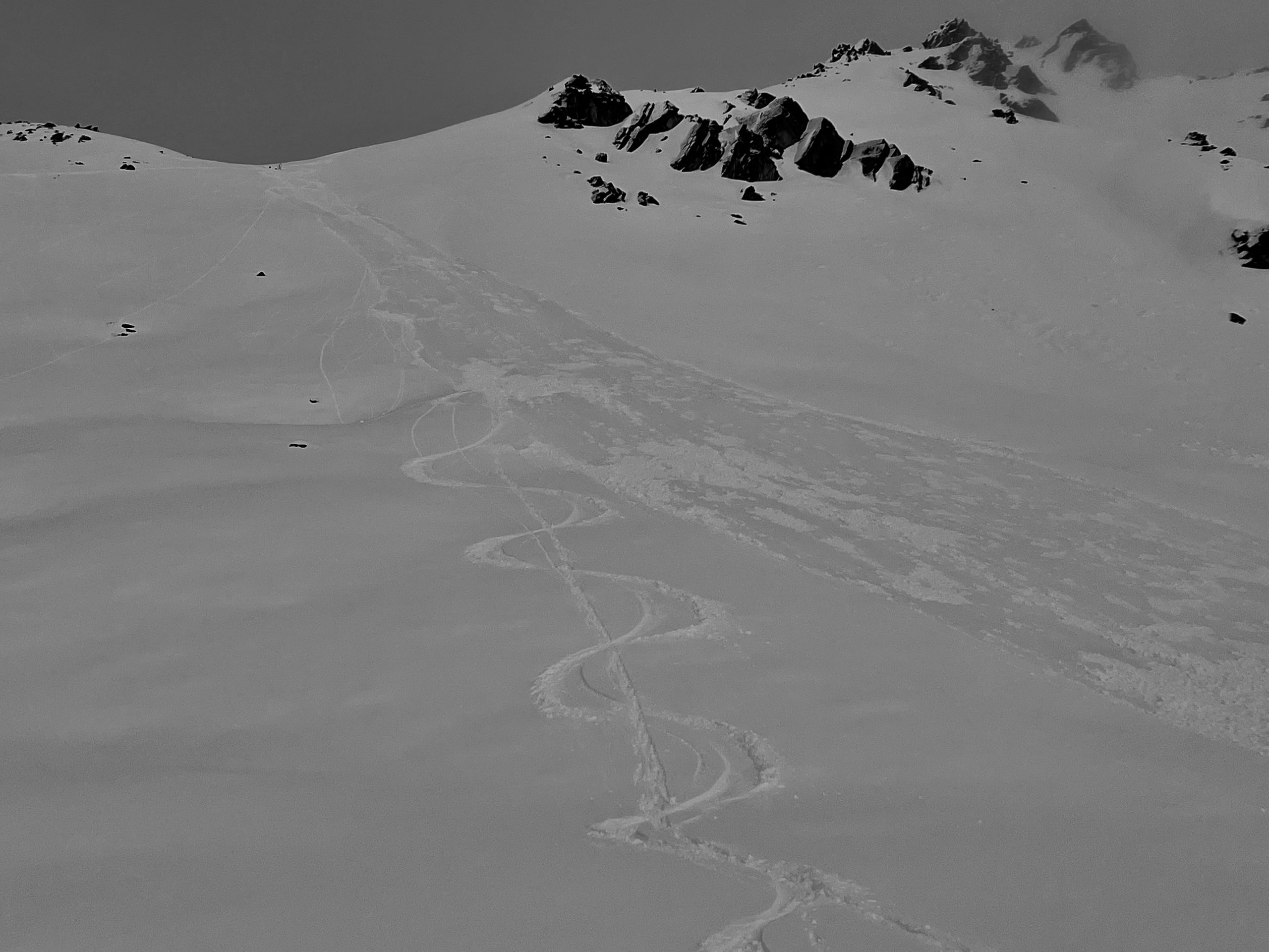
Skier triggered wet loose on Microdot.
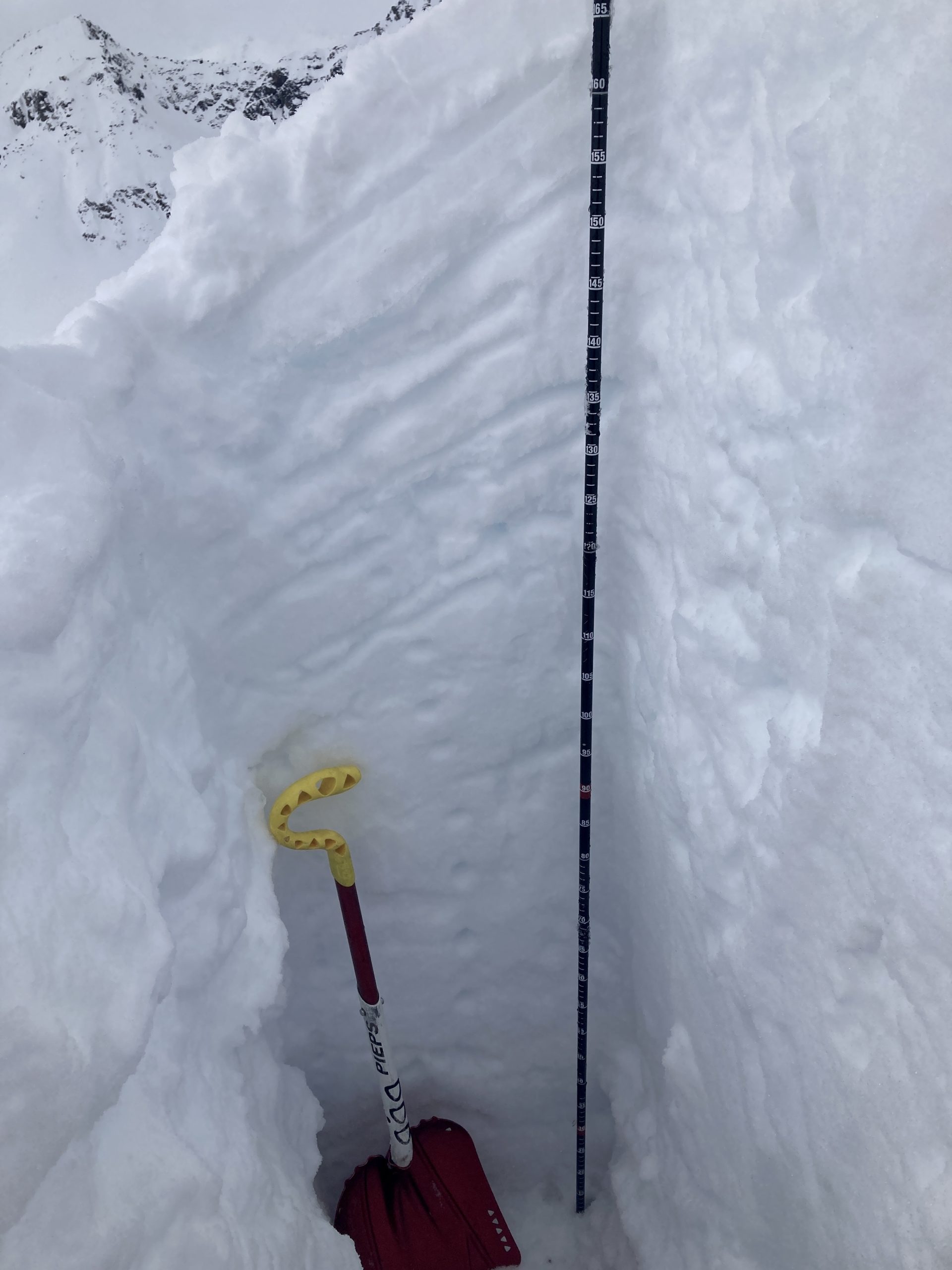
Microdot 04/05 South Facing 4566’ HS 175 33 degrees 10cm HN Fist-Moist 175-115 (8) crusts counted! 1f to 4f facets rounding to DH moist/rounding Observed perc columns and deformed crusts

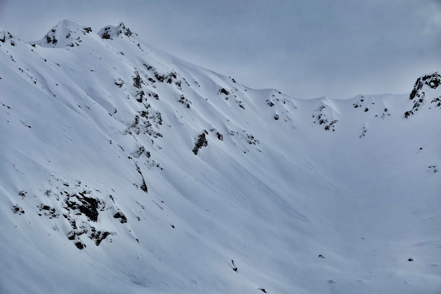
Loose activity under Eldorado

Forecaster Allie Barker getting the picture on the southerly aspect of Microdot, with some recent wet loose activity and a few parties on Ray Wallace behind her.
Natural Loose activity observed on S facing Microdot.

Shiny bed surface on SW facing bench below Gold Cord lake. It was easy to scrape away the new snow and initiate loose activity on this aspect.