| Recent Avalanches? | Yes |
| Collapsing (Whumphing)? | Yes |
| Cracking (Shooting cracks)? | Yes |
Observation: Hatcher Pass
Location: Hatcher Pass, recent avalanche investigations, x4068, Edlorado lowers, Rae Wallace bowl.
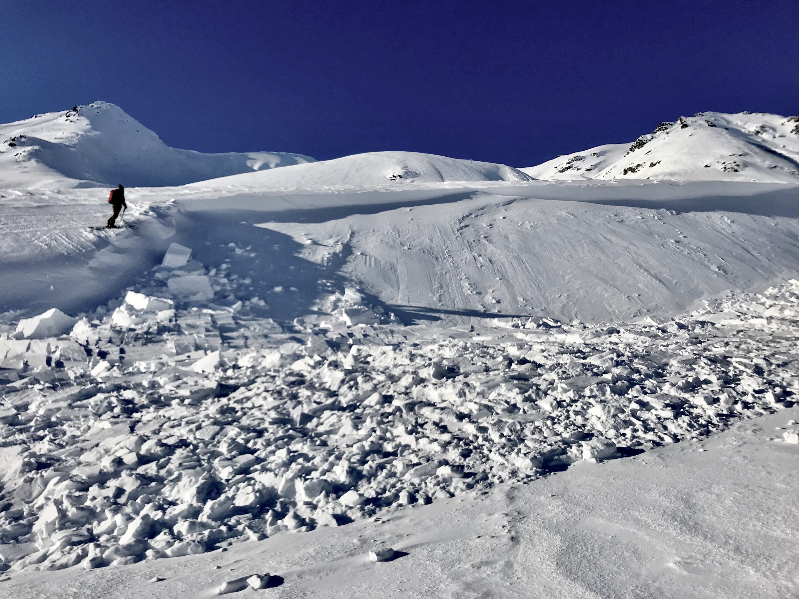
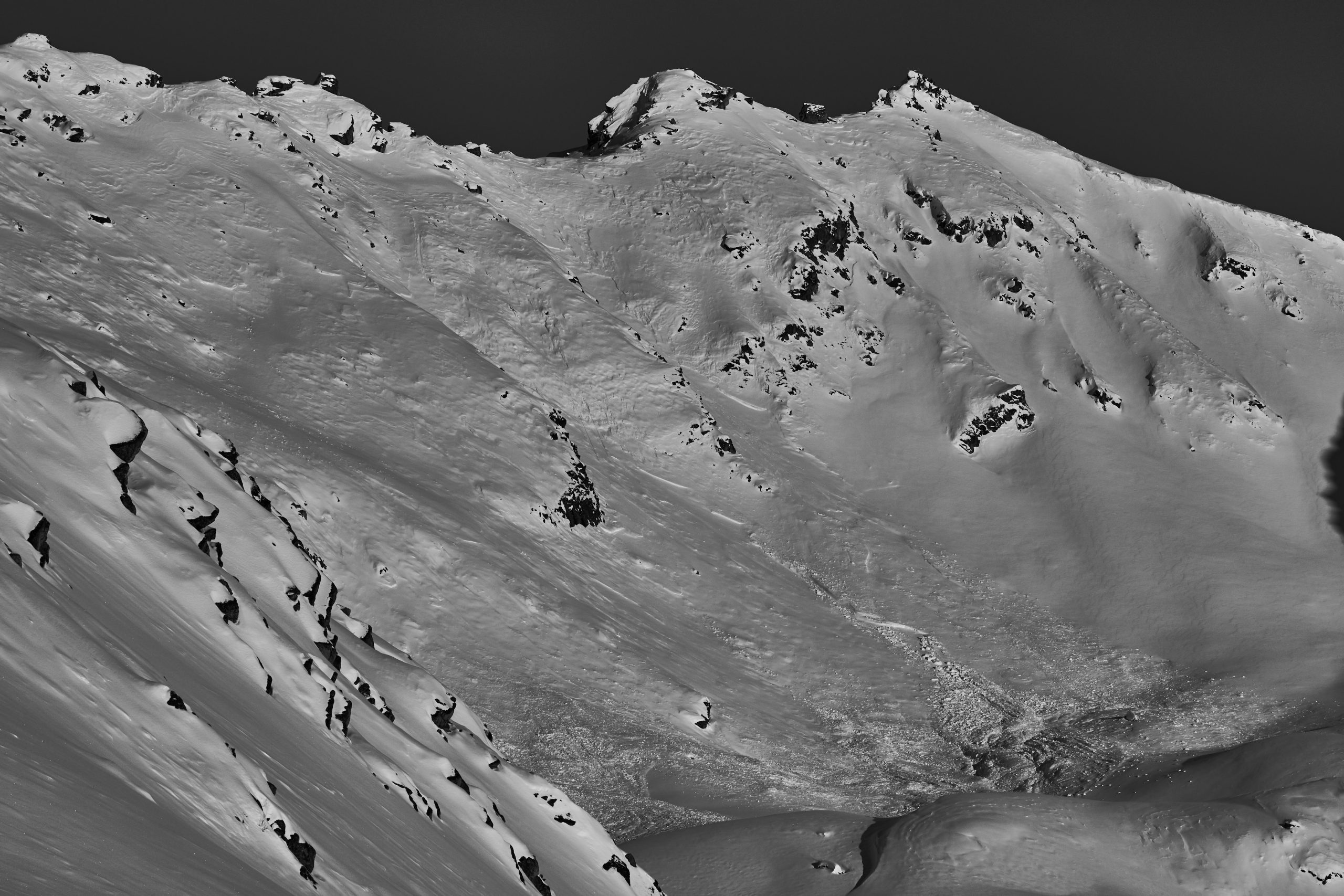
Monday’s observations revealed widespread natural avalanches from the 2/8 to very early morning of 2/10 avalanche cycle on all aspects at mid to upper elevations, with a few large avalanches near the lower elevations.
On Thursday we investigated several avalanches from this avalanche cycle.
On Friday we took a specific look at South aspects.
Obvious signs of instability
Observer Comments
Recent, widespread, large avalanches.
Likely 2/11 or 12 - A new avalanche was remotely triggered by a snow machine from 100 feet away, on a steep creek sidewall above Fishhook Creek, 50cm deep, ENE, 2700'.
Monday through Friday collapsing was stubborn to trigger and hard to find and reproduce. We were able to get some localize collapsing on steep creek walls between the Fishhook Parking lot and peak 4068.
We did not encounter any shooting cracks.
On Friday, snowmachiners reported some deep cracking in the snowpack on the Willow side by Dog Sled Pass, but no new avalanches. They generally avoided steeper terrain.
Weather
2/8 to ealry morning 2/10 strong winds transported new and old, abundant, low density snow. This built wind slabs over persistent grain types which failed naturally, 1-4 feet deep, D2-D3.
On 2/10 the skies cleared, and wind relaxed by mid day. Generally cool temps, clear skies, and light to calm wind remained for the week. A burst of elevated gusts at 4500' happened on Wednesday evening.
Snow surface
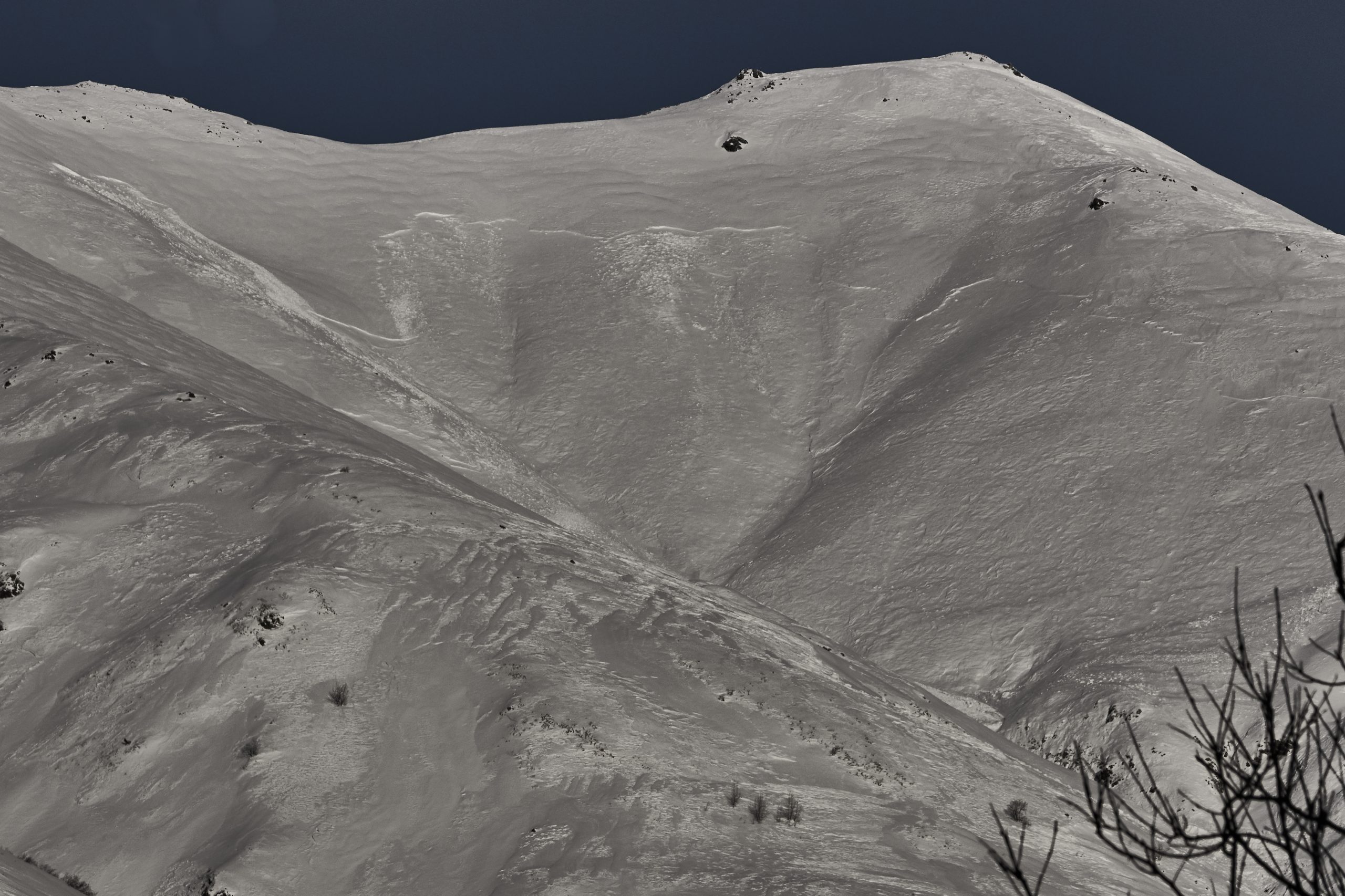
A mix of surface textures is widespread throughout HP, with wind drifts, scalloping, sastrugi, wind exposed melt freeze crust, breakable wind crust, supportable crust, and rock hard snow. Very few locations were wind protected, with the lowest elevations in the trees and bushes still holding some soft, not wind effected snow.
Significant top and cross loading at mid to upper elevations is readily apparent, mostly on NW to East aspects, with scouring on SE to W.
Snowpack
2/8-10 winds, plus new snow from 2/5-10, resulted in widespread hard slab conditions sitting on older, weak, faceted snow. Early January's cold temps and clear skies resulted in large grain facets, 3-4mm in size, up to 20cm deep.
In the rare exception of wind protected slopes, new slabs sit on this thick pile of junk, and show a propensity for propagation with moderate ECTP results. Riders have been getting out as of mid week, but slope testing data is still low resolution.
In areas that received heavier wind, pretty much all aspects at mid to upper elevations, thick, hard slabs 1-4 feet deep, sit on two thinner, weak layers of facets. In these locations we observed generally ECTP Hard to ECTX results, and difficulty triggering deeply buried weak layers in CT and deep Tap test, but PST´s demonstrated that propagation propensity is present with numerous results below PST50END in both layers at multiple locations, and aspects, in the mid elevation band. See PST results in video on Fx 2/15.
The last observed avalanche was on 2/11 or 12, with a snow machine remote trigger on the Fishhook Creek sidewall, see advisory for pictures and lcoation.

Crown Profile on x4068

Snow texture widespread, mid to upper elevations
Edlorado Test Slope

Martin Mine D2.5
Marmot SE crossed road, but did not run farther
West face of Rae Wallace bowl between Microdot and Raw Wallace North